Jackson County is a county located in the northeastern part of the U.S. state of Georgia. As of the 2020 census, the population was 75,907. The county seat is Jefferson.
Jackson County comprises the Jefferson, GA Micropolitan Statistical Area, which is included in the Atlanta-Athens-Clarke County-Sandy Springs, GA Combined Statistical Area.
| Name: | Jackson County |
|---|---|
| FIPS code: | 13-157 |
| State: | Georgia |
| Founded: | 1796 |
| Named for: | James Jackson |
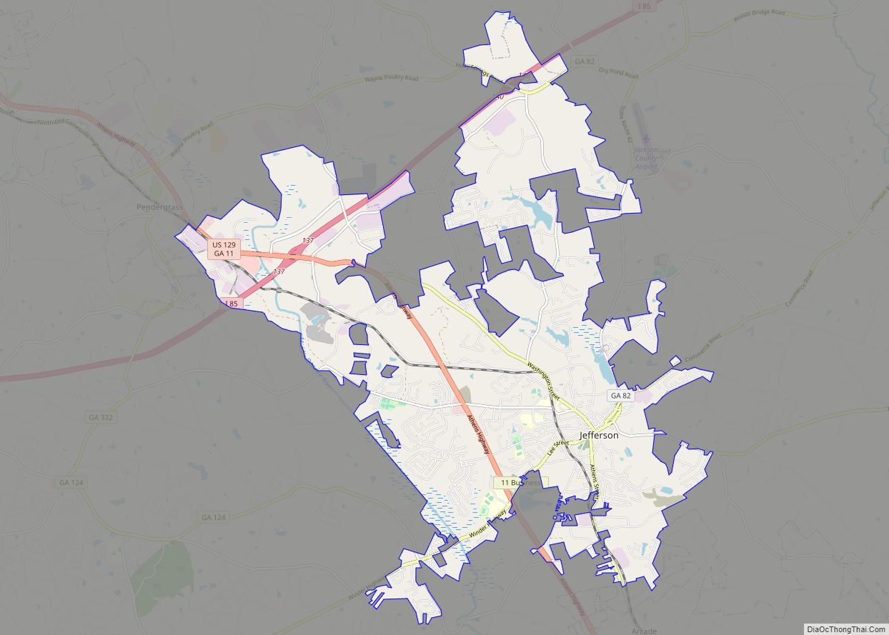
| Seat: | Jefferson |
| Largest city: | Jefferson |
| Total Area: | 343 sq mi (890 km²) |
| Land Area: | 340 sq mi (900 km²) |
| Total Population: | 75,907 |
| Population Density: | 223/sq mi (86/km²) |
| Time zone: | UTC−5 (Eastern) |
| Summer Time Zone (DST): | UTC−4 (EDT) |
| Website: | www.jacksoncountygov.com |
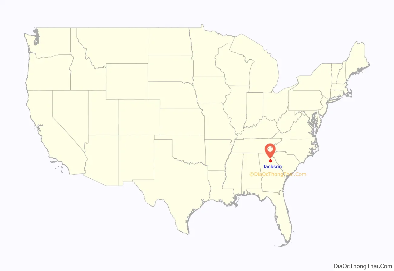
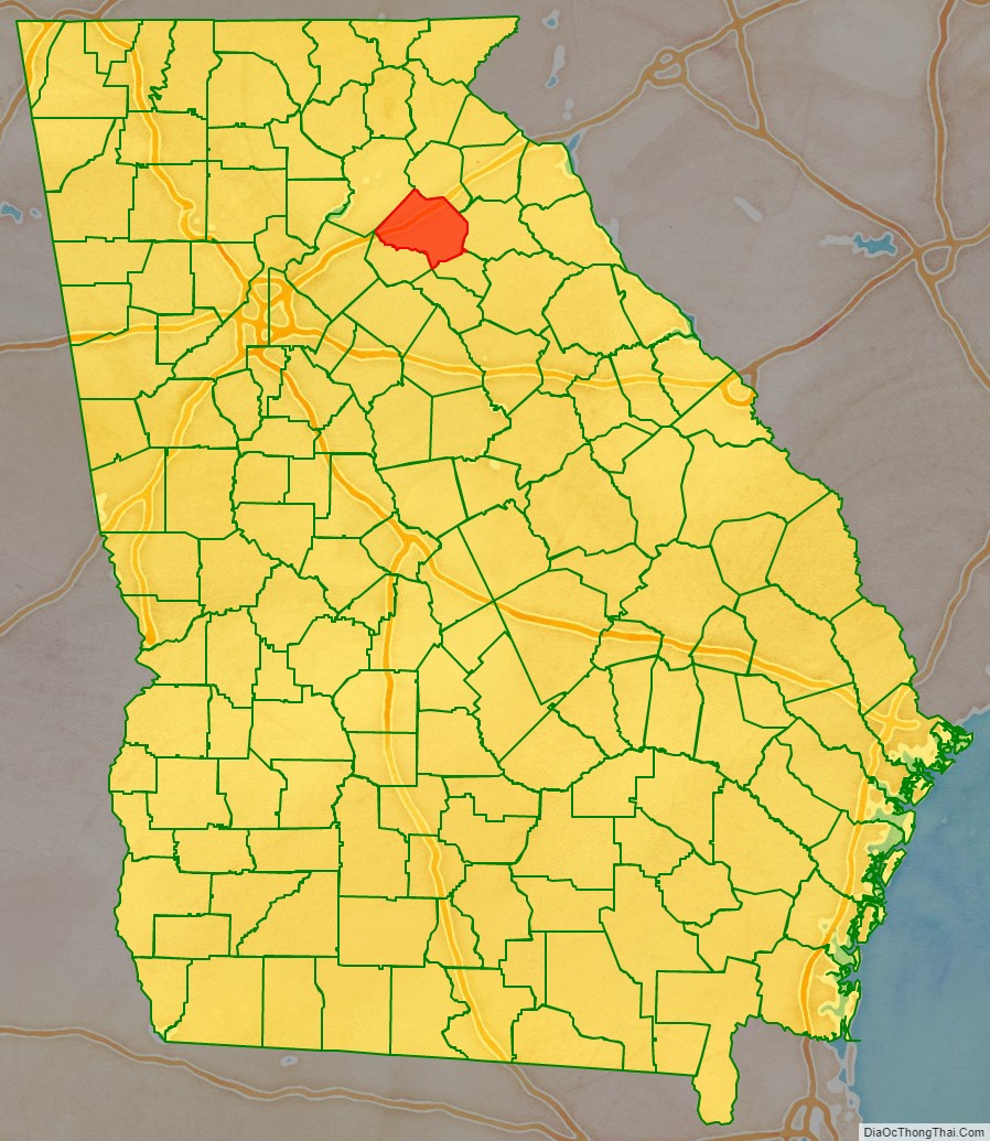
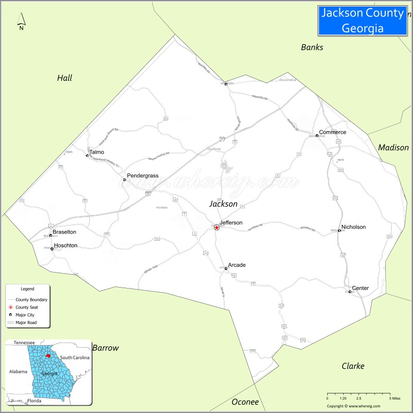
Jackson County location map. Where is Jackson County?
History
Most of the first non-Native American settlers came from Effingham County in 1786. On February 11, 1796, Jackson County was split off from part of Franklin County, Georgia. The new county was named in honor of Revolutionary War Lieutenant Colonel, Congressman, Senator and Governor James Jackson. The county originally covered an area of approximately 1,800 square miles (4,662.0 km), with Clarksboro as its first county seat.
In 1801, the Georgia General Assembly granted 40,000 acres (160 km) of land in Jackson County for a state college. Franklin College (now University of Georgia) began classes the same year, and the city of Athens was developed around the school. Also the same year, a new county was developed around the new college town, and Jackson lost territory to the new Clarke. The county seat was moved to an old Indian village called Thomocoggan, a location with ample water supply from Curry Creek and four large springs. In 1804, the city was renamed Jefferson, after Thomas Jefferson.
Jackson lost more territory in 1811 in the creation of Madison County, in 1818 in the creation of Walton, Gwinnett, and Hall counties, in 1858 in the creation of Banks County, and in 1914 in the creation of Barrow County.
The first county courthouse, a log and wooden frame building with an attached jail, was built on south side of the public square; a second, larger, two-story brick courthouse with a separate jailhouse was built in 1817. In 1880, a third was built on a hill north of the square. This courthouse was the oldest continuously operating courthouse in the United States until 2004, when the current courthouse was constructed north of Jefferson.
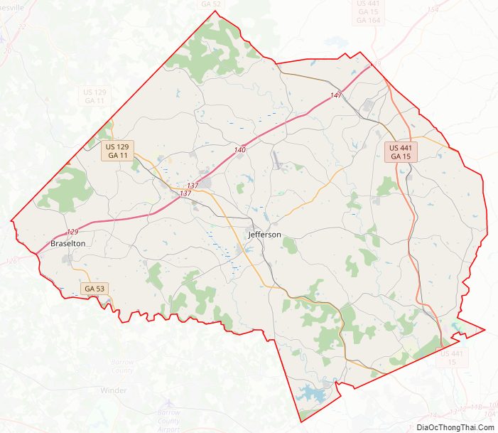
Jackson County Road Map
Geography
According to the U.S. Census Bureau, the county has a total area of 343 square miles (890 km), of which 340 square miles (880 km) is land and 3.4 square miles (8.8 km) (1.0%) is water.
The vast majority of Jackson County is located in the Upper Oconee River sub-basin of the Altamaha River basin, with just a small portion of the county’s northern edge, between Maysville to just east of Commerce, located in the Broad River sub-basin of the Savannah River basin.
Rivers and creeks
- North Oconee River
- Sandy Creek (Georgia)
- Curry Creek
- Middle Oconee River
- Pond Fork
- Allen Creek (Holders Creek)
- Mulberry River
Adjacent counties
- Banks County – north
- Madison County – east
- Clarke County – southeast
- Gwinnett County – southwest
- Barrow County – west
- Hall County – northwest
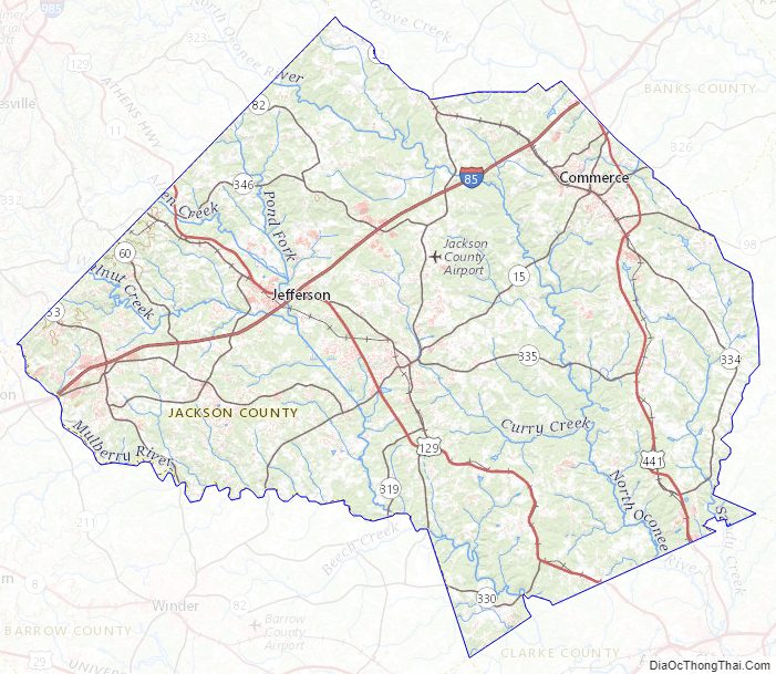
Jackson County Topographic Map
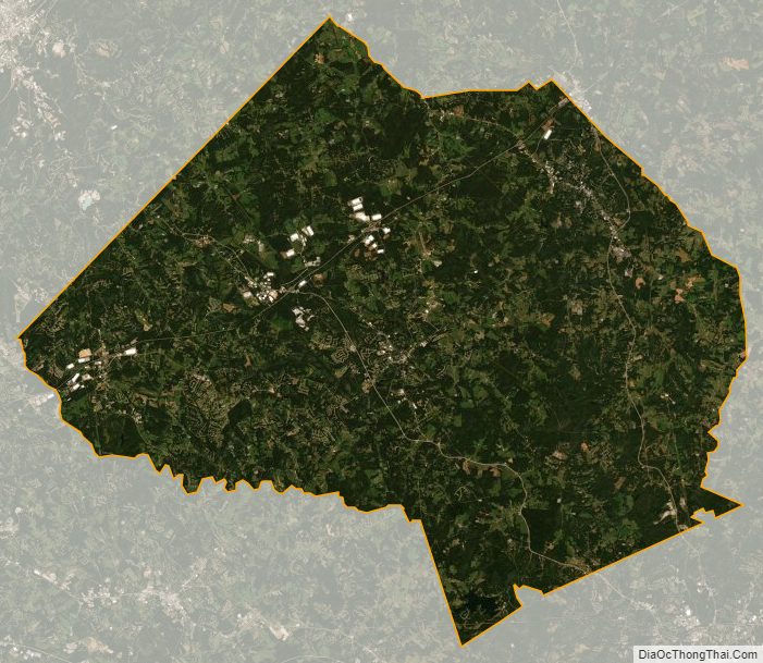
Jackson County Satellite Map
Jackson County Outline Map