Gwinnett County (/ɡwɪˈnɛt/ gwih-NET) is located in the north central portion of the U.S. state of Georgia. It forms part of the Atlanta metropolitan area. In 2020, the population was 957,062, making it the second-most populous county in Georgia (after Fulton County). Its county seat is Lawrenceville. The county is named for Button Gwinnett, one of the signatories of the Declaration of Independence.
Gwinnett County is included in the Atlanta-Sandy Springs-Roswell, GA Metropolitan Statistical Area. It is located about 10 miles northeast of Atlanta’s city limits.
| Name: | Gwinnett County |
|---|---|
| FIPS code: | 13-135 |
| State: | Georgia |
| Founded: | 1818 |
| Named for: | Button Gwinnett |
| Seat: | Lawrenceville |
| Largest city: | Peachtree Corners |
| Total Area: | 437 sq mi (1,130 km²) |
| Land Area: | 430 sq mi (1,100 km²) |
| Total Population: | 942,627 |
| Population Density: | 2,123/sq mi (820/km²) |
| Time zone: | UTC−5 (Eastern) |
| Summer Time Zone (DST): | UTC−4 (EDT) |
| Website: | www.gwinnettcounty.com |
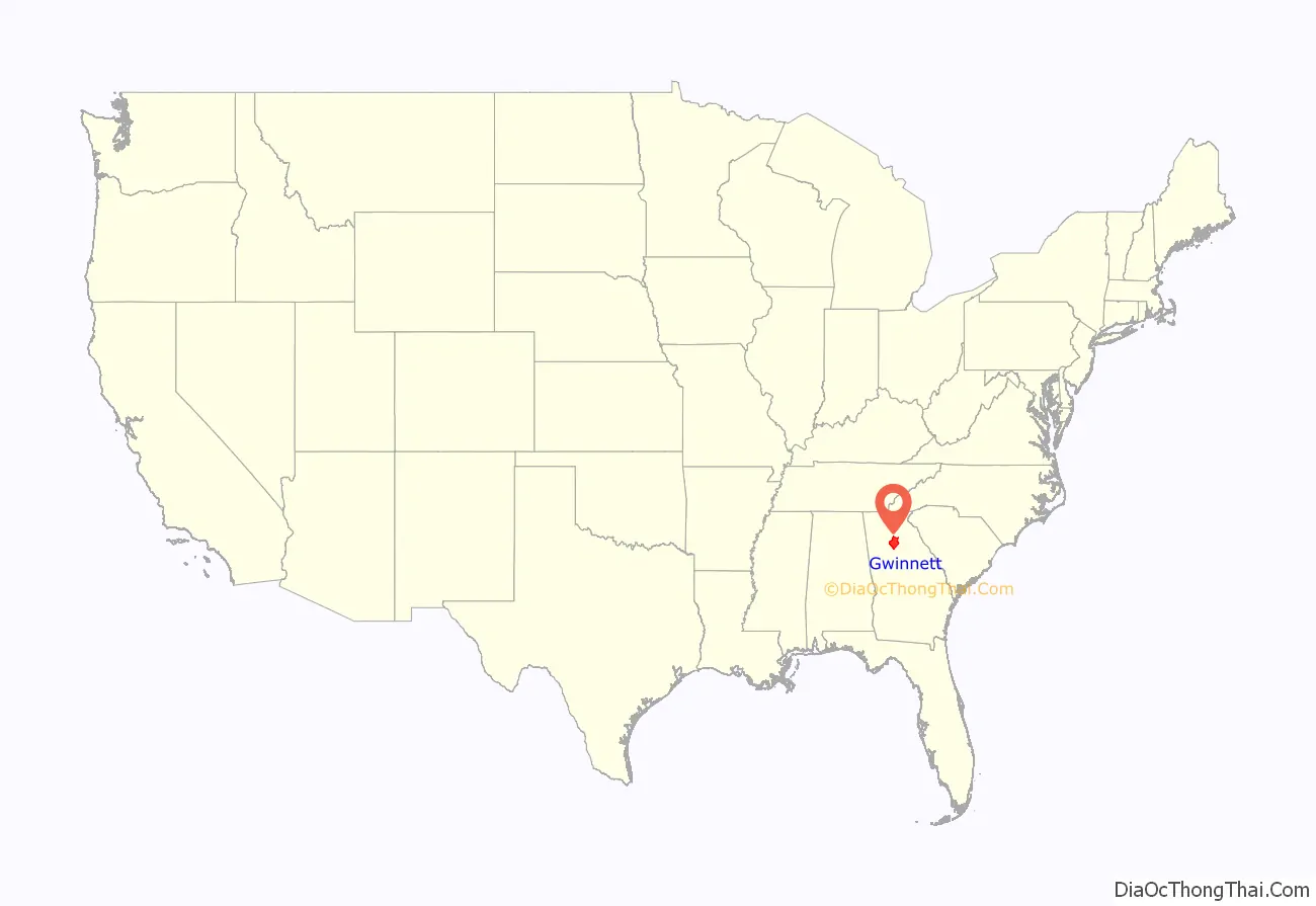
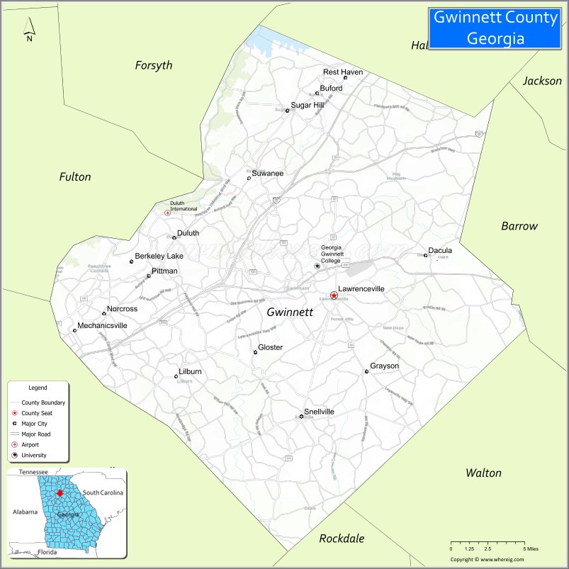
Gwinnett County location map. Where is Gwinnett County?
History
In 1813, Fort Daniel was created during the War of 1812 in territory that would become Gwinnett County. The county was created in 1818 by an act of the Georgia General Assembly, Gwinnett County was formed from parts of Jackson County (formerly part of Franklin County) and from lands gained through the cession of Creek Indian lands. Named for Button Gwinnett, one of the signatories of the Declaration of Independence, the first county election was held at the home of Elisha Winn, and the first Superior Court was held in his barn. The county seat was later placed at Lawrenceville.
In 1831, a group of white men were tried and found guilty in Lawrenceville for violating Georgia law by living in the Cherokee Nation without a valid passport from the Governor. Two of the men appealed to the US Supreme Court in Worcester v. Georgia, which resulted in a ruling stating that only the federal government had jurisdiction over native lands, a decision which still stands.
In 1861, all three of Gwinnett County’s representatives at the Georgia Constitutional Convention (1861) in Milledgeville voted against secession. Towards the end of the war, Union troops foraged in Gwinnett County as part of the Atlanta Campaign. The Freedmen’s Bureau was active in Gwinnett County during Reconstruction. In 1871 the courthouse in Lawrenceville was burned by the Ku Klux Klan in an attempt to avoid prosecution for their crimes, which included the shooting of a black election manager in Norcross.
Early in the county’s history, gold mining was a minor industry. The Gwinnett Manufacturing Company, a cotton textile factory, operated in Lawrenceville in the 1850s through 1865, when it burned. The Bona Allen Company in Buford, Georgia produced saddles, harnesses and other leather goods from 1873 to 1981.
The northeastern part of Gwinnett County was removed in 1914 to form a part of the new Barrow County.
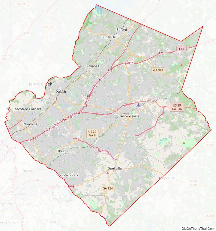
Gwinnett County Road Map
Geography
According to the U.S. Census Bureau, the county has a total area of 437 square miles (1,130 km), of which 430 square miles (1,100 km) is land and 6.4 square miles (17 km) (1.5%) is water. The county is located in the upper Piedmont region of the state.
It is located along the Eastern Continental Divide. A portion of the county to the northwest is a part of the Chattahoochee River National Recreation Area chain.
Allocation of water from the regional reservoir, Lake Lanier, at the extreme north of the county, has been subject to the Tri-state water dispute.
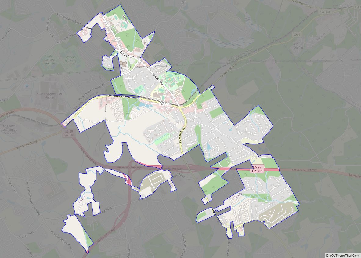
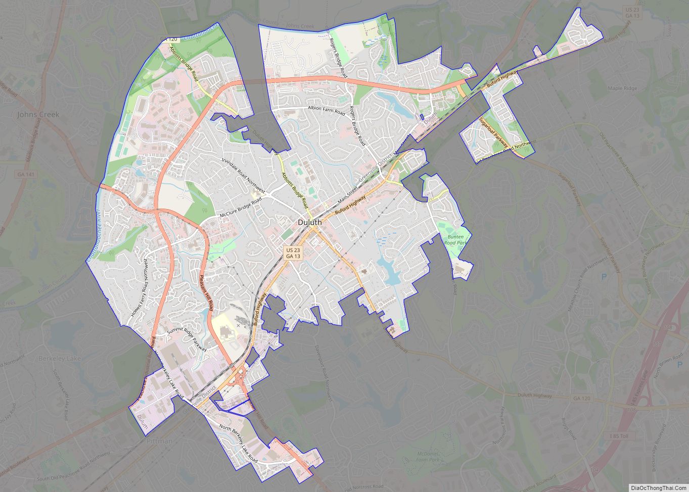
The southern and central portions of Gwinnett County are located in the Upper Ocmulgee River sub-basin of the Altamaha River basin. Most of the county’s northern edge, from south of Peachtree Corners to north of Buford, is located in the Upper Chattahoochee River sub-basin of the ACF River Basin (Apalachicola-Chattahoochee-Flint River Basin). The county’s eastern edge, north and south of Dacula, is located in the Upper Oconee River sub-basin of the same Altamaha River basin.
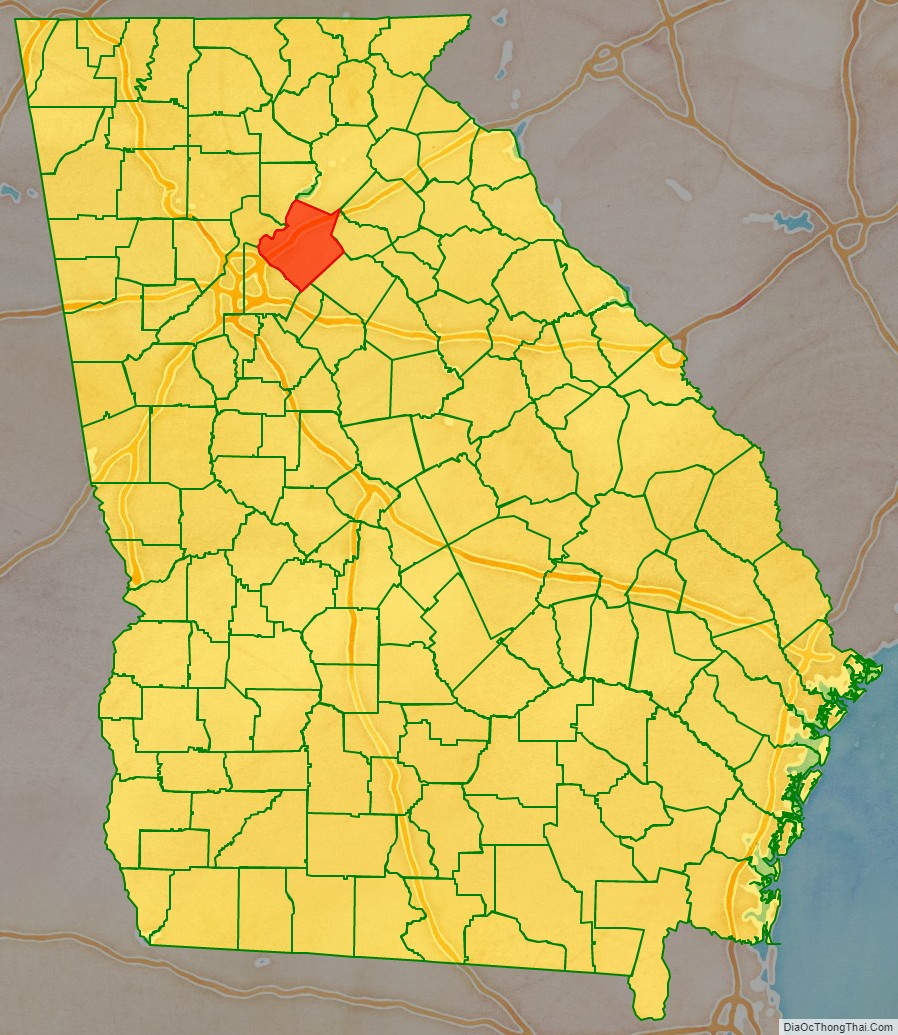
Adjacent counties
- Forsyth County – north
- Hall County – northeast
- Jackson County – northeast
- Barrow County – east
- Walton County – southeast
- Rockdale County – south
- DeKalb County – southwest
- Fulton County – west
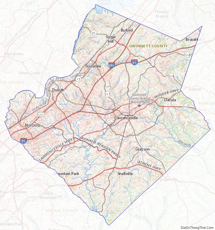
Gwinnett County Topographic Map
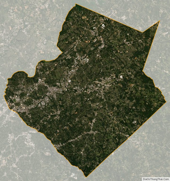
Gwinnett County Satellite Map
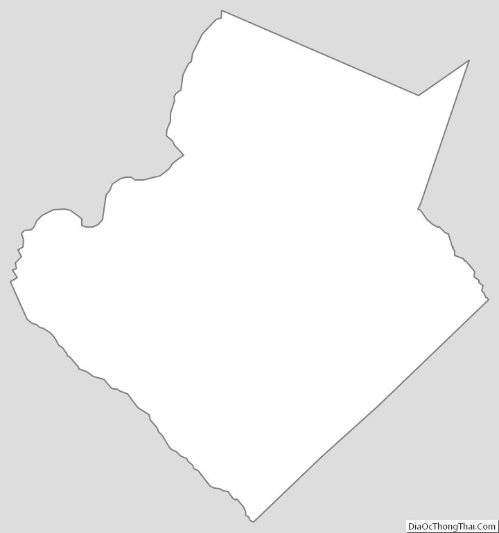
Gwinnett County Outline Map