Billings County is a county in the U.S. state of North Dakota. As of the 2020 census, the population was 945, making it the second-least populous county in North Dakota. Its county seat and only incorporated place is Medora.
The Territorial legislature authorized Billings County on February 10, 1879, naming it for Northern Pacific Railway president Frederick H. Billings. It was organized on May 4, 1886. The original county boundary was significantly altered since its creation, by actions in 1883, 1885, 1887, 1896, 1901 and 1904. Its most significant alterations came in 1907 (Bowman County partitioned off), 1912 (Golden Valley County partitioned off), and 1914 (Slope County partitioned off).
| Name: | Billings County |
|---|---|
| FIPS code: | 38-007 |
| State: | North Dakota |
| Founded: | 1879 |
| Named for: | Frederick H. Billings |
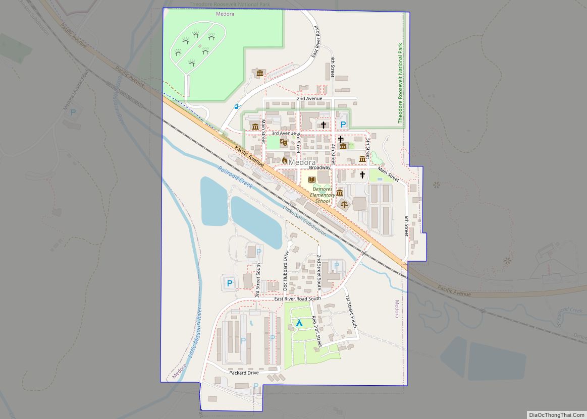
| Seat: | Medora |
| Largest city: | Medora |
| Total Area: | 1,153 sq mi (2,990 km²) |
| Land Area: | 1,149 sq mi (2,980 km²) |
| Total Population: | 945 |
| Population Density: | 0.82/sq mi (0.32/km²) |
| Time zone: | UTC−7 (Mountain) |
| Summer Time Zone (DST): | UTC−6 (MDT) |
| Website: | www.billingscountynd.gov |
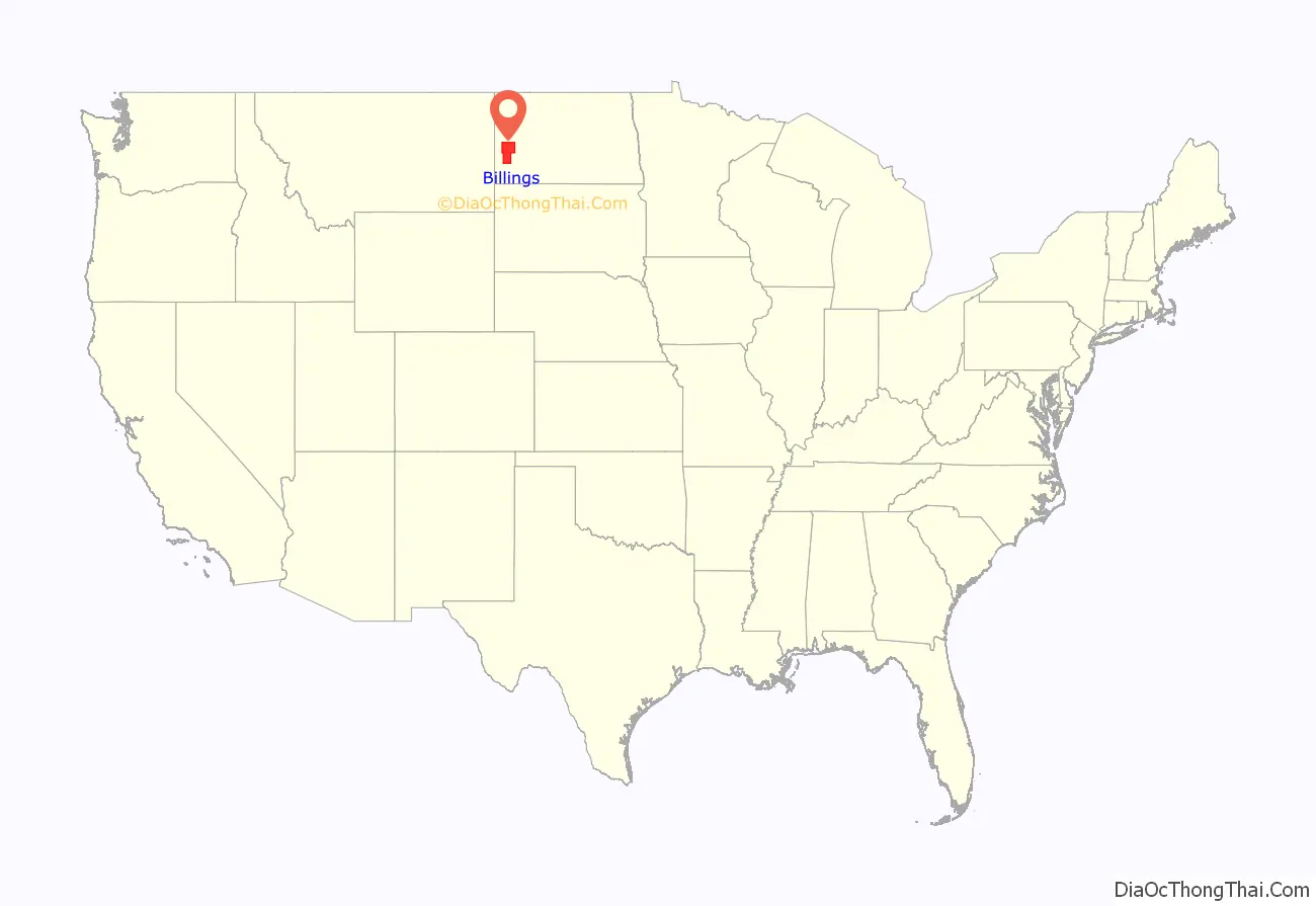
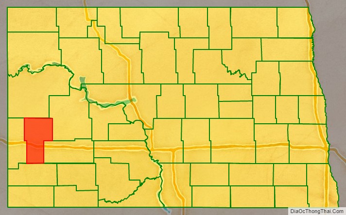
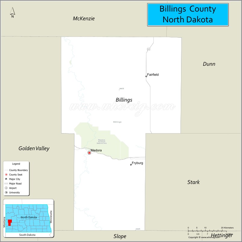
Billings County location map. Where is Billings County?
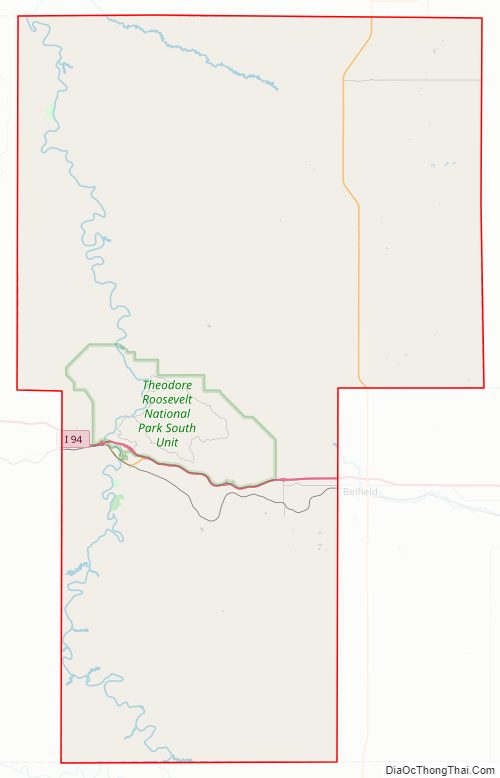
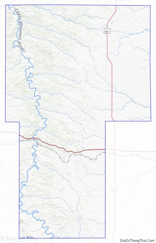
Billings County Road Map
Geography
The Little Missouri River flows northward through the western portion of the county. Bullion Creek flows eastward into the southwestern corner of the county to discharge into the Little Missouri River.
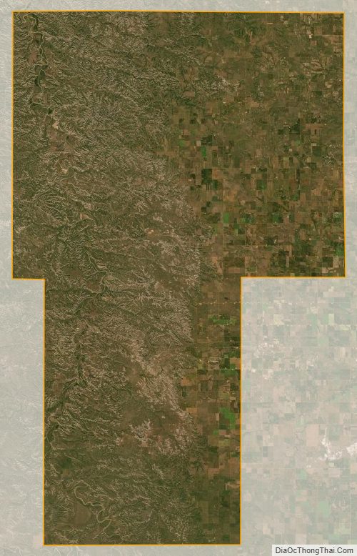
Billings County terrain consists of rugged semi-arid hills in its western portion, giving way to more level ground in the east. The terrain slopes to the east and south, with its highest terrain along its west boundary line, at 2,523′ (769m) ASL.
Billings County has a total area of 1,153 square miles (2,990 km), of which 1,149 square miles (2,980 km) is land and 4.6 square miles (12 km) (0.4%) is water. The South Unit of Theodore Roosevelt National Park lies in the central part of the county, just north of Medora.
Major highways
- Interstate 94
- U.S. Highway 85
Adjacent counties
- McKenzie County – north
- Dunn County – northeast
- Stark County – east
- Slope County – south
- Golden Valley County – west
Protected areas
- Little Missouri National Grassland (part)
- Sully Creek State Park
- Theodore Roosevelt National Park (South Unit)
Billings County Topographic Map
Billings County Satellite Map
Billings County Outline Map