Medora is a city in Billings County, North Dakota, United States. The only incorporated place in Billings County, it is also the county seat. Much of the surrounding area is part of either Little Missouri National Grassland or Theodore Roosevelt National Park. The population was 121 at the 2020 census. It is part of the Dickinson Micropolitan Statistical Area.
| Name: | Medora city |
|---|---|
| LSAD Code: | 25 |
| LSAD Description: | city (suffix) |
| State: | North Dakota |
| County: | Billings County |
| Founded: | 1883 |
| Elevation: | 2,267 ft (691 m) |
| Total Area: | 0.41 sq mi (1.07 km²) |
| Land Area: | 0.39 sq mi (1.02 km²) |
| Water Area: | 0.02 sq mi (0.05 km²) |
| Total Population: | 121 |
| Population Density: | 307.89/sq mi (118.85/km²) |
| ZIP code: | 58645 |
| Area code: | 701 |
| FIPS code: | 3851900 |
| GNISfeature ID: | 1035000 |
| Website: | medorand.com |
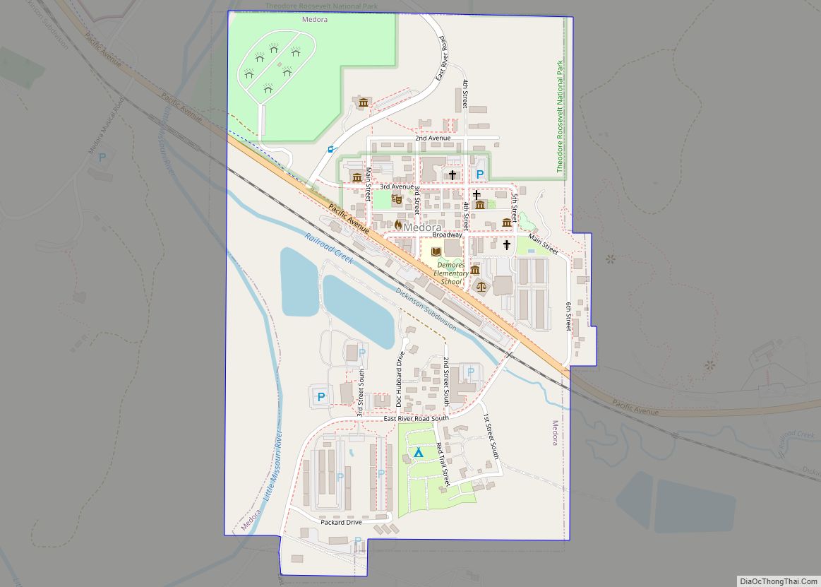
Online Interactive Map
Click on ![]() to view map in "full screen" mode.
to view map in "full screen" mode.
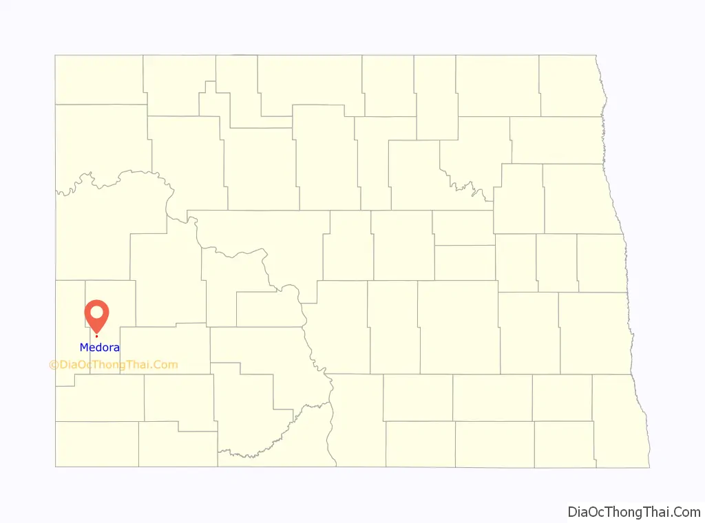
Medora location map. Where is Medora city?

History
Medora was founded in 1883 along the transcontinental rail line of the Northern Pacific Railway by French nobleman Marquis de Mores, who named the city after his wife Medora von Hoffman. Marquis de Mores wanted to ship refrigerated meat to Chicago via the railroad. He built a meat packing plant for this purpose and a house named the Chateau de Mores, which is now a museum.
In the evening of April 7, 1903, President Theodore Roosevelt, who had visited and invested in ranches in the area in the 1880s, visited Medora on a presidential tour of the Western United States. Most of the Badlands’ residents turned out to greet him on his whistle stop. Roosevelt later recalled that “the entire population of the Badlands down to the smallest baby had gathered to meet me… They all felt I was their man, their old friend; and even if they had been hostile to me in the old days when we were divided by the sinister bickering and jealousies and hatreds of all frontier communities, they now firmly believed they had always been my staunch friends and admirers. I shook hands with them all and…I only regretted that I could not spend three hours with them.” A local hotel changed its name that same year to the Rough Riders Hotel. In 1986 the hotel was purchased and operated by the Theodore Roosevelt Medora Foundation.
Also home to the popular Medora Musical, the city of Medora has become one of the most popular tourist attractions in the state.
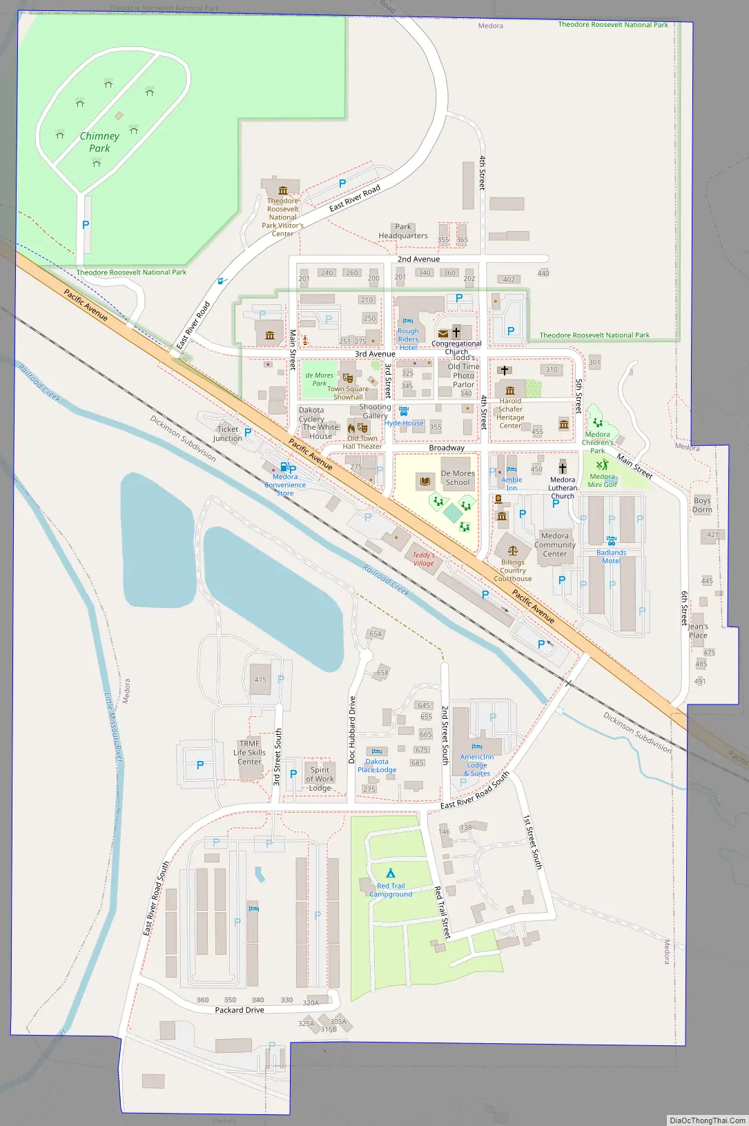
Medora Road Map
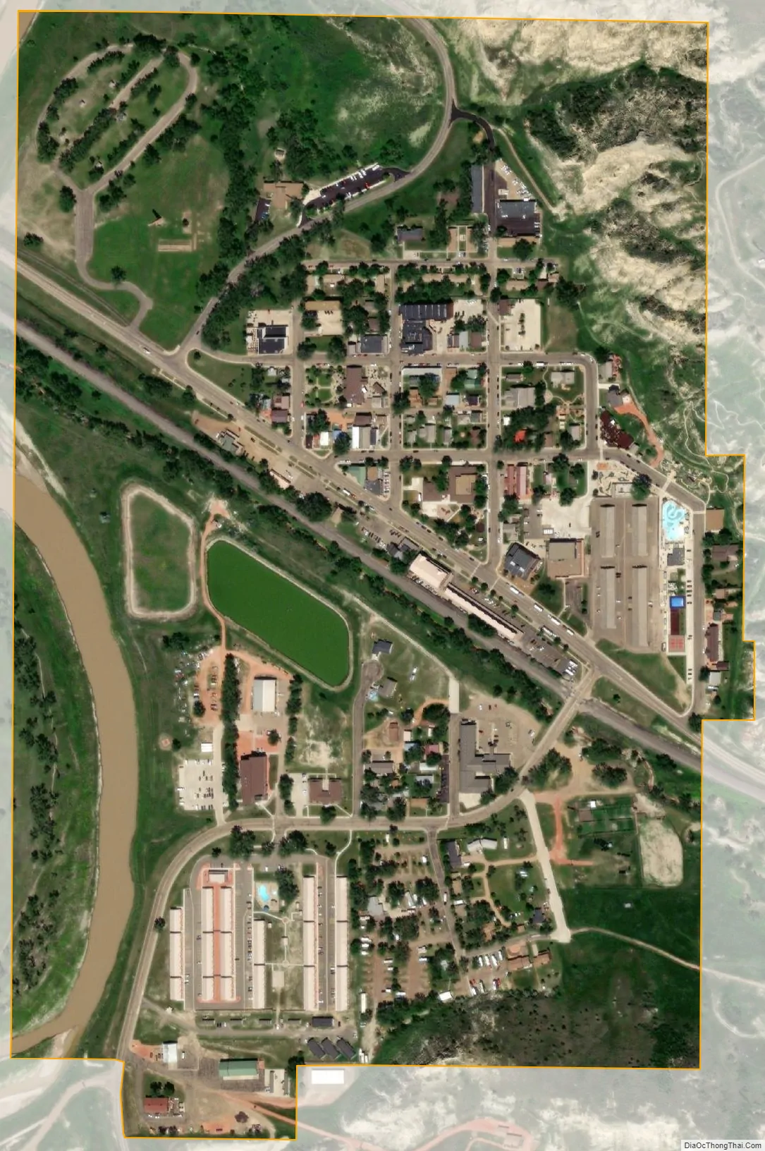
Medora city Satellite Map
Geography
Medora is located at 46°54′51″N 103°31′30″W / 46.91417°N 103.52500°W / 46.91417; -103.52500 (46.914258, -103.524942).
According to the United States Census Bureau, the city has a total area of 0.37 square miles (0.96 km), of which 0.36 square miles (0.93 km) is land and 0.01 square miles (0.03 km) is water.
Climate
According to the Köppen climate classification system, Medora has a cold semi-arid climate (BSk).
See also
Map of North Dakota State and its subdivision:- Adams
- Barnes
- Benson
- Billings
- Bottineau
- Bowman
- Burke
- Burleigh
- Cass
- Cavalier
- Dickey
- Divide
- Dunn
- Eddy
- Emmons
- Foster
- Golden Valley
- Grand Forks
- Grant
- Griggs
- Hettinger
- Kidder
- Lamoure
- Logan
- McHenry
- McIntosh
- McKenzie
- McLean
- Mercer
- Morton
- Mountrail
- Nelson
- Oliver
- Pembina
- Pierce
- Ramsey
- Ransom
- Renville
- Richland
- Rolette
- Sargent
- Sheridan
- Sioux
- Slope
- Stark
- Steele
- Stutsman
- Towner
- Traill
- Walsh
- Ward
- Wells
- Williams
- Alabama
- Alaska
- Arizona
- Arkansas
- California
- Colorado
- Connecticut
- Delaware
- District of Columbia
- Florida
- Georgia
- Hawaii
- Idaho
- Illinois
- Indiana
- Iowa
- Kansas
- Kentucky
- Louisiana
- Maine
- Maryland
- Massachusetts
- Michigan
- Minnesota
- Mississippi
- Missouri
- Montana
- Nebraska
- Nevada
- New Hampshire
- New Jersey
- New Mexico
- New York
- North Carolina
- North Dakota
- Ohio
- Oklahoma
- Oregon
- Pennsylvania
- Rhode Island
- South Carolina
- South Dakota
- Tennessee
- Texas
- Utah
- Vermont
- Virginia
- Washington
- West Virginia
- Wisconsin
- Wyoming