Chautauqua County is the westernmost county in the U.S. state of New York. As of the 2020 census, the population was 127,657. Its county seat is Mayville, and its largest city is Jamestown. Its name is believed to be the lone surviving remnant of the Erie language, a tongue lost in the 17th century Beaver Wars; its meaning is unknown and a subject of speculation. The county was created in 1808 and organized in 1811.
Chautauqua County comprises the Jamestown–Dunkirk–Fredonia, NY Micropolitan Statistical Area. It is located south of Lake Erie and includes a small portion of the Cattaraugus Reservation of the Seneca.
| Name: | Chautauqua County |
|---|---|
| FIPS code: | 36-013 |
| State: | New York |
| Founded: | February 9, 1811 |
| Named for: | Chautauqua Lake |
| Seat: | Mayville |
| Largest city: | Jamestown |
| Total Area: | 1,500 sq mi (4,000 km²) |
| Land Area: | 1,060 sq mi (2,700 km²) |
| Total Population: | 127,657 |
| Population Density: | 120.4/sq mi (46.5/km²) |
| Time zone: | UTC−5 (Eastern) |
| Summer Time Zone (DST): | UTC−4 (EDT) |
| Website: | www.co.chautauqua.ny.us |
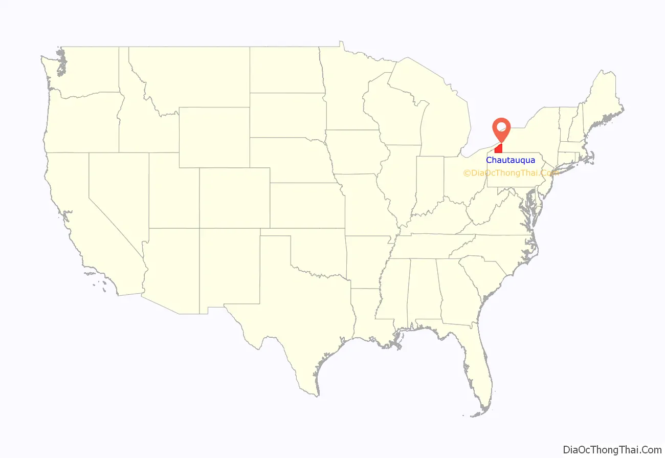
Chautauqua County location map. Where is Chautauqua County?
History
Prior to European colonization, most of what is now Chautauqua County was inhabited by the indigenous Erie people prior to the Beaver Wars in the 1650s. French forces traversed the territory beginning in 1615. The Seneca Nation conquered the territory during the Beaver Wars and held it through the next century until siding with the British crown, their allies for most of the 18th century, against the American revolutionaries in the American Revolutionary War.
Chautauqua County was organized by the state legislature during the development of western New York after the American Revolutionary War and the ratification of The Treaty of Canandaigua, between the United States and the Council of the Six Nations. It was officially separated from Genesee County on March 11, 1808. This partition was performed under the same terms that produced Cattaraugus and Niagara counties. The partition was done for political purposes, but the counties were not properly organized for self-government, so they were all administered as part of Niagara County.
On February 9, 1811, Chautauqua was completely organized, and its separate government was launched. This established Chautauqua as a county of 1,100 square miles (2,850 square km) of land. Chautauqua has not been altered since.
The first New York Chautauqua Assembly, was organized in 1874 by Methodist minister John Heyl Vincent and businessman Lewis Miller in the county at a campsite on the shores of Chautauqua Lake.
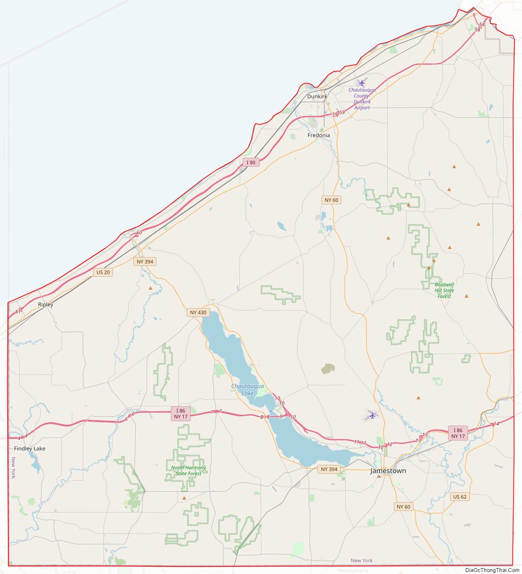
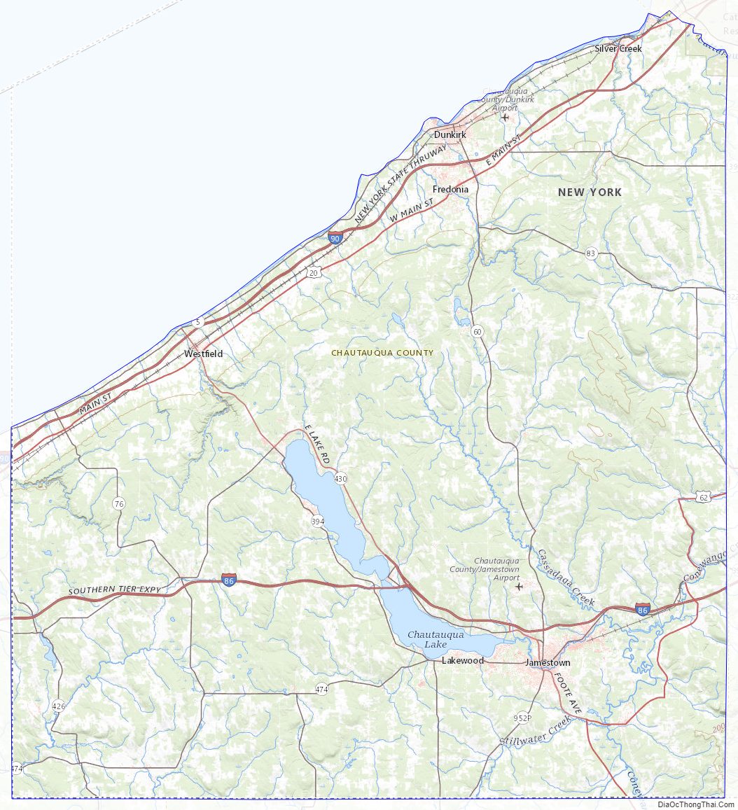
Chautauqua County Road Map

Geography
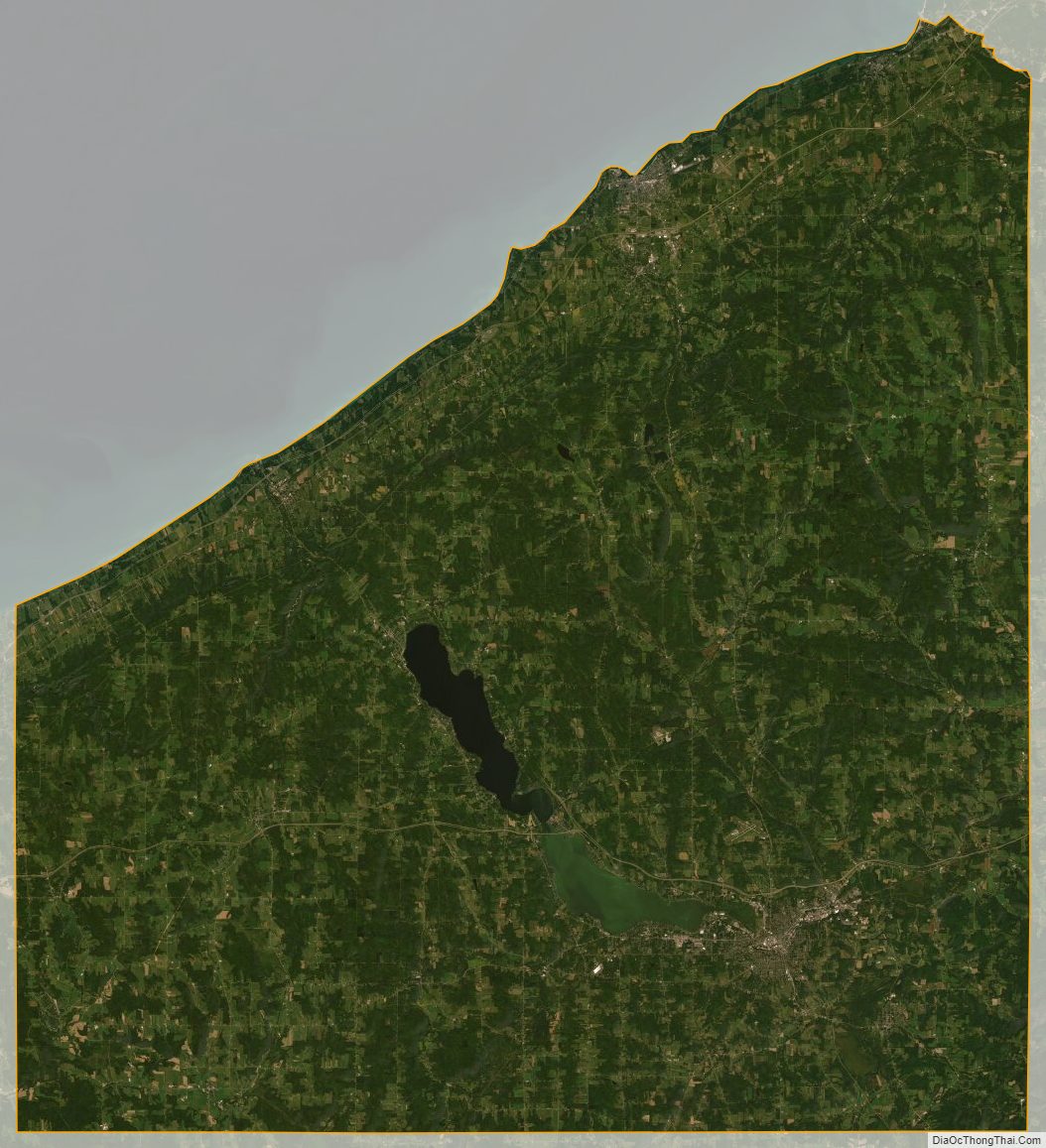
According to the U.S. Census Bureau, the county has a total area of 1,500 square miles (3,900 km), of which 1,060 square miles (2,700 km) is land and 440 square miles (1,100 km) (29%) is water.
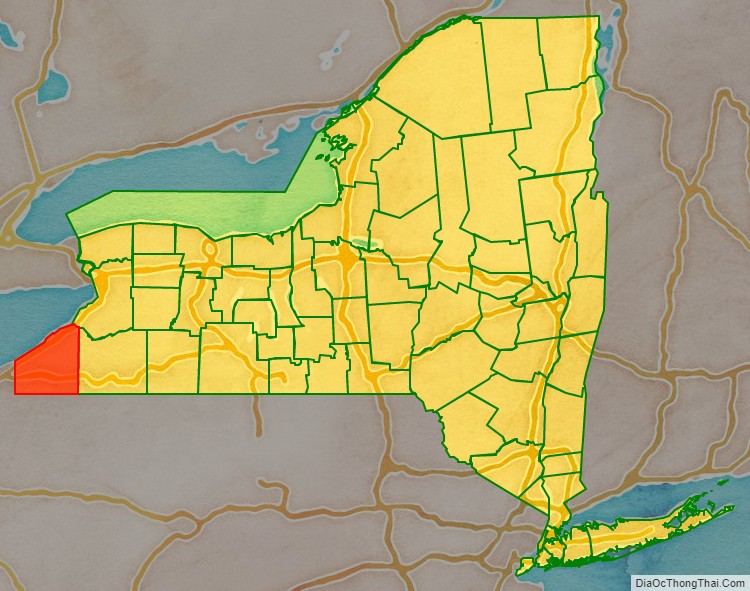
Chautauqua County, in the southwestern corner of New York State, along the New York-Pennsylvania border, is the westernmost of New York’s counties. Chautauqua Lake is located in the center of the county, and Lake Erie is its northern border.
Part of the Eastern Continental Divide runs through Chautauqua County. The area that drains into the Conewango Creek (including Chautauqua Lake) eventually empties into the Gulf of Mexico; the rest of the county’s watershed empties into Lake Erie and via Lake Ontario and the St. Lawrence Seaway into the North Atlantic Ocean. This divide, known as the Chautauqua Ridge, can be used to mark the border between the Southern Tier and the Niagara Frontier. It is also a significant dividing point in the county’s geopolitics, with the “North County” being centered on Dunkirk and the “South County” centered on Jamestown each having their own interests.
The county is generally composed of rolling hills and valleys, with elevations ranging anywhere between 1100 and 2100 feet, although the land within a few miles of Lake Erie is generally flat and at an elevation of 1000 feet or lower. The lowest point in the county is Lake Erie, at 571 feet (174 meters), and the highest point is Gurnsey Benchmark at 2,180 feet (660 meters).
Adjacent counties
- Erie County – northeast
- Cattaraugus County – east
- Warren County, Pennsylvania – southeast
- Erie County, Pennsylvania – southwest
Major highways
- I-86 / NY 17 / Southern Tier Expressway
- I-90 Toll / New York Thruway
- US 20
- US 62
- NY 5
- NY 39
- NY 60
- NY 83
- NY 394
- NY 426
- NY 430
- NY 474
Chautauqua County Topographic Map
Chautauqua County Satellite Map
Chautauqua County Outline Map