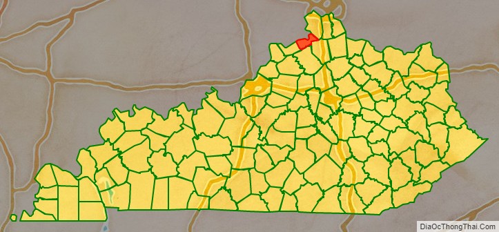
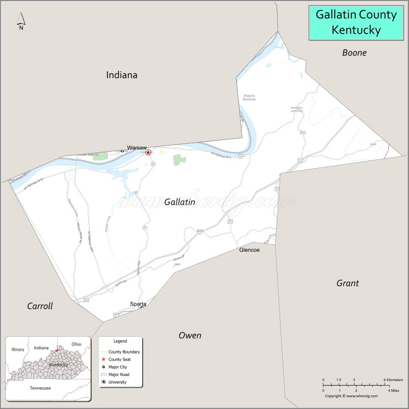
Gallatin County, is a county located in the northern part of the U.S. state of Kentucky. Its county seat is Warsaw. The county was founded in 1798 and named for Albert Gallatin, the Secretary of the Treasury under President Thomas Jefferson. Gallatin County is included in the Cincinnati-Middletown, OH-KY-IN Metropolitan Statistical Area. It is located along the Ohio River across from Indiana.
| Name: | Gallatin County |
|---|---|
| FIPS code: | 21-077 |
| State: | Kentucky |
| Founded: | 1798 |
| Named for: | Albert Gallatin |
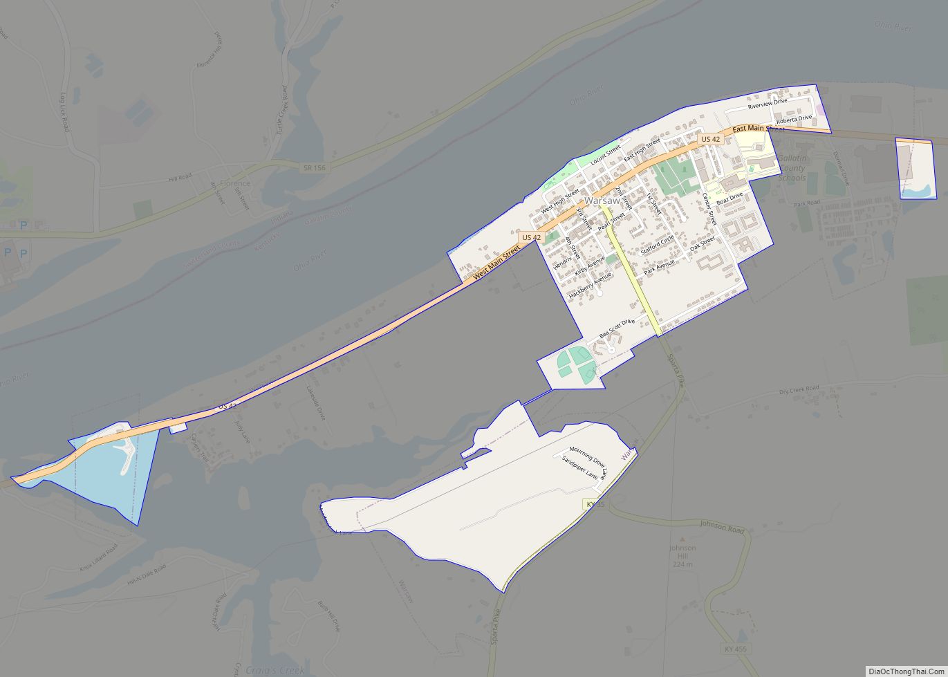
| Seat: | Warsaw |
| Largest city: | Warsaw |
| Total Area: | 105 sq mi (270 km²) |
| Land Area: | 101 sq mi (260 km²) |
| Total Population: | 8,690 |
| Population Density: | 83/sq mi (32/km²) |
| Time zone: | UTC−5 (Eastern) |
| Summer Time Zone (DST): | UTC−4 (EDT) |
| Website: | gallatincounty.ky.gov |
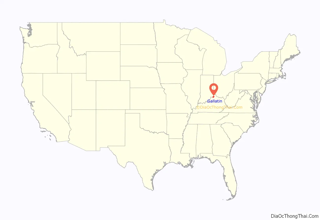
Gallatin County location map. Where is Gallatin County?
History
The county was formed on December 14, 1798. Gallatin was the 31st Kentucky county to be established. It was derived from parts of Franklin and Shelby counties. Later, parts of the county were pared off to create three additional counties: Owen in 1819, Trimble in 1836, and Carroll in 1838. Today Gallatin is one tenth of its original size. Its northern border is the Ohio River.
The population of Gallatin County in 1800 was 1,291, according to the Second Census of Kentucky, composed of 960 whites, 329 slaves, and 2 “freemen of color”.
During the Civil War, several skirmishes occurred in the county and the Union Army arrested a number of men for treason for supporting the Confederates.
The 1866 Gallatin County Race Riot happened just after the Civil War, when bands of lawless Ku Klux Klansmen terrorized parts of the Bluegrass State. “A band of five hundred whites in Gallatin County… forced hundreds of blacks to flee across the Ohio River.”
On December 4, 1868, two passenger steamers, the America and the United States, collided on the Ohio River near Warsaw. The United States carried a cargo of kerosene barrels which caught fire. The flames soon spread to the America, and many passengers perished by burning or drowning. The combined death toll was 162, making it one of the most deadly steamboat accidents in American history.
The Lynchings of the Frenches of Warsaw were conducted by a white mob on May 3, 1876. It was unusual as Benjamin and Mollie French were killed for the murder of Lake Jones, another, older African-American man. They were hanged by local masked KKK members.
As the 20th century progressed, commercial river trade began to decline, and the steamboat era ended, as faster means of transportation became available. Rail lines expanded, automobiles and trucks became reliable, and aircraft soon arrived on the scene. In the postwar period after World War II, numerous major highways were constructed, leading to greater auto travel and commuting. Gallatin County is traversed by I-71, U.S. 42, and U.S. 127. By the 1980s, more than 50 percent of the population was employed outside the county.
Construction on the Markland Locks and Dam began in 1956 and was completed in 1964. In 1967 a hydroelectric power plant was built at the dam, which provided jobs.
Marco Allen Chapman was executed in 2008 for multiple murders he committed on August 23, 2002, in Warsaw, Kentucky. He murdered two children, Chelbi Sharon, 7, and Cody Sharon, 6, by slitting their throats. He raped and stabbed their mother, Carolyn Marksberry, more than 15 times. A third child, daughter 10-year-old Courtney Sharon, played dead after being stabbed and then escaped. Thirty-seven-year-old Chapman was executed on November 21, 2008, by lethal injection at the Kentucky State Penitentiary in Eddyville, Kentucky. He was the last person executed by the Commonwealth.
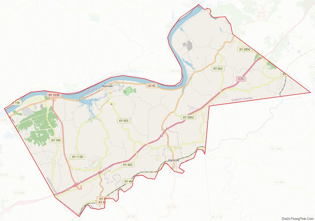
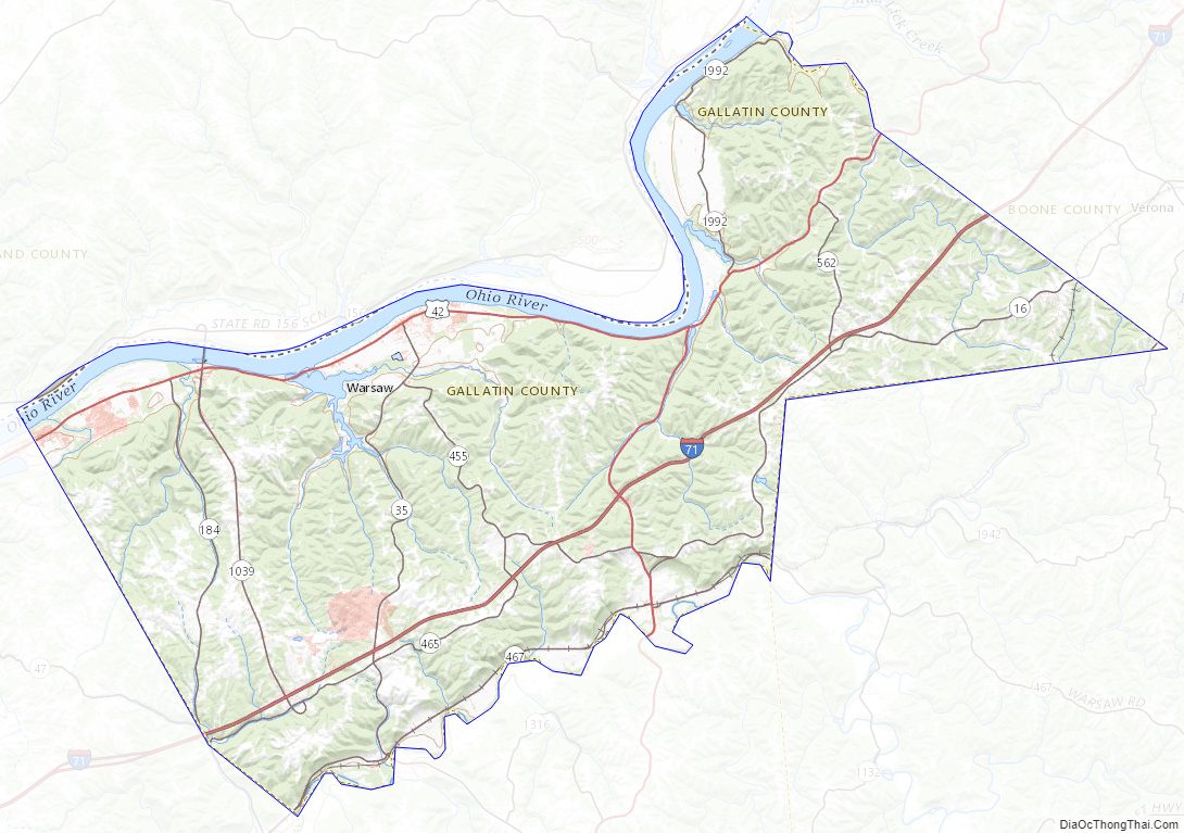
Gallatin County Road Map
Geography
According to the U.S. Census Bureau, the county has a total area of 105 square miles (270 km), of which 101 square miles (260 km) is land and 3.5 square miles (9.1 km) (3.3%) is water. It is the second smallest county by area in Kentucky.
Adjacent counties
- Switzerland County, Indiana (north)
- Boone County (northeast)
- Grant County (southeast)
- Owen County (south)
- Carroll County (west)
Gallatin County Topographic Map
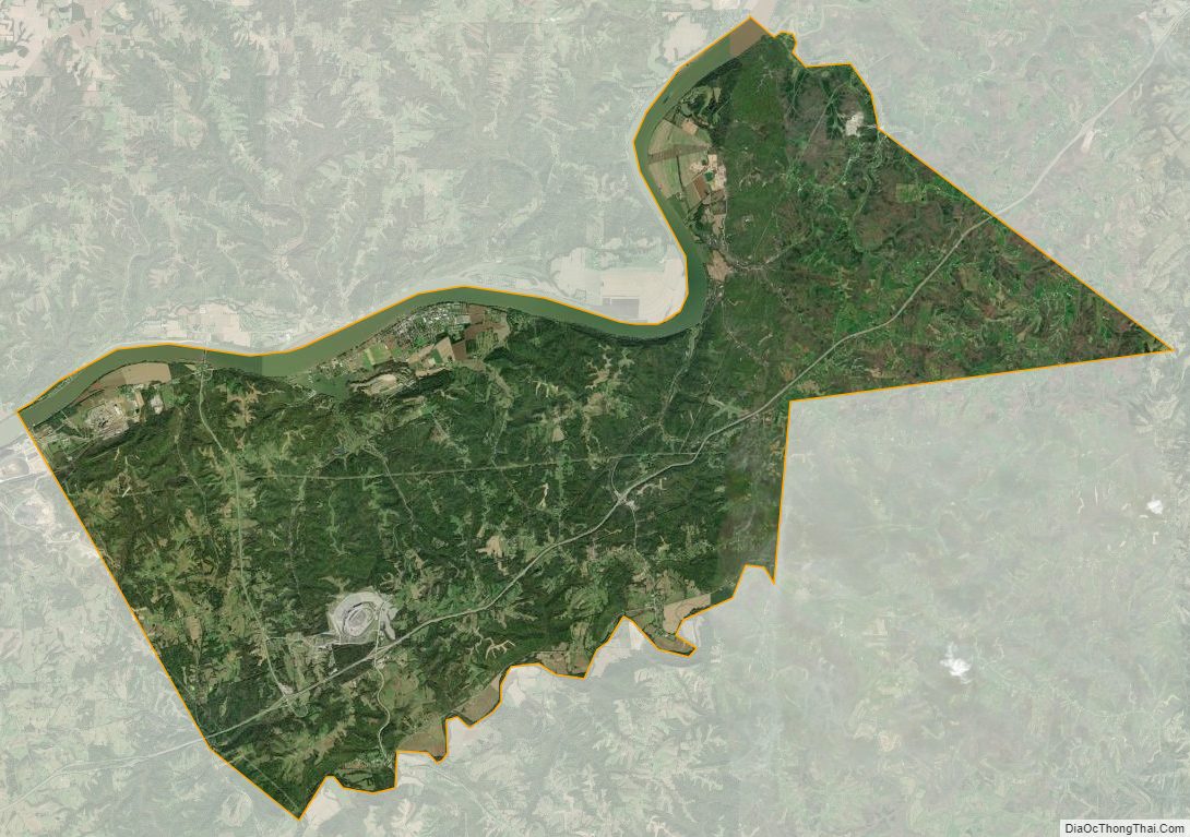
Gallatin County Satellite Map
Gallatin County Outline Map