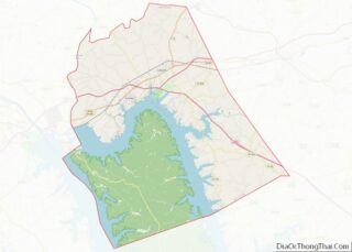
Eddyville is a home rule-class city in and the county seat of Lyon County, Kentucky, United States. The population was 2,554 at the 2010 census, up from 2,350 in 2000. The Kentucky State Penitentiary is located at Eddyville. The town is considered a tourist attraction because of its access to nearby Lake Barkley.
| Name: | Eddyville city |
|---|---|
| LSAD Code: | 25 |
| LSAD Description: | city (suffix) |
| State: | Kentucky |
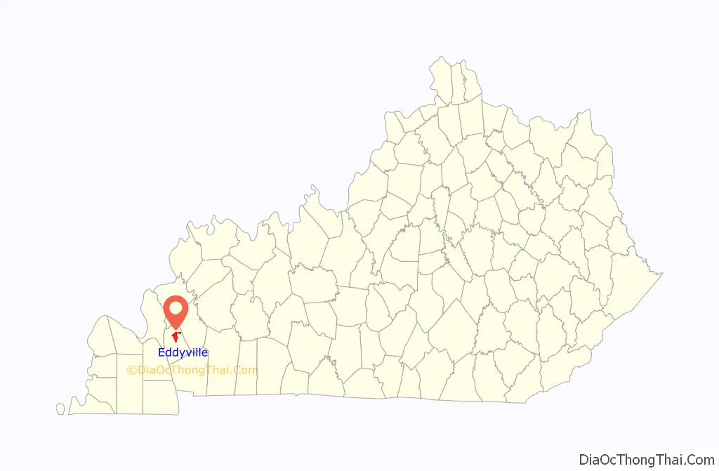
| County: | Lyon County |
| Elevation: | 436 ft (133 m) |
| Total Area: | 7.71 sq mi (19.98 km²) |
| Land Area: | 6.90 sq mi (17.87 km²) |
| Water Area: | 0.81 sq mi (2.11 km²) |
| Total Population: | 2,375 |
| Population Density: | 344.30/sq mi (132.94/km²) |
| ZIP code: | 42038 |
| Area code: | 270 & 364 |
| FIPS code: | 2123824 |
| GNISfeature ID: | 2403538 |
| Website: | eddyvilleky.org |
Online Interactive Map
Click on ![]() to view map in "full screen" mode.
to view map in "full screen" mode.
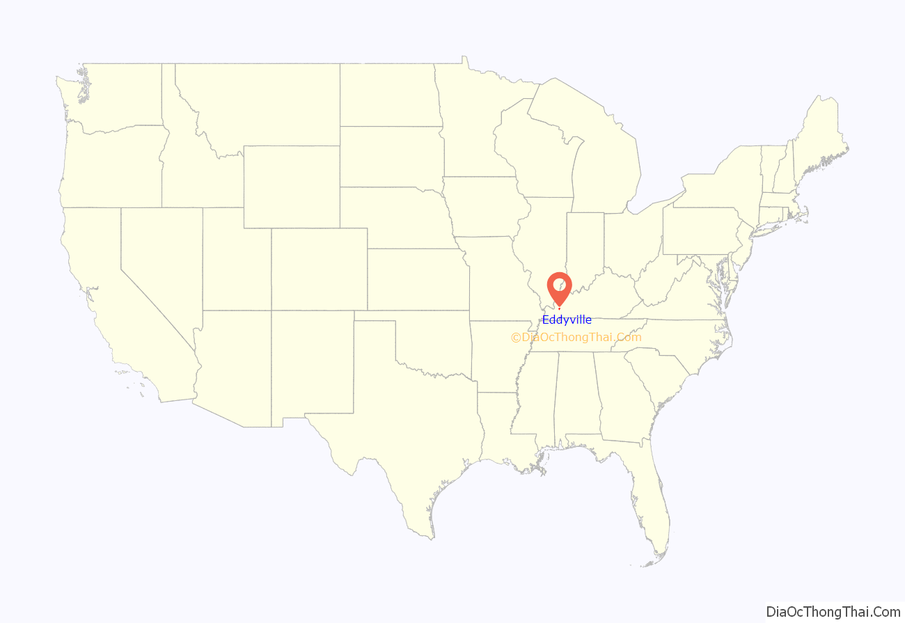
Eddyville location map. Where is Eddyville city?
History
Eddyville, the seat of Lyon County, was settled around 1798 and named for the eddies in the nearby Cumberland River. It became the seat of Livingston County when the county was formed in 1799; then the seat of Caldwell County upon its formation in 1809; and finally the seat of Lyon County upon its establishment in 1854. Thus, it holds the distinction of being the only city in Kentucky to have served as the county seat of three separate counties. The Eddyville post office opened in 1801.
Throughout Kentucky, Eddyville is best known as a metonym for the Kentucky State Penitentiary, although the prison itself is actually 3 miles (5 km) south of the present town on the shore of Lake Barkley in “Old Eddyville” on KY 730. Taking six years to build (1884–1890), the massive stone prison structure towers over Lake Barkley and is sometimes called “The Castle on the Cumberland.” Its electric chair has had a long history of use, dating to the period before 1936 when executions were still publicly conducted in Kentucky for some crimes (e.g. rape as in the case of Rainey Bethea) while electrocutions at Eddyville were strictly reserved for others (e.g., murder). Executions are still held at the prison, although there have only been three since 1976 and only one since 1999. The primary method has been changed to lethal injection.
Following the completion of Kentucky Dam in the 1940s, rumors began that a dam would be built on the lower Cumberland. This meant relocating Eddyville and Kuttawa. By the mid-1950s, the construction plans were confirmed. The U.S. Army Corps of Engineers began surveying for the construction of Barkley Dam. This was met with anger from the local population.
The situation was resolved by Lee S. Jones, a native of Lyon County who had attended law school and settled in Louisville, where he had gained a reputation as one of the best “tax lawyers” and made his wealth. Jones had purchased farms in the Fairview community (which is now the site of Eddyville). He came to the Eddyville City Council and presented his plan: each person owning land in the towns (Eddyville and Kuttawa) to be flooded would receive a free lot in the new Eddyville site. This also applied to businesses.
Eddyville residents accepted his offer and on August 13, 1959, the official plat for the new town was filed with the county court clerk. The plat included 254 residential lots, 46 business lots, 28 acres (110,000 m) for construction of a school and campus, city park, courthouse, health office, water works, and location of streets.
August 28, 1959, was designated as “Dedication and Free Deed Day” at the new site. A large group of people gathered for the event, which was held in a field, close to the site of the current post office. Mr. Jones handed the first deed to Boyce and Lillian Yates, then presented approximately 60 more residential lots. The first house to be built in the new town was the home of Mr. and Mrs. J. I. Moore. The first business to be built was the Kentucky Utilities office. During the time of building, Eddyville was “booming” and, with the impoundment of Lake Barkley in the 1960s, tourists began making their way into the area for the abundance of fish and boating. However, the tourist influx wasn’t sufficient to create steady economic growth. Although campgrounds and marinas were springing up around the lake, the city was struggling.
Construction of the West Kentucky Outlet Mall was launched in December 1988. Three brothers, Bob, Darrell and Ben Jent, purchased a tract of land in the city limits of Eddyville and started construction of a mall, which opened the following fall with ten stores. Within a short time the mall would boast a total of nearly 50 stores. The opening of the mall brought a surge of progress to Eddyville, as a variety of businesses began to move into the city. For the first time in the town’s history, people could choose their favorite restaurant, motel, clothing store or other places to shop—all without leaving town. It has been said the mall did more for the progress of Eddyville than any other endeavor since the establishment of the town in 1799, with the possible exception of the building of the Kentucky State Penitentiary. The town was listed as the second fastest growing area in Kentucky in 1997 based on tourism.
The mall has since suffered severe economic troubles, and few stores are currently left.
A regional water park, Venture River, operates seasonally in Eddyville.
Hundreds of homes and businesses were damaged or destroyed in Eddyville and Lyon County from an EF4 tornado that ripped through western Kentucky on December 10-11, 2021.
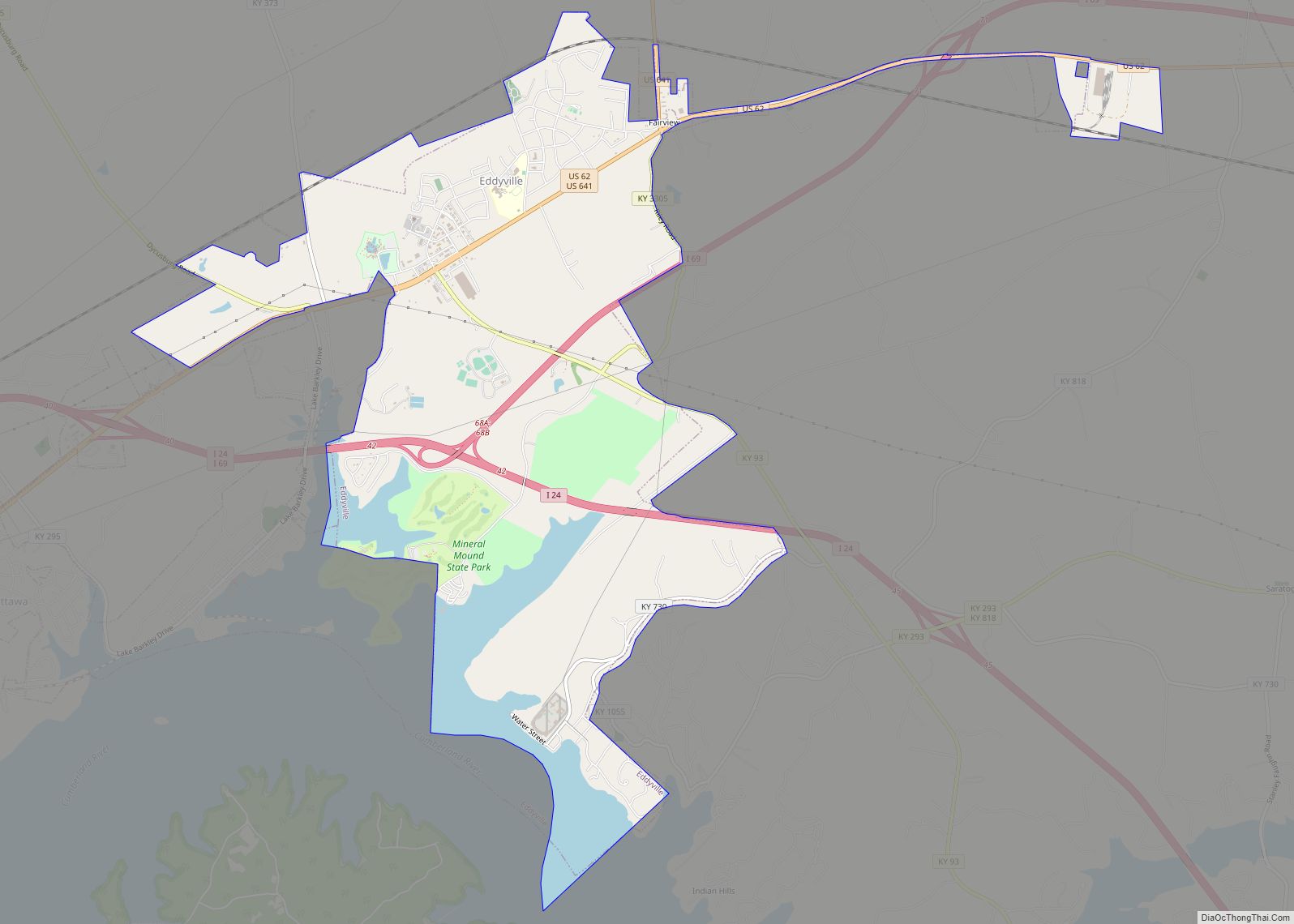
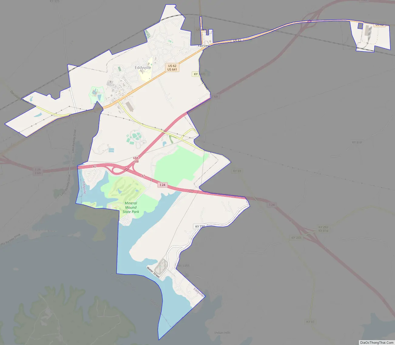
Eddyville Road Map
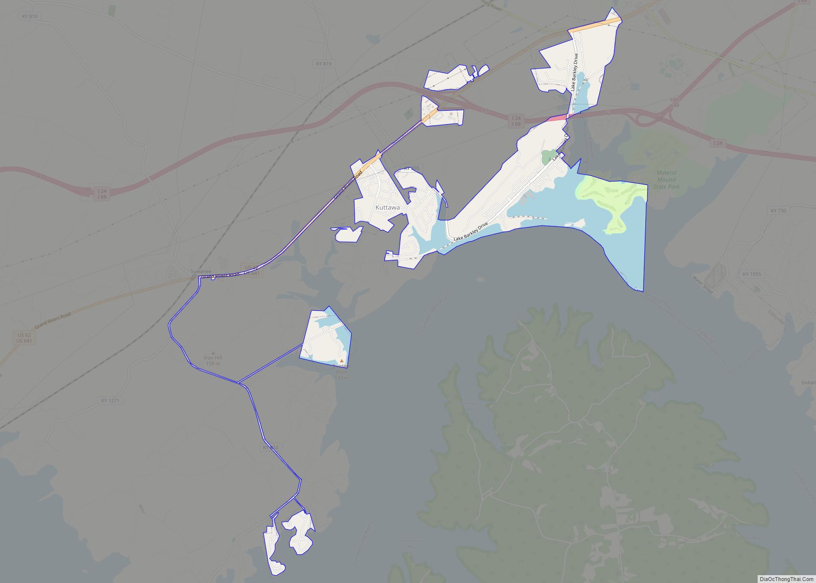
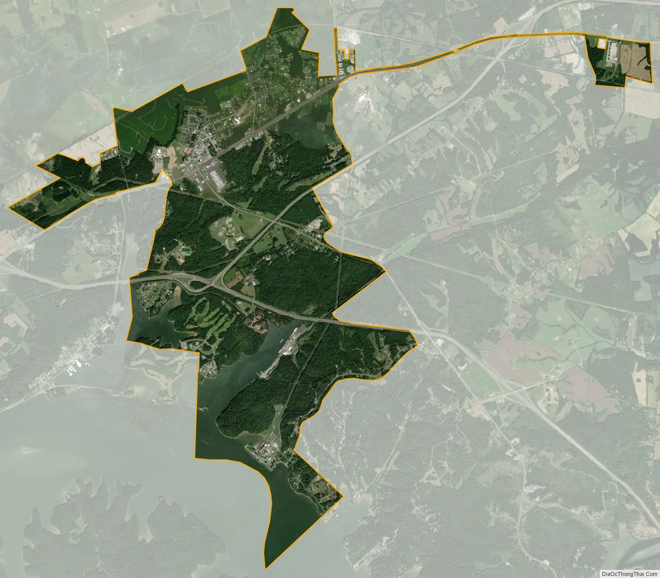
Eddyville city Satellite Map
Geography
Eddyville is located in north-central Lyon County and is bordered to the west by Kuttawa and to the south by Lake Barkley on the Cumberland River.
Two Interstate highways, I-24 and I-69, intersect in Eddyville. I-24 leads southeast 102 miles (164 km) to Nashville, Tennessee, and west 34 miles (55 km) to Paducah, while I-69 leads northeast 94 miles (151 km) to Evansville, Indiana, and southwest 66 miles (106 km) to the Tennessee border at Fulton. The two highways lead west together from Eddyville for 16 miles (26 km) before splitting near Calvert City. U.S. Route 62 passes through the center of Eddyville, leading northeast 11 miles (18 km) to Princeton and southwest 4 miles (6 km) into Kuttawa. U.S. Route 641 passes through Eddyville with US 62 but splits off at the northeast border of the city and leads north 18 miles (29 km) to its northern terminus in Marion.
Mineral Mound State Park occupies a peninsula in Lake Barkley in the southern part of the city. The park, golf course and peninsula extend southwest into the city limits of Kuttawa. The Kentucky State Penitentiary, also fronting on Lake Barkley, is within the southernmost extent of the Eddyville limits, 5 miles (8 km) by road south of the center of town.
According to the United States Census Bureau, Eddyville has a total area of 7.7 square miles (20.0 km), of which 6.9 square miles (17.9 km) are land and 0.81 square miles (2.1 km), or 10.56%, are water.
See also
Map of Kentucky State and its subdivision:- Adair
- Allen
- Anderson
- Ballard
- Barren
- Bath
- Bell
- Boone
- Bourbon
- Boyd
- Boyle
- Bracken
- Breathitt
- Breckinridge
- Bullitt
- Butler
- Caldwell
- Calloway
- Campbell
- Carlisle
- Carroll
- Carter
- Casey
- Christian
- Clark
- Clay
- Clinton
- Crittenden
- Cumberland
- Daviess
- Edmonson
- Elliott
- Estill
- Fayette
- Fleming
- Floyd
- Franklin
- Fulton
- Gallatin
- Garrard
- Grant
- Graves
- Grayson
- Green
- Greenup
- Hancock
- Hardin
- Harlan
- Harrison
- Hart
- Henderson
- Henry
- Hickman
- Hopkins
- Jackson
- Jefferson
- Jessamine
- Johnson
- Kenton
- Knott
- Knox
- Larue
- Laurel
- Lawrence
- Lee
- Leslie
- Letcher
- Lewis
- Lincoln
- Livingston
- Logan
- Lyon
- Madison
- Magoffin
- Marion
- Marshall
- Martin
- Mason
- McCracken
- McCreary
- McLean
- Meade
- Menifee
- Mercer
- Metcalfe
- Monroe
- Montgomery
- Morgan
- Muhlenberg
- Nelson
- Nicholas
- Ohio
- Oldham
- Owen
- Owsley
- Pendleton
- Perry
- Pike
- Powell
- Pulaski
- Robertson
- Rockcastle
- Rowan
- Russell
- Scott
- Shelby
- Simpson
- Spencer
- Taylor
- Todd
- Trigg
- Trimble
- Union
- Warren
- Washington
- Wayne
- Webster
- Whitley
- Wolfe
- Woodford
- Alabama
- Alaska
- Arizona
- Arkansas
- California
- Colorado
- Connecticut
- Delaware
- District of Columbia
- Florida
- Georgia
- Hawaii
- Idaho
- Illinois
- Indiana
- Iowa
- Kansas
- Kentucky
- Louisiana
- Maine
- Maryland
- Massachusetts
- Michigan
- Minnesota
- Mississippi
- Missouri
- Montana
- Nebraska
- Nevada
- New Hampshire
- New Jersey
- New Mexico
- New York
- North Carolina
- North Dakota
- Ohio
- Oklahoma
- Oregon
- Pennsylvania
- Rhode Island
- South Carolina
- South Dakota
- Tennessee
- Texas
- Utah
- Vermont
- Virginia
- Washington
- West Virginia
- Wisconsin
- Wyoming