Highland County is a county located in the Commonwealth of Virginia. As of the 2020 census, the population was 2,232. Its county seat is Monterey. Known as “Virginia’s Switzerland” or “Virginia’s Little Switzerland”, Highland County is the least populous jurisdiction in Virginia, including counties and independent cities. Highland lays claim to being one of the least populous counties and one of the highest average elevations east of the Mississippi River.
| Name: | Highland County |
|---|---|
| FIPS code: | 51-091 |
| State: | Virginia |
| Founded: | 1847 |
| Seat: | Monterey |
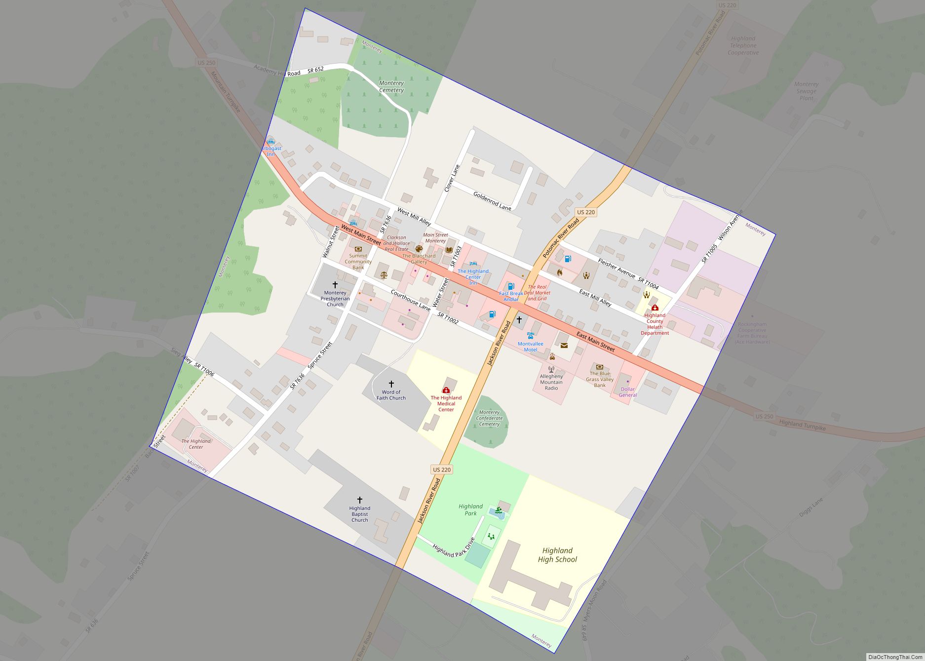
| Largest town: | Monterey |
| Total Area: | 416 sq mi (1,080 km²) |
| Land Area: | 415 sq mi (1,070 km²) |
| Total Population: | 2,232 |
| Population Density: | 5.4/sq mi (2.1/km²) |
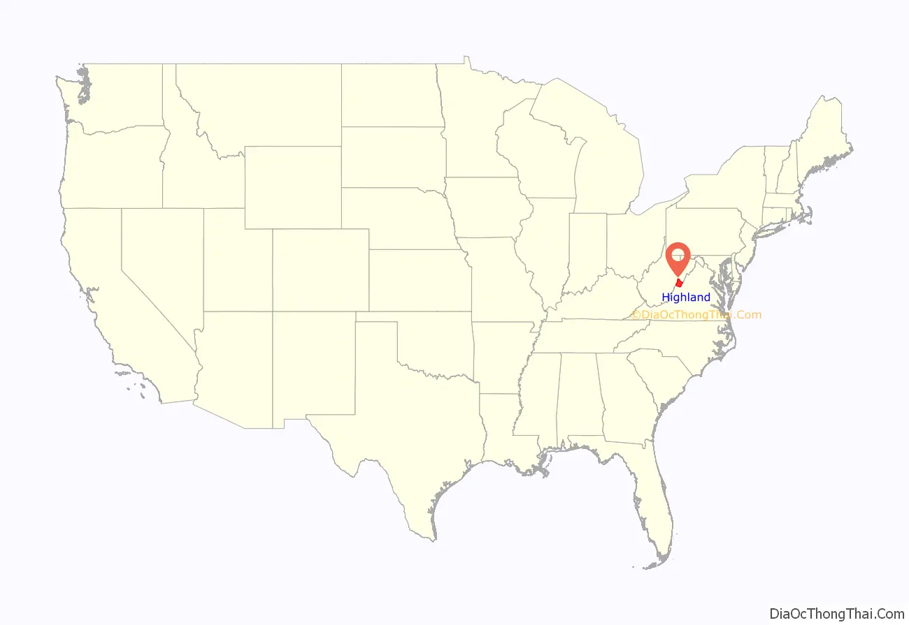
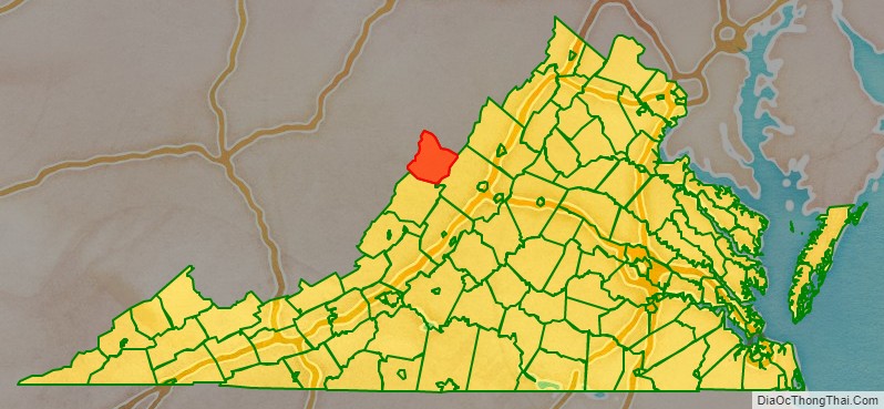
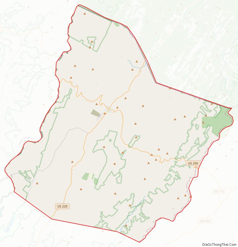
Highland County location map. Where is Highland County?
History
Settlement of this portion of the Colony of Virginia by Europeans began around 1745. Located west of the Tidewater and Piedmont regions in Virginia and also west of the Shenandoah Valley, this area is beyond (known in old Virginia as the “Transmountaine”) the Blue Ridge Mountains. Rather than cross such a formidable physical barrier, most early settlers came southerly up the Valley across the Potomac River from Maryland and Pennsylvania. Many followed the Great Wagon Road, also known as the Valley Pike (U.S. Route 11 in modern times). As German immigrants began to push over the mountains to the northern area of the present county, those of Scots-Irish descent settled in the southern part.
Even after Virginia and the other 12 colonies won their independence from Great Britain after the American Revolutionary War, the area remained sparsely populated. In the 1840s, the historic Staunton-Parkersburg Turnpike was built through the area. Engineered by Claudius Crozet through the mountainous terrain, it was a toll road partially funded by the Virginia Board of Public Works. The turnpike formed an important link between the upper Shenandoah Valley with the Ohio River.
Highland County was formed in 1847 from Bath County and Pendleton County after a bill was passed by the Virginia General Assembly on March 19 of that year. The desire for the new county’s formation arose due to multiple reasons, including the distances from the areas in present-day Highland to the county seats of Bath and Pendleton and the advantageous position of the new turnpike. Highland was named for its lofty elevation.
Control of the Staunton-Parkersburg Turnpike became crucial during the American Civil War (1861–1865). By all accounts, documented in many letters home from young troops, a miserable winter in 1861 was spent by Union and Confederate troops holding opposing high elevation positions along the road. The Battle of McDowell, the first Confederate victory of Stonewall Jackson’s Shenandoah Valley campaign, took place at McDowell on May 8, 1862.
In the 20th century, the Turnpike was re-designated as U.S. Route 250. In the 21st century, it remains Highland County’s major east–west roadway, and crossing into West Virginia, becomes a National Scenic Byway.
Highland County Road Map
Geography
According to the U.S. Census Bureau, Highland County has a total area of 415.9 square miles (1,077.2 km), of which 415.2 square miles (1,075.4 km) is land and 0.7 square miles (1.8 km) (0.2%) is water.
The county’s western border is naturally defined and lies along the Eastern Continental Divide in the Allegheny Mountains. Likewise, the eastern border lies along the ridge line of Shenandoah Mountain. The northern and southern boundaries of the county are defined more artificially, cutting across numerous mountain ridges and valleys. The county is bordered to the west by Pocahontas County in the state of West Virginia, to the north by Pendleton County, West Virginia, to the east by Augusta County, Virginia, and to the south by Bath County, Virginia. The county is 153 miles (246 km) northwest of Richmond, Virginia.
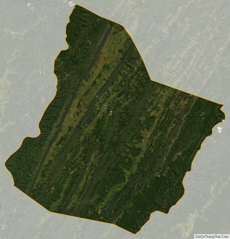
The average elevation of Highland County is 2,832 feet (863 m), which is the 16th highest average elevation among counties in the Eastern United States. The highest elevation in the county is 4,545 feet (1,385 m) in the Allegheny Mountains and the lowest elevation is 1,625 feet (495 m) near the Cowpasture River southwest of Patna. The western regions of the county are generally higher in elevation than are the eastern and especially southeastern regions. As the county lies within the Ridge-and-Valley province of the Appalachian Mountains, it features numerous valleys and mountain ridges that are generally oriented in a “northeast to southwest” direction. The valleys are from west to east the Alleghany Valley, the Bluegrass Valley, the Monterey Valley, the Bullpasture Valley, and the Cowpasture Valley. The majority of the county and all the southern portions of the county form part of the James River watershed, while northern sections drain into the Potomac River. West of Monterey, the divide is roughly centered along the path of U.S. Route 250; however, in eastern Highland County, the James watershed extends further northward.
The westernmost valley, the Alleghany Valley, is narrow and situated between Allegheny Mountain to the west and Lantz Mountain to the east. It is drained by Back Creek, a tributary of the Jackson River, in the southern section of the county and is drained by Straight Fork to the north. The Laurel Fork runs to the west of Alleghany Valley, joining the Straight Fork in Pendleton County, West Virginia to the north to form the North Fork South Branch Potomac River. The Bluegrass Valley contains the headwaters of the Jackson River south of U.S. 250 and the South Branch Potomac River to the north. The northern section of the valley, in the area of the village of Blue Grass, is considerably wider than the southern section of the valley. The Jackson River flows out of Bluegrass Valley to the east through Vanderpool Gap approximately 4 miles (6.4 km) south of Hightown. A short distance south, the Bluegrass Valley is drained by the Back Creek. Monterey Valley is located roughly in the center of the county, and its drainage is separated at Monterey. To the north of Monterey, the valley is drained by the Strait Creek and South Branch Potomac River; to the south, the valley is drained by the Jackson River. The Bullpasture Valley is drained throughout the county to the south by the Bullpasture River. The Cowpasture Valley, the easternmost valley in the county, is mostly drained to the south by the Cowpasture River, although a small portion to the north is drained by the South Fork South Branch Potomac River.
Adjacent counties
- Augusta County (southeast)
- Bath County (south)
- Pendleton County, West Virginia (north)
- Pocahontas County, West Virginia (west)
Protected areas
Highland County contains parts of the George Washington National Forest concentrated mainly along the county’s western and eastern borders. The Highland Wildlife Management Area, held by the Virginia Department of Game and Inland Fisheries, is a 14,283-acre (57.80 km) wildlife preserve located in three distinct locations within the county. These locations include the Jack Mountain tract southwest of McDowell, the Bullpasture Mountain tract south of McDowell in the southeastern corner of the county, and the Little Doe Hill tract west of McDowell. The national forest and Highland Wildlife Management Area combined account for 71,455 acres (289.17 km) of Highland County’s land, or approximately 28% of the county’s total land area.
All of Highland County is located within the United States National Radio Quiet Zone, a 13,000-square-mile (34,000 km) area of limited radio activity. The area is intended to minimize interference at the Green Bank Telescope operated by the National Radio Astronomy Observatory in Green Bank, West Virginia and the Sugar Grove Station in Sugar Grove, West Virginia.
Highland County Topographic Map

Highland County Satellite Map
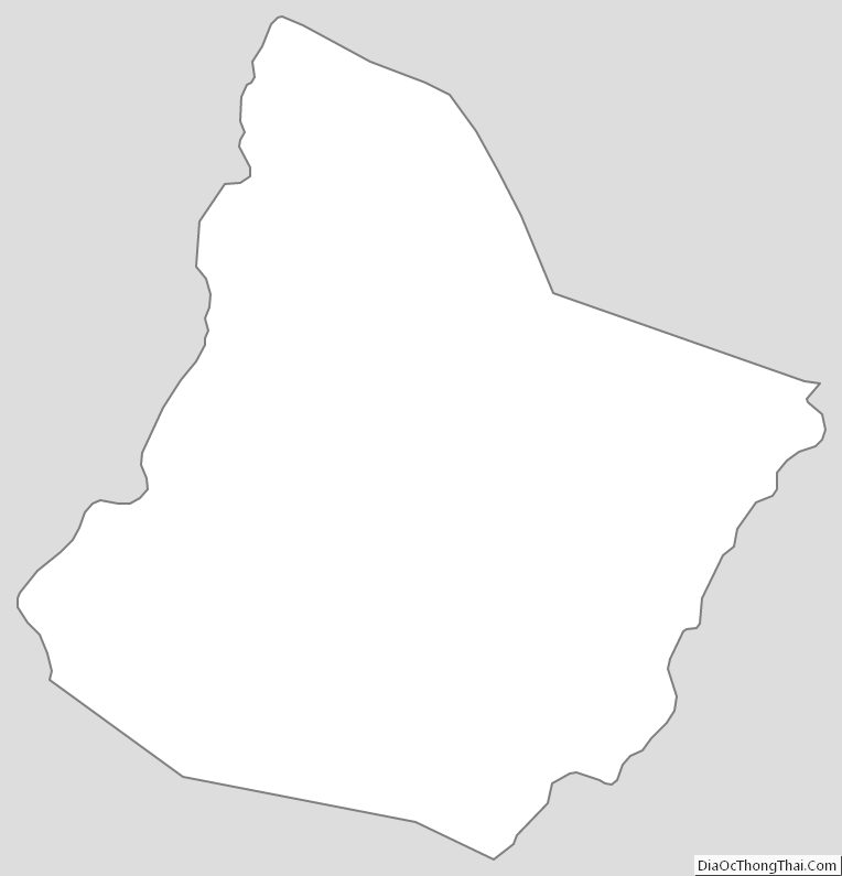
Highland County Outline Map