Kershaw County is a county located in the U.S. state of South Carolina. As of the 2020 census, its population was 65,403. The county seat and largest city is Camden. The county was created in 1791 from parts of Claremont, Lancaster, Fairfield, and Richland counties. It is named for Col. Joseph Kershaw (1727–1791), an early settler and American Revolutionary War patriot.
Kershaw County is part of the Columbia, South Carolina Metropolitan Statistical Area.
| Name: | Kershaw County |
|---|---|
| FIPS code: | 45-055 |
| State: | South Carolina |
| Founded: | 1791 |
| Named for: | Joseph Brevard Kershaw |
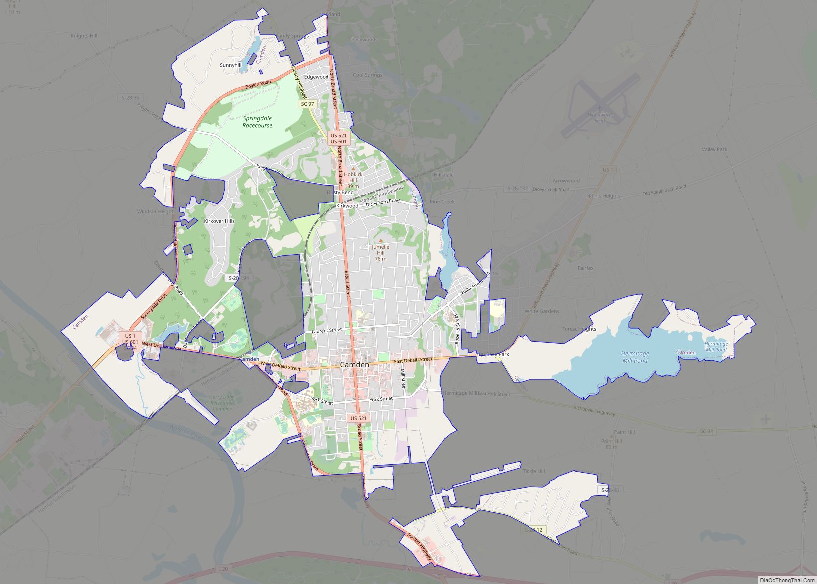
| Seat: | Camden |
| Largest city: | Camden |
| Total Area: | 740 sq mi (1,900 km²) |
| Land Area: | 727 sq mi (1,880 km²) |
| Total Population: | 65,403 |
| Population Density: | 88/sq mi (34/km²) |
| Time zone: | UTC−5 (Eastern) |
| Summer Time Zone (DST): | UTC−4 (EDT) |
| Website: | www.kershaw.sc.gov |
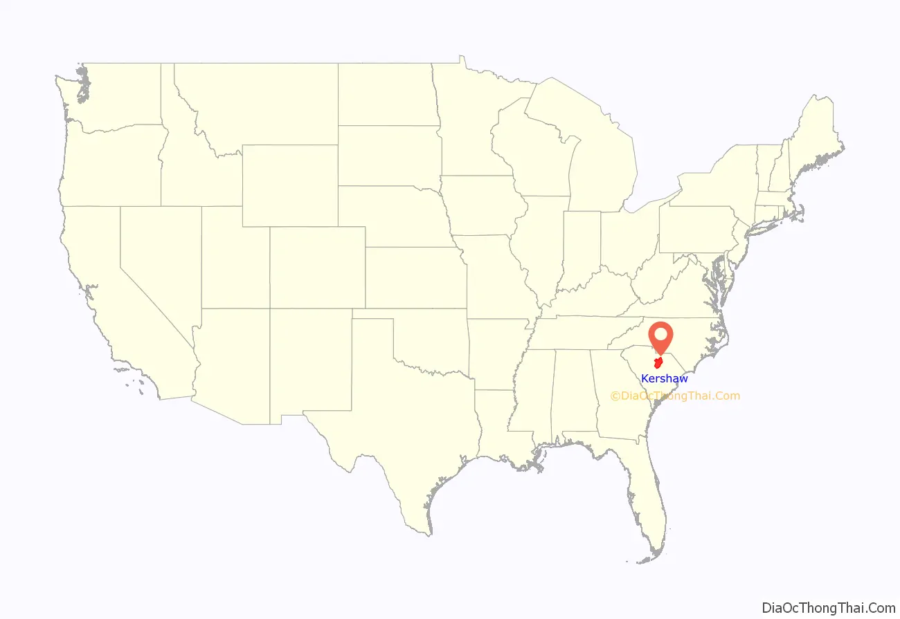
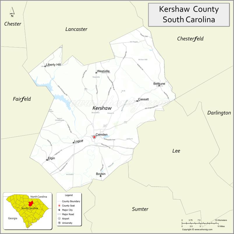
Kershaw County location map. Where is Kershaw County?
History
Kershaw County was named for Col. Joseph Kershaw (1727–1791), an early settler considered as “the father of Camden“. Originally part of Camden District, Kershaw County was formed in 1791 from parts of Claremont, Lancaster, Fairfield, and Richland counties. The county seat is Camden, the oldest inland city in South Carolina. This site was settled around 1732 by English traders and farmers who moved inland from Charleston. Welsh Baptists moved the area in large numbers in the 1740s and 1750s. At the time, in England and Wales Protestants who were not from the established Anglican church were politically disadvantaged in various ways, however, in South Carolina they could still practice freely (provided that they called their churches “meeting houses.”) Baptists from Abergavenny, Trap, Carmarthenshire, Llanbedr, Crickhowell, Vale of Grwyney, Abertillery, Griffithstown and Brecon arrived in what has since become Kershaw County between 1740 and 1760, primarily arriving as large family units. They were joined by a similar migration of English Baptists who came from Long Sutton, Lincolnshire, Boston, Lincolnshire, Coningsby, Grantham, as well as Christchurch, Dorset and Lymington. From about 1800 until about 1867, the county was known as Kershaw District.
During the American Revolutionary War, the British occupied Camden from June 1780 to May 1781. Fourteen battles took place in the area, including the Battle of Camden in 1780 and the Battle of Hobkirk’s Hill in 1781.
After the state seceded from the Union, six men from Kershaw served in the American Civil War as Confederate generals: James Cantey (1818–1873), James Chesnut (1815–1885), John Doby Kennedy (1840–1896), Joseph Brevard Kershaw (1822–1894), and John Bordenave Villepigue (1830–1862), Zachariah C. Deas (1819–1882). Richard Rowland Kirkland, a Confederate soldier and hero at the Battle of Fredericksburg, was also from Kershaw County. He served under General Kershaw. In the last months of the war, Union troops under Gen. William T. Sherman burned parts of Camden in February 1865, in their March to the Sea.
Under the 1868 South Carolina Constitution, the Kershaw District became home rule Kershaw County with the state representatives also being county commissioners. During the Reconstruction era, some freedmen and other men of color were elected to various political offices. Among them was Henry Cardozo, who had been pastor of Old Bethel Methodist Church in Charleston, South Carolina. He served in the state senate as a Republican from Kershaw County, from 1870 to 1874. (February 1, 1836 – July 22, 1903) was an American clergyman, politician, and educator. When Francis Lewis Cardozo was elected in South Carolina as Secretary of State in 1868, he was the first African American to hold a statewide office in the United States.
During World War I, two Kershaw County men were awarded the Medal of Honor in two separate actions while fighting in France in October 1918. The first was Richmond Hobson Hilton, recognized for actions taking place on October 11, 1918, during which he lost an arm. The second was John Canty Villepigue on October 15, 1918; he was wounded so severely in the action for which he was recognized that he died several months later from his injuries. Villepigue was a descendant of General John B. Villepigue noted above.
Statesman and financier Bernard M. Baruch (1870–1965), labor leader Lane Kirkland, and baseball player Larry Doby, the first African-American player in the American League, were each born in Kershaw County. Former South Carolina Governor John C. West was also from Kershaw County.
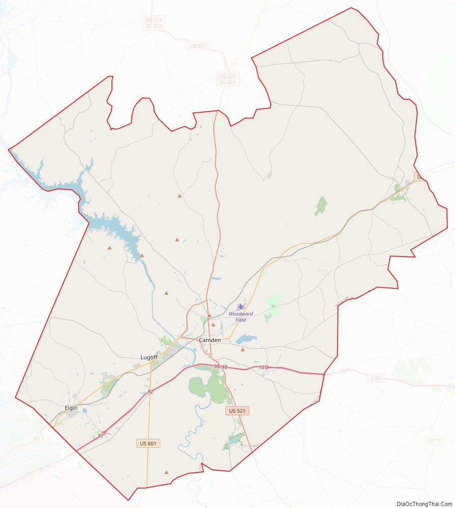
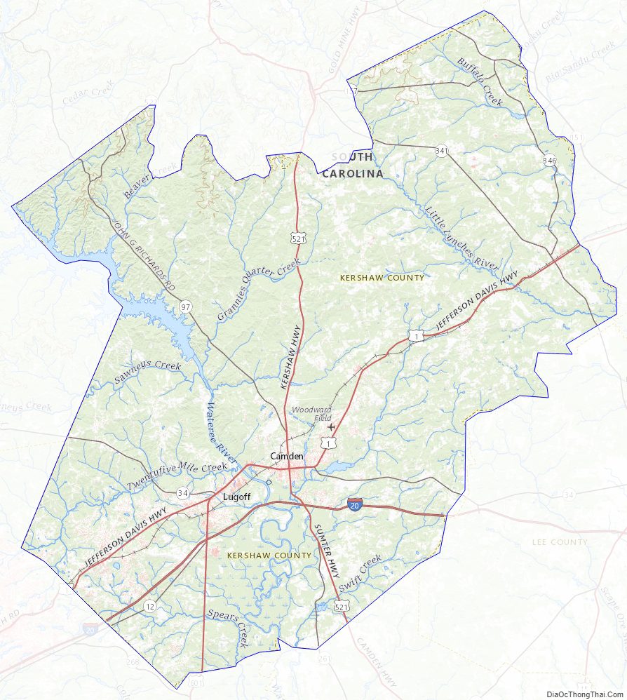
Kershaw County Road Map
Geography
According to the U.S. Census Bureau, the county has a total area of 740 square miles (1,900 km), of which 727 square miles (1,880 km) is land and 14 square miles (36 km) (1.9%) is water. Kershaw County is one of three counties that compromises Lake Wateree, in which the lake is compromised with the Wateree River, which flows through Kershaw County.
Earthquakes
Between December 2021 and December 2022, southeastern Kershaw County experienced over 80 earthquakes, 11 of which exceeded a 2.5 magnitude. 6 of the quakes exceeded a 3.0 magnitude, the largest of which registering at a 3.6.
National Protected areas
- Historic Camden Revolutionary War Site
- Camden Battlefield, site of the Battle of Camden
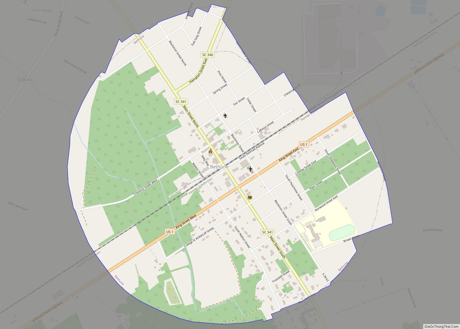
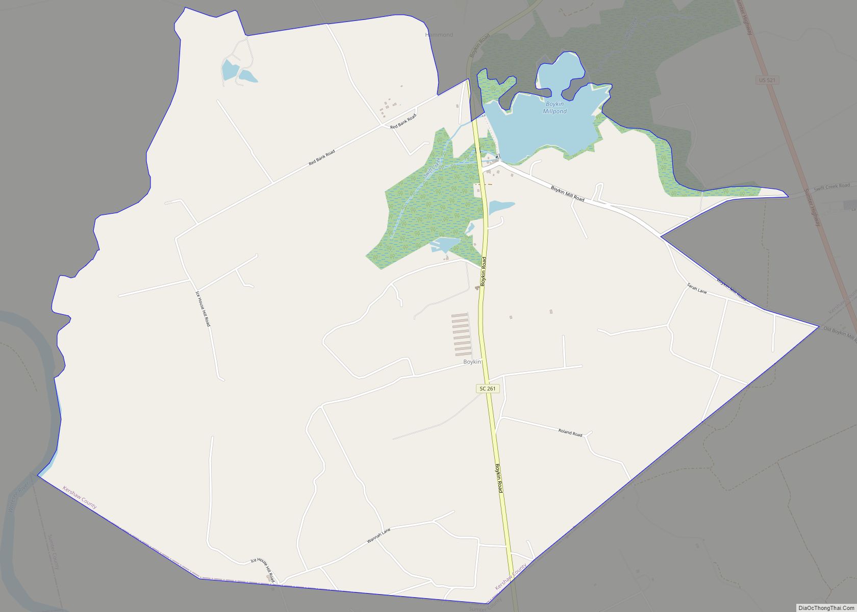
- Boykin Mill Complex
- Kendall Mill Historic District
State and local protected areas
- Camden Battlefield and Longleaf Pine Preserve
- Goodale State Park
- Powderkegg Wildlife Preserve
- Savage Bay Heritage Park
Major water bodies
- Beaver Creek
- Black Creek
- Catawba River
- Lake Wateree
- Lynches River
- Raglins Creek
- Wateree River
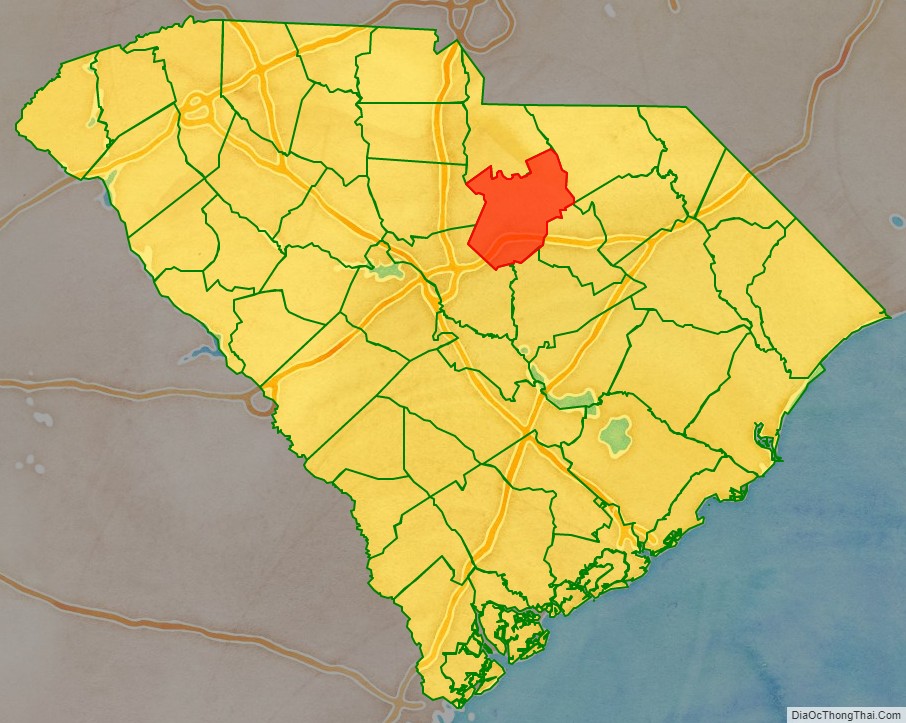
Adjacent counties
- Richland County – southwest
- Lee County – southeast
- Fairfield County – west
- Lancaster County – north
- Chesterfield County – northeast
- Sumter County – southeast
- Darlington County – east
Major highways
- I-20
- US 1
- US 1 Truck (Camden)
- US 1 Truck (Cheraw)
- US 521
- US 521 Bus.
- US 521 Conn.
- US 521 Truck (Camden 1)
- US 521 Truck (Camden 2)
- US 521 Truck (Kershaw)
- US 601
- US 601 Bus.
- US 601 Truck
- SC 12
- SC 34
- SC 34 Truck
- SC 97
- SC 261
- SC 522
- SC 903
Major infrastructure
- Camden Station
- Woodward Field (Kershaw County Airport)
Kershaw County Topographic Map
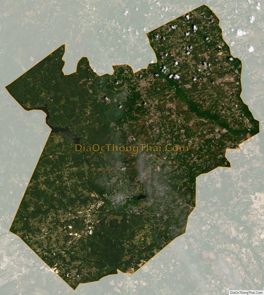
Kershaw County Satellite Map
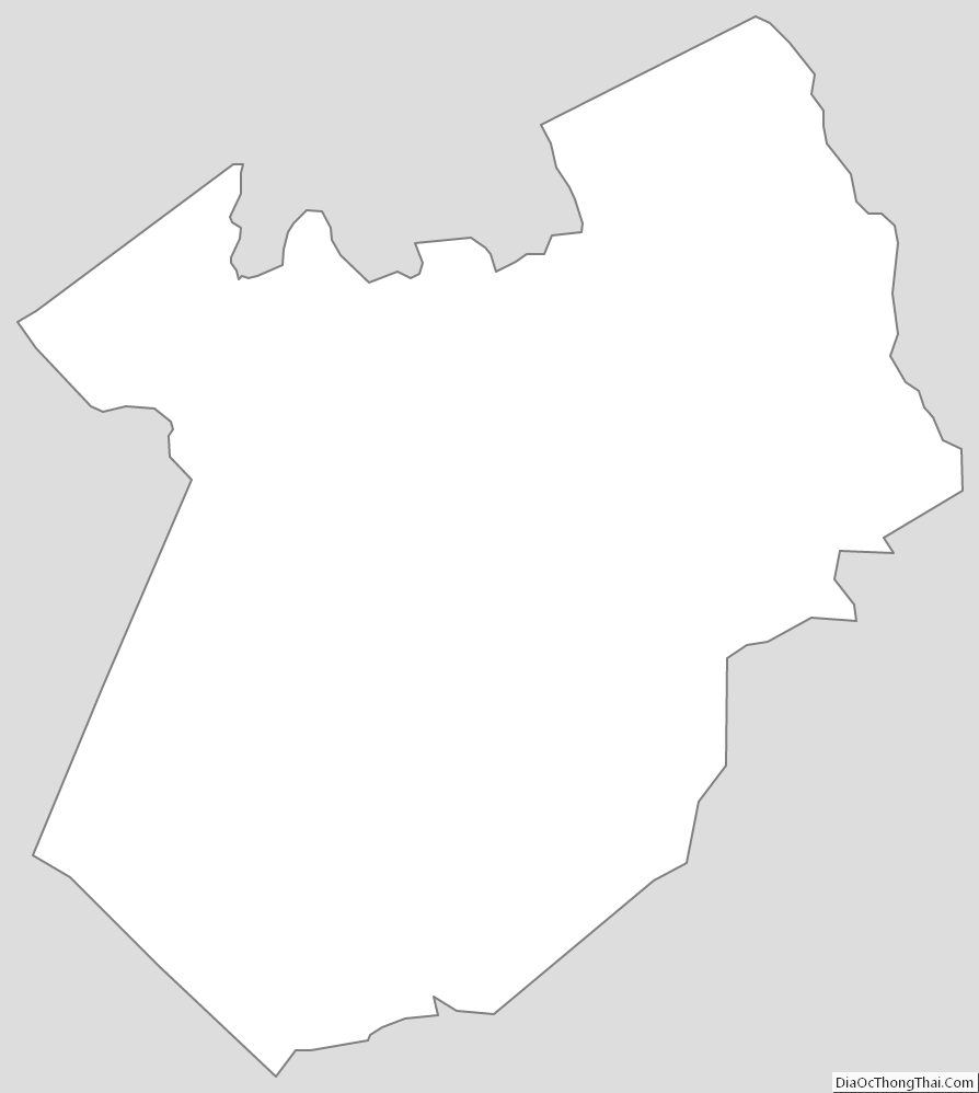
Kershaw County Outline Map