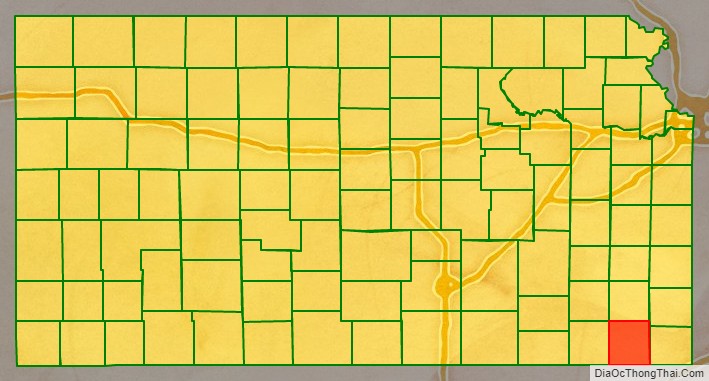
Labette County (county code LB) is a county located in Southeast Kansas. As of the 2020 census, the county population was 20,184. Its county seat is Oswego, and its most populous city is Parsons. The county was named after LaBette creek, the second-largest creek in the county, which runs roughly NNW-SSE from near Parsons to Chetopa. The creek in turn was named after French-Canadian fur trapper Pierre LaBette who had moved to the area, living along the Neosho River, and marrying into the Osage tribe in the 1830s and 1840s.
| Name: | Labette County |
|---|---|
| FIPS code: | 20-099 |
| State: | Kansas |
| Founded: | February 26, 1867 |
| Named for: | Pierre La Bette |
| Seat: | Oswego |
| Largest city: | Parsons |
| Total Area: | 653 sq mi (1,690 km²) |
| Land Area: | 645 sq mi (1,670 km²) |
| Total Population: | 20,184 |
| Population Density: | 31.3/sq mi (12.1/km²) |
| Time zone: | UTC−6 (Central) |
| Summer Time Zone (DST): | UTC−5 (CDT) |
| Website: | LabetteCounty.com |
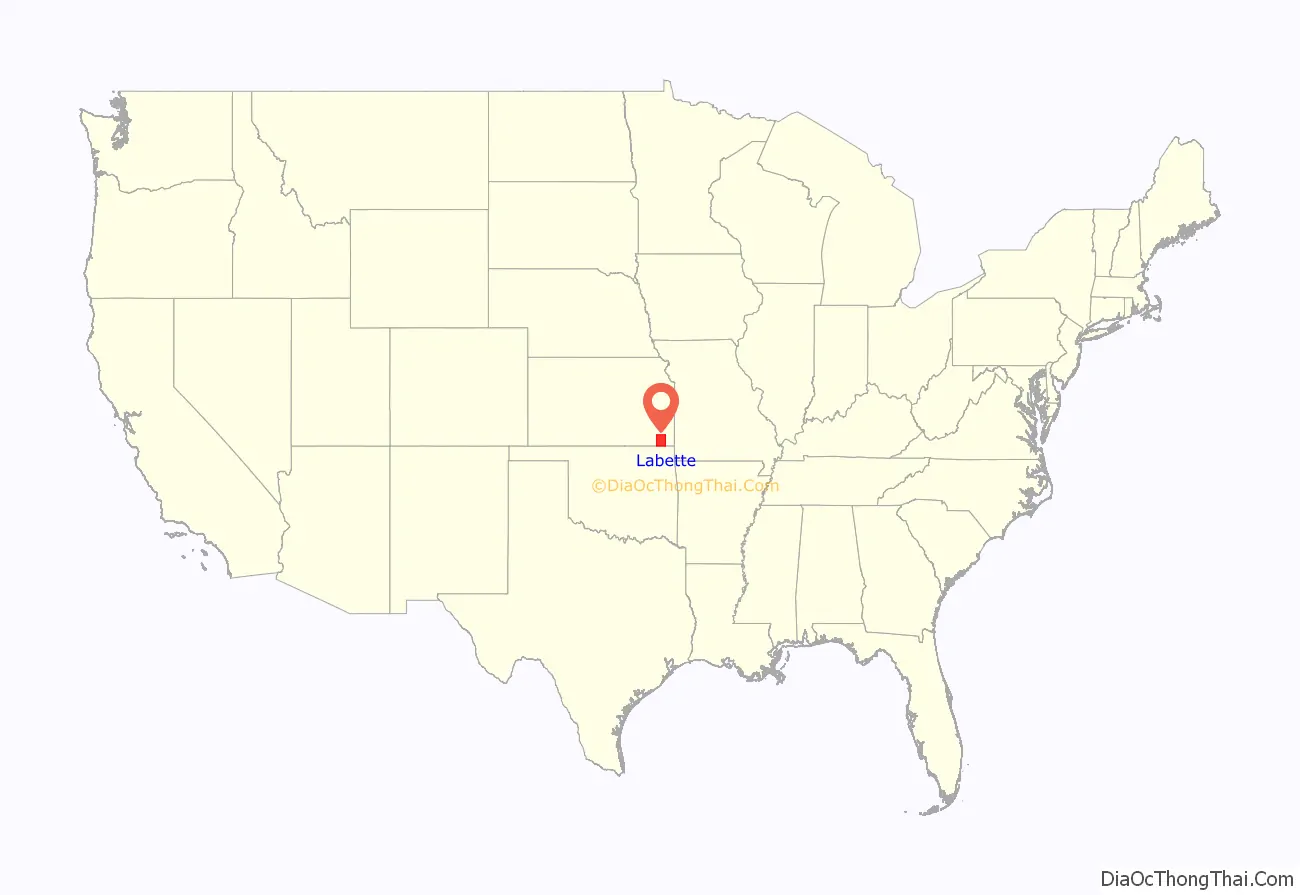
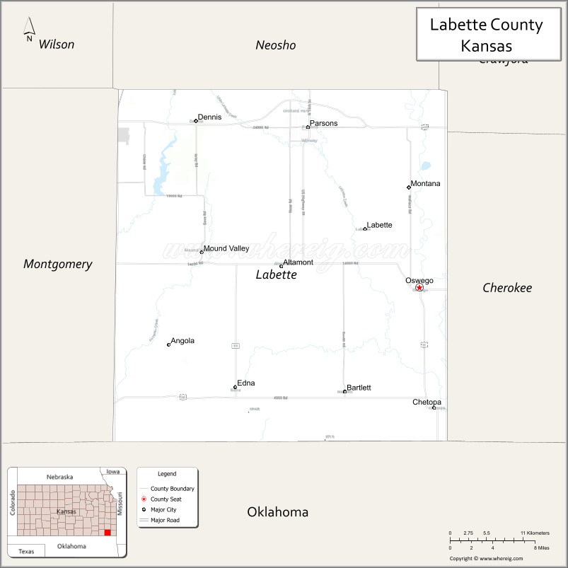
Labette County location map. Where is Labette County?
History
In the 1840s Labette County had a population mainly consisting of Osage people, although there were also many Cherokee and Euro-Americans. Many of the Euro-Americans were merchants with Osage or Cherokee wives.
Between 1871 and 1873, at least eleven people vanished in the vicinity of an inn and general store operated by the Bender family in Labette County. Following the disappearance of the Benders in 1873, it was discovered that they had apparently murdered a number of travellers. Between eight and eleven bodies were discovered buried on the premises. Governor Thomas A. Osborn offered a reward of $2,000 for the apprehension of the Benders, but they were never found.
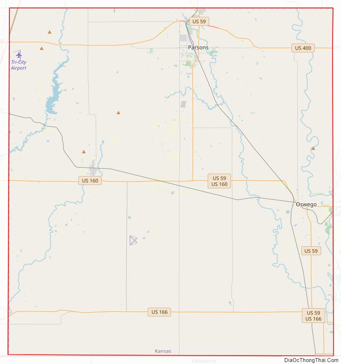
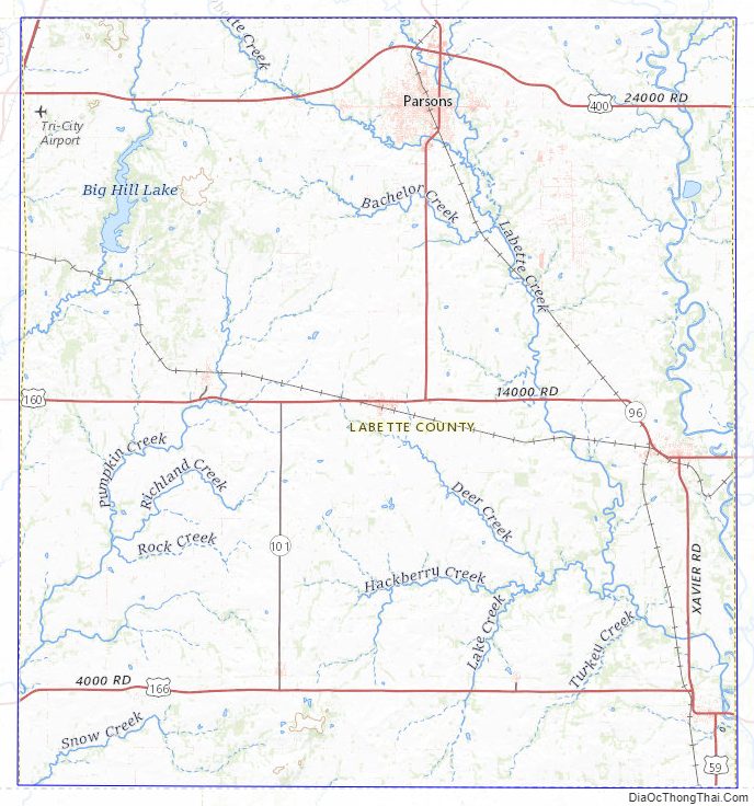
Labette County Road Map
Geography
According to the U.S. Census Bureau, the county has a total area of 653 square miles (1,690 km), of which 645 square miles (1,670 km) is land and 7.8 square miles (20 km) (1.2%) is water.
Adjacent counties
- Neosho County (north)
- Crawford County (northeast)
- Cherokee County (east)
- Craig County, Oklahoma (south)
- Nowata County, Oklahoma (southwest)
- Montgomery County (west)
Labette County Topographic Map
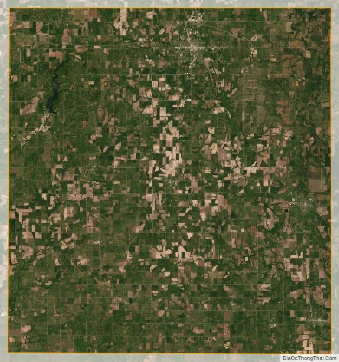
Labette County Satellite Map
Labette County Outline Map