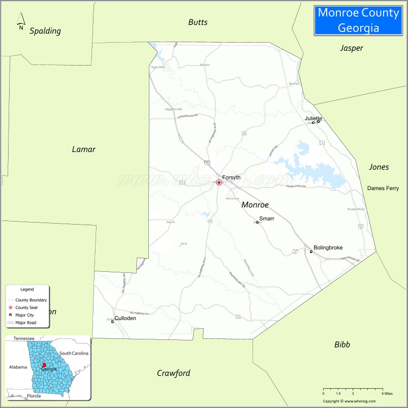
Monroe County is a county located in the central portion of the U.S. state of Georgia. As of the 2020 census, the population was 27,957. The county seat is Forsyth. The county was created on May 15, 1821. The county was named for James Monroe.
Monroe County is included in the Macon, GA Metropolitan Statistical Area.
| Name: | Monroe County |
|---|---|
| FIPS code: | 13-207 |
| State: | Georgia |
| Founded: | 1821 |
| Named for: | James Monroe |
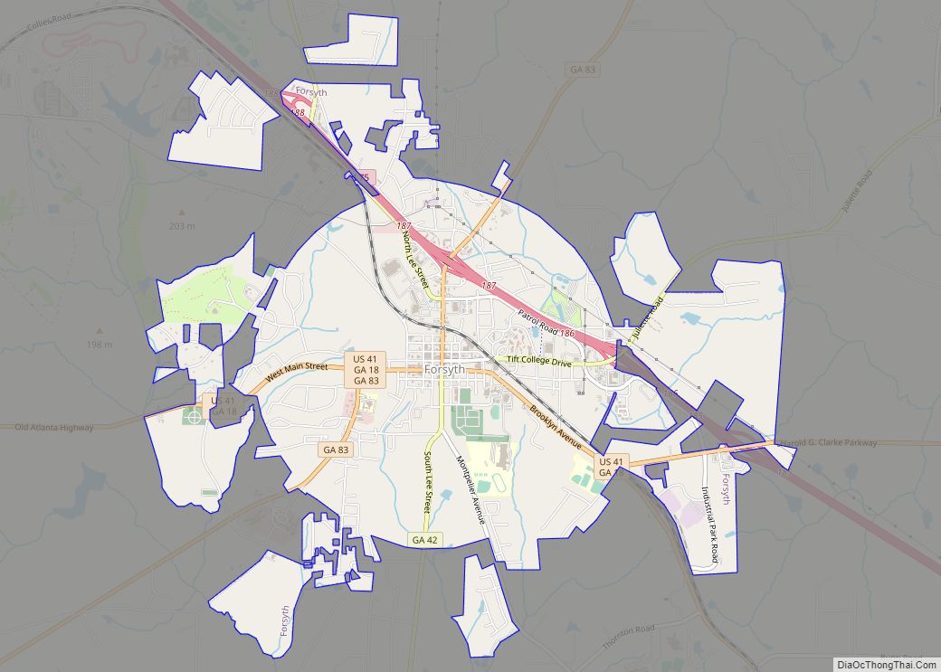
| Seat: | Forsyth |
| Largest city: | Forsyth |
| Total Area: | 398 sq mi (1,030 km²) |
| Land Area: | 396 sq mi (1,030 km²) |
| Total Population: | 27,957 |
| Population Density: | 71/sq mi (27/km²) |
| Time zone: | UTC−5 (Eastern) |
| Summer Time Zone (DST): | UTC−4 (EDT) |
| Website: | www.monroecountygeorgia.com |
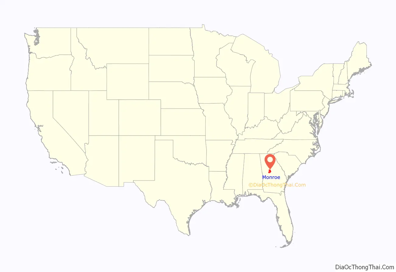
Monroe County location map. Where is Monroe County?

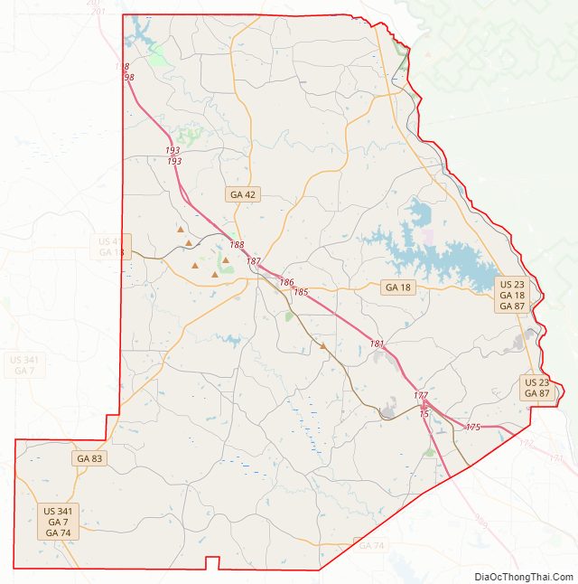
Monroe County Road Map
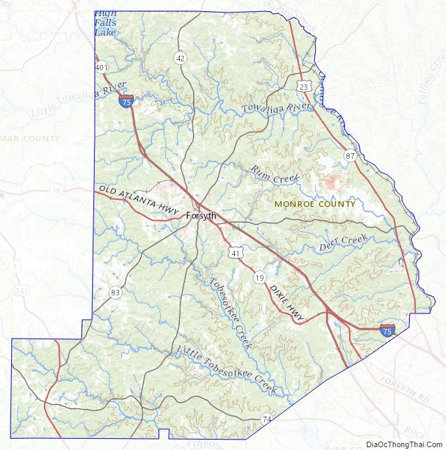
Geography
According to the U.S. Census Bureau, the county has a total area of 398 square miles (1,030 km), of which 396 square miles (1,030 km) is land and 2.2 square miles (5.7 km) (0.5%) is water. It is located in the Piedmont region of the state.
The vast majority of Monroe County is located in the Upper Ocmulgee River sub-basin of the Altamaha River basin, with just a tiny southwestern corner of the county, west of a line between Yatesville and Culloden, located in the Upper Flint River sub-basin of the ACF River Basin (Apalachicola-Chattahoochee-Flint River Basin).
Major highways
- Interstate 75
- Interstate 475
- U.S. Route 23
- U.S. Route 41
- U.S. Route 341
- State Route 7
- State Route 18
- State Route 19
- State Route 42
- State Route 74
- State Route 83
- State Route 87
- State Route 401 (unsigned designation for I-75)
- State Route 408 (unsigned designation for I-475)
Adjacent counties
- Butts County (north)
- Jasper County (northeast)
- Jones County (east)
- Bibb County (southeast)
- Crawford County (south)
- Upson County (southwest)
- Lamar County (west)
Monroe County Topographic Map
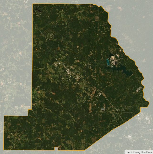
Monroe County Satellite Map
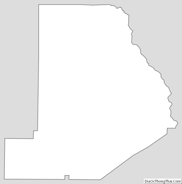
Monroe County Outline Map