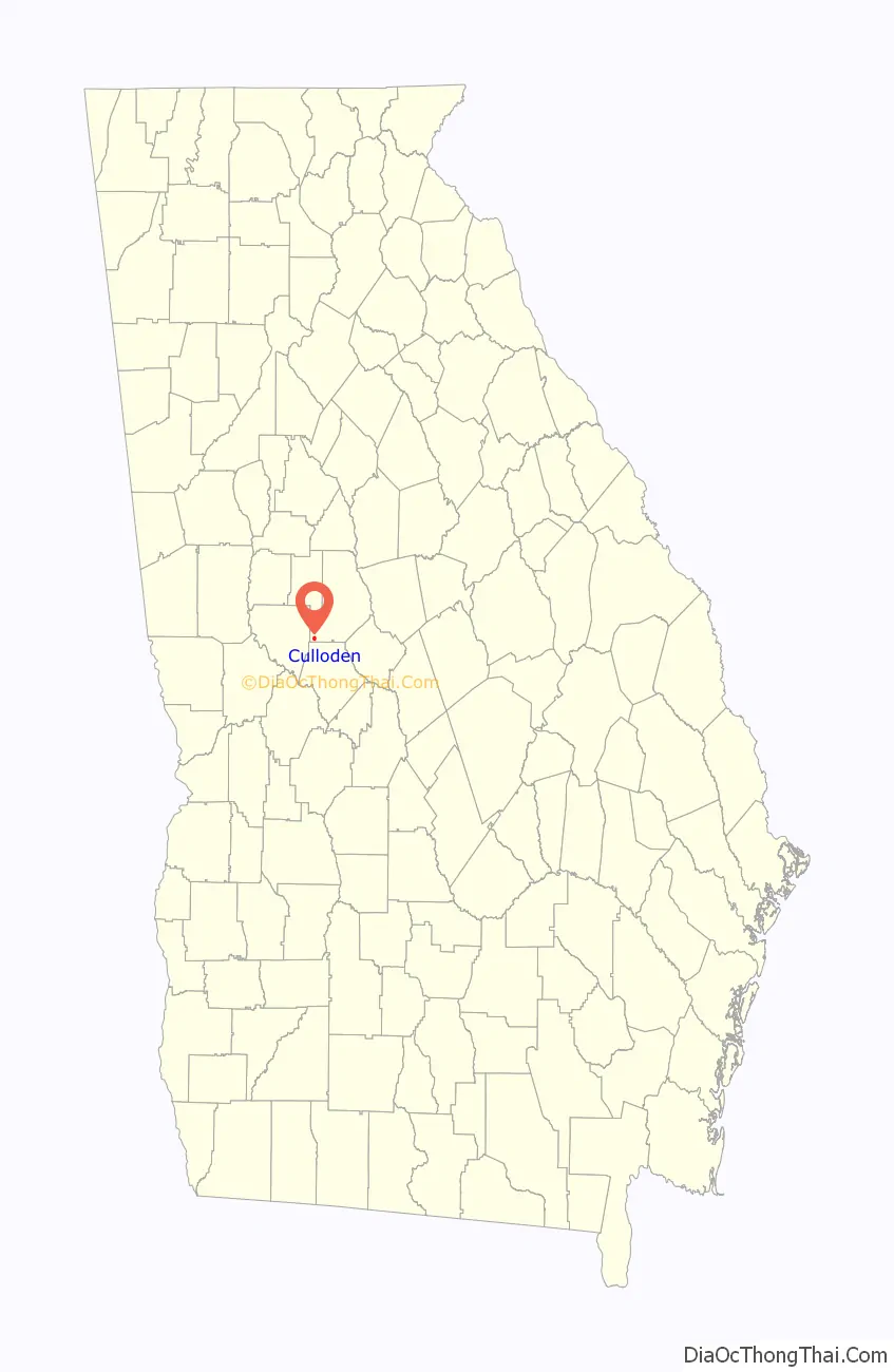
Culloden is a city in Monroe County, Georgia, United States. The population was 200 in the 2020 census. It is part of the Macon Metropolitan Statistical Area.
| Name: | Culloden city |
|---|---|
| LSAD Code: | 25 |
| LSAD Description: | city (suffix) |
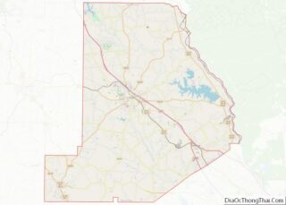
| State: | Georgia |
| County: | Monroe County |
| Elevation: | 725 ft (221 m) |
| Total Area: | 0.79 sq mi (2.06 km²) |
| Land Area: | 0.78 sq mi (2.01 km²) |
| Water Area: | 0.02 sq mi (0.04 km²) |
| Total Population: | 200 |
| Population Density: | 257.40/sq mi (99.36/km²) |
| ZIP code: | 31016 |
| Area code: | 478 |
| FIPS code: | 1320848 |
| GNISfeature ID: | 0355402 |
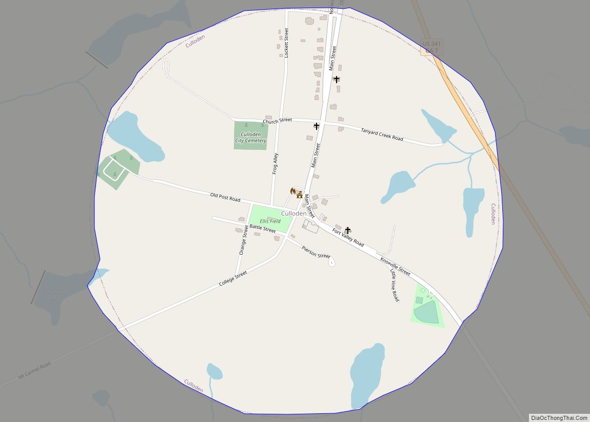
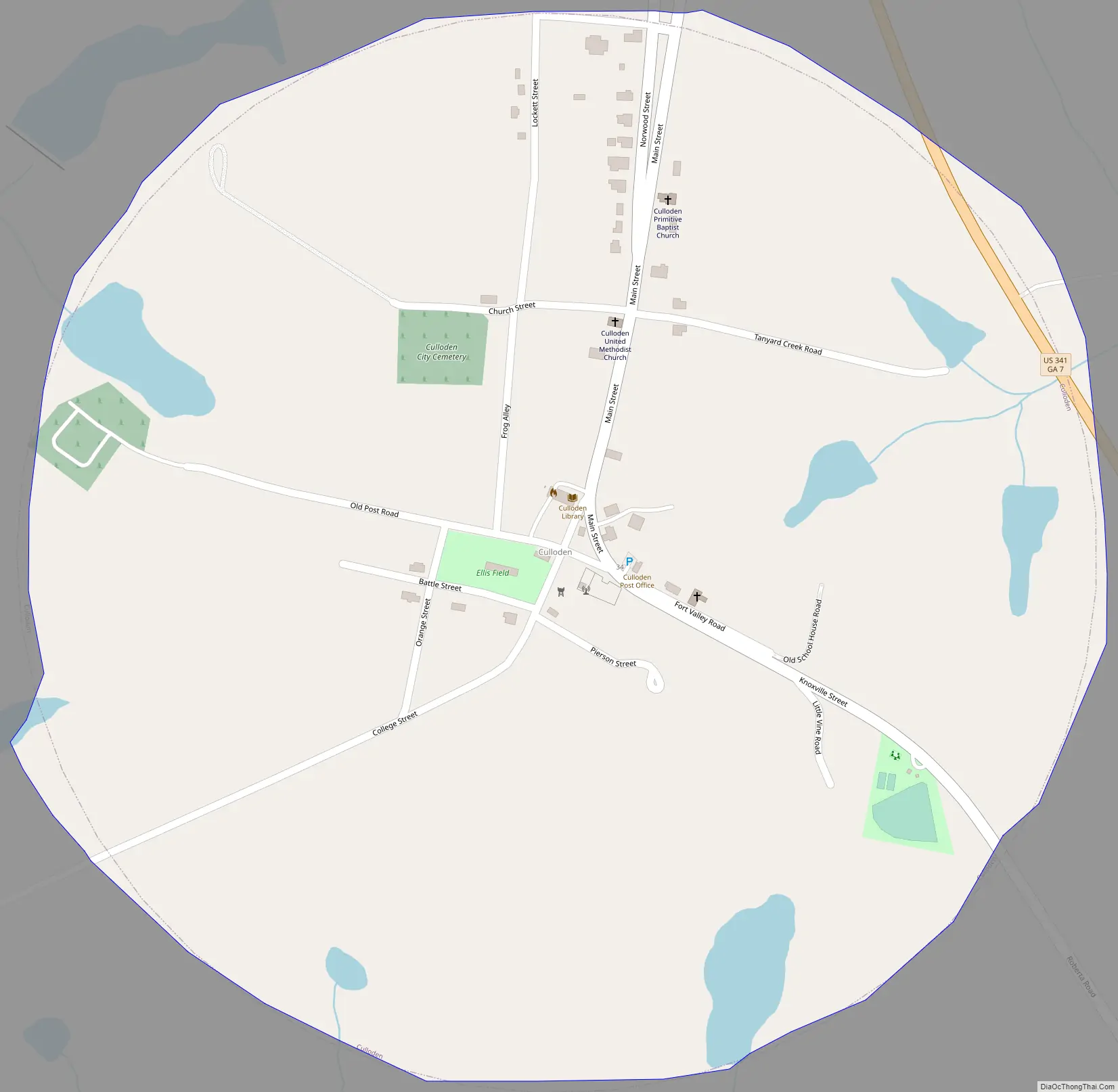
Online Interactive Map
Click on ![]() to view map in "full screen" mode.
to view map in "full screen" mode.
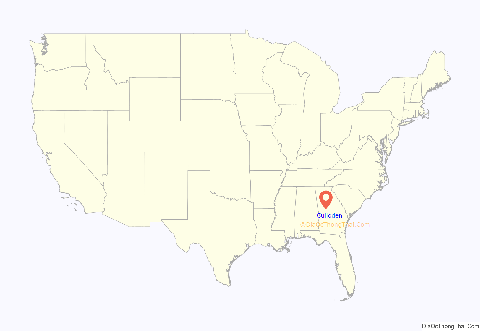
Culloden location map. Where is Culloden city?
History
The first settlement at Culloden was made ca. 1739. The community was named after William Culloden, a local merchant. A post office called Culloden has been in operation since 1825. The Georgia General Assembly incorporated the place in 1887 as the “City of Culloden”, with municipal corporate limits extending in a one-mile radius from the central town well.
Culloden Road Map
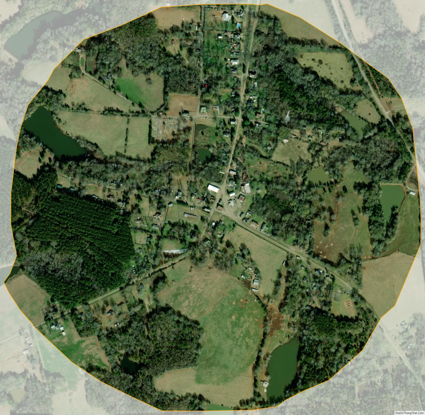
Culloden city Satellite Map
Geography
Culloden is located in the southwestern part of Monroe County at 32°51′47″N 84°5′37″W / 32.86306°N 84.09361°W / 32.86306; -84.09361 (32.863155, -84.093621).
The city is located along U.S. Route 341 and Georgia State Route 74. U.S. 341 runs from north to south just east of the city, leading north 15 miles (24 km) to Barnesville and south 12 miles (19 km) to Roberta. GA-74 runs from west to east to the north of the city, leading east 32 miles (51 km) to Macon and west 17 miles (27 km) to Thomaston.
According to the United States Census Bureau, Culloden has a total area of 0.8 square miles (2.1 km), of which 0.02 square miles (0.05 km), or 2.14%, are water. The city sits on the Eastern Continental Divide, separating waters that flow southwest to the Gulf of Mexico from those that flow southeast to the Atlantic Ocean. Water on the west side of the city flows into tributaries of Auchumpkee Creek, which leads southwest to the Flint River, part of the Apalachicola River watershed, while water to the east flows to tributaries of Echeconnee Creek, which runs southeast to the Ocmulgee River, part of the Altamaha River watershed.
See also
Map of Georgia State and its subdivision:- Appling
- Atkinson
- Bacon
- Baker
- Baldwin
- Banks
- Barrow
- Bartow
- Ben Hill
- Berrien
- Bibb
- Bleckley
- Brantley
- Brooks
- Bryan
- Bulloch
- Burke
- Butts
- Calhoun
- Camden
- Candler
- Carroll
- Catoosa
- Charlton
- Chatham
- Chattahoochee
- Chattooga
- Cherokee
- Clarke
- Clay
- Clayton
- Clinch
- Cobb
- Coffee
- Colquitt
- Columbia
- Cook
- Coweta
- Crawford
- Crisp
- Dade
- Dawson
- Decatur
- DeKalb
- Dodge
- Dooly
- Dougherty
- Douglas
- Early
- Echols
- Effingham
- Elbert
- Emanuel
- Evans
- Fannin
- Fayette
- Floyd
- Forsyth
- Franklin
- Fulton
- Gilmer
- Glascock
- Glynn
- Gordon
- Grady
- Greene
- Gwinnett
- Habersham
- Hall
- Hancock
- Haralson
- Harris
- Hart
- Heard
- Henry
- Houston
- Irwin
- Jackson
- Jasper
- Jeff Davis
- Jefferson
- Jenkins
- Johnson
- Jones
- Lamar
- Lanier
- Laurens
- Lee
- Liberty
- Lincoln
- Long
- Lowndes
- Lumpkin
- Macon
- Madison
- Marion
- McDuffie
- McIntosh
- Meriwether
- Miller
- Mitchell
- Monroe
- Montgomery
- Morgan
- Murray
- Muscogee
- Newton
- Oconee
- Oglethorpe
- Paulding
- Peach
- Pickens
- Pierce
- Pike
- Polk
- Pulaski
- Putnam
- Quitman
- Rabun
- Randolph
- Richmond
- Rockdale
- Schley
- Screven
- Seminole
- Spalding
- Stephens
- Stewart
- Sumter
- Talbot
- Taliaferro
- Tattnall
- Taylor
- Telfair
- Terrell
- Thomas
- Tift
- Toombs
- Towns
- Treutlen
- Troup
- Turner
- Twiggs
- Union
- Upson
- Walker
- Walton
- Ware
- Warren
- Washington
- Wayne
- Webster
- Wheeler
- White
- Whitfield
- Wilcox
- Wilkes
- Wilkinson
- Worth
- Alabama
- Alaska
- Arizona
- Arkansas
- California
- Colorado
- Connecticut
- Delaware
- District of Columbia
- Florida
- Georgia
- Hawaii
- Idaho
- Illinois
- Indiana
- Iowa
- Kansas
- Kentucky
- Louisiana
- Maine
- Maryland
- Massachusetts
- Michigan
- Minnesota
- Mississippi
- Missouri
- Montana
- Nebraska
- Nevada
- New Hampshire
- New Jersey
- New Mexico
- New York
- North Carolina
- North Dakota
- Ohio
- Oklahoma
- Oregon
- Pennsylvania
- Rhode Island
- South Carolina
- South Dakota
- Tennessee
- Texas
- Utah
- Vermont
- Virginia
- Washington
- West Virginia
- Wisconsin
- Wyoming