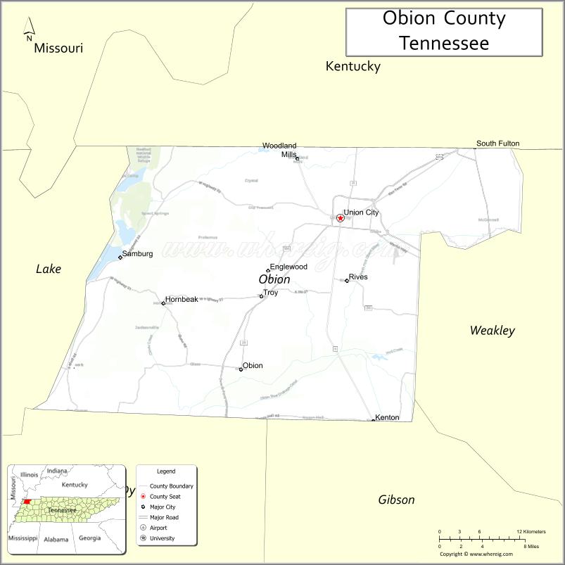
| Name: | Obion County |
|---|---|
| FIPS code: | 47-131 |
| State: | Tennessee |
| Founded: | 1824 |
| Named for: | Obion River |
| Seat: | Union City |
| Largest city: | Union City |
| Total Area: | 556 sq mi (1,440 km²) |
| Land Area: | 545 sq mi (1,410 km²) |
| Total Population: | 30,787 |
| Population Density: | 58/sq mi (22/km²) |
| Time zone: | UTC−6 (Central) |
| Summer Time Zone (DST): | UTC−5 (CDT) |
| Website: | www.obioncountytn.gov |
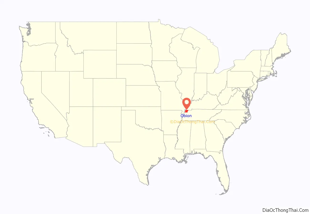
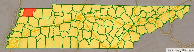
Obion County location map. Where is Obion County?
History
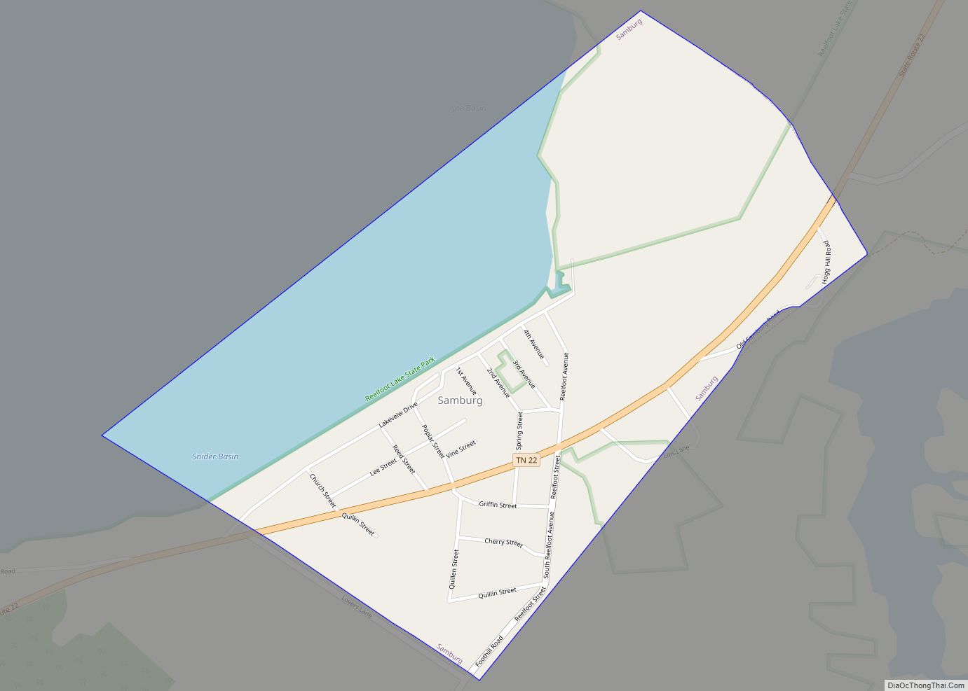
In the year, 1811 there was a large seismic activity located on the New Madrid Fault Line. The series of earthquakes, while devastating, formed Reelfoot Lake.
Obion was later established in 1823 and organized the following year. It was named for the Obion River, which flows through the county and is a tributary of the nearby Mississippi River. The word “Obion” is believed to be derived from a Native American word meaning “many forks,” or from an Irish trapper named O’Brien.
The founding of Obion County originally came from the expansion of railroads. The county has since moved towards many agricultural and manufacturing productions.
In 2013, Discovery Park of America opened in Union City. Discovery Park is a 50-acre encyclopedic museum and heritage park with exhibits pertaining to local and national history, military history, art, science, and technology.
Obion County Road Map
Geography
According to the U.S. Census Bureau, the county has a total area of 556 square miles (1,440 km), of which 545 square miles (1,410 km) is land and 11 square miles (28 km) (1.9%) is water. It is located in the “rolling hills of northwest Tennessee”.
Adjacent counties
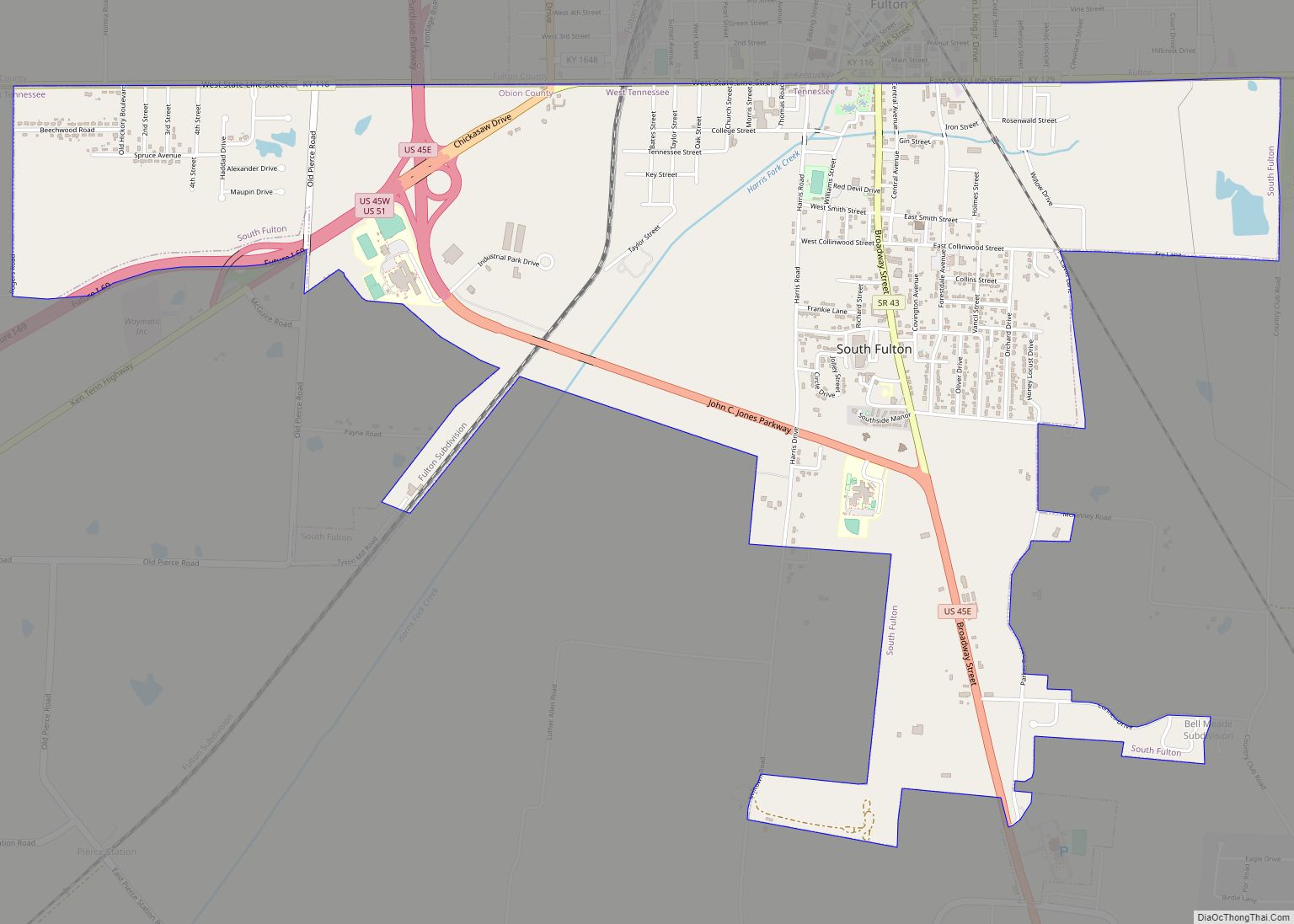
- Fulton County, Kentucky (north)
- Hickman County, Kentucky (northeast)
- Weakley County (east)
- Gibson County (southeast)
- Dyer County (southwest)
- Lake County (west)
National protected area
- Reelfoot National Wildlife Refuge (part)
State protected areas
- Glover Wetland Wildlife Management Area
- Gooch Wildlife Management Area
- Hop-In Refuge
- Obion River Wildlife Management Area (part)
- Reelfoot Lake State Natural Area (part)
- Reelfoot Lake State Park (part)
- Three Rivers Wildlife Management Area
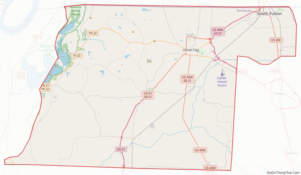
Major highways
- I-69
- US 45
- US 45E
- US 45W
- US 51
- SR 5
- SR 21
- SR 22
- SR 157
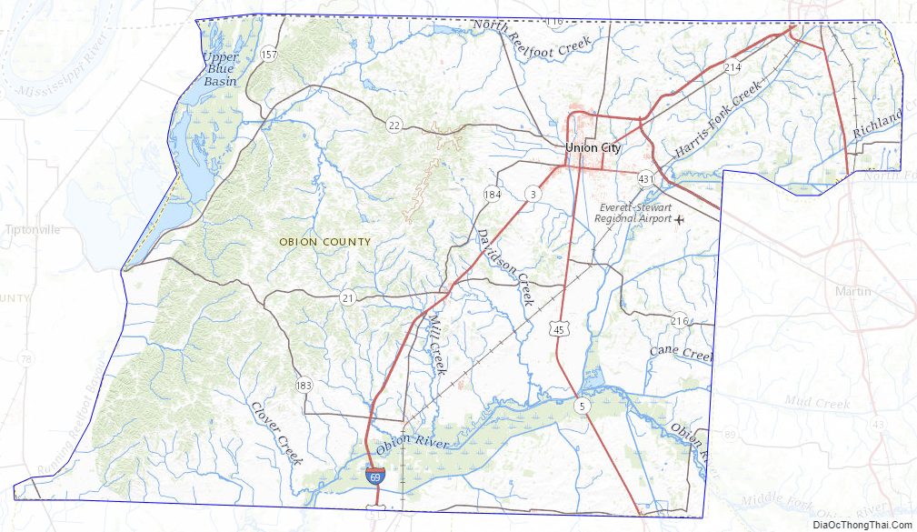
Obion County Topographic Map
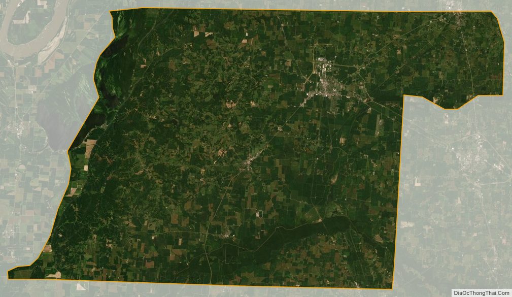
Obion County Satellite Map
Obion County Outline Map