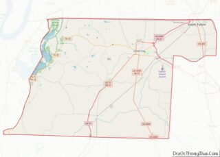
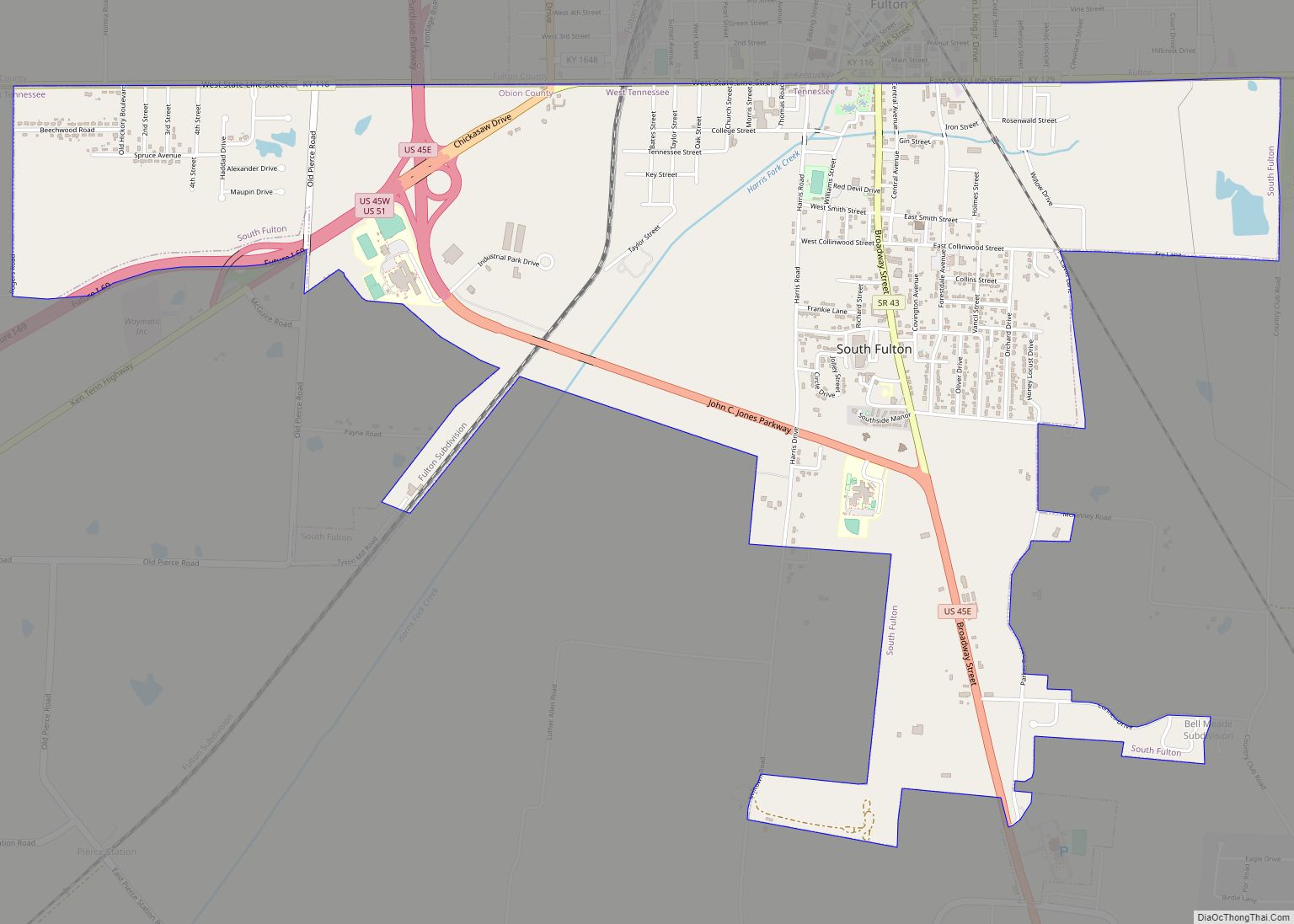
South Fulton is a city in Obion County, Tennessee, United States. The population was 2,245 at the 2020 census. It is part of the Union City, TN–KY Micropolitan Statistical Area.
| Name: | South Fulton city |
|---|---|
| LSAD Code: | 25 |
| LSAD Description: | city (suffix) |
| State: | Tennessee |
| County: | Obion County |
| Elevation: | 354 ft (108 m) |
| Total Area: | 3.38 sq mi (8.76 km²) |
| Land Area: | 3.38 sq mi (8.76 km²) |
| Water Area: | 0.00 sq mi (0.00 km²) |
| Total Population: | 2,245 |
| Population Density: | 663.61/sq mi (256.25/km²) |
| ZIP code: | 38257 |
| Area code: | 731 |
| FIPS code: | 4769900 |
| GNISfeature ID: | 1303727 |
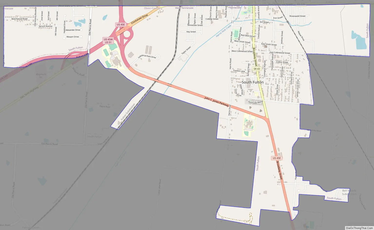
Online Interactive Map
Click on ![]() to view map in "full screen" mode.
to view map in "full screen" mode.
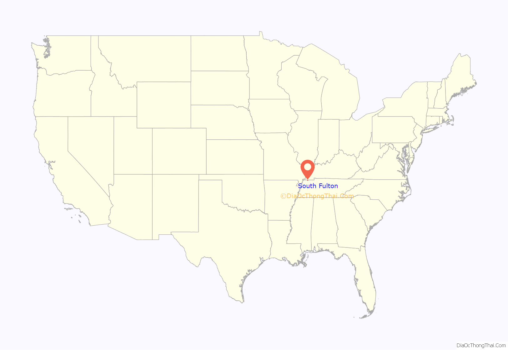
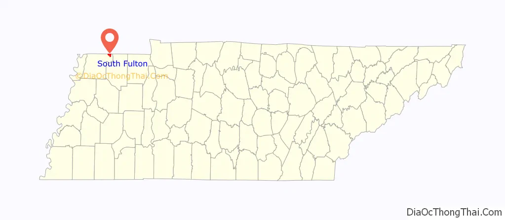
South Fulton location map. Where is South Fulton city?
History
South Fulton was first known as Jacksonville due to the fact that land in the area once belonged to Andrew Jackson. It is recorded that Andrew Jackson sold 1,000 acres (400 hectares) in northeast Weakley County in 1823. Jacksonville existed from about 1859 until 1895 when South Fulton was first chartered.
South Fulton Road Map
South Fulton city Satellite Map

Geography
South Fulton is located at 36°29′48″N 88°52′45″W / 36.49667°N 88.87917°W / 36.49667; -88.87917 (36.496716, -88.879193).
According to the United States Census Bureau, the city has a total area of 3.1 square miles (8.0 km), all land.
See also
Map of Tennessee State and its subdivision:- Anderson
- Bedford
- Benton
- Bledsoe
- Blount
- Bradley
- Campbell
- Cannon
- Carroll
- Carter
- Cheatham
- Chester
- Claiborne
- Clay
- Cocke
- Coffee
- Crockett
- Cumberland
- Davidson
- Decatur
- DeKalb
- Dickson
- Dyer
- Fayette
- Fentress
- Franklin
- Gibson
- Giles
- Grainger
- Greene
- Grundy
- Hamblen
- Hamilton
- Hancock
- Hardeman
- Hardin
- Hawkins
- Haywood
- Henderson
- Henry
- Hickman
- Houston
- Humphreys
- Jackson
- Jefferson
- Johnson
- Knox
- Lake
- Lauderdale
- Lawrence
- Lewis
- Lincoln
- Loudon
- Macon
- Madison
- Marion
- Marshall
- Maury
- McMinn
- McNairy
- Meigs
- Monroe
- Montgomery
- Moore
- Morgan
- Obion
- Overton
- Perry
- Pickett
- Polk
- Putnam
- Rhea
- Roane
- Robertson
- Rutherford
- Scott
- Sequatchie
- Sevier
- Shelby
- Smith
- Stewart
- Sullivan
- Sumner
- Tipton
- Trousdale
- Unicoi
- Union
- Van Buren
- Warren
- Washington
- Wayne
- Weakley
- White
- Williamson
- Wilson
- Alabama
- Alaska
- Arizona
- Arkansas
- California
- Colorado
- Connecticut
- Delaware
- District of Columbia
- Florida
- Georgia
- Hawaii
- Idaho
- Illinois
- Indiana
- Iowa
- Kansas
- Kentucky
- Louisiana
- Maine
- Maryland
- Massachusetts
- Michigan
- Minnesota
- Mississippi
- Missouri
- Montana
- Nebraska
- Nevada
- New Hampshire
- New Jersey
- New Mexico
- New York
- North Carolina
- North Dakota
- Ohio
- Oklahoma
- Oregon
- Pennsylvania
- Rhode Island
- South Carolina
- South Dakota
- Tennessee
- Texas
- Utah
- Vermont
- Virginia
- Washington
- West Virginia
- Wisconsin
- Wyoming