Union City is located in Obion County, Tennessee, United States. 11,170 people were living in the town as of the 2020 census. It is the principal urban settlement of the surrounding micropolitan area, which includes Obion County and Fulton County, Kentucky. Union City is home to Discovery Park of America which is a world-renowned encyclopedic museum with many exhibits pertaining to local history, as well as state, national, and world history, science, technology, and art.
| Name: | Union City city |
|---|---|
| LSAD Code: | 25 |
| LSAD Description: | city (suffix) |
| State: | Tennessee |
| County: | Obion County |
| Incorporated: | 1867 |
| Elevation: | 338 ft (103 m) |
| Total Area: | 12.12 sq mi (31.38 km²) |
| Land Area: | 12.11 sq mi (31.36 km²) |
| Water Area: | 0.01 sq mi (0.02 km²) |
| Total Population: | 11,170 |
| Population Density: | 922.53/sq mi (356.18/km²) |
| ZIP code: | 38261 & 38281 |
| Area code: | 731 |
| FIPS code: | 4775940 |
| GNISfeature ID: | 1273213 |
| Website: | www.unioncitytn.gov |
Online Interactive Map
Click on ![]() to view map in "full screen" mode.
to view map in "full screen" mode.
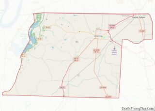
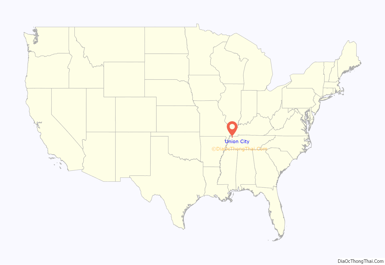
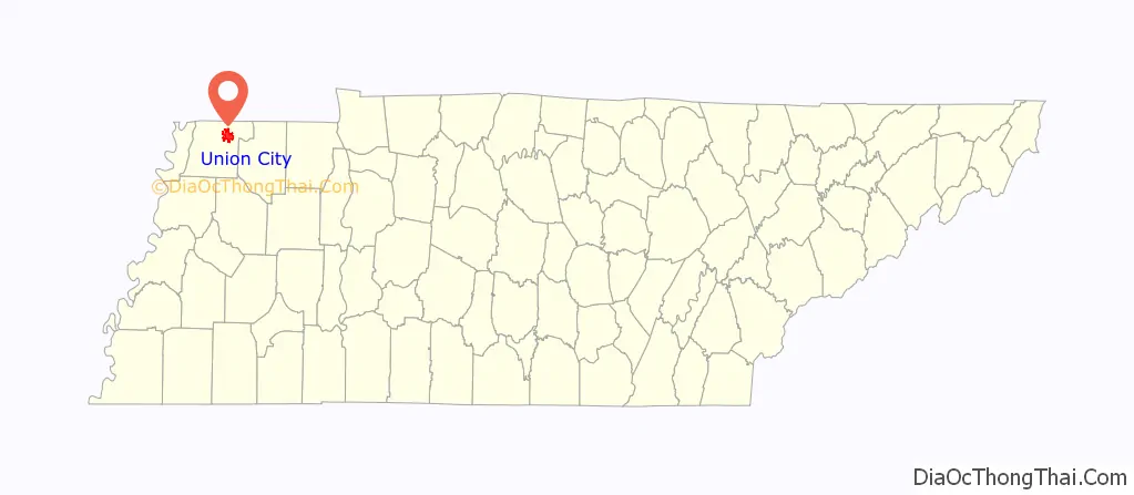
Union City location map. Where is Union City city?
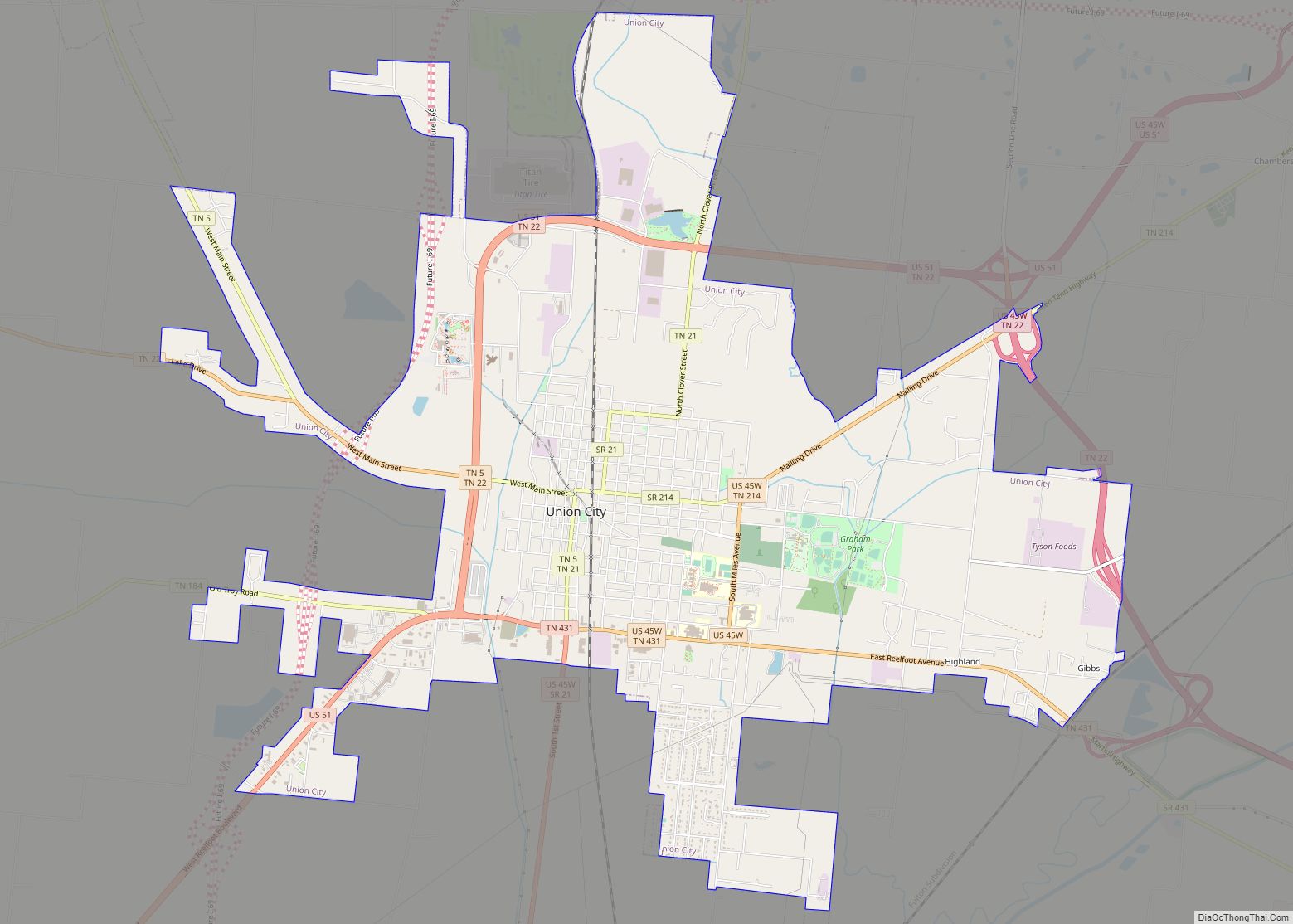
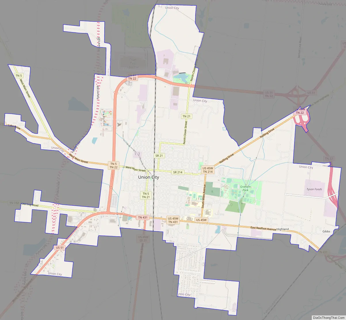
Union City Road Map
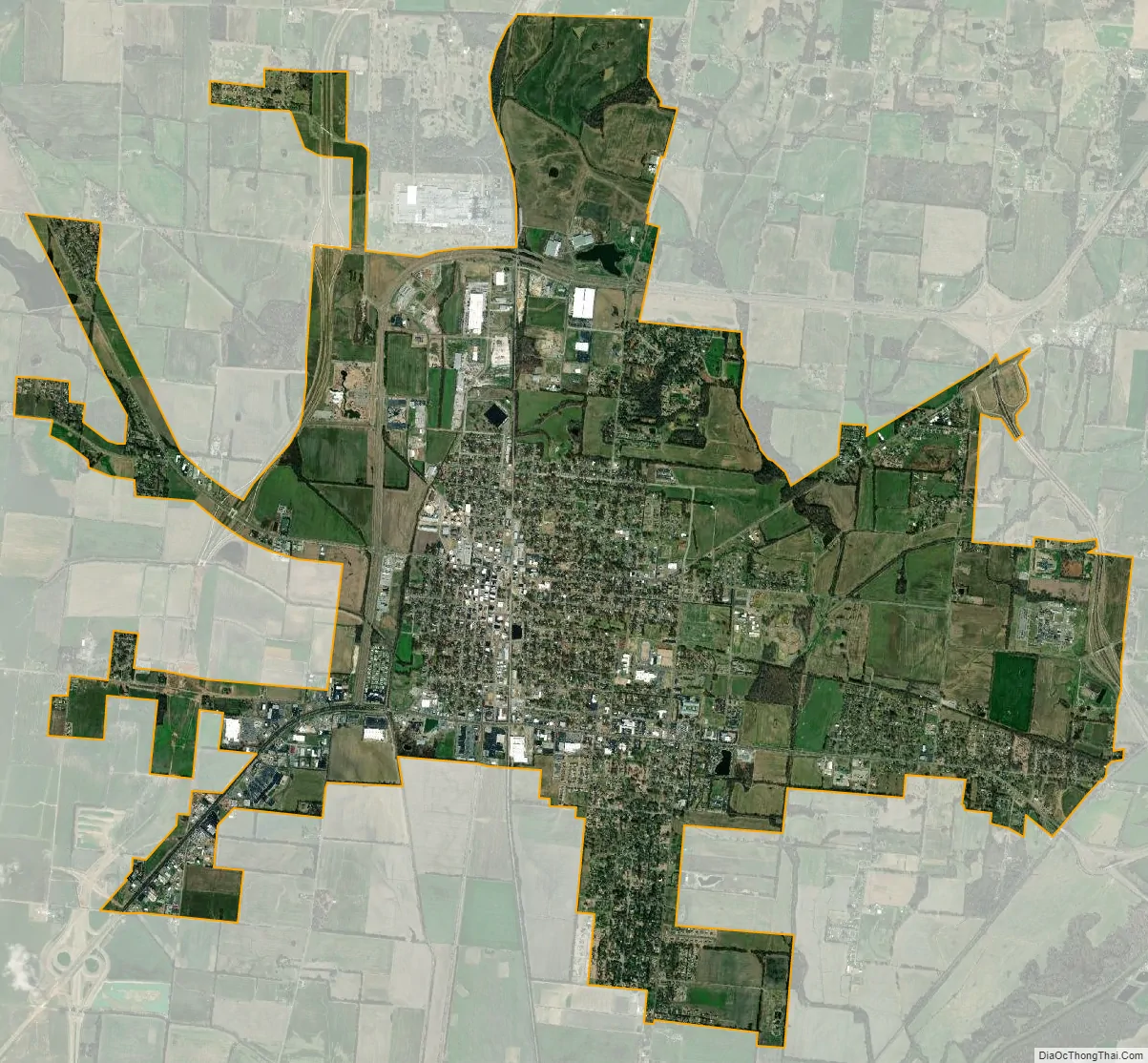
Union City city Satellite Map
Geography
Union City is located at 36°25′28″N 89°3′3″W / 36.42444°N 89.05083°W / 36.42444; -89.05083 (36.424395, −89.050850). According to the United States Census Bureau, the city has a total area of 10.7 square miles (28 km), all land. The mayor, appointed by his fellow city councilors since 1988, is Terry Hailey.
Climate
See also
Map of Tennessee State and its subdivision:- Anderson
- Bedford
- Benton
- Bledsoe
- Blount
- Bradley
- Campbell
- Cannon
- Carroll
- Carter
- Cheatham
- Chester
- Claiborne
- Clay
- Cocke
- Coffee
- Crockett
- Cumberland
- Davidson
- Decatur
- DeKalb
- Dickson
- Dyer
- Fayette
- Fentress
- Franklin
- Gibson
- Giles
- Grainger
- Greene
- Grundy
- Hamblen
- Hamilton
- Hancock
- Hardeman
- Hardin
- Hawkins
- Haywood
- Henderson
- Henry
- Hickman
- Houston
- Humphreys
- Jackson
- Jefferson
- Johnson
- Knox
- Lake
- Lauderdale
- Lawrence
- Lewis
- Lincoln
- Loudon
- Macon
- Madison
- Marion
- Marshall
- Maury
- McMinn
- McNairy
- Meigs
- Monroe
- Montgomery
- Moore
- Morgan
- Obion
- Overton
- Perry
- Pickett
- Polk
- Putnam
- Rhea
- Roane
- Robertson
- Rutherford
- Scott
- Sequatchie
- Sevier
- Shelby
- Smith
- Stewart
- Sullivan
- Sumner
- Tipton
- Trousdale
- Unicoi
- Union
- Van Buren
- Warren
- Washington
- Wayne
- Weakley
- White
- Williamson
- Wilson
- Alabama
- Alaska
- Arizona
- Arkansas
- California
- Colorado
- Connecticut
- Delaware
- District of Columbia
- Florida
- Georgia
- Hawaii
- Idaho
- Illinois
- Indiana
- Iowa
- Kansas
- Kentucky
- Louisiana
- Maine
- Maryland
- Massachusetts
- Michigan
- Minnesota
- Mississippi
- Missouri
- Montana
- Nebraska
- Nevada
- New Hampshire
- New Jersey
- New Mexico
- New York
- North Carolina
- North Dakota
- Ohio
- Oklahoma
- Oregon
- Pennsylvania
- Rhode Island
- South Carolina
- South Dakota
- Tennessee
- Texas
- Utah
- Vermont
- Virginia
- Washington
- West Virginia
- Wisconsin
- Wyoming