Pulaski County is a county located in the central portion of the U.S. state of Georgia. As of the 2020 census, the population was 9,855. The county seat is Hawkinsville.
| Name: | Pulaski County |
|---|---|
| FIPS code: | 13-235 |
| State: | Georgia |
| Founded: | 1808 |
| Named for: | Kazimierz Pułaski |
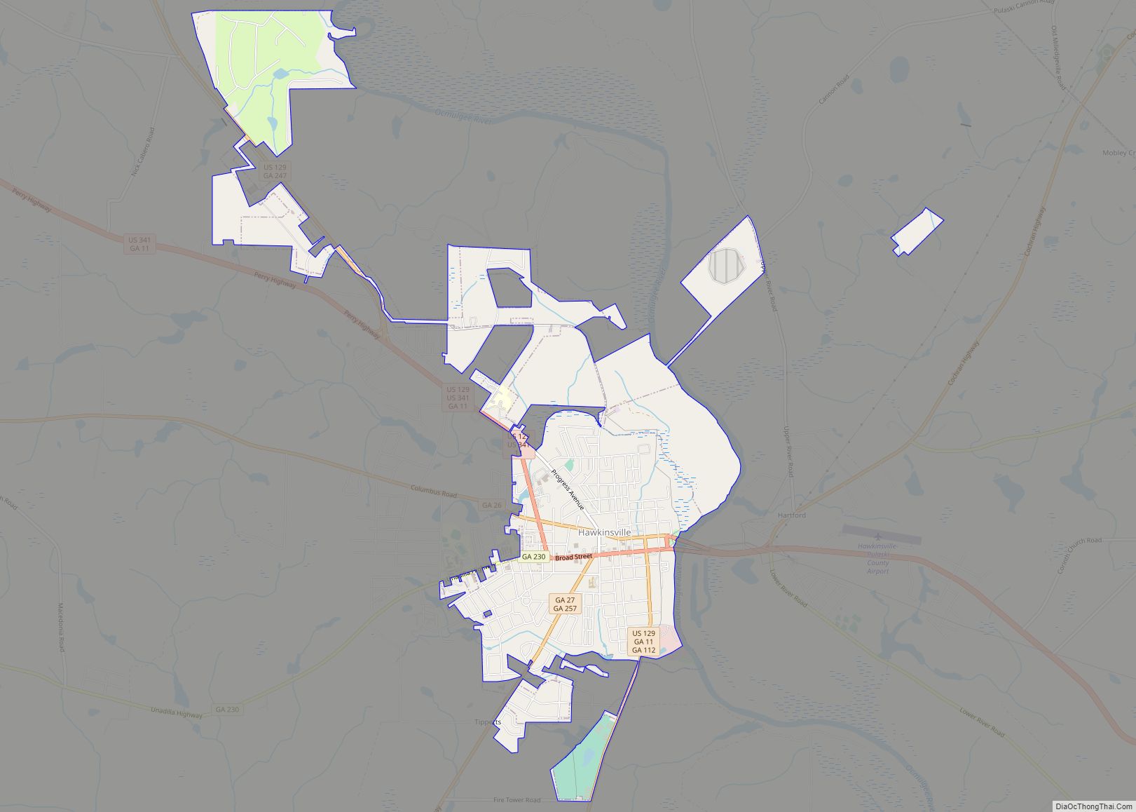
| Seat: | Hawkinsville |
| Largest city: | Hawkinsville |
| Total Area: | 251 sq mi (650 km²) |
| Land Area: | 249 sq mi (640 km²) |
| Total Population: | 9,855 |
| Population Density: | 40/sq mi (20/km²) |
| Time zone: | UTC−5 (Eastern) |
| Summer Time Zone (DST): | UTC−4 (EDT) |
| Website: | hawkinsville-pulaski.org |
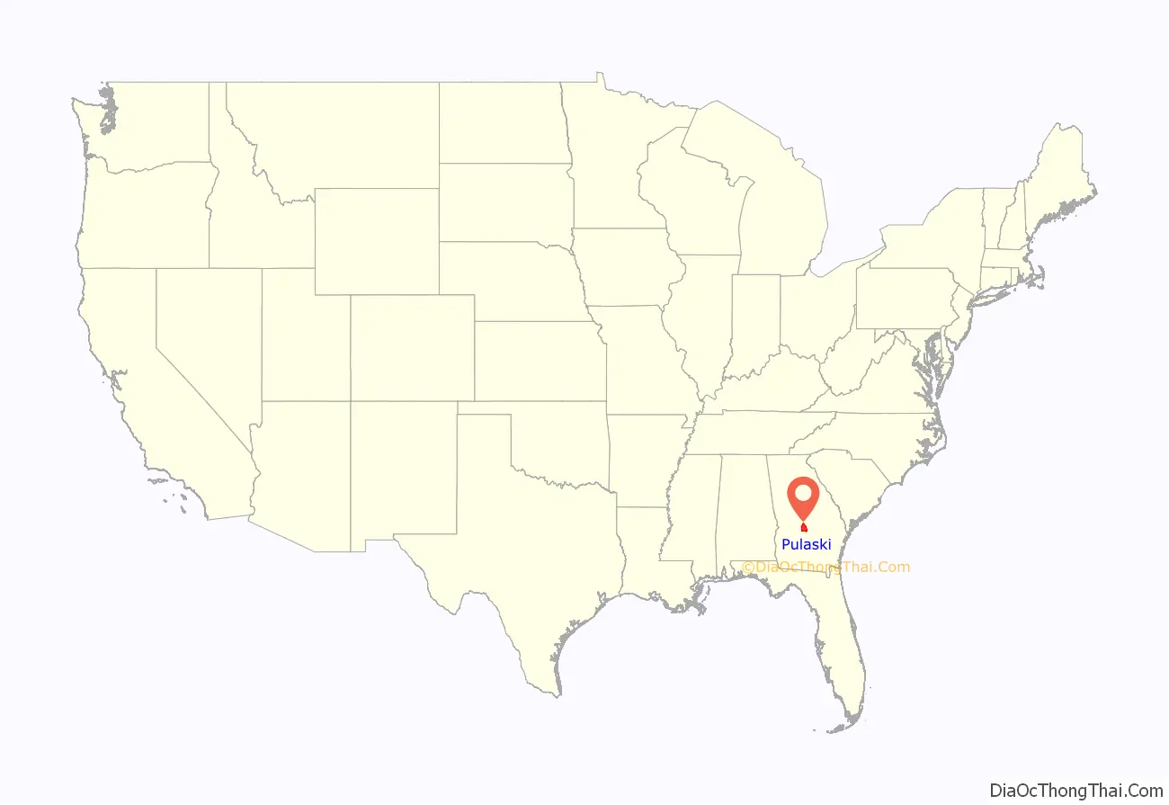
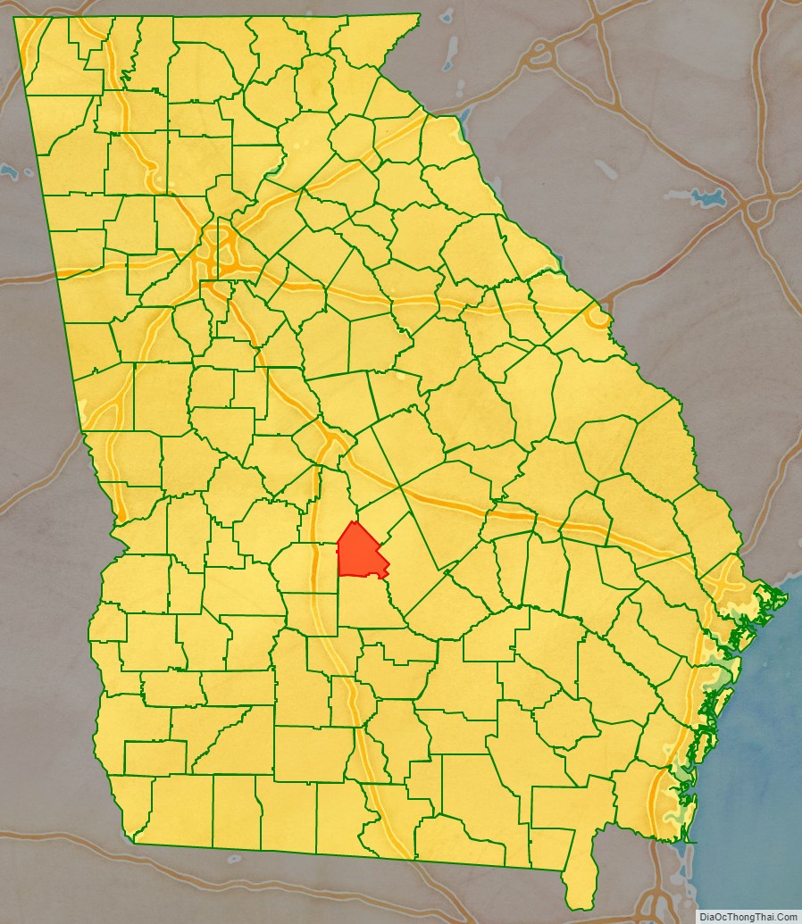
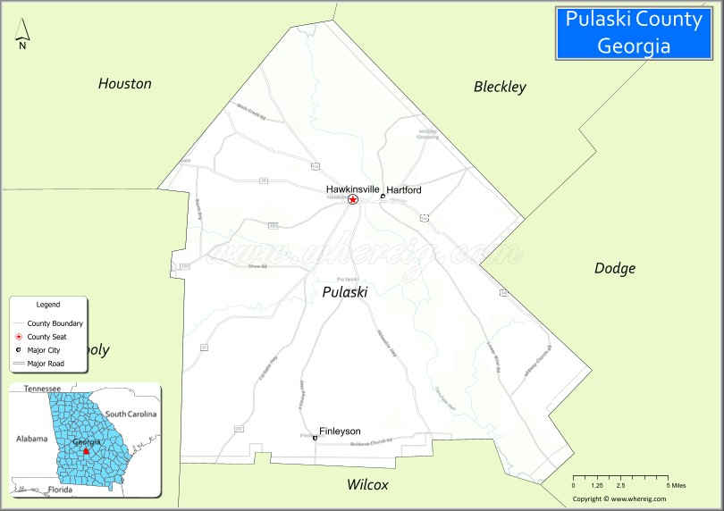
Pulaski County location map. Where is Pulaski County?
History
Pulaski County was created by an act of the Georgia General Assembly on December 13, 1808, from a portion of Laurens County. In the antebellum years, it was developed for cotton cultivation and is part of the Black Belt of Georgia, an arc of highly fertile soil.
In 1870, Dodge County was partially created from a section of Pulaski County by another legislative act. In 1912, the northwestern half of Pulaski County was used to create Bleckley County via a constitutional amendment approved by Georgia voters.
The county was named for Count Kazimierz Pułaski of Poland who fought and died for United States independence in the American Revolutionary War.
The county population fell by more than half from 1910 to 1930, as residents moved to cities. African Americans especially joined the Great Migration to northern and midwestern cities, both to gain work and to escape the Jim Crow racial oppression of the South.
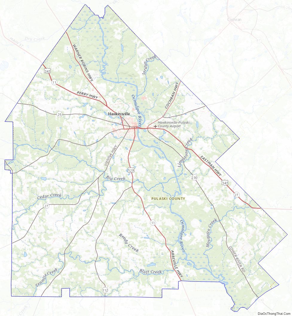
Pulaski County Road Map
Geography
According to the U.S. Census Bureau, the county has a total area of 251 square miles (650 km), of which 249 square miles (640 km) is land and 2.2 square miles (5.7 km) (0.9%) is water. The entirety of Pulaski County is located in the Lower Ocmulgee River sub-basin of the Altamaha River basin.
Major highways
- U.S. Route 129
U.S. Route 129 Alternate
U.S. Route 129 Business- U.S. Route 341
U.S. Route 341 Business- State Route 11
- State Route 11 Business
- State Route 26
- State Route 27
- State Route 112
- State Route 230
- State Route 247
- State Route 257
Adjacent counties
- Bleckley County – northeast
- Dodge County – east
- Wilcox County – south
- Dooly County – west
- Houston County – northwest
Pulaski County Topographic Map
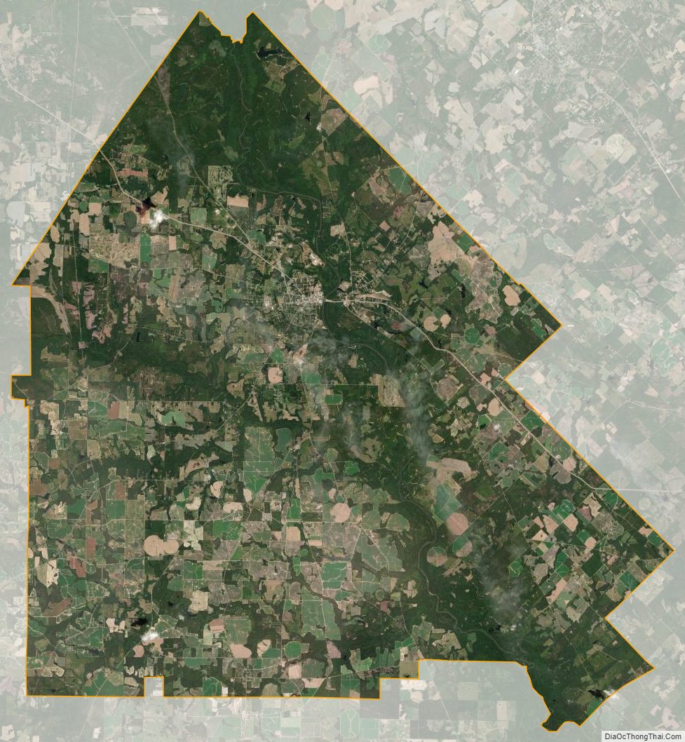
Pulaski County Satellite Map
Pulaski County Outline Map