Hawkinsville is a city in and the county seat of Pulaski County, Georgia, United States. The population was 4,589 at the 2010 census.
Hawkinsville is known as the “Harness Horse Capital” of Georgia. The Lawrence Bennett Harness Horse Racing facility is owned by the city and serves as an important training ground during winter months. The Harness Festival takes place every April at the end of training before horses head north for the harness racing season.
| Name: | Hawkinsville city |
|---|---|
| LSAD Code: | 25 |
| LSAD Description: | city (suffix) |
| State: | Georgia |
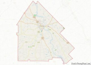
| County: | Pulaski County |
| Elevation: | 262 ft (80 m) |
| Total Area: | 5.38 sq mi (13.93 km²) |
| Land Area: | 5.37 sq mi (13.91 km²) |
| Water Area: | 0.01 sq mi (0.02 km²) |
| Total Population: | 3,980 |
| Population Density: | 741.15/sq mi (286.14/km²) |
| ZIP code: | 31036 |
| Area code: | 478 |
| FIPS code: | 1337396 |
| GNISfeature ID: | 0331934 |
| Website: | hawkinsville-pulaski.org |
Online Interactive Map
Click on ![]() to view map in "full screen" mode.
to view map in "full screen" mode.
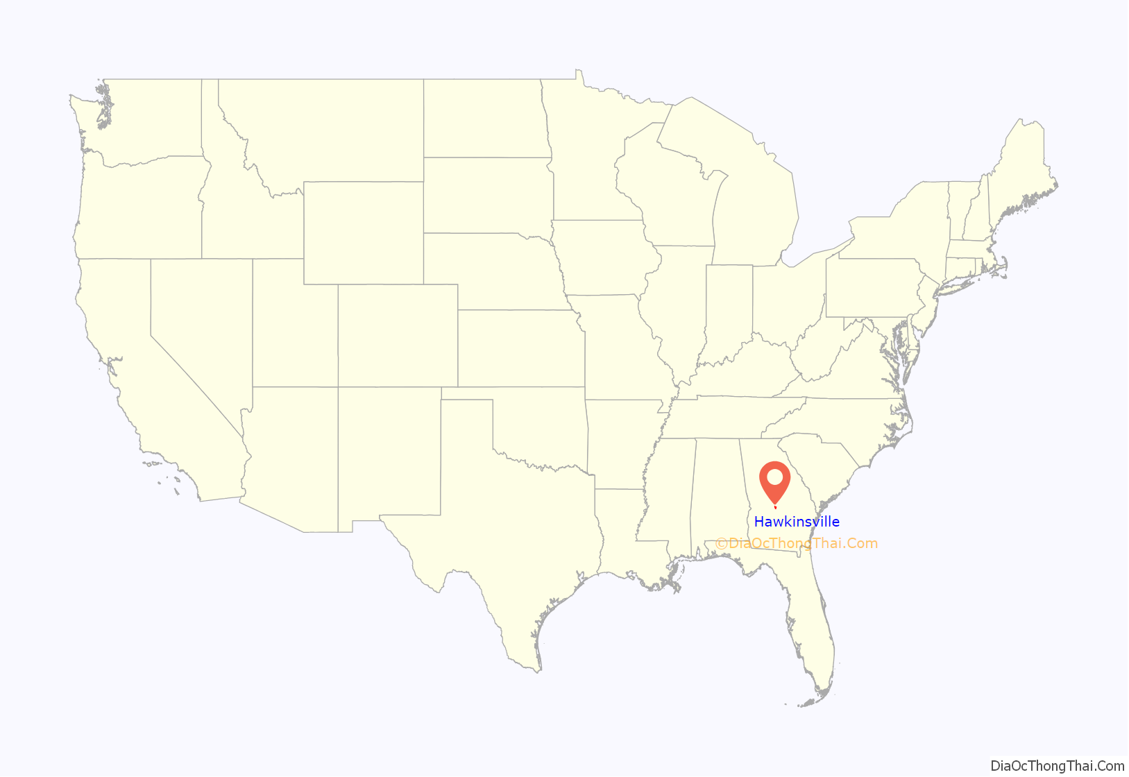
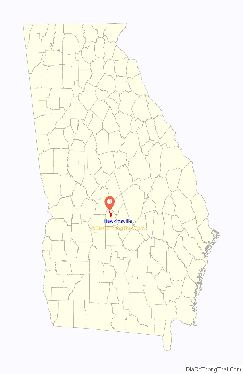
Hawkinsville location map. Where is Hawkinsville city?
History
Hawkinsville was founded in 1830. In 1837, the seat of Pulaski County was transferred to Hawkinsville from Hartford. The community was named for Benjamin Hawkins, delegate to the Continental Congress, and the United States Indian Agent in the Southeast, appointed by President George Washington.
The city includes Hawkinsville High School and several historical sites, including Hawkinsville City Hall-Auditorium, Hawkinsville Public School, the Merritt-Ragan House, the Pulaski County Courthouse, and Taylor Hall. St. Thomas African Methodist Episcopal Church was organized after the American Civil War as one of hundreds of AME churches planted in the South by missionaries from the first black independent denomination in the United States, founded in the early 19th century in Philadelphia, Pennsylvania. The Hawkinsville Commercial and Industrial Historic District is listed on the National Register of Historic Places. Hawkinsville is also home to the historic Hawkinsville Opera House.
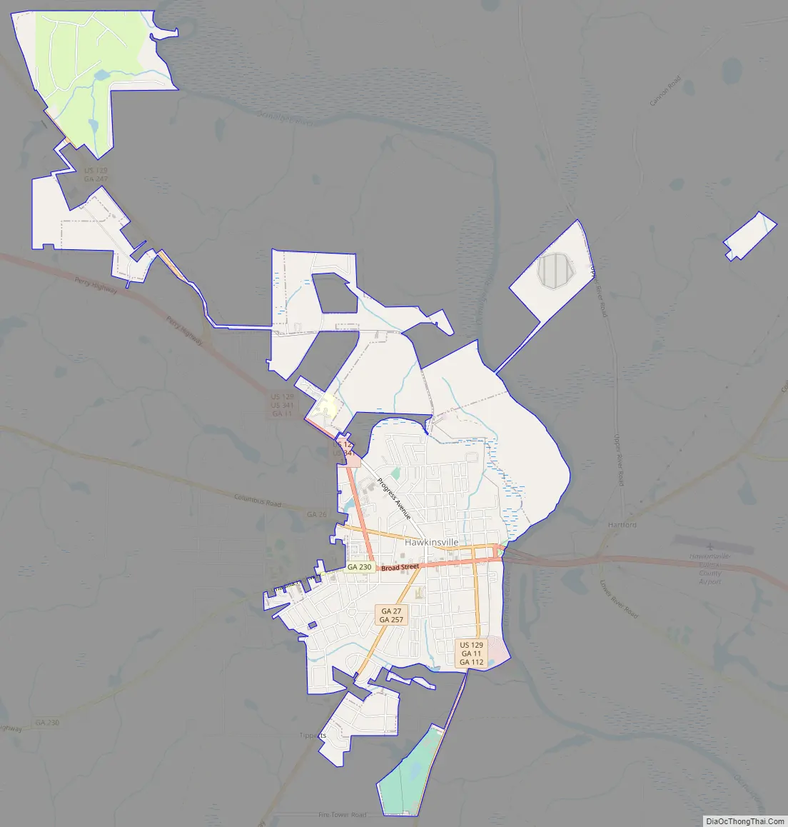
Hawkinsville Road Map
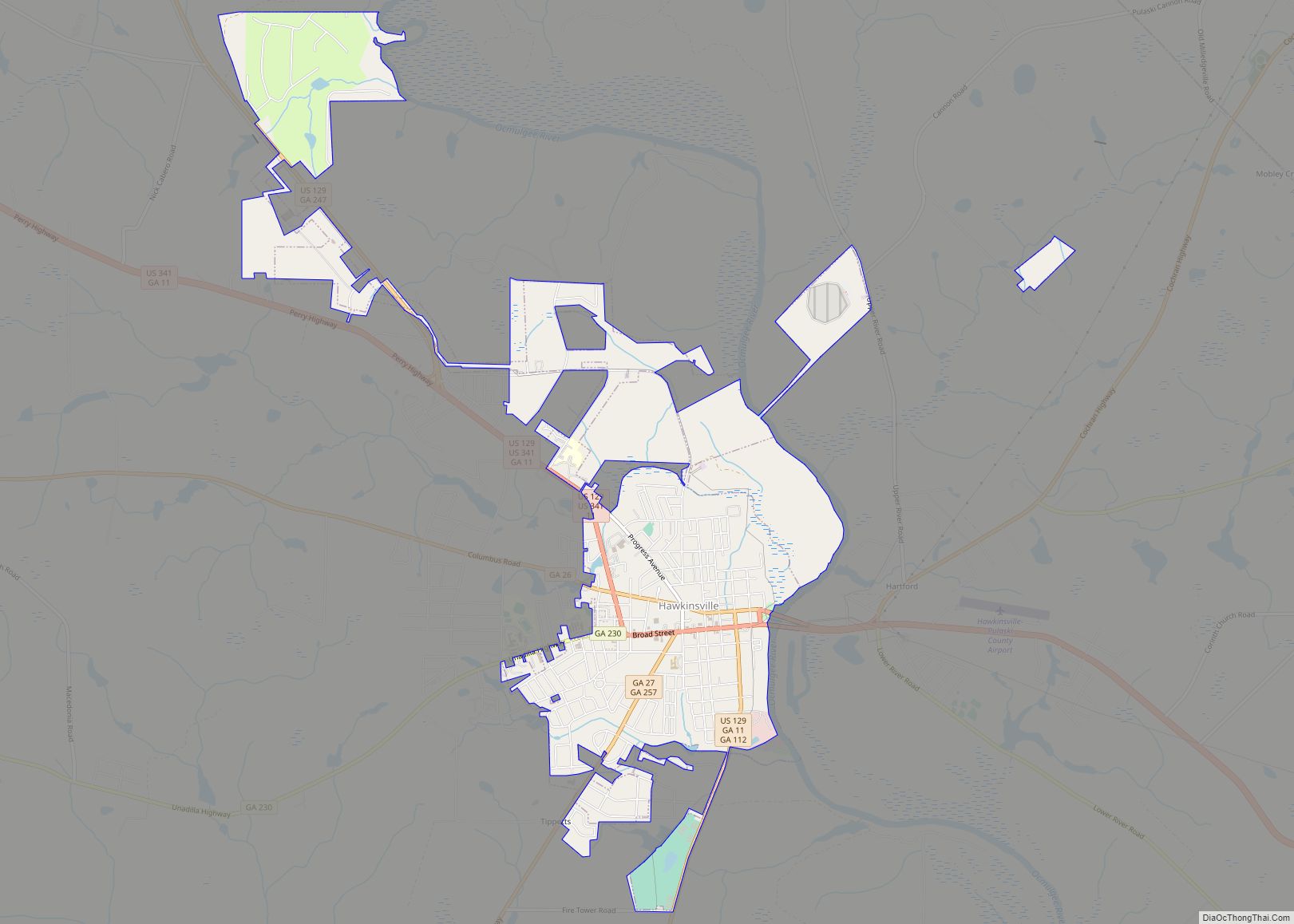
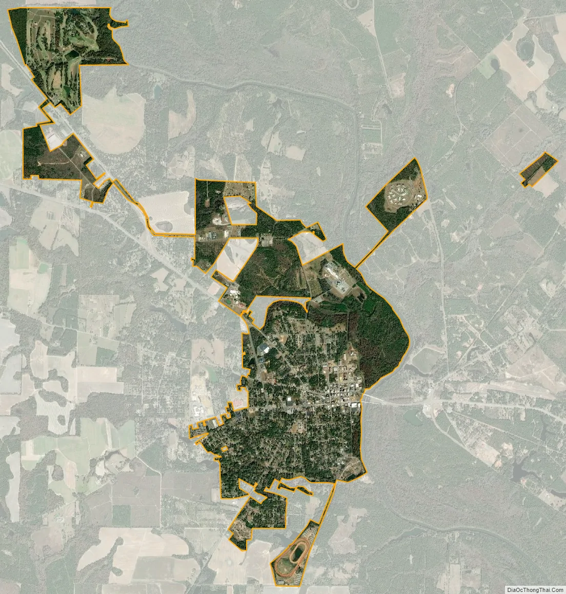
Hawkinsville city Satellite Map
Geography
Many highways converge in the city. U.S. Routes 129 and 341 are the two main highways through town, and run through the downtown area together. Upon leaving the city, U.S. 341 leads northwest 21 mi (34 km) to Perry along Interstate 75 and southeast 20 mi (32 km) to Eastman. U.S. 129 follows the route of U.S. 341 north of the city, but splits off northwest of downtown, leading north 28 mi (45 km) to Warner Robins. South of downtown, U.S. 129 leads south 24 mi (39 km) to Abbeville. In addition, an alternate route of U.S. 129 connects the city to Cochran, 11 mi (18 km) to the northeast. Other highways that run through the city include Georgia State Routes 26, 27, 230, and 257.
According to the United States Census Bureau, the city has a total area of 4.4 square miles (11 km), of which 4.4 square miles (11 km) is land and 0.1 square miles (0.26 km) (1.57%) is water.
Climate
Hawkinsville has a humid subtropical climate (Köppen climate classification Cfa), with mild winters and hot, humid summers.
See also
Map of Georgia State and its subdivision:- Appling
- Atkinson
- Bacon
- Baker
- Baldwin
- Banks
- Barrow
- Bartow
- Ben Hill
- Berrien
- Bibb
- Bleckley
- Brantley
- Brooks
- Bryan
- Bulloch
- Burke
- Butts
- Calhoun
- Camden
- Candler
- Carroll
- Catoosa
- Charlton
- Chatham
- Chattahoochee
- Chattooga
- Cherokee
- Clarke
- Clay
- Clayton
- Clinch
- Cobb
- Coffee
- Colquitt
- Columbia
- Cook
- Coweta
- Crawford
- Crisp
- Dade
- Dawson
- Decatur
- DeKalb
- Dodge
- Dooly
- Dougherty
- Douglas
- Early
- Echols
- Effingham
- Elbert
- Emanuel
- Evans
- Fannin
- Fayette
- Floyd
- Forsyth
- Franklin
- Fulton
- Gilmer
- Glascock
- Glynn
- Gordon
- Grady
- Greene
- Gwinnett
- Habersham
- Hall
- Hancock
- Haralson
- Harris
- Hart
- Heard
- Henry
- Houston
- Irwin
- Jackson
- Jasper
- Jeff Davis
- Jefferson
- Jenkins
- Johnson
- Jones
- Lamar
- Lanier
- Laurens
- Lee
- Liberty
- Lincoln
- Long
- Lowndes
- Lumpkin
- Macon
- Madison
- Marion
- McDuffie
- McIntosh
- Meriwether
- Miller
- Mitchell
- Monroe
- Montgomery
- Morgan
- Murray
- Muscogee
- Newton
- Oconee
- Oglethorpe
- Paulding
- Peach
- Pickens
- Pierce
- Pike
- Polk
- Pulaski
- Putnam
- Quitman
- Rabun
- Randolph
- Richmond
- Rockdale
- Schley
- Screven
- Seminole
- Spalding
- Stephens
- Stewart
- Sumter
- Talbot
- Taliaferro
- Tattnall
- Taylor
- Telfair
- Terrell
- Thomas
- Tift
- Toombs
- Towns
- Treutlen
- Troup
- Turner
- Twiggs
- Union
- Upson
- Walker
- Walton
- Ware
- Warren
- Washington
- Wayne
- Webster
- Wheeler
- White
- Whitfield
- Wilcox
- Wilkes
- Wilkinson
- Worth
- Alabama
- Alaska
- Arizona
- Arkansas
- California
- Colorado
- Connecticut
- Delaware
- District of Columbia
- Florida
- Georgia
- Hawaii
- Idaho
- Illinois
- Indiana
- Iowa
- Kansas
- Kentucky
- Louisiana
- Maine
- Maryland
- Massachusetts
- Michigan
- Minnesota
- Mississippi
- Missouri
- Montana
- Nebraska
- Nevada
- New Hampshire
- New Jersey
- New Mexico
- New York
- North Carolina
- North Dakota
- Ohio
- Oklahoma
- Oregon
- Pennsylvania
- Rhode Island
- South Carolina
- South Dakota
- Tennessee
- Texas
- Utah
- Vermont
- Virginia
- Washington
- West Virginia
- Wisconsin
- Wyoming