Poland is a Central European country covering an area of 312,696 sq. km in Central Europe.
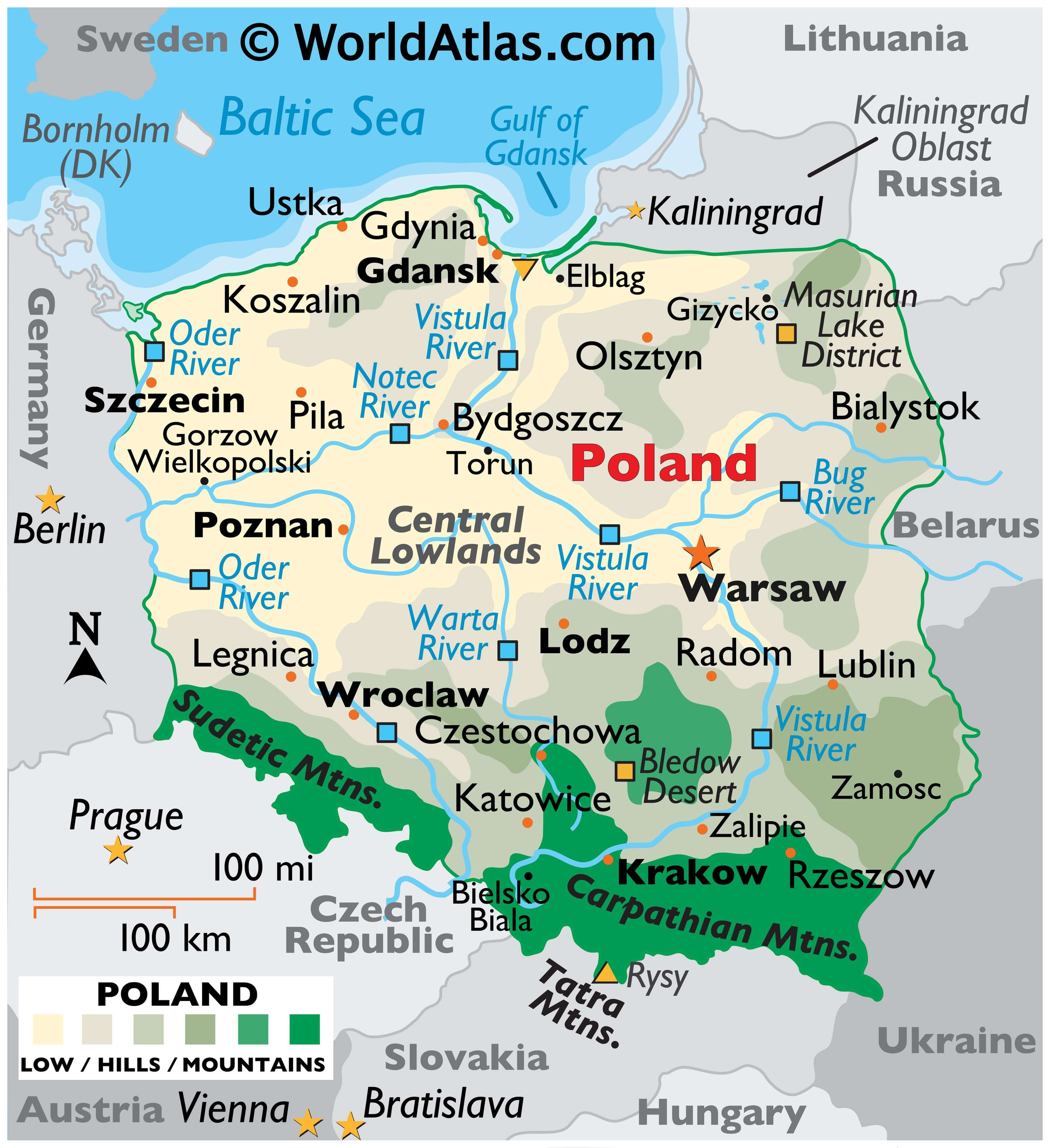
As seen on the physical map above, the country has a coastline on the Baltic Sea to the north. The coastline is fairly smooth with beaches and sand dunes but indented by scattered low-rising cliffs.
From the Baltic lowlands, Poland’s land rises gently into tree-covered hilly areas, with some higher elevations in the Pomeranian Lake District in the northeast.
The northern regions are somewhat hilly. Flat fertile farmlands and river valleys dominate the Central Lowlands that blend into a hillier area to the south of the Vistula River.
The southern third of the country is a mountainous region. Major ranges include the Sudetes, and the Tatra Mountains which are the most elevated part of the Carpathian Mountains. Poland has 21 mountains over 2,000 m (6,600 ft) in elevation, and all are located in the Tatras, along the border with Slovakia. Poland’s measured highest-point is Mt. Rysy in the High Tatras; it stands at 2,499 m (8,199 ft) in elevation. The lowest point in Poland at -1.8 m (-5.7 ft) is located at Raczki Elblaskie in the Vistula Delta.
Marked on the map above is the Bledow Desert that is located in southern Poland. It is only one of five natural deserts in Europe. It has a total area of 32 sq km (12 sq mi). Some of its dunes extend up to 30 m (98 ft).
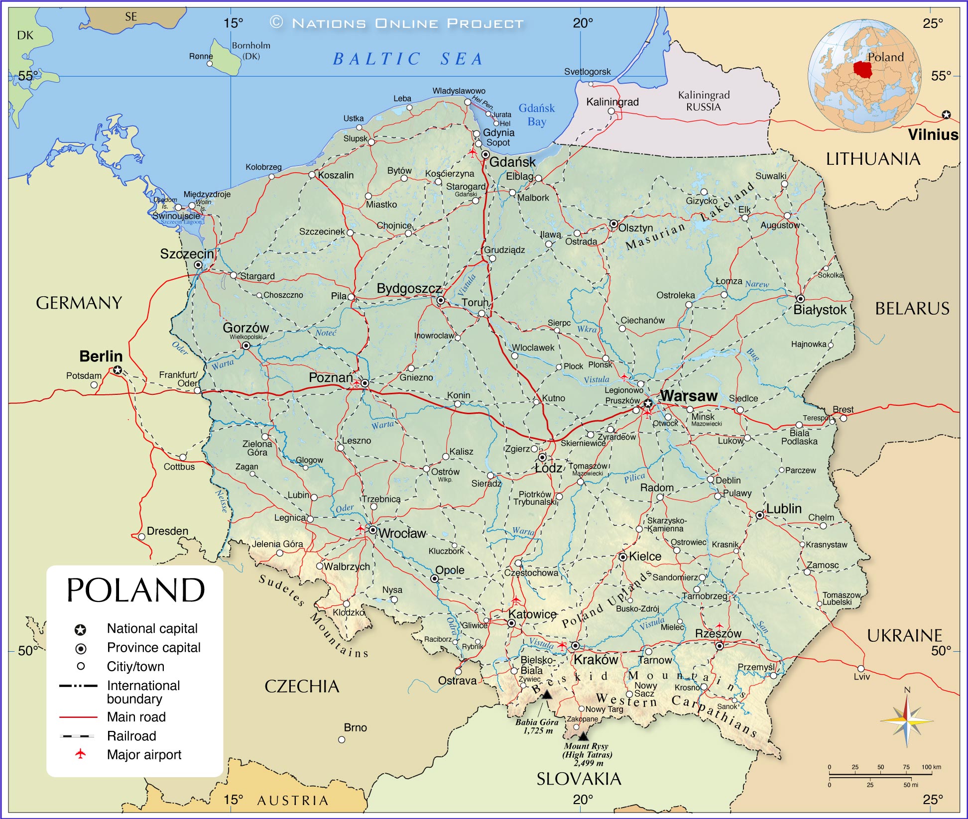
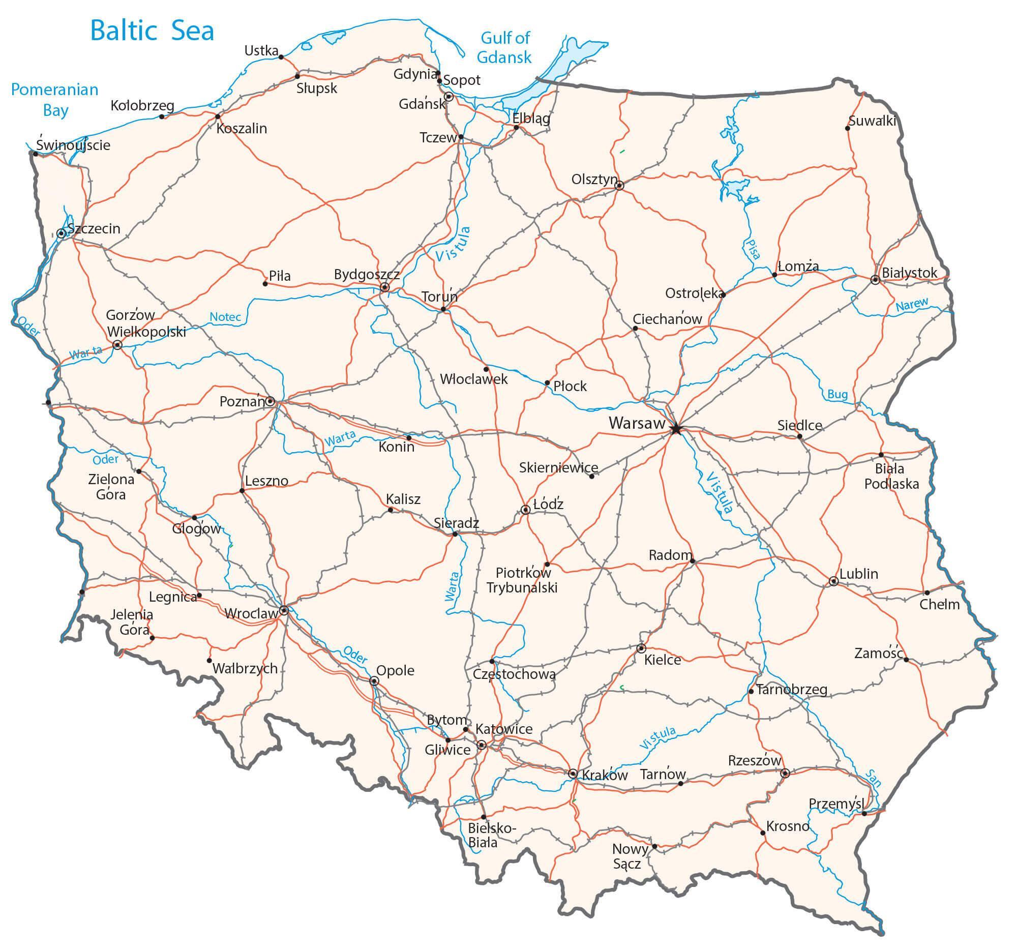
The Oder, Vistula and Warta are the country’s major rivers. The longest river in Poland is the Vistula at 1,047 km (651 mi) long. It is followed by the Oder which forms part of Poland’s western border, at 854 km (531 mi) long.
Poland has hundreds of small lakes, and in Europe, only Finland has a greater density of lakes. Numerous small lakes dot the far northeast.
| Flag: |  |
|---|---|
| Legal Name: | Republic of Poland |
| Capital Value: | Warsaw |
| Demonym(s): |
|
| Government: | Unitary parliamentary republic |
| Legislature: | Parliament |
| Total Area: | 312,685 km² |
| Land Area: | 304,255 km² |
| Water Area: | 8,430 km² |
| Population: | 37,970,874 |
| Density: | 122/km (316.0/sq mi) (98th) |
| GDP: | $592.16 Billion |
| GDP Per Capita: | $15,595.23 |
| Currency Value: | Zlotych (PLN) |
| Driving side: | right |
| Calling code: | +48 |
| Internet TLD: | .pl |
From the stunning Tatra Mountains to the picturesque Masurian Lake District, explore the beauty of Poland with this interactive map. See the major cities, towns, roads, rivers, and lakes that make up this fascinating country. With satellite imagery and an elevation map, you’re sure to capture the complete picture of this wonderful nation.
Online Interactive Political Map
Click on ![]() to view map in "full screen" mode.
to view map in "full screen" mode.
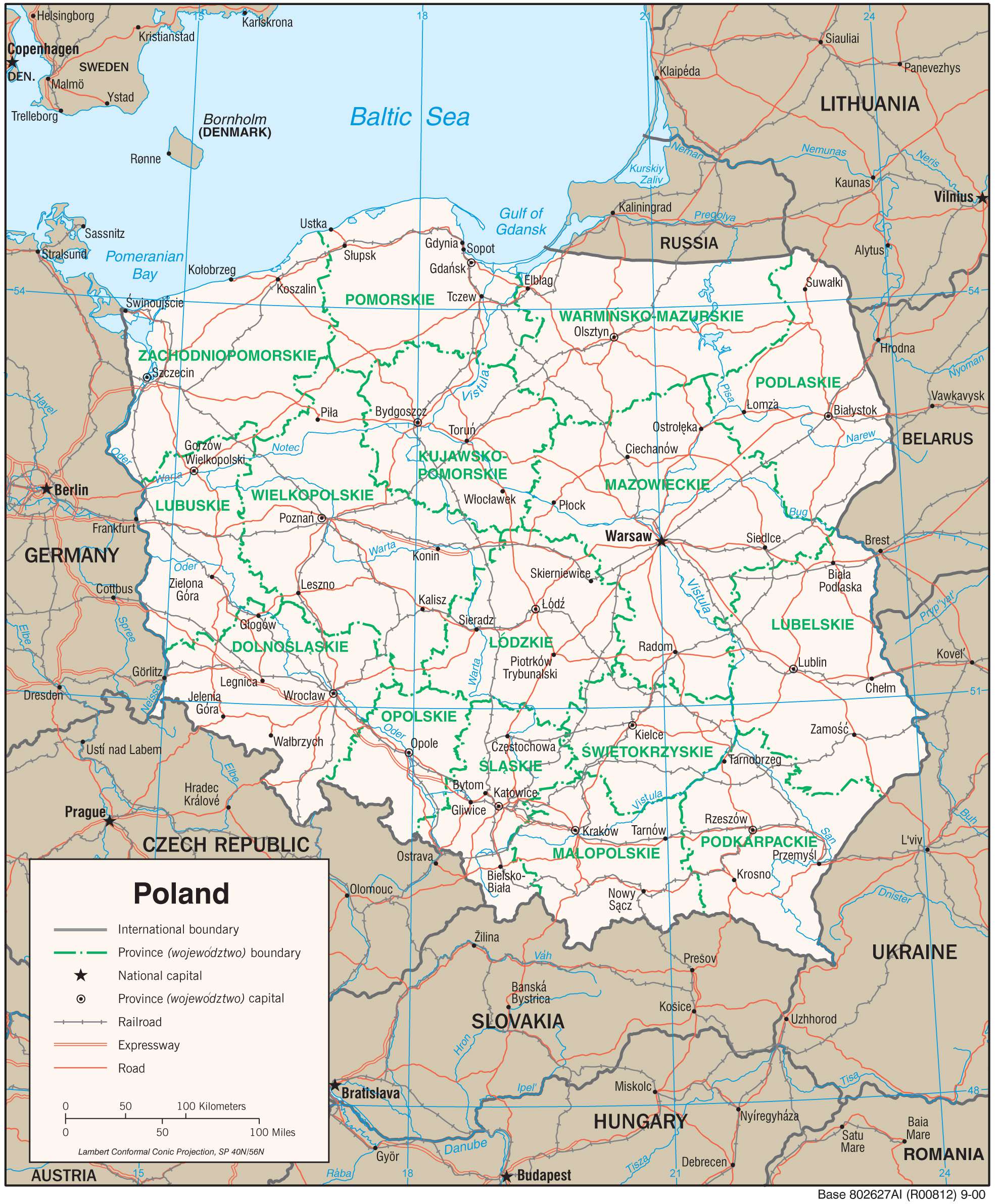
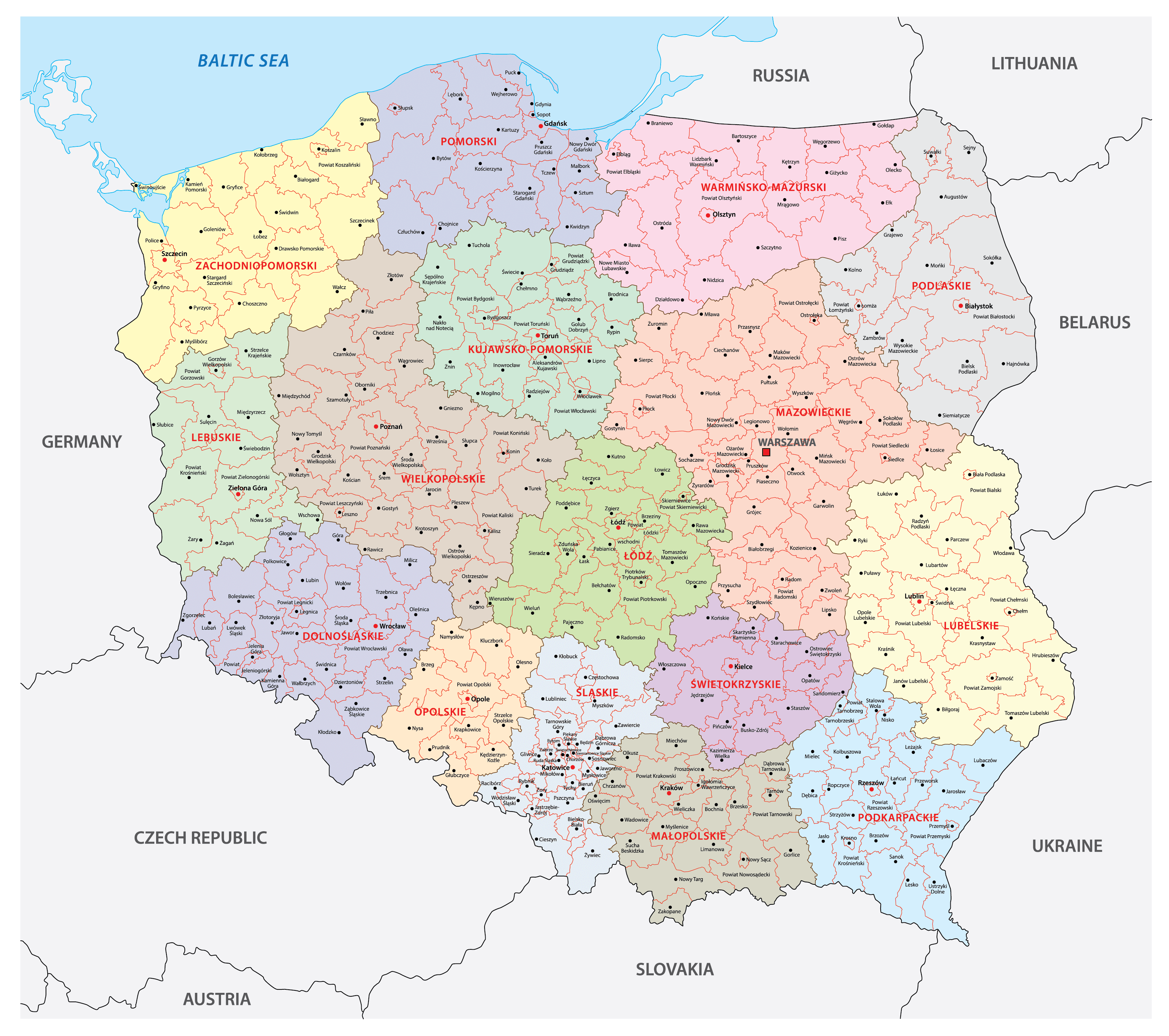
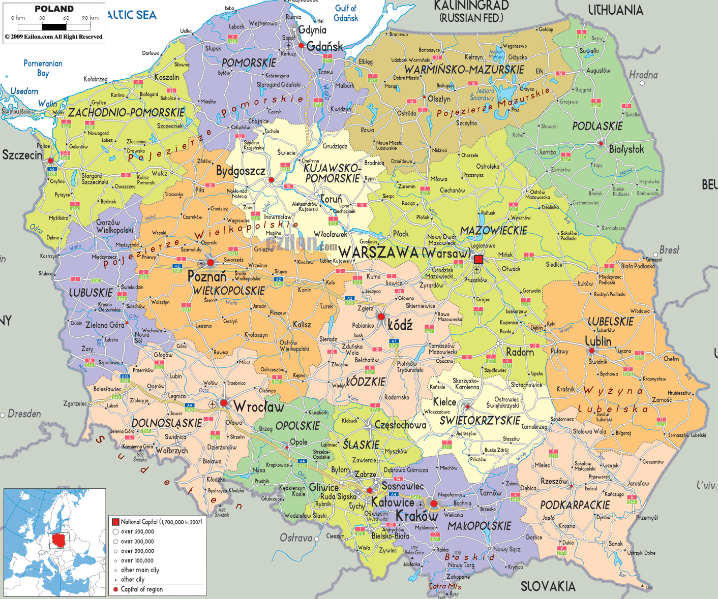
Poland (officially, the Republic of Poland) is divided into 16 voivodeships [provinces] (wojewodztwa, sing. wojewodztwo). In alphabetical order, these voivodeships are: Dolnoslaskie (Lower Silesian), Kujawsko-Pomorskie (Kuyavian-Pomeranian), Lubelskie (Lublin), Lubuskie (Lubusz), Lodzkie (Lodz), Malopolskie (Lesser Poland), Mazowieckie (Masovian), Opolskie (Opole), Podkarpackie (Subcarpathian), Podlaskie, Pomorskie (Pomeranian), Slaskie (Silesian),Swietokrzyskie (Holy Cross), Warminsko-Mazurskie (Warmian-Masurian), Wielkopolskie (Greater Poland) and Zachodniopomorskie (West Pomeranian).
With an area of 312,696 sq. km, and a population of over 38 million, Poland is the 5th most populous member of EU. Poland serves as the geographical and cultural crossroads of Eastern and Western Europe. Located in the east-central part of the country, Warsaw is the capital and the largest city of Poland. It is also the administrative, cultural and economic center of the country. Warsaw is the 7th most populous capital city in EU.
Location Maps
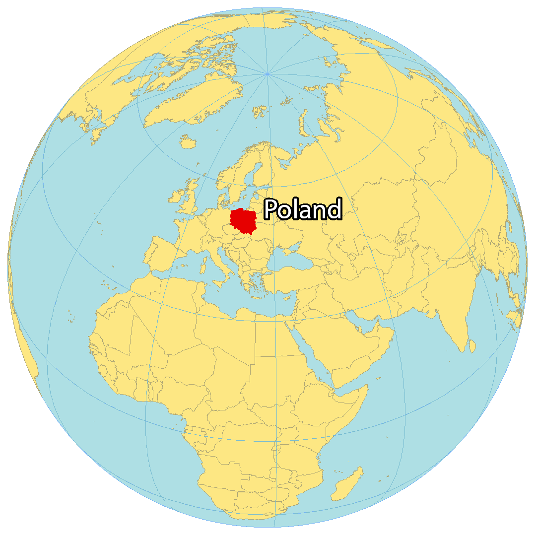
Where is Poland?
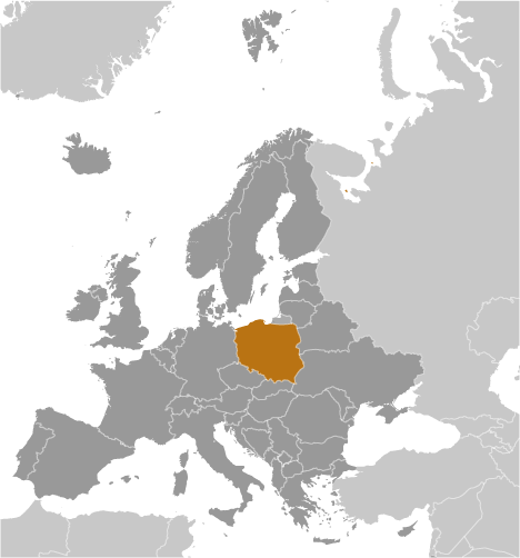
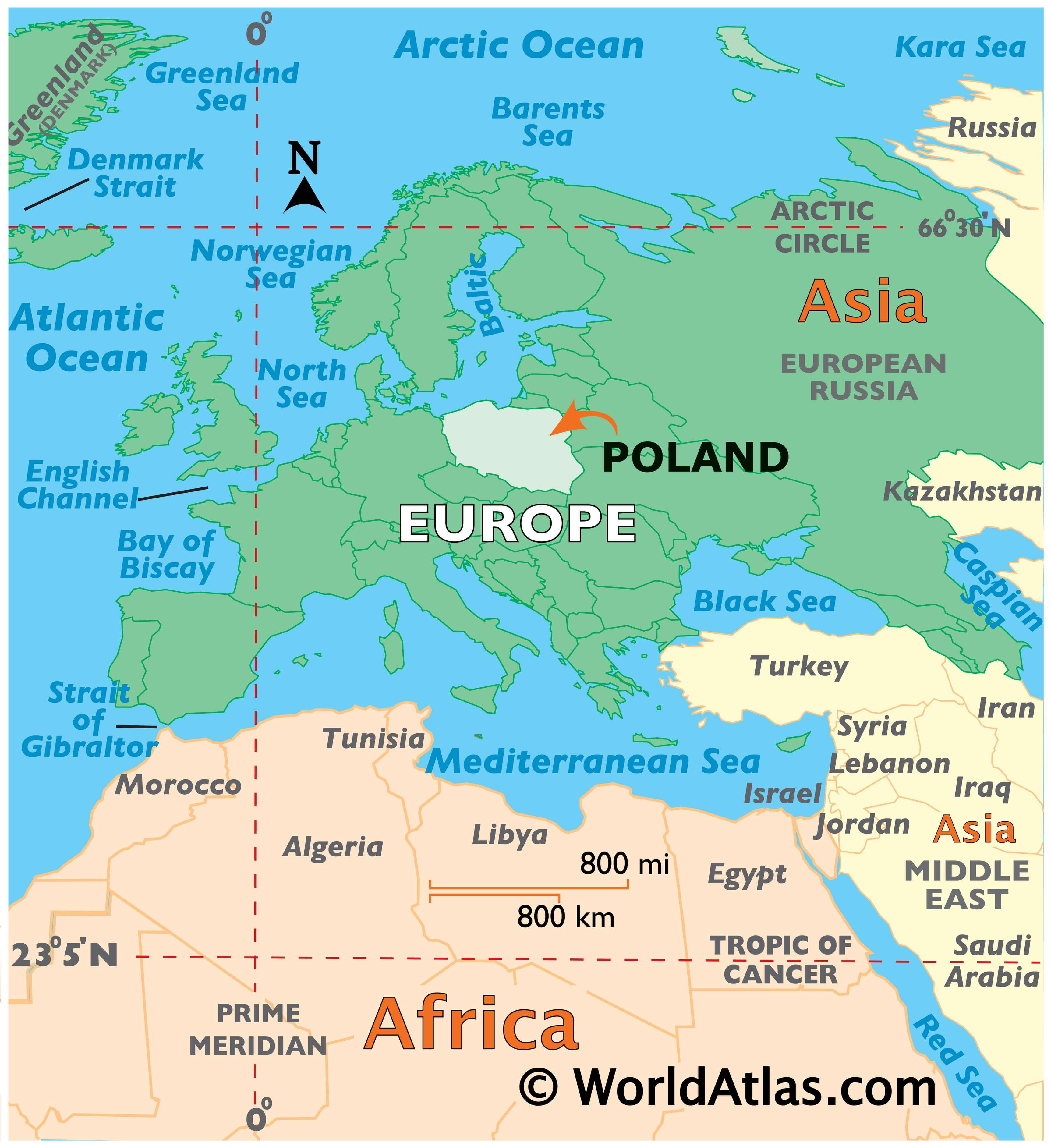
Poland is located in Central Europe, surrounded by the Baltic Sea to the north. It is bordered by six countries, including Germany to the west, the Czech Republic to the southwest, Slovakia to the south, Ukraine to the southeast, Belarus to the east, and Lithuania to the northeast. The terrain in Poland is flat and mostly plain, offering few natural barriers, which has led to its history as an area of conflict. Its coastline is approximately 770 km (478 mi) long. The capital and largest city of Poland is Warsaw, while other major cities include Krakow, Lodz, and Wroclaw.
High Definition Political Map of Poland
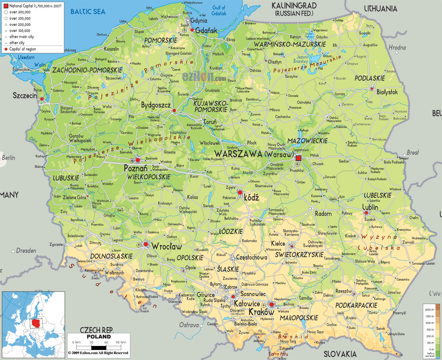
Physical Map of Poland
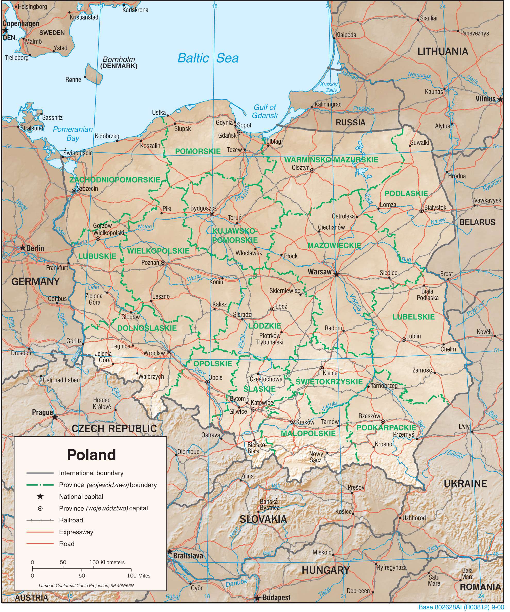
Transportation Map of Poland