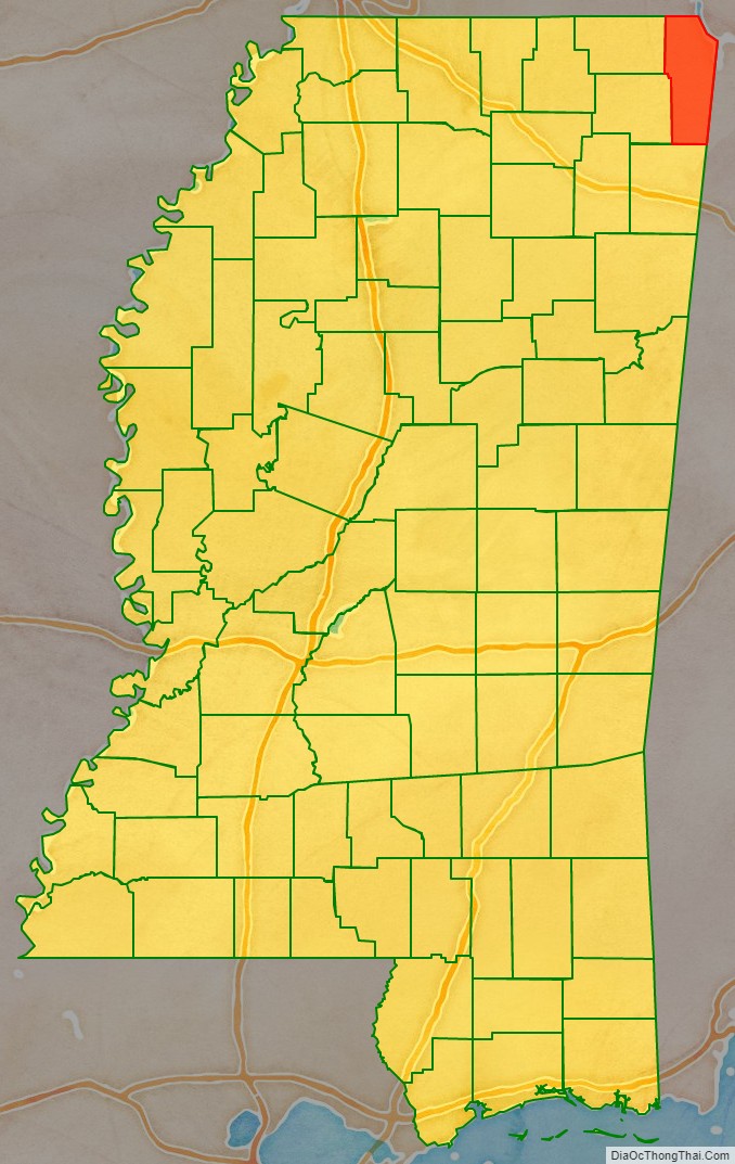
Tishomingo County is a county located in the northeastern corner of the U.S. state of Mississippi. As of the 2020 census, the population was 18,850. Its county seat is Iuka.
| Name: | Tishomingo County |
|---|---|
| FIPS code: | 28-141 |
| State: | Mississippi |
| Founded: | 1836 |
| Named for: | Tishomingo |
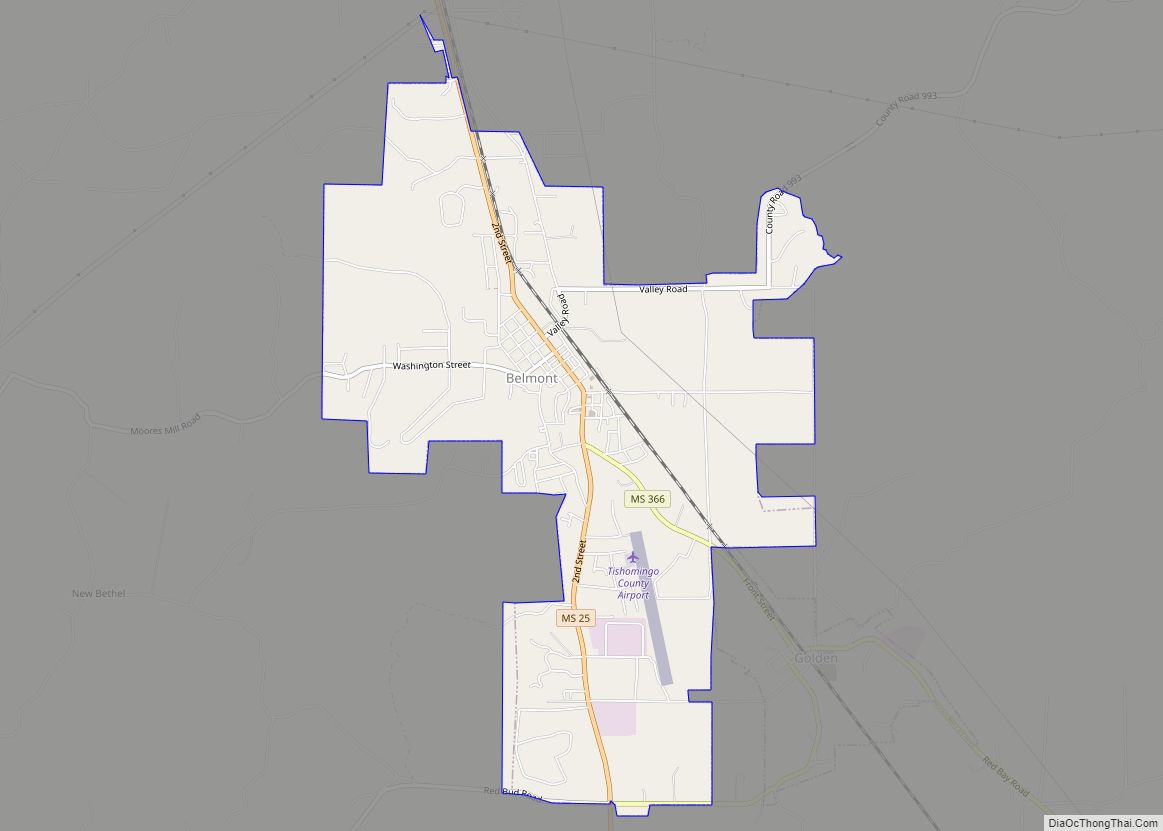
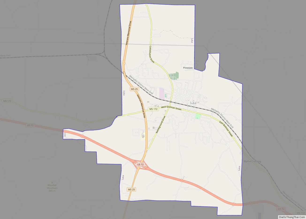
| Seat: | Iuka |
| Largest city: | Iuka |
| Total Area: | 445 sq mi (1,150 km²) |
| Land Area: | 424 sq mi (1,100 km²) |
| Total Population: | 18,850 |
| Population Density: | 42/sq mi (16/km²) |
| Time zone: | UTC−6 (Central) |
| Summer Time Zone (DST): | UTC−5 (CDT) |
| Website: | co.tishomingo.ms.us |
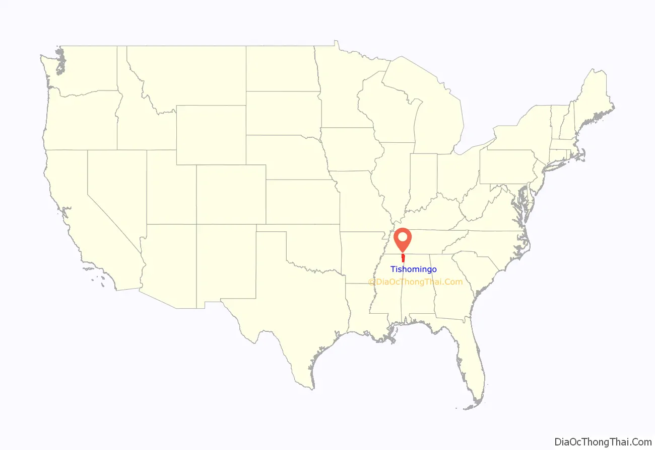
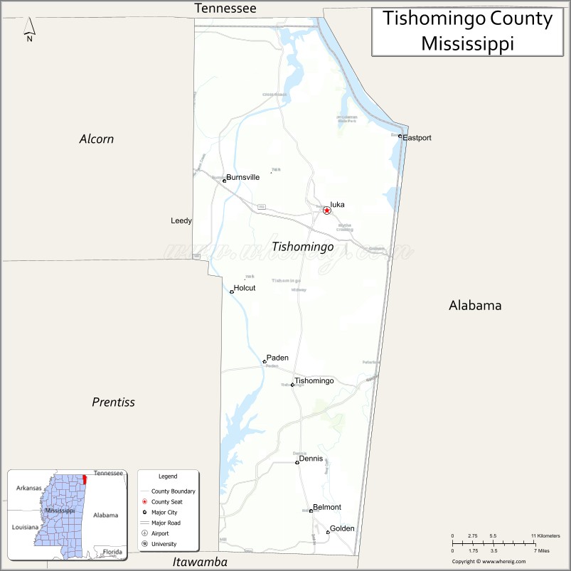
Tishomingo County location map. Where is Tishomingo County?
History
Tishomingo County was organized February 9, 1836, from Chickasaw lands that were ceded to the United States. The Chickasaw were forced by Indian Removal to relocate to lands in the Indian Territory (now Oklahoma).
Jacinto was the original county seat of Tishomingo County and its historic courthouse building is listed on the National Register of Historic Places.
Parts of the northeastern side of Tishomingo county are part of the Battle of Shiloh Civil War battlefield.
In 1870 the area was divided into Alcorn, Prentiss and Tishomingo counties. Tishomingo’s county seat was relocated to Iuka.
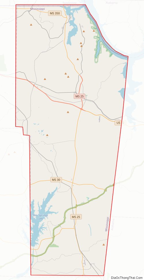
Tishomingo County Road Map
Geography
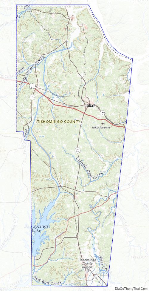
According to the U.S. Census Bureau, the county has a total area of 445 square miles (1,150 km), of which 424 square miles (1,100 km) is land and 20 square miles (52 km) (4.6%) is water. The highest natural point in Mississippi, the 806 feet (246 meters) Woodall Mountain, is located in the county. Tishomingo County is the only county in Mississippi with outcroppings of natural limestone formations.
Adjacent counties
- Hardin County, Tennessee (north)
- Lauderdale County, Alabama (northeast)
- Colbert County, Alabama (east)
- Franklin County, Alabama (southeast)
- Itawamba County (south)
- Prentiss County (southwest)
- Alcorn County (northwest)
Major highways
- U.S. Route 72
- Mississippi Highway 4
- Mississippi Highway 25
- Mississippi Highway 30
- Mississippi Highway 172
- Mississippi Highway 350
- Mississippi Highway 364
- Mississippi Highway 365
- Mississippi Highway 366
- Mississippi Highway 760
- Natchez Trace Parkway
National protected area
Natchez Trace Parkway
Tishomingo County Topographic Map
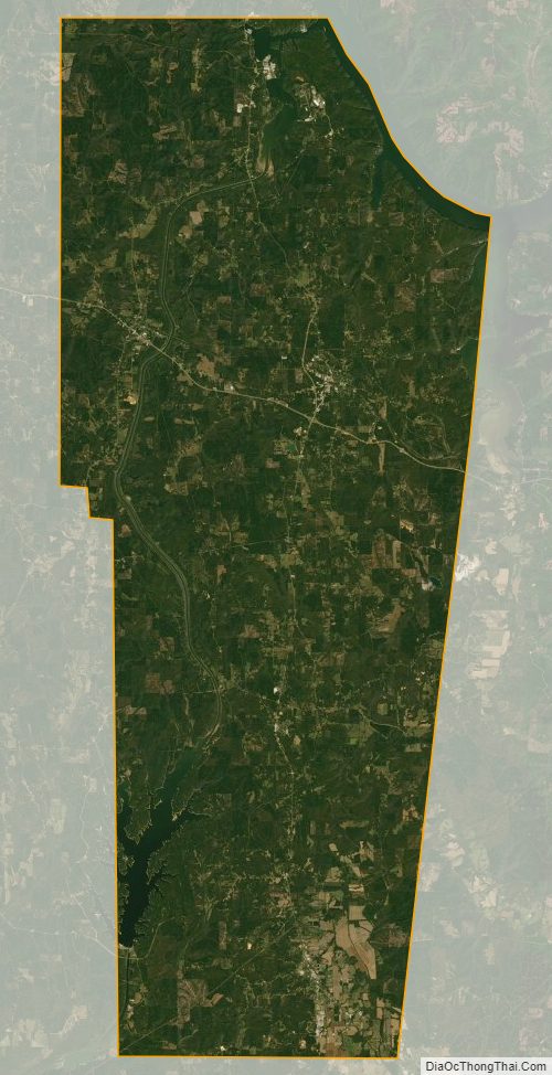
Tishomingo County Satellite Map
Tishomingo County Outline Map