Tishomingo is a town in Tishomingo County, Mississippi, United States. The population of the city of Tishomingo was 339 at the 2010 census.
| Name: | Tishomingo town |
|---|---|
| LSAD Code: | 43 |
| LSAD Description: | town (suffix) |
| State: | Mississippi |
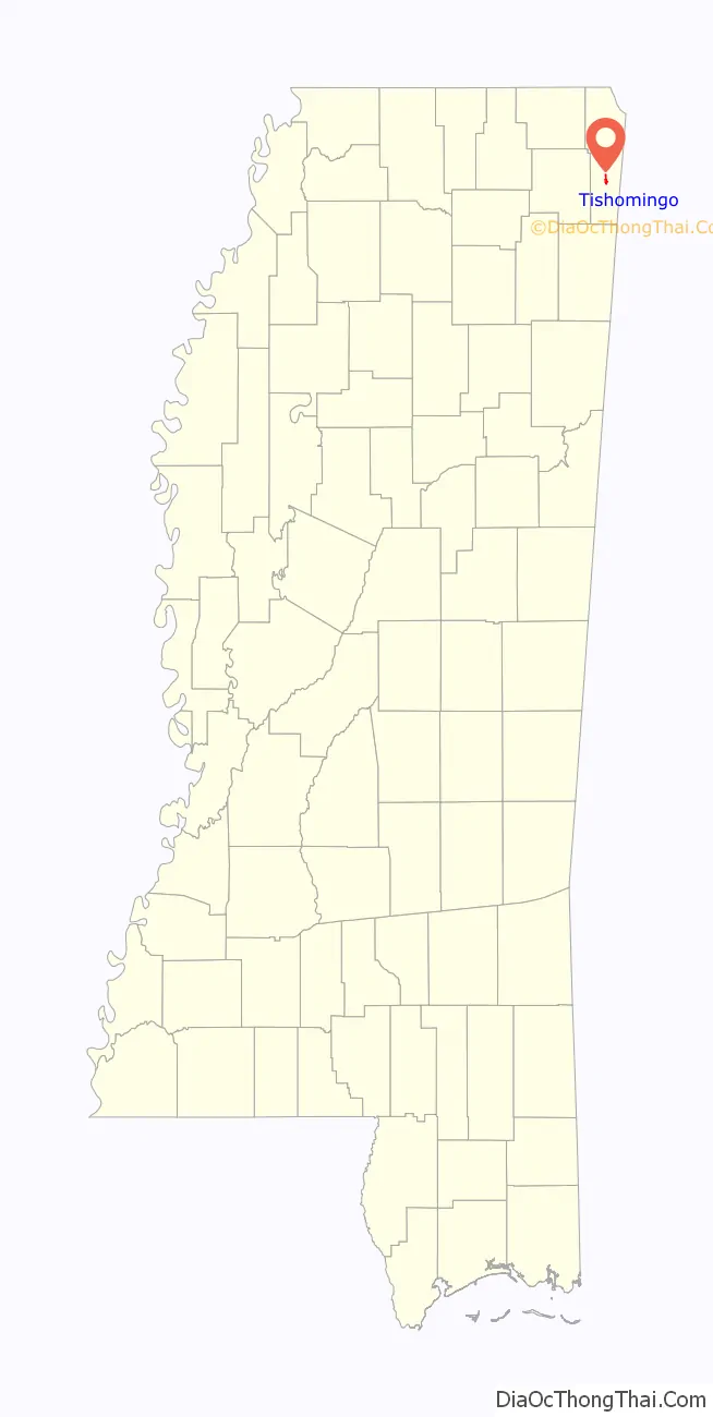
| County: | Tishomingo County |
| Elevation: | 512 ft (156 m) |
| Total Area: | 0.85 sq mi (2.21 km²) |
| Land Area: | 0.85 sq mi (2.21 km²) |
| Water Area: | 0.00 sq mi (0.00 km²) |
| Total Population: | 370 |
| Population Density: | 433.76/sq mi (167.49/km²) |
| ZIP code: | 38873 |
| Area code: | 662 |
| FIPS code: | 2873720 |
| GNISfeature ID: | 0678781 |
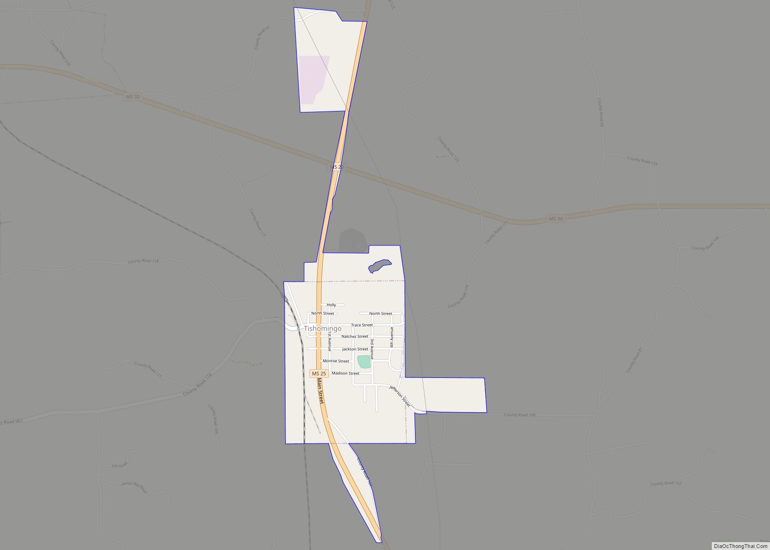
Online Interactive Map
Click on ![]() to view map in "full screen" mode.
to view map in "full screen" mode.
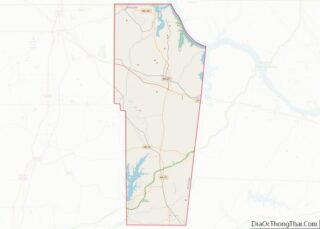
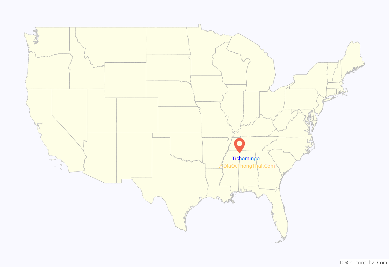
Tishomingo location map. Where is Tishomingo town?
History
Tishomingo is named for Tishomingo, who signed the Treaty of Pontotoc in 1832. He served with Major-General Anthony Wayne against the Shawnees in the Northwest Territory and received a silver medal from President George Washington. During the War of 1812, he served under Andrew Jackson. After his service in the military, he retired to become a farmer until white settlers came onto his land. In 1837, a final treaty forced the Chickasaws to move to the Indian Territory in present-day Oklahoma. Tishomingo died of smallpox on the Trail of Tears and is buried in Arkansas somewhere near Little Rock. His son, Iuka, is the namesake of the county seat of Tishomingo County, Mississippi.
This town developed with the building of the Illinois Central Railroad. Andrew Jackson also camped at the site of Tishomingo, on his way to visit the Creek nation.
National Register of Historic Places
Four sites near Tishomingo are listed on the National Register of Historic Places, including Bear Creek Mound and Village Site, and Tishomingo State Park.
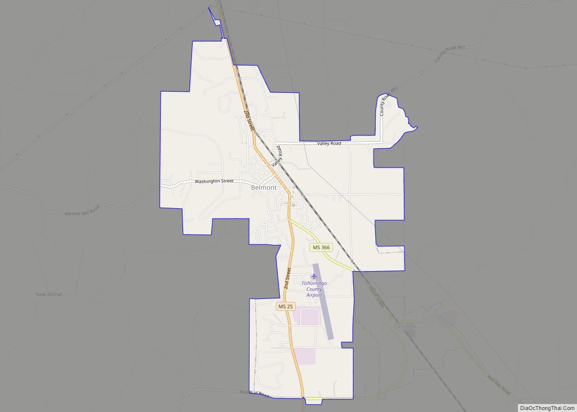
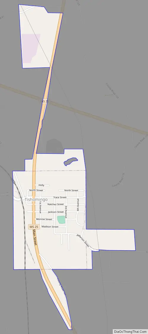
Tishomingo Road Map
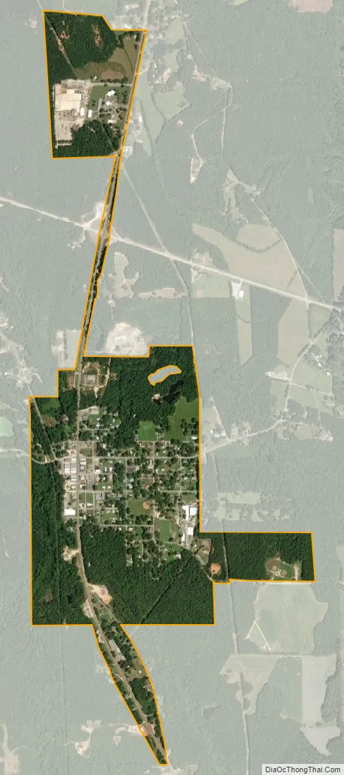
Tishomingo city Satellite Map
Geography
According to the United States Census Bureau, the town has a total area of 0.6 square miles (1.6 km), all land. The town is situated along Mississippi Highway 25, south of the highway’s intersection with Mississippi Highway 30, and north of its intersection with the Natchez Trace Parkway. The Mississippi-Alabama border lies a few miles to the east, Tishomingo State Park lies to the southeast, and Bay Springs Lake (part of the Tennessee-Tombigbee Waterway) lies to the west. Via MS-25, Iuka, the county seat of Tishomingo County, is 13 mi (21 km) north, and Belmont is 9 mi (14 km) south.
Communities near Tishomingo
Rivers and streams
- King Creek
See also
Map of Mississippi State and its subdivision:- Adams
- Alcorn
- Amite
- Attala
- Benton
- Bolivar
- Calhoun
- Carroll
- Chickasaw
- Choctaw
- Claiborne
- Clarke
- Clay
- Coahoma
- Copiah
- Covington
- Desoto
- Forrest
- Franklin
- George
- Greene
- Grenada
- Hancock
- Harrison
- Hinds
- Holmes
- Humphreys
- Issaquena
- Itawamba
- Jackson
- Jasper
- Jefferson
- Jefferson Davis
- Jones
- Kemper
- Lafayette
- Lamar
- Lauderdale
- Lawrence
- Leake
- Lee
- Leflore
- Lincoln
- Lowndes
- Madison
- Marion
- Marshall
- Monroe
- Montgomery
- Neshoba
- Newton
- Noxubee
- Oktibbeha
- Panola
- Pearl River
- Perry
- Pike
- Pontotoc
- Prentiss
- Quitman
- Rankin
- Scott
- Sharkey
- Simpson
- Smith
- Stone
- Sunflower
- Tallahatchie
- Tate
- Tippah
- Tishomingo
- Tunica
- Union
- Walthall
- Warren
- Washington
- Wayne
- Webster
- Wilkinson
- Winston
- Yalobusha
- Yazoo
- Alabama
- Alaska
- Arizona
- Arkansas
- California
- Colorado
- Connecticut
- Delaware
- District of Columbia
- Florida
- Georgia
- Hawaii
- Idaho
- Illinois
- Indiana
- Iowa
- Kansas
- Kentucky
- Louisiana
- Maine
- Maryland
- Massachusetts
- Michigan
- Minnesota
- Mississippi
- Missouri
- Montana
- Nebraska
- Nevada
- New Hampshire
- New Jersey
- New Mexico
- New York
- North Carolina
- North Dakota
- Ohio
- Oklahoma
- Oregon
- Pennsylvania
- Rhode Island
- South Carolina
- South Dakota
- Tennessee
- Texas
- Utah
- Vermont
- Virginia
- Washington
- West Virginia
- Wisconsin
- Wyoming