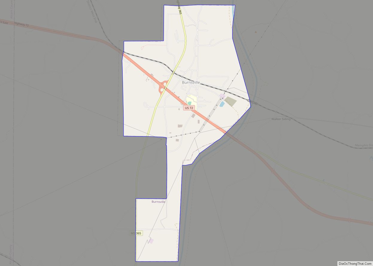
Burnsville is a town in Tishomingo County in northeastern Mississippi, United States. The population was 936 at the 2010 census.
| Name: | Burnsville town |
|---|---|
| LSAD Code: | 43 |
| LSAD Description: | town (suffix) |
| State: | Mississippi |
| County: | Tishomingo County |
| Elevation: | 463 ft (141 m) |
| Total Area: | 4.79 sq mi (12.41 km²) |
| Land Area: | 4.77 sq mi (12.36 km²) |
| Water Area: | 0.02 sq mi (0.05 km²) |
| Total Population: | 868 |
| Population Density: | 181.93/sq mi (70.25/km²) |
| ZIP code: | 38833 |
| Area code: | 662 |
| FIPS code: | 2809820 |
| GNISfeature ID: | 0667827 |
| Website: | burnsvillems.com |
Online Interactive Map
Click on ![]() to view map in "full screen" mode.
to view map in "full screen" mode.
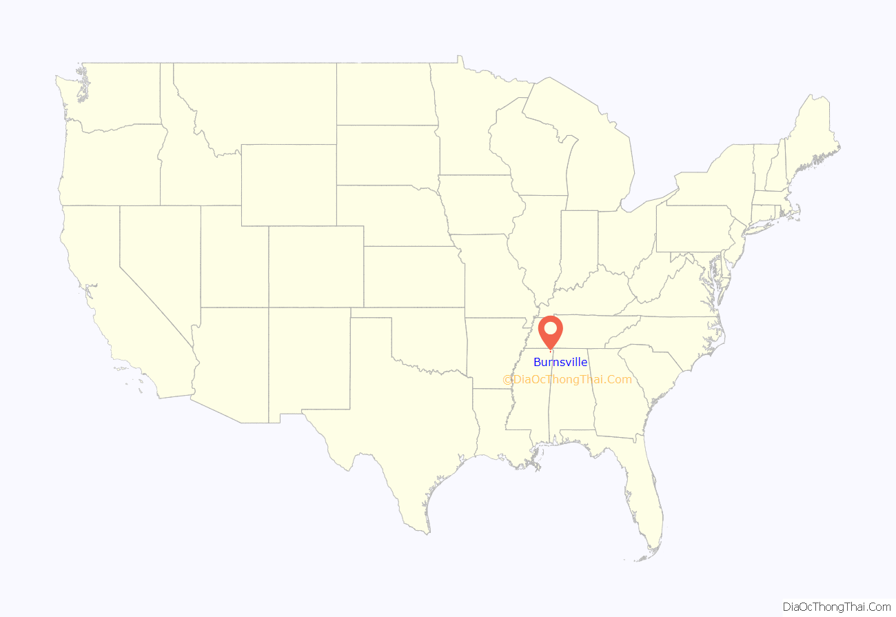
Burnsville location map. Where is Burnsville town?
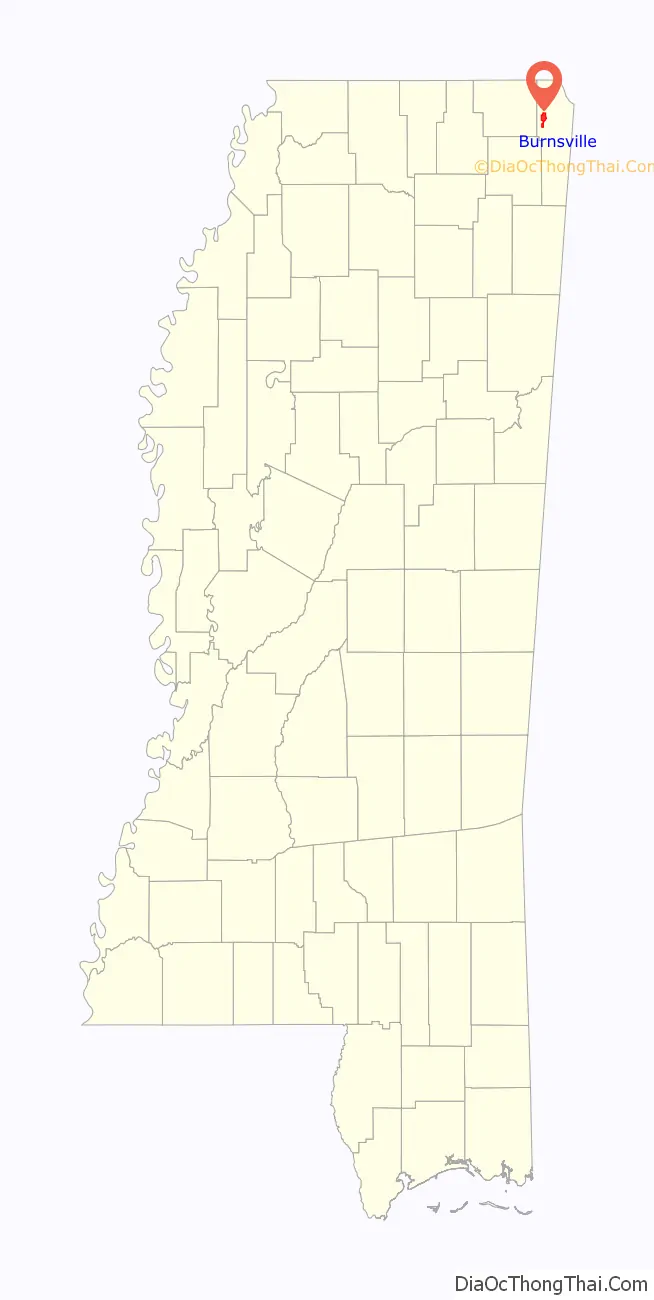
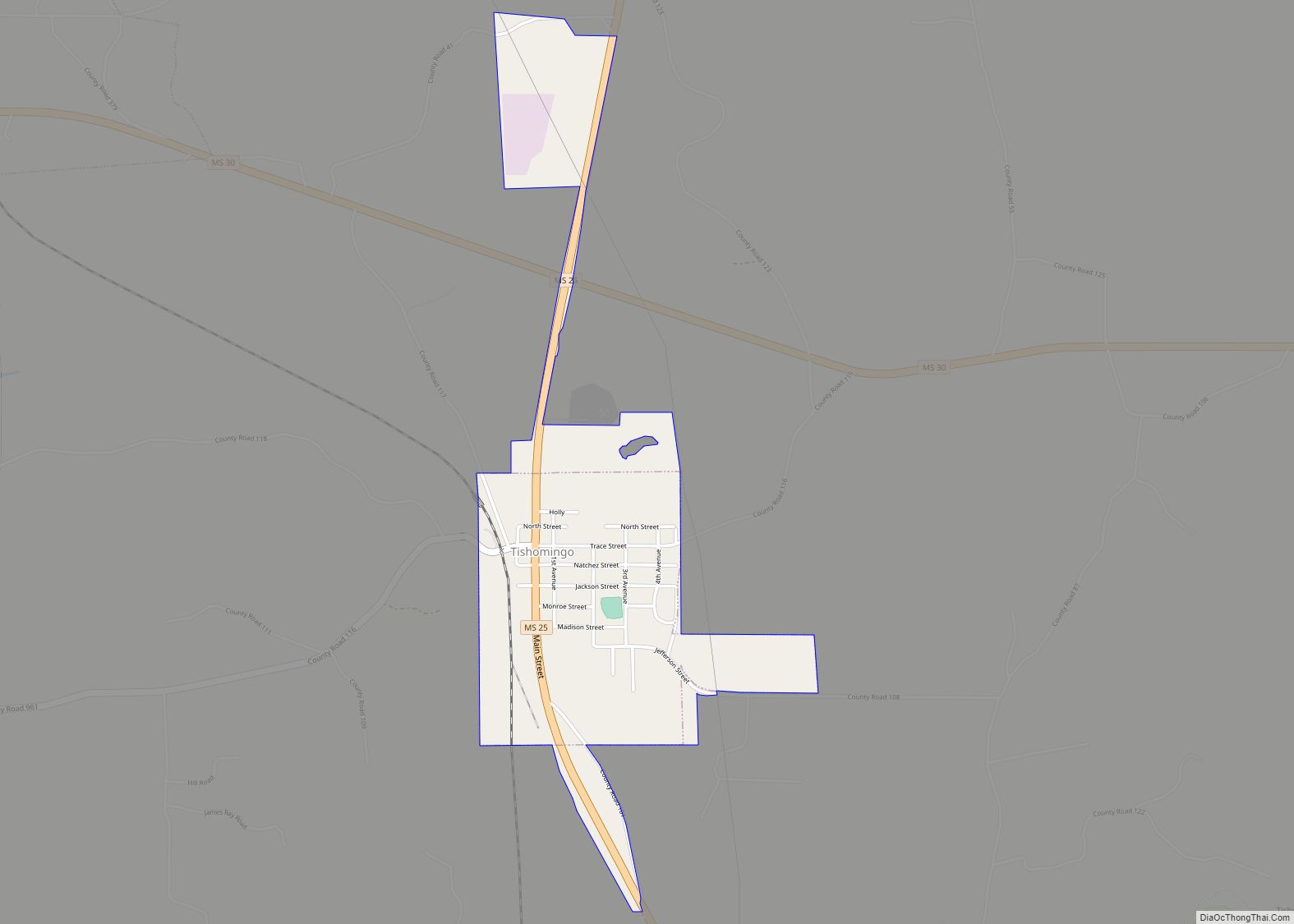
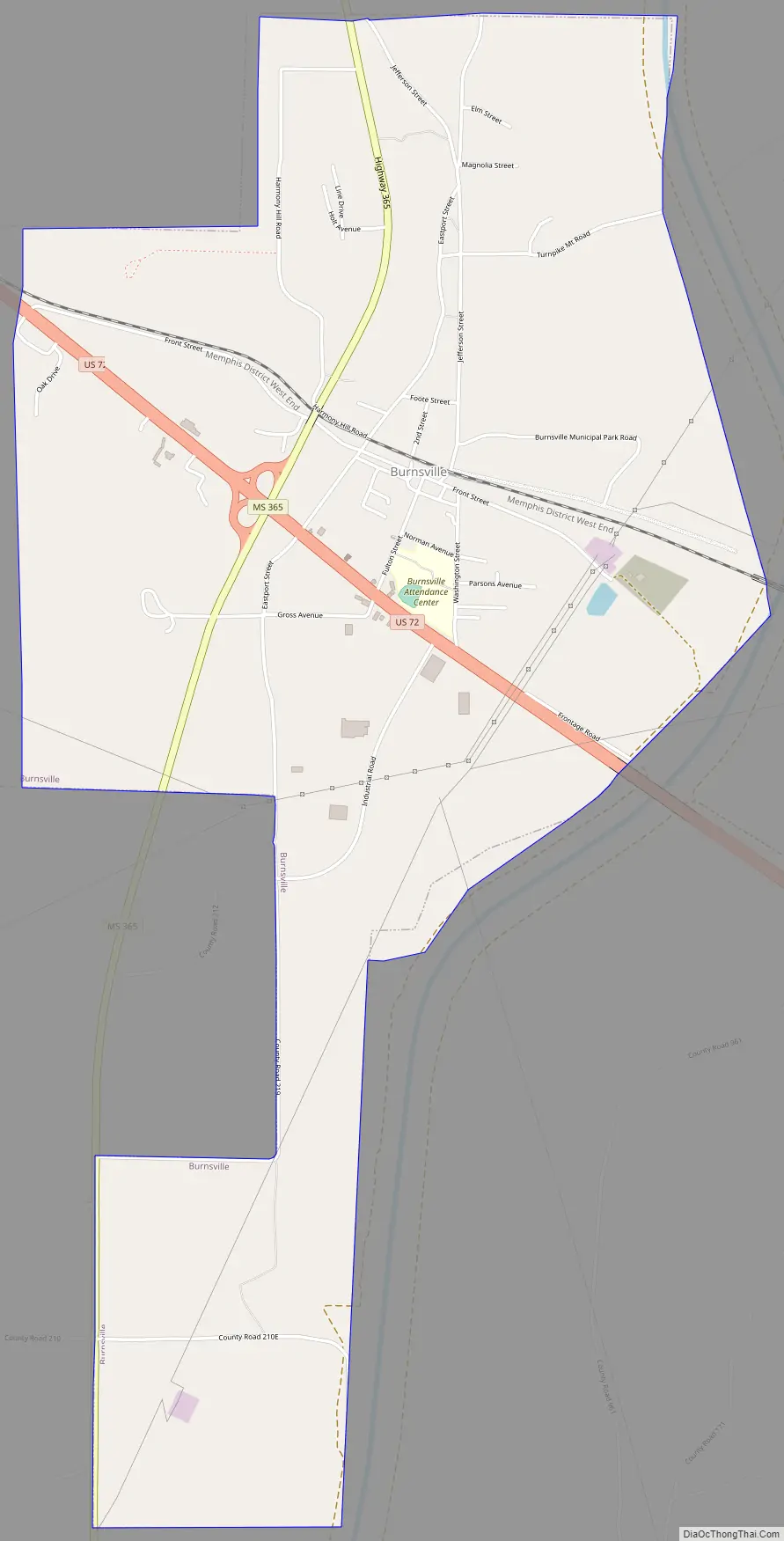
Burnsville Road Map
Burnsville city Satellite Map

Geography
Burnsville is located on the west side of the Tennessee–Tombigbee Waterway. The town is at the intersection of US Route 72 and Mississippi Highway 365. U.S. 72 runs from west to east through the southern part of the town, leading southeast 8 mi (13 km) to Iuka, the county seat of Tishomingo County, and northwest 14 mi (23 km) to Corinth. MS Highway 365 runs through the main part of town from north to south, leading north 6 mi (9.7 km) to Doskie and south to Bay Springs Lake.
According to the United States Census Bureau, the town has a total area of 4.8 square miles (12 km), of which 4.8 square miles (12 km) is land and 0.04 square miles (0.10 km) (0.42%) is water.
Rivers and streams
- Little Yellow Creek
- Yellow Creek
- Tennessee-Tombigbee Waterway
Other formations
- Turnpike Hill lies just east of the town on the east side of the Tennessee-Tombigbee Waterway.
See also
Map of Mississippi State and its subdivision:- Adams
- Alcorn
- Amite
- Attala
- Benton
- Bolivar
- Calhoun
- Carroll
- Chickasaw
- Choctaw
- Claiborne
- Clarke
- Clay
- Coahoma
- Copiah
- Covington
- Desoto
- Forrest
- Franklin
- George
- Greene
- Grenada
- Hancock
- Harrison
- Hinds
- Holmes
- Humphreys
- Issaquena
- Itawamba
- Jackson
- Jasper
- Jefferson
- Jefferson Davis
- Jones
- Kemper
- Lafayette
- Lamar
- Lauderdale
- Lawrence
- Leake
- Lee
- Leflore
- Lincoln
- Lowndes
- Madison
- Marion
- Marshall
- Monroe
- Montgomery
- Neshoba
- Newton
- Noxubee
- Oktibbeha
- Panola
- Pearl River
- Perry
- Pike
- Pontotoc
- Prentiss
- Quitman
- Rankin
- Scott
- Sharkey
- Simpson
- Smith
- Stone
- Sunflower
- Tallahatchie
- Tate
- Tippah
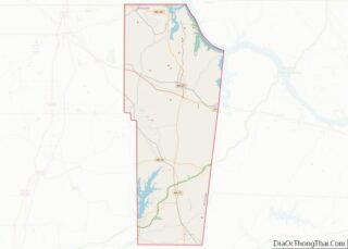
- Tishomingo
- Tunica
- Union
- Walthall
- Warren
- Washington
- Wayne
- Webster
- Wilkinson
- Winston
- Yalobusha
- Yazoo
- Alabama
- Alaska
- Arizona
- Arkansas
- California
- Colorado
- Connecticut
- Delaware
- District of Columbia
- Florida
- Georgia
- Hawaii
- Idaho
- Illinois
- Indiana
- Iowa
- Kansas
- Kentucky
- Louisiana
- Maine
- Maryland
- Massachusetts
- Michigan
- Minnesota
- Mississippi
- Missouri
- Montana
- Nebraska
- Nevada
- New Hampshire
- New Jersey
- New Mexico
- New York
- North Carolina
- North Dakota
- Ohio
- Oklahoma
- Oregon
- Pennsylvania
- Rhode Island
- South Carolina
- South Dakota
- Tennessee
- Texas
- Utah
- Vermont
- Virginia
- Washington
- West Virginia
- Wisconsin
- Wyoming