Lauderdale County is a county located in the northwestern corner of the U.S. state of Alabama. At the 2020 census the population was 93,564. Its county seat is Florence. Its name is in honor of Colonel James Lauderdale, of Tennessee. Lauderdale is part of the Florence-Muscle Shoals, AL Metropolitan Statistical Area, also known as “The Shoals”.
| Name: | Lauderdale County |
|---|---|
| FIPS code: | 01-077 |
| State: | Alabama |
| Founded: | February 6, 1818 |
| Named for: | James Lauderdale |
| Seat: | Florence |
| Largest city: | Florence |
| Total Area: | 721 sq mi (1,870 km²) |
| Land Area: | 668 sq mi (1,730 km²) |
| Total Population: | 93,564 |
| Population Density: | 130/sq mi (50/km²) |
| Time zone: | UTC−6 (Central) |
| Summer Time Zone (DST): | UTC−5 (CDT) |
| Website: | LauderdaleCountyAL.Gov |
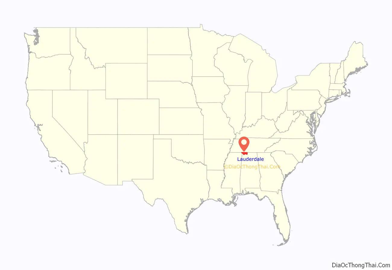
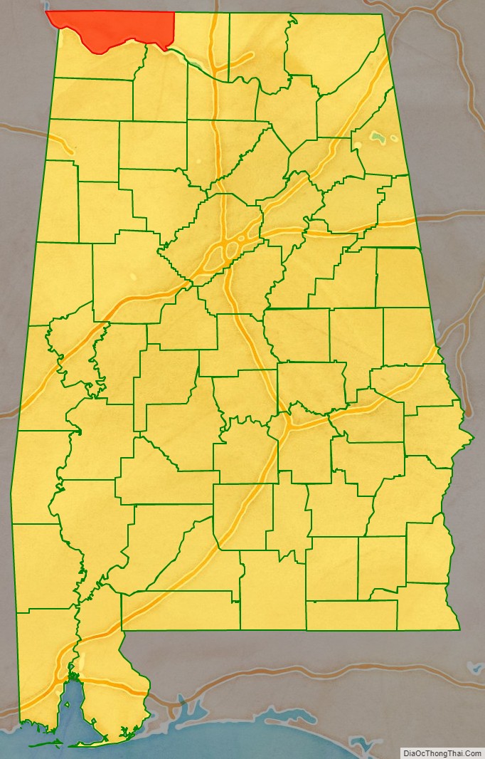
Lauderdale County location map. Where is Lauderdale County?
History
Lauderdale County was named in honor of Col. James Lauderdale who was born in Virginia in about 1780. In the early 19th century, Lauderdale, who moved to West Tennessee, became a major in General John Coffee’s cavalry of volunteers. Later promoted to lieutenant colonel, he commanded a brigade of mounted riflemen, serving under Andrew Jackson. According to reliable historians, Col. Lauderdale did not die in the Battle of New Orleans, but was wounded in the Battle of Talladega and died on December 23, 1814, seventeen days before Jackson’s decisive defeat of the British at New Orleans. Several towns and counties in the southern states were named in his honor, though it is said that he never set foot in Lauderdale County.
Lauderdale County was established in 1818, a year before Alabama became a state. Florence, the county seat of Lauderdale County, was also established in 1818. At this time a group of investors, under the name of Cypress Land Company purchased from the government 5,515 acres (22.32 km) of land consisting of the original town site. Other towns in Lauderdale County competing for early settlers because of their proximity to the river were Savage’s Spring, nine miles (14 km) below Florence and Waterloo, some 20 miles (32 km) downriver.
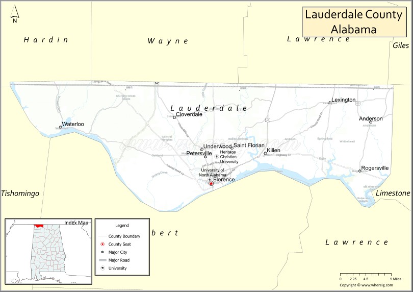
Among the older settlements in the county is Center Star, located between Killen and Rogersville. This area was once claimed by both the Chickasaws and Cherokees, necessitating a cession of territory from each tribe before the settlement could be established. At one time, the remains of an old Indian village could be seen southwest of Center Star. Other old settlements included Middleton and Elgin, the latter known first as Ingram’s Elgin Cross Roads.
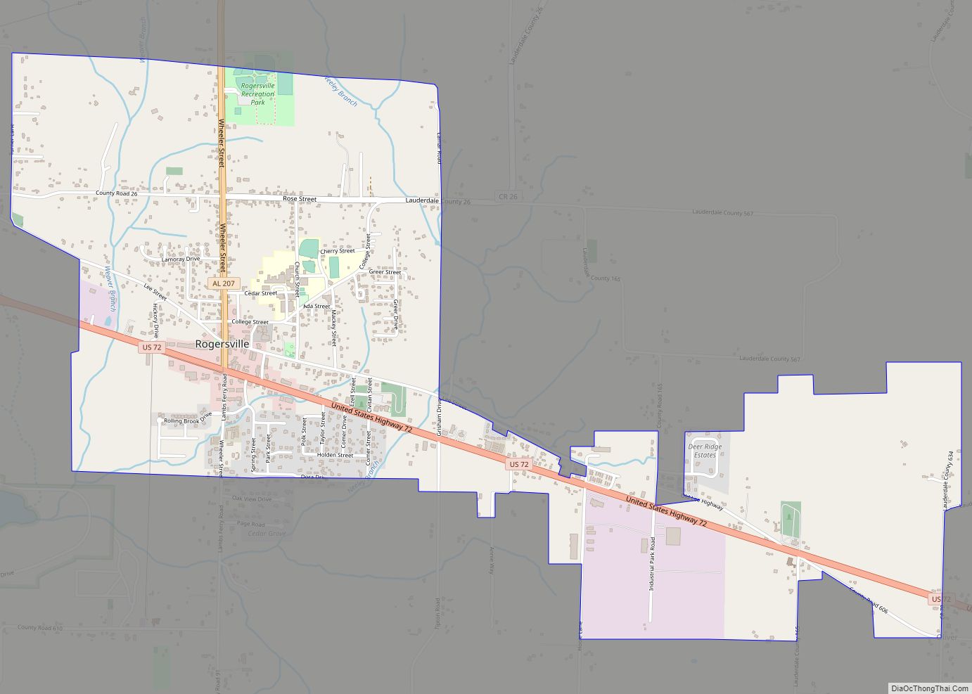
Rogersville, lying some 23 miles (37 km) to the east of Florence, was named for John Rogers, an Indian trader, whose sons were fast friends of the great Sam Houston. The late Will Rogers is said to have been a descendant of this same family. An early ferry that operated for many years was Lamb’s Ferry near Rogersville.
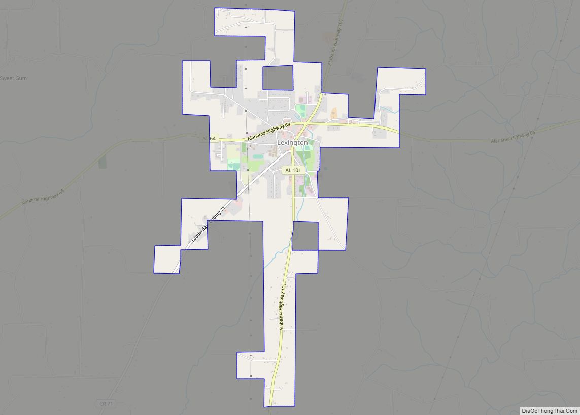
Lexington, Springfield, and Anderson lie to the north of the Lee Highway, the town of Lexington being a part of the territory once claimed by the Cherokee. Many of the settlers of that area came from Tennessee and the Carolinas. The first post office of record at Lexington was on the Loretto Road, north of town, in 1880. Mail at that time was brought in from Loretto, Tennessee, by horseback and carts.
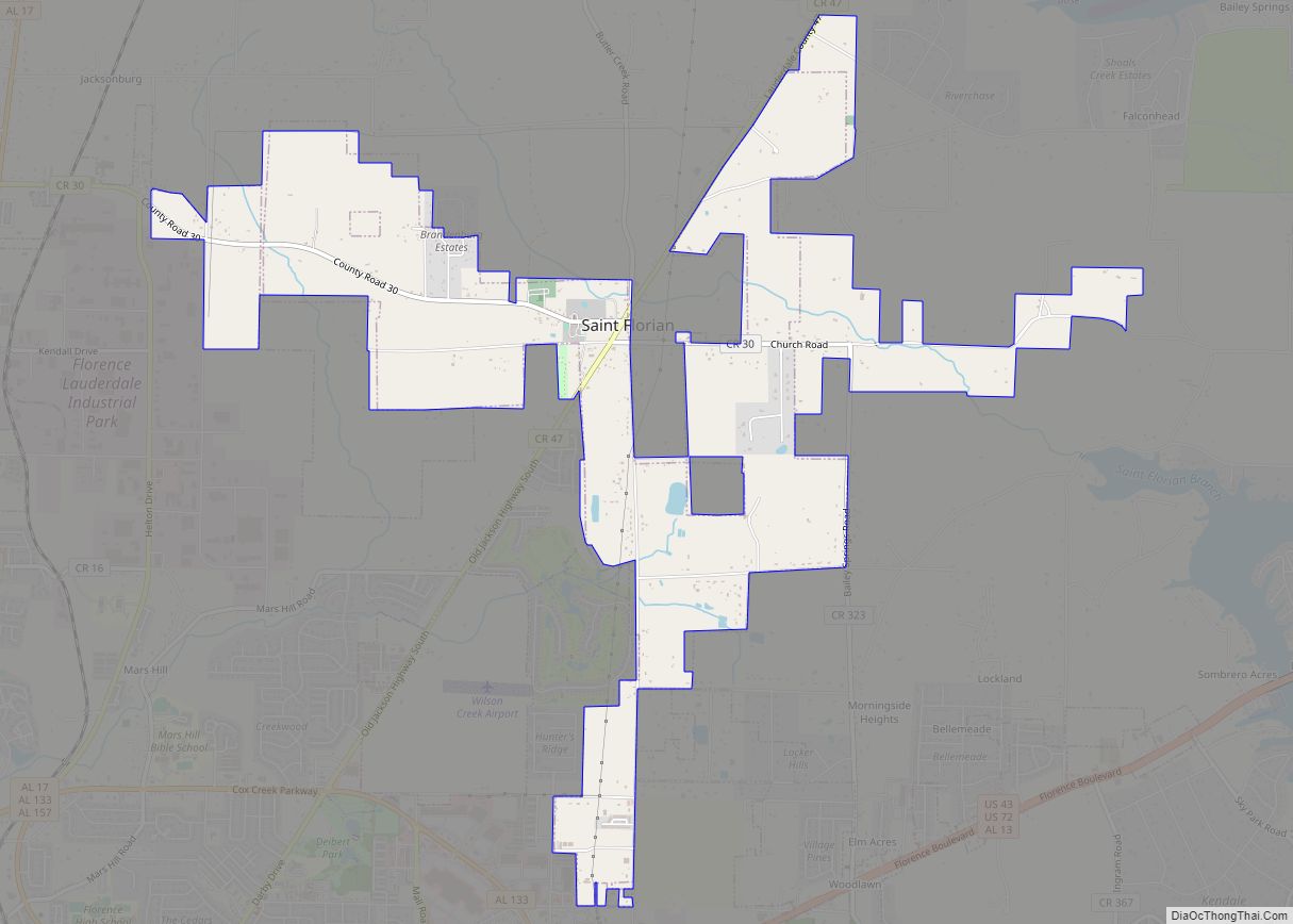
The town of St. Florian was established in 1872 on the Jackson Highway and named by its Catholic founders (of German descent) for their patron saint.
Four Alabama governors were from the county – Hugh McVay, Robert M. Patton, Edward A. O’Neal and Emmett O’Neal.
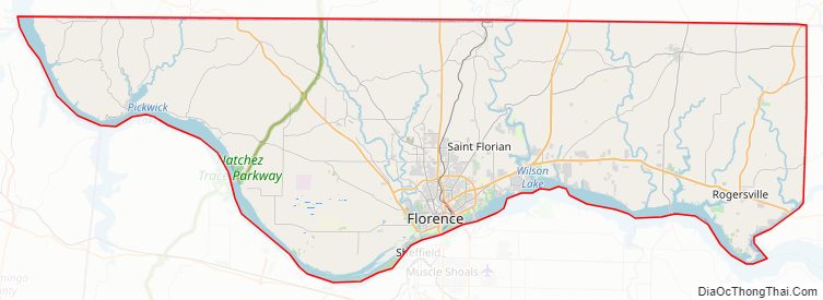
Lauderdale County Road Map
Geography
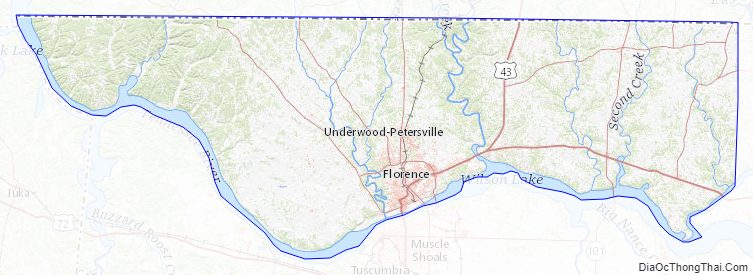
According to the United States Census Bureau, the county has a total area of 721 square miles (1,870 km), of which 668 square miles (1,730 km) is land and 53 square miles (140 km) (7.4%) is water.
National protected areas
- Key Cave National Wildlife Refuge
- Natchez Trace Parkway (part)
Rivers
- Tennessee River
- Elk River
Adjacent counties
- Wayne County, Tennessee – north
- Lawrence County, Tennessee – north
- Giles County, Tennessee – northeast
- Limestone County – east
- Lawrence County – southeast
- Colbert County – south
- Tishomingo County, Mississippi – west
- Hardin County, Tennessee – northwest
Lauderdale County Topographic Map
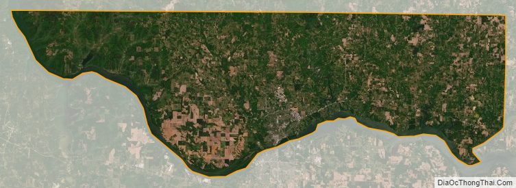
Lauderdale County Satellite Map
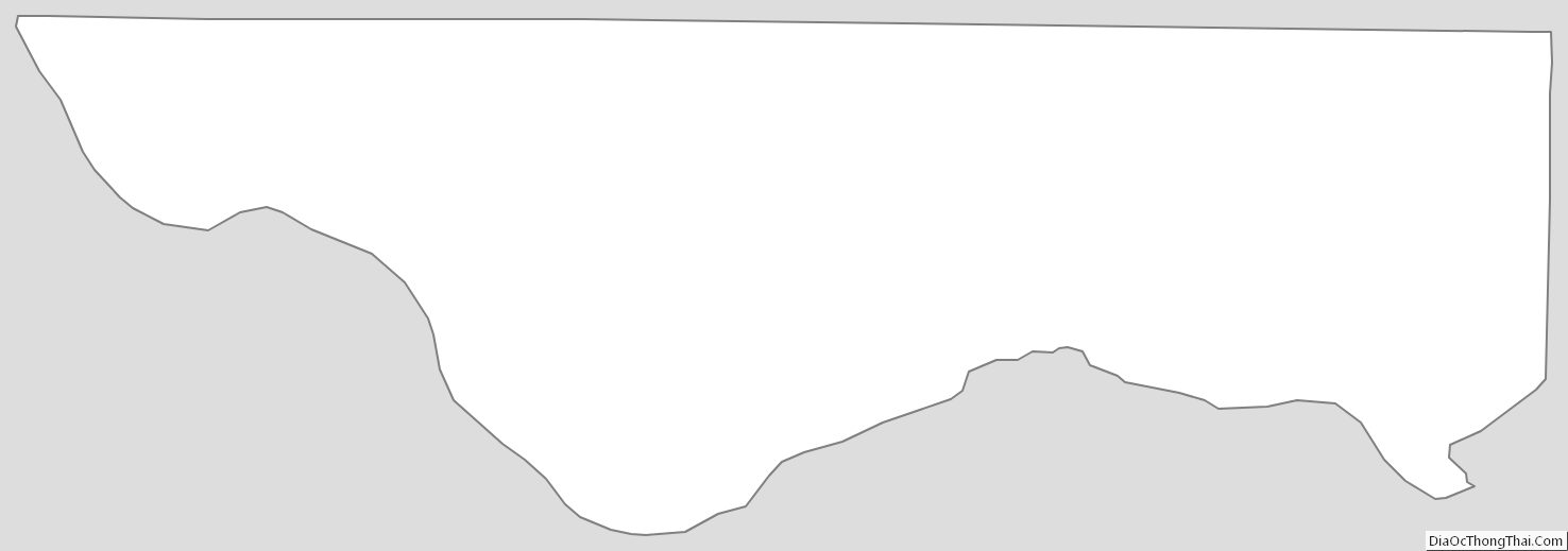
Lauderdale County Outline Map