| Name: | Colbert County |
|---|---|
| FIPS code: | 01-033 |
| State: | Alabama |
| Founded: | February 6, 1867 |
| Named for: | George and Levi Colbert |
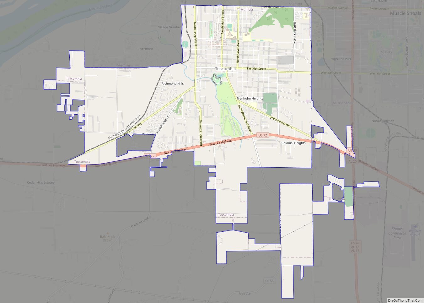
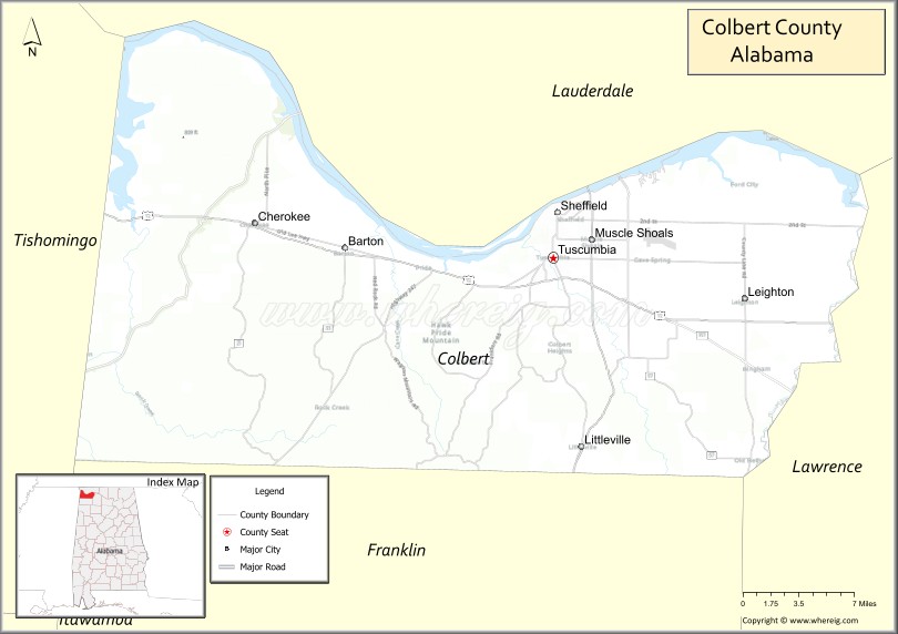
| Seat: | Tuscumbia |
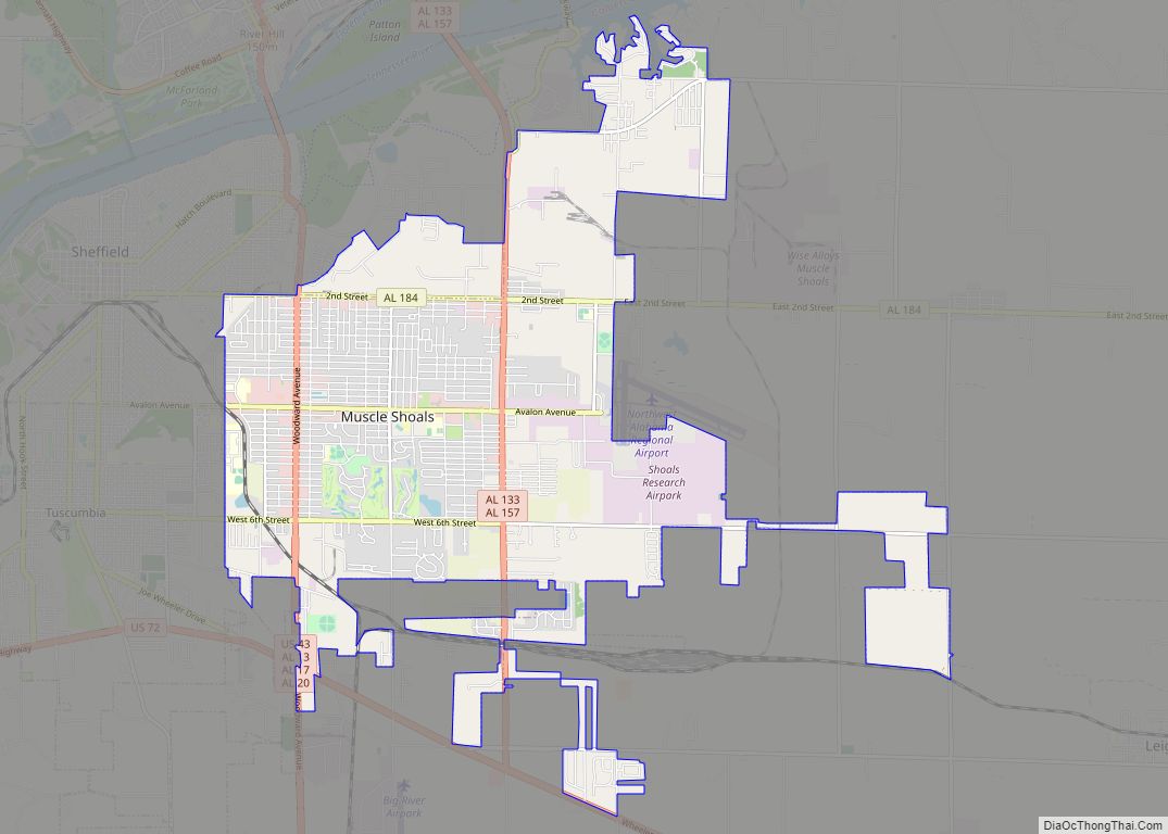
| Largest city: | Muscle Shoals |
| Total Area: | 622 sq mi (1,610 km²) |
| Land Area: | 593 sq mi (1,540 km²) |
| Total Population: | 57,227 |
| Population Density: | 92/sq mi (36/km²) |
| Time zone: | UTC−6 (Central) |
| Summer Time Zone (DST): | UTC−5 (CDT) |
| Website: | www.colbertcounty.org |
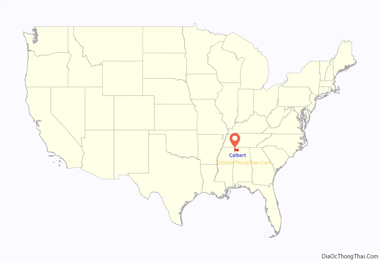
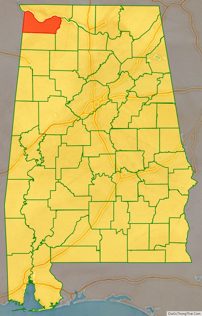
Colbert County location map. Where is Colbert County?
History
The Chickasaw and Cherokee peoples are the earliest known inhabitants of Colbert County, an area that was part of their territories for hundreds of years. Before they emerged, there were earlier cultures of indigenous peoples who established settlements and seasonal villages for thousands of years in the area.
In the 1810s, settlers began to settle in an area at a crossroads that developed as Leighton, Alabama. Colbert County was originally established during the Reconstruction era after the American Civil War on February 6, 1867. The state legislature split it from Franklin County over political issues. It was abolished eight months later on November 29, 1867 by an Alabama constitutional convention, and reestablished by the legislature on February 24, 1870.
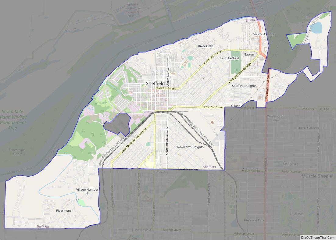
In 1890, the eastern boundary of Colbert County was changed from County Line Road to Town Creek; this resulted in all of the town of Leighton placed within Colbert County. Colbert County is the location of Ivy Green, the birthplace of noted author and activist Helen Keller. Colbert County includes the cities of Sheffield and Muscle Shoals, where many popular American and British musicians, such as Aretha Franklin and the Rolling Stones, respectively, recorded music.
Also located in Colbert County is the Key Underwood Coon Dog Memorial Graveyard established in 1937. Coon dogs were bred and trained for hunting in this region.
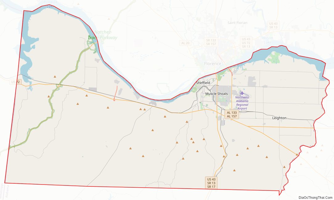
Colbert County Road Map
Geography
According to the United States Census Bureau, the county has a total area of 622 square miles (1,610 km), of which 593 square miles (1,540 km) is land and 30 square miles (78 km) (4.7%) is water. The county’s elevation ranges from 410 feet at the Tennessee River in northwestern Colbert County to 980 feet in southeastern Colbert County at the broadcast facility’s tower of WQPR-FM/WFIQ-TV.
National protected area
- Natchez Trace Parkway (part)
River
- Tennessee River
Major creeks
- Bear Creek
- Cane Creek
- Mulberry Creek
- Spring Creek
- Town Creek
Waterfalls
- Cane Creek Canyon Waterfall
- Rainbow Branch Waterfall
- Wilson Dam Waterfall
Notable springs
- Big Spring at Tuscumbia
- Buzzard Roost Spring at Margerum
- Chalybeate Spring at Littleville
- Milk Springs at Colbert Heights
- Shegog Spring at Ford City
Notable mountains
- Bald Knob
- Coburn Mountain
- Colbert Mountain
- Hawk Pride Mountain
- LaGrange Mountain
- Mountain Mills Ridge
- Sand Mountain
- Underwood Mountain
- Wagnon Mountain
- Wheeler Mountain
Adjacent counties
- Lauderdale County, Alabama – north
- Lawrence County, Alabama – southeast
- Franklin County, Alabama – south
- Tishomingo County, Mississippi – west
Colbert County Topographic Map
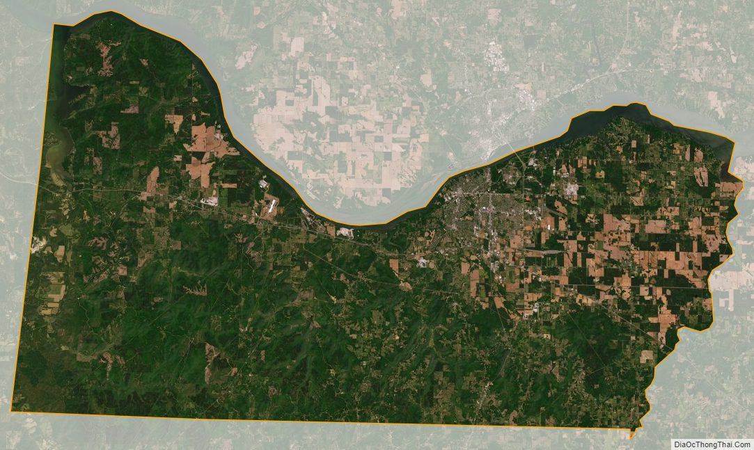
Colbert County Satellite Map
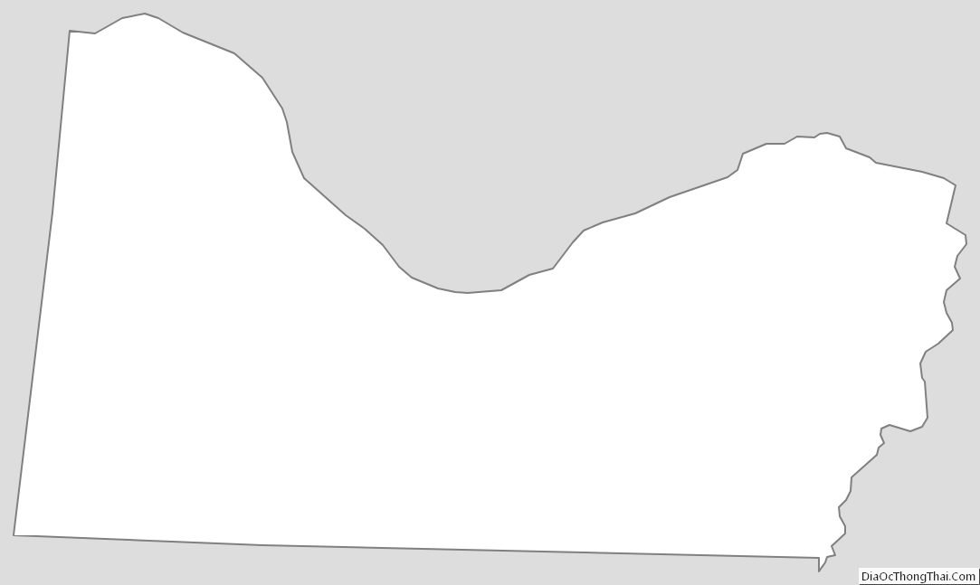
Colbert County Outline Map