Cherry Valley is a village of 8.72 square miles (22.6 km) that lies primarily in Winnebago County. Approximately ten percent of the village is within Boone County. The village is within the Rockford, Illinois Metropolitan Statistical Area, and borders the southeast side of Rockford. It is also within the Kishwaukee River valley. The population is 2905 at the 2020 census, down from 3,162 as of the 2010 census.
| Name: | Cherry Valley village |
|---|---|
| LSAD Code: | 47 |
| LSAD Description: | village (suffix) |
| State: | Illinois |
| County: | Boone County, Winnebago County |
| Elevation: | 728 ft (222 m) |
| Total Area: | 8.66 sq mi (22.42 km²) |
| Land Area: | 8.40 sq mi (21.77 km²) |
| Water Area: | 0.25 sq mi (0.65 km²) |
| Total Population: | 2,905 |
| Population Density: | 345.63/sq mi (133.45/km²) |
| Area code: | 815 |
| FIPS code: | 1713074 |
| Website: | www.cherryvalley.org |
Online Interactive Map
Click on ![]() to view map in "full screen" mode.
to view map in "full screen" mode.
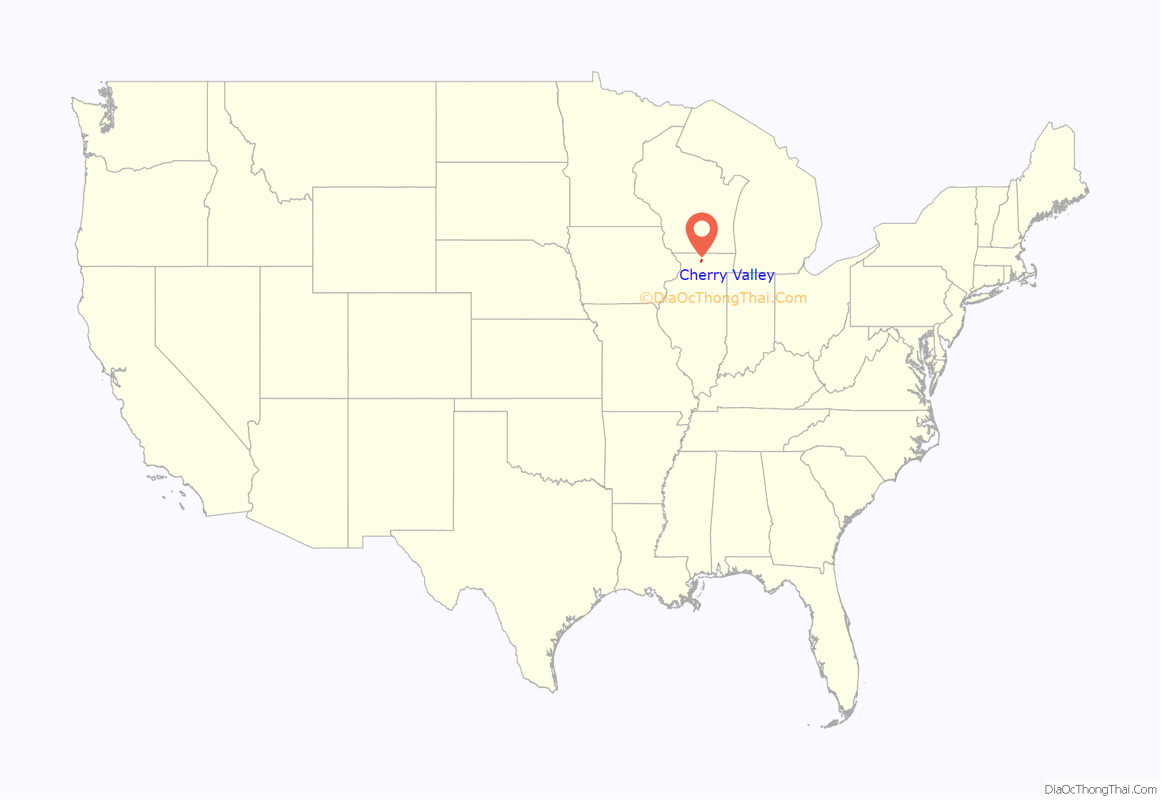
Cherry Valley location map. Where is Cherry Valley village?

History
Official documents from the Winnebago County Clerk’s office and the Village of Cherry Valley state Cherry Valley was settled in 1836. The first settler within Cherry Valley was Joseph Griggs who, along with his family, settled on the north bank of the Kishwaukee River in 1835. Cherry Valley was incorporated as a village on January 31, 1857. Early landmark events for Cherry Valley was the establishment of a mill on the Kishwaukee River, and the coming of the railroad in 1852.
Early on Cherry Valley was called by various names, such as “Griggs Ford” and Graball, and then other names, before the present name was adopted. After deciding to change the name, the people put their suggestions into a hat. A Mrs. Butler, from Cherry Valley, New York placed the name of Cherry Valley in the hat and that name was selected. The core of the village, centered on its main street businesses in small brick buildings, is surrounded by several blocks of houses built in the 19th century. This late 19th-century appearance is further accentuated by turn-of-the-20th-century-style lamp lights as well as the original brick paving along the eastern end of main street.
Relationship with Rockford
Although close to Rockford, Cherry Valley was far enough away to be considered, for most of its history, not a part of the Rockford community. However, with the advent of modern transportation in the later 20th century, Cherry Valley became in essence a suburb of Rockford. As the city of Rockford grew and expanded its boundaries, it came in direct contact with Cherry Valley. Since that time, there have been land control-related issues between the two municipalities. For the most part, these issues have been resolved with a boundary agreement between the two communities.
Cherry Valley today
In the last dozen years Cherry Valley has seen a shift towards Chicago, with roughly a third of its new residents being former Chicago suburban residents who live in the village and commute to work in the Chicago suburbs. Being near to an interchange on I-90 (Jane Addams Memorial Tollway) contributed to this shift, and in 2006 the toll booths on the Cherry Valley interchange and exit were removed because of increased traffic flow and the need to remove the chronic traffic jams that had built over the years.
Most of Cherry Valley is within the Rockford School District, with a small portion in the Belvidere School District. Schools closed and demolished in 2019
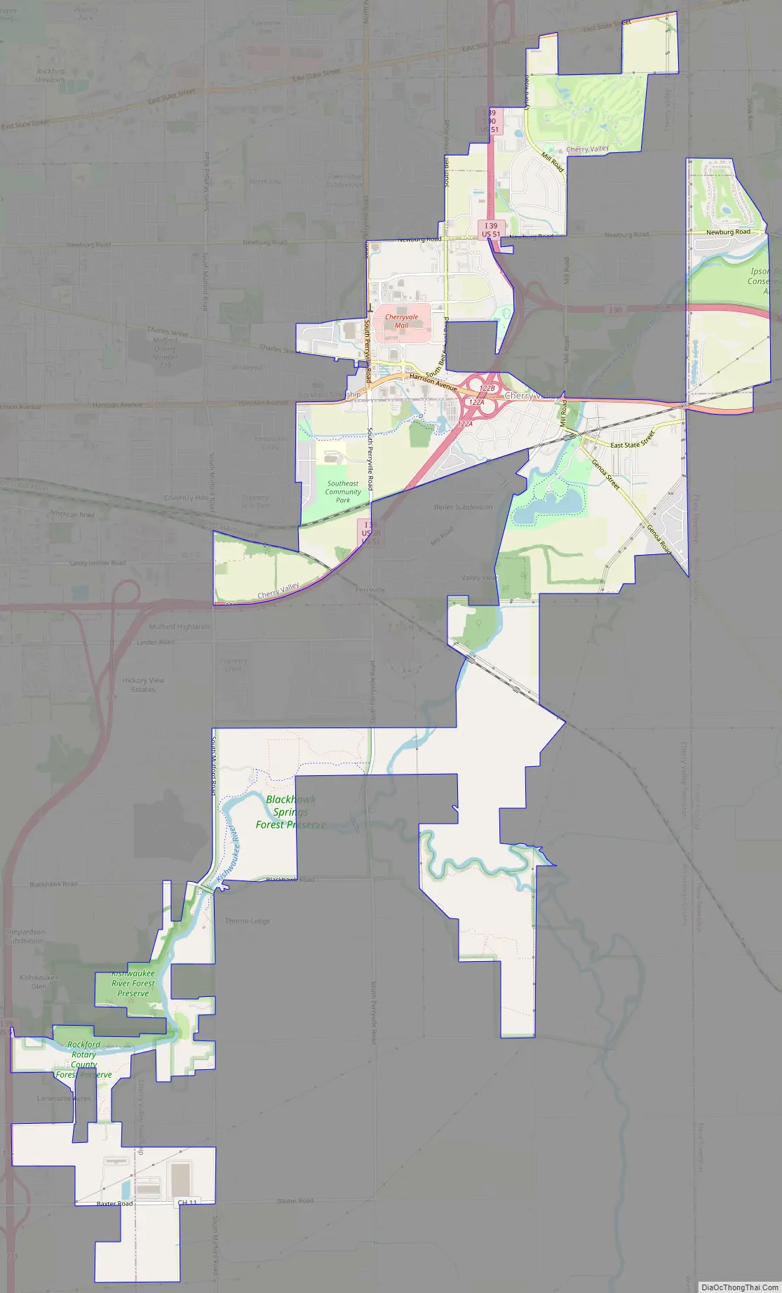
Cherry Valley Road Map
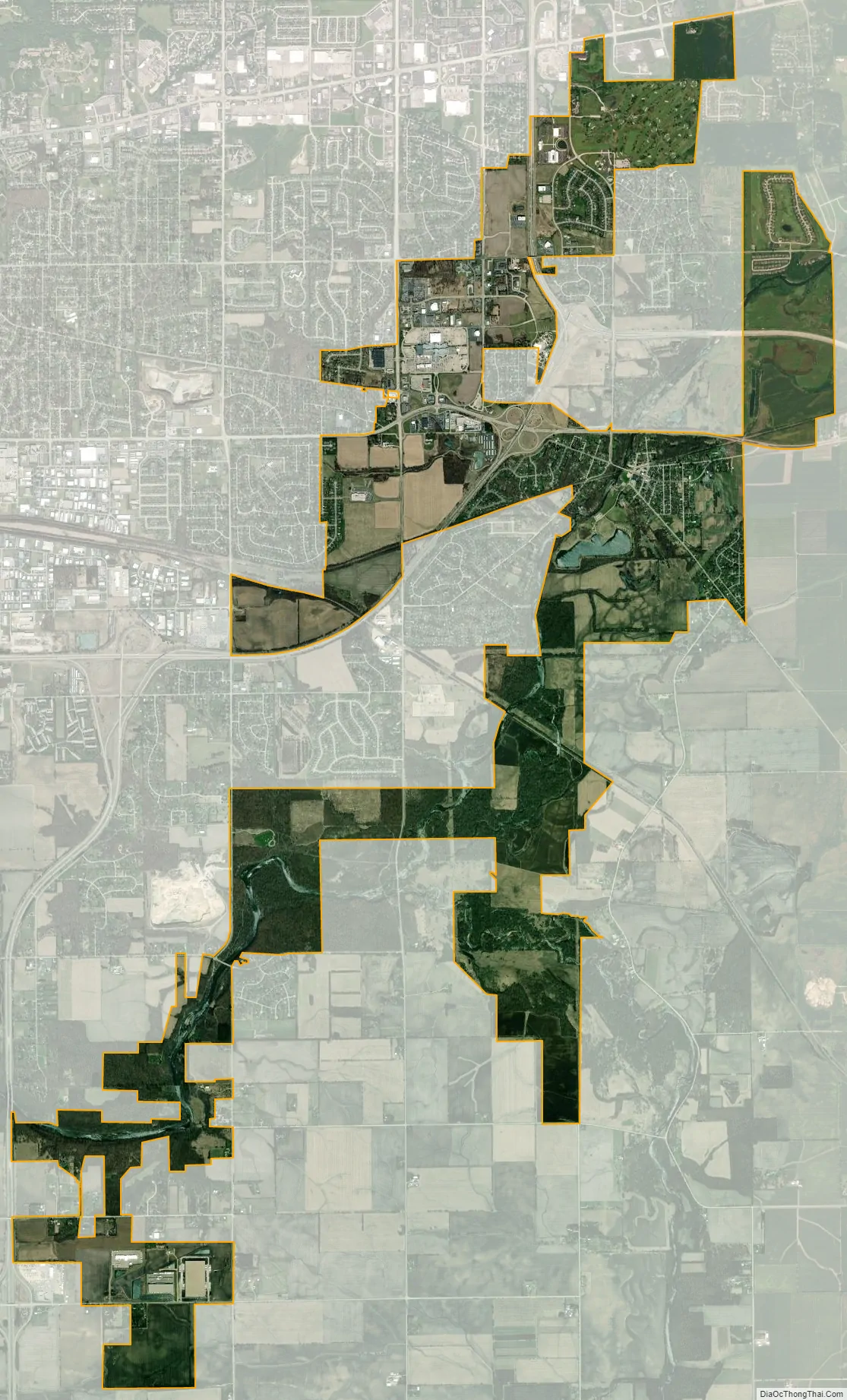
Cherry Valley city Satellite Map
Geography
The core of the village is located a little north of the confluence of the north and south branches of the Kishwaukee river. There is a slight depression as one moves towards the center of the village, which is a formation of the Kishwaukee river valley.
According to the 2021 census gazetteer files, Cherry Valley has a total area of 8.66 square miles (22.43 km), of which 8.41 square miles (21.78 km) (or 97.09%) is land and 0.25 square miles (0.65 km) (or 2.91%) is water. The north branch of the Kishwaukee River travels through Cherry Valley’s central business district. The largest body of water in the village is Cherry Valley Lake which is situated just east of the Kishwaukee River in Baumann Park. The village is served by Interstate 90, Interstate 39, U.S. Route 20 and U.S. Route 51.
See also
Map of Illinois State and its subdivision:- Adams
- Alexander
- Bond
- Boone
- Brown
- Bureau
- Calhoun
- Carroll
- Cass
- Champaign
- Christian
- Clark
- Clay
- Clinton
- Coles
- Cook
- Crawford
- Cumberland
- De Kalb
- De Witt
- Douglas
- Dupage
- Edgar
- Edwards
- Effingham
- Fayette
- Ford
- Franklin
- Fulton
- Gallatin
- Greene
- Grundy
- Hamilton
- Hancock
- Hardin
- Henderson
- Henry
- Iroquois
- Jackson
- Jasper
- Jefferson
- Jersey
- Jo Daviess
- Johnson
- Kane
- Kankakee
- Kendall
- Knox
- La Salle
- Lake
- Lake Michigan
- Lawrence
- Lee
- Livingston
- Logan
- Macon
- Macoupin
- Madison
- Marion
- Marshall
- Mason
- Massac
- McDonough
- McHenry
- McLean
- Menard
- Mercer
- Monroe
- Montgomery
- Morgan
- Moultrie
- Ogle
- Peoria
- Perry
- Piatt
- Pike
- Pope
- Pulaski
- Putnam
- Randolph
- Richland
- Rock Island
- Saint Clair
- Saline
- Sangamon
- Schuyler
- Scott
- Shelby
- Stark
- Stephenson
- Tazewell
- Union
- Vermilion
- Wabash
- Warren
- Washington
- Wayne
- White
- Whiteside
- Will
- Williamson
- Winnebago
- Woodford
- Alabama
- Alaska
- Arizona
- Arkansas
- California
- Colorado
- Connecticut
- Delaware
- District of Columbia
- Florida
- Georgia
- Hawaii
- Idaho
- Illinois
- Indiana
- Iowa
- Kansas
- Kentucky
- Louisiana
- Maine
- Maryland
- Massachusetts
- Michigan
- Minnesota
- Mississippi
- Missouri
- Montana
- Nebraska
- Nevada
- New Hampshire
- New Jersey
- New Mexico
- New York
- North Carolina
- North Dakota
- Ohio
- Oklahoma
- Oregon
- Pennsylvania
- Rhode Island
- South Carolina
- South Dakota
- Tennessee
- Texas
- Utah
- Vermont
- Virginia
- Washington
- West Virginia
- Wisconsin
- Wyoming