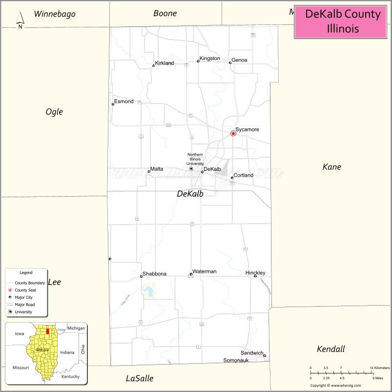
DeKalb County is a county located in the U.S. state of Illinois. As of the 2020 United States Census, the population was 100,420. Its county seat is Sycamore.
DeKalb County is part of the Chicago-Naperville–Elgin, IL-IN–WI Metropolitan Statistical Area.
| Name: | DeKalb County |
|---|---|
| FIPS code: | 17-037 |
| State: | Illinois |
| Founded: | 4 March 1837 |
| Named for: | Johann de Kalb |
| Seat: | Sycamore |
| Largest city: | DeKalb |
| Total Area: | 635 sq mi (1,640 km²) |
| Land Area: | 631 sq mi (1,630 km²) |
| Total Population: | 100,420 |
| Population Density: | 160/sq mi (61/km²) |
| Time zone: | UTC−6 (Central) |
| Summer Time Zone (DST): | UTC−5 (CDT) |
| Website: | www.dekalbcounty.org |
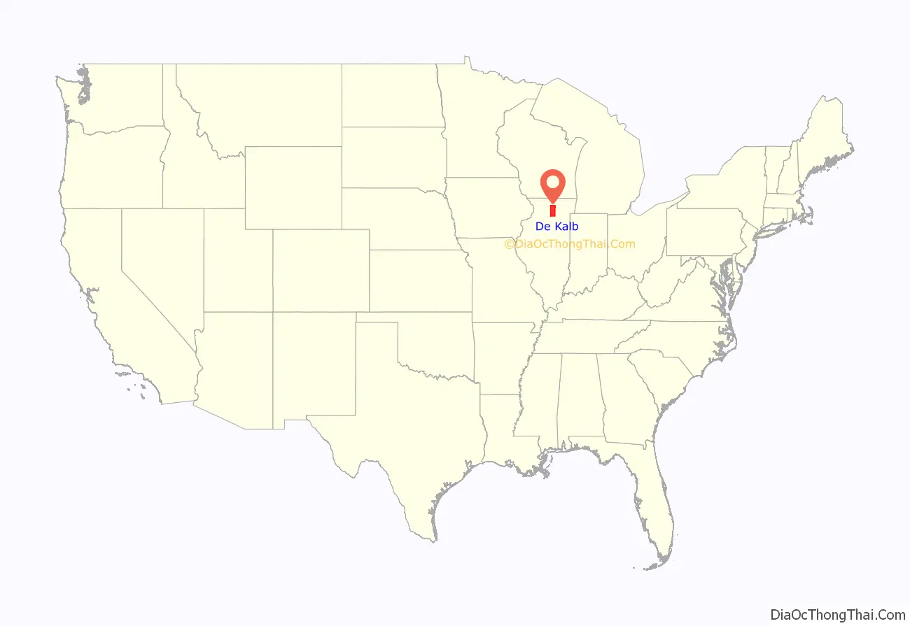
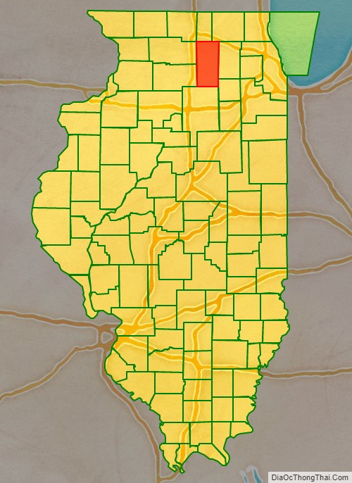
DeKalb County location map. Where is DeKalb County?
History
DeKalb County was formed on 4 March 1837, out of Kane County, Illinois. The county was named for Johann de Kalb, a German (Bavarian) hero of the American Revolutionary War. DeKalb County’s area is approximately 632.7 square miles, and is located 63 miles west of Chicago. There are 19 townships in the county with the county seat at Sycamore.
Between 1834 and 1837, settlements were formed in DeKalb County along streams and wooded areas due to fertile soil, wild game, and food and water opportunities. Primary growth stemmed from the introduction of the railroad which brought easier methods of transportation and opportunities for industrial growth. Early industries based in DeKalb County included Sandwich Mfg. Co, Marsh Harvester Co, barbed wire, and Gurler Bros Pure Milk Co.
The county is noted for agriculture. In 1852, the DeKalb Agricultural Society produced the county’s first Agricultural Fair, in Sycamore. Eventually farmers, businessmen, bankers and newspapermen organized to become the DeKalb County Soil Improvement Association, which later was split into DeKalb County Farm Bureau and DeKalb Agricultural Association (DEKALB AgResearch, Inc., Monsanto). DeKalb County is credited with being the birthplace of the Farm Bureau movement. DeKalb County is also the 2nd largest hog producing county in Illinois and the 66th largest in the nation.
Education has played an important role in the area with Northern Illinois University located in DeKalb and Kishwaukee College located in Malta. Except for 2020 (COVID-19), a major fair has been held each year since 1887 at the Sandwich Fairgrounds in Sandwich.
DeKalb County at the time of its creation in 1837
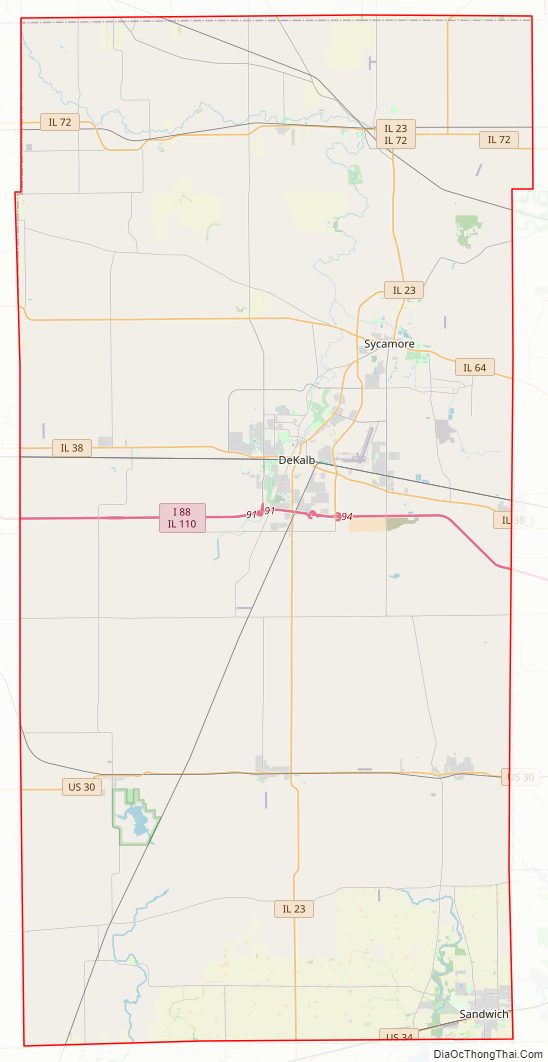
DeKalb County Road Map
Geography
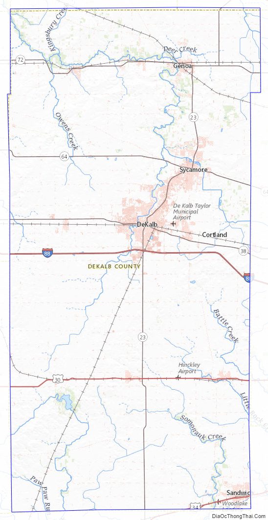
According to the US Census Bureau, the county has a total area of 635 square miles (1,640 km), of which 631 square miles (1,630 km) is land and 3.4 square miles (8.8 km) (0.5%) is water.
Climate and weather
In recent years, average temperatures in the county seat of Sycamore have ranged from a low of 10 °F (−12 °C) in January to a high of 84 °F (29 °C) in July, although a record low of −27 °F (−33 °C) was recorded in January 1985 and a record high of 103 °F (39 °C) was recorded in August 1988. Average monthly precipitation ranged from 1.40 inches (36 mm) in February to 4.49 inches (114 mm) in June.
Adjacent counties
- Boone County – north
- McHenry County – northeast
- Kane County – east
- Kendall County – southeast
- LaSalle County – south
- Lee County – west
- Ogle County – west
- Winnebago County – northwest
Major highways
- Interstate 88
- US Route 30
- US Route 34
- Illinois Route 23
- Illinois Route 38
- Illinois Route 64
- Illinois Route 72
- Illinois Route 110
DeKalb County Topographic Map
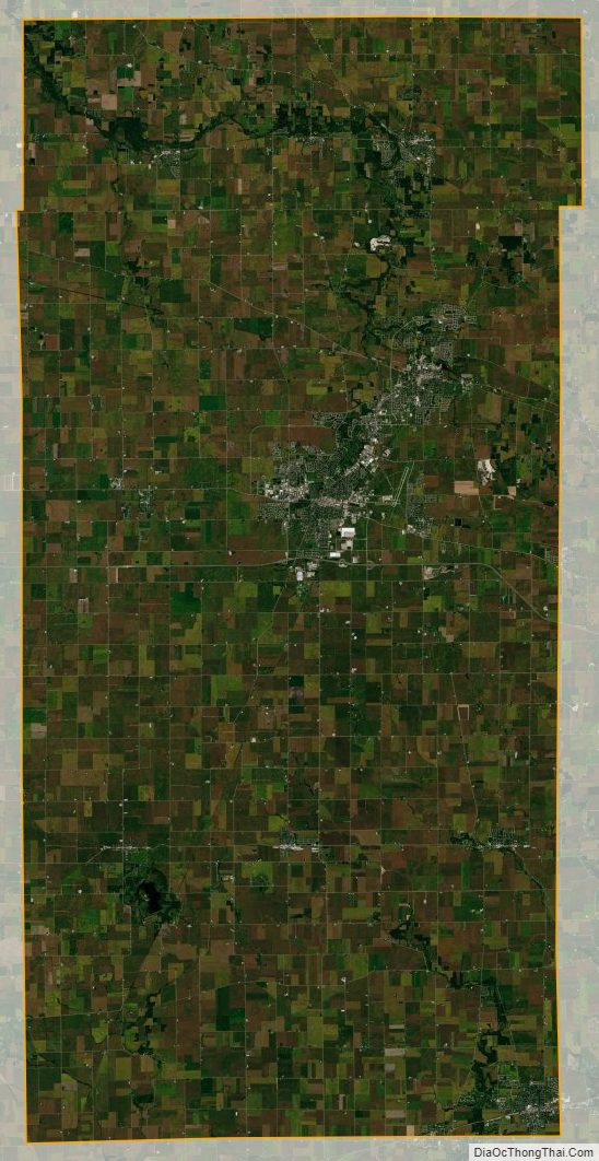
DeKalb County Satellite Map
DeKalb County Outline Map