| Name: | New York city |
|---|---|
| LSAD Code: | 25 |
| LSAD Description: | city (suffix) |
| State: | New York |
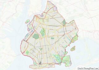
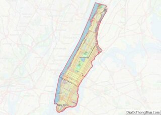
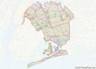
| County: | Bronx County, Kings County, New York County, Queens County, Richmond County |
| FIPS code: | 3651000 |
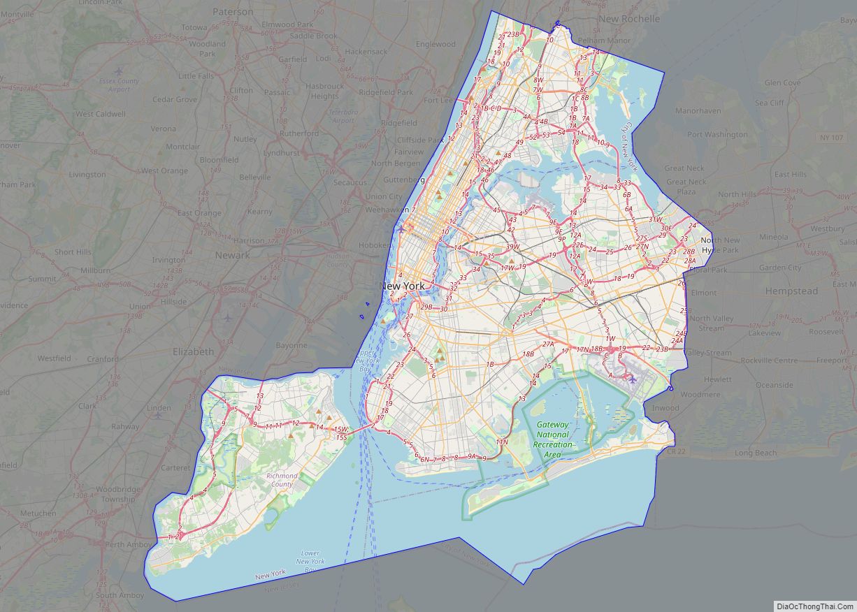
Discover the best of New York City with our interactive map! Our New York City map collection features roads, highways, major landmarks, and things to do. Plus, it allows you to explore “The City that Never Sleeps” like a local. From the bustling streets of Manhattan to the leafy parks of Brooklyn, this comprehensive map will help you find your way around the Big Apple.
Whether you’re a first-time visitor or a longtime resident of New York City, our New York City map collection will give you the tools you need to get around the city like a pro. Get the most out of your trip with our detailed map of the Big Apple.
Online Interactive Map
Click on ![]() to view map in "full screen" mode.
to view map in "full screen" mode.
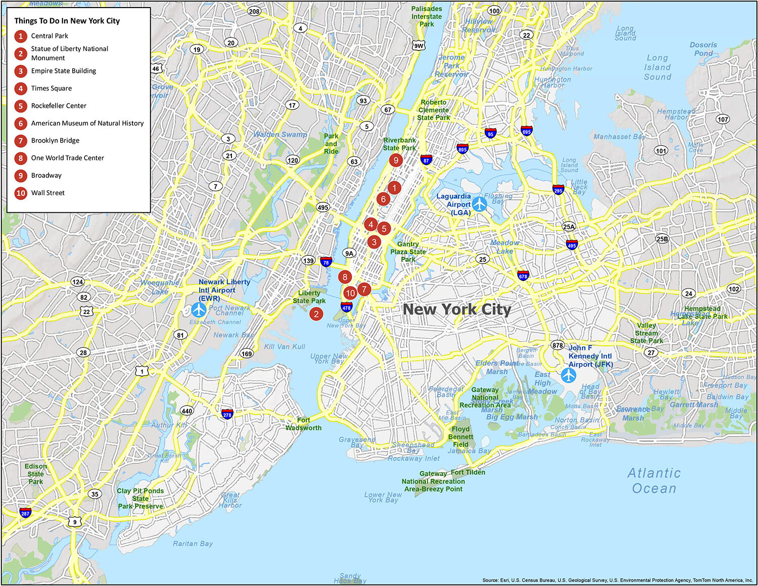
From its bustling neighborhoods to its world-class museums, exciting nightlife, and incomparable skyline, there is something for everyone to experience when you travel to New York City. This interactive map helps you explore the city and more. It includes the best restaurants and bars in New York City and is the perfect way to plan your itinerary for the day. This map is ideal for travelers who want to find the best places to visit, where to get the most out of their time, and where to stay. Find your favorite NYC places like the Empire State Building, Central Park, and Broadway shows on this map.
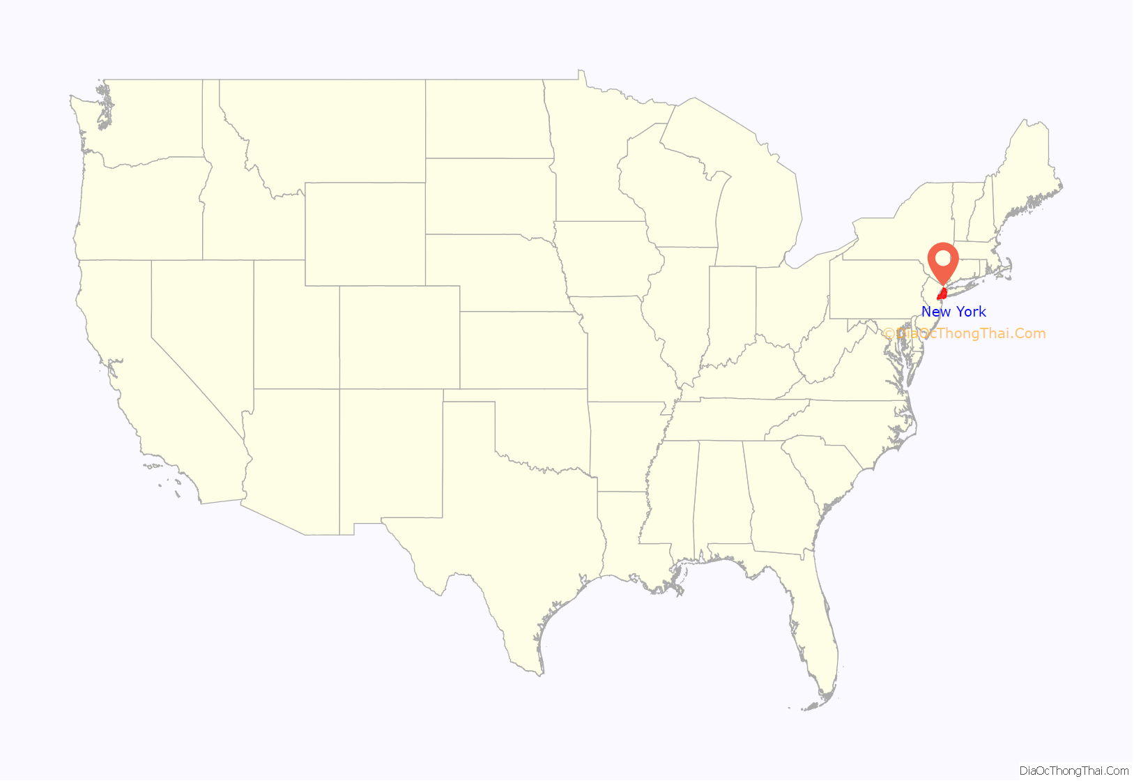
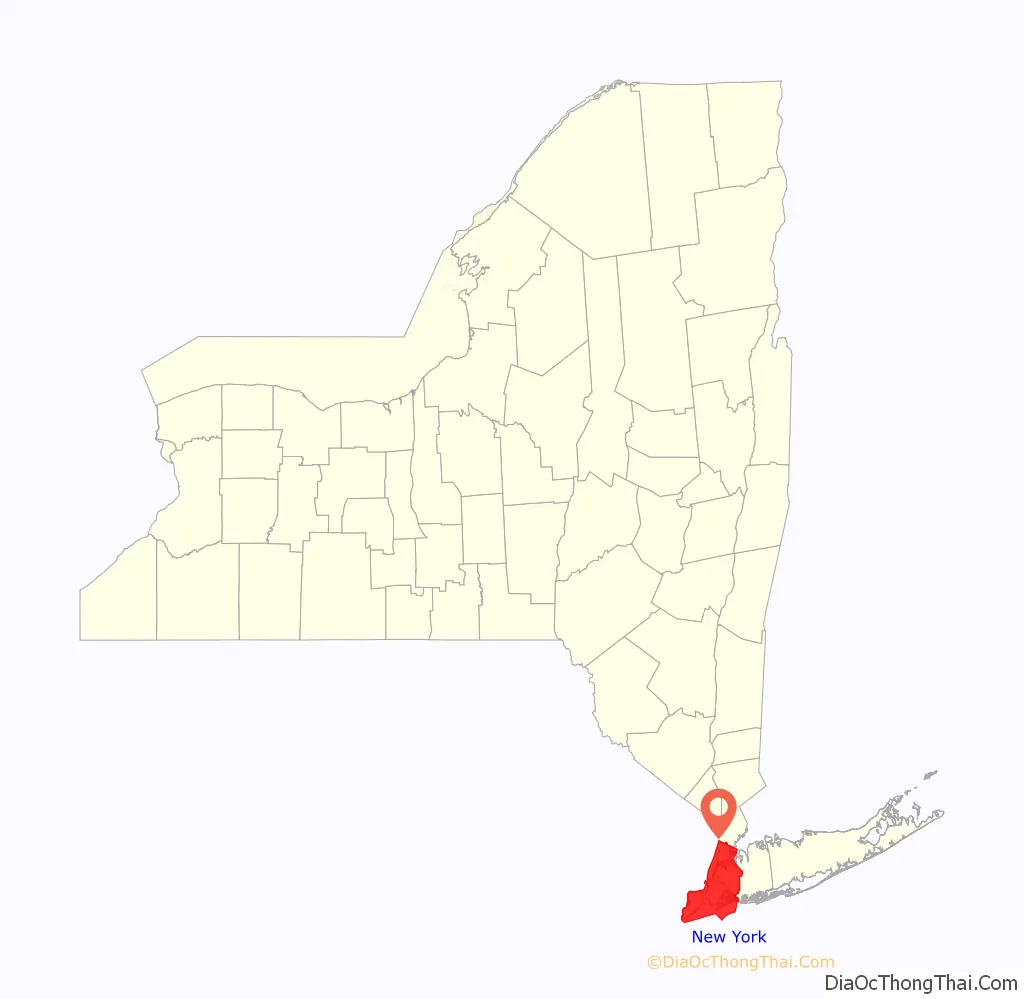
New York location map. Where is New York city?
New York Road Map
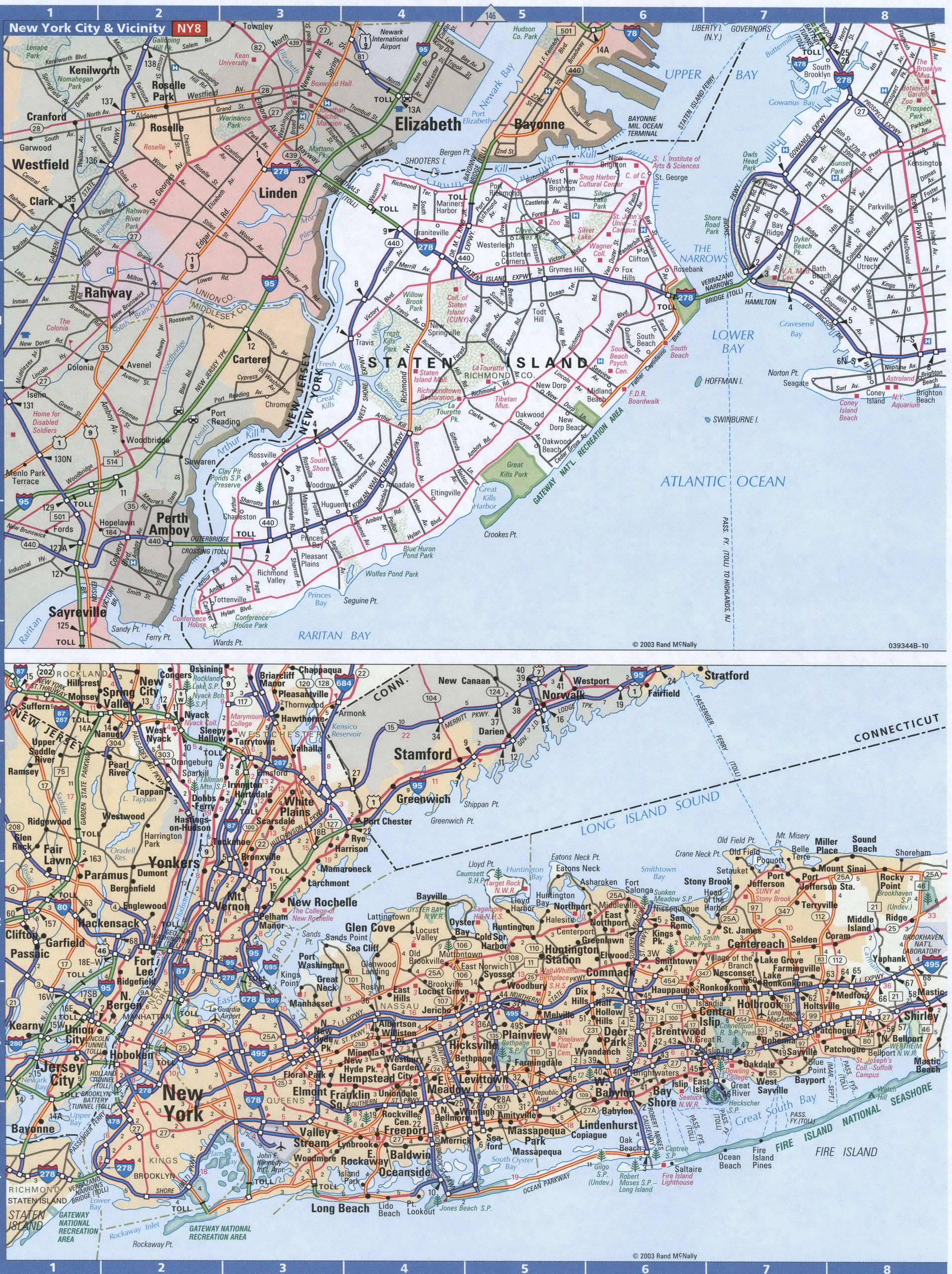
We love New York City and its intricate road system! This free to download and print New York City road map is perfect for tourists, drivers, and those who want to find their way around the Big Apple. It includes a detailed map of Manhattan, Brooklyn, and the 5 main boroughs of NYC so you can get around the city with ease. For anyone visiting New York City, this road map is a handy resource that you can keep in your glove box or purse for quick reference so you’ll never get lost. For any travel outside the city, then check out our road map of New York state with interstates and highway information, such as I-78, I-87, I-95, I-278, I-295, I-478, I-495, I-678, I-695, I-895, 1, 9, 27, 440, 878. It also includes Bronx River Pky, Belt Pky, Cross Bronx Expy, Cross Island Pky, Dr. Martin Luther King Expy, Grand Central Pky, Gun Hill Pky, Henry Hudson Pky, Homer Pky, Hutchinson River Pky, John F Kennedy Expy, Korean War Veterans Pky, Pelham Pky, Queens Midtown Expy, Saw Mill River Pky, Sheridan Expy, Southern State Pky, Whitestone Expy, 1st Ave, 2nd Ave, 8th Ave, 9th Ave, 10th Ave, 11th Ave, 12th Ave, 14th St, 23rd St, 30th St, 34th St, 37th St, 40th St, 42nd St, 177th St, Bowery St, Bruckner Blvd, Canal St, Christopher Ln, Delancey St, Drumgoole Rd, Dyer Ave, FDR Dr, Flatbush Ave, Harlem River Dr, Hudson St, Joe Louis Plz, Kearney Ave, Laight St, Lincoln Tunnel, Mac Donough Pl, Manhattan Bridge, Richmond Ave, Street Via, Tillary St, Triborough Bridge, Tunnel Exit St, United Nations Plz, Victory Blvd, West St, Williamsburg Bridge.
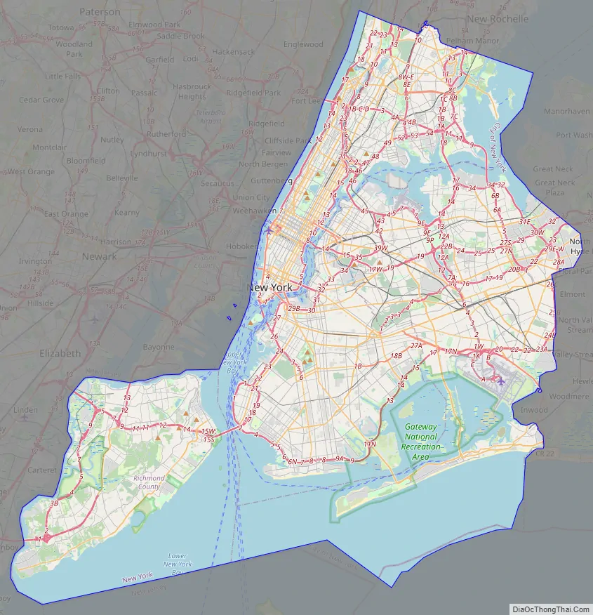
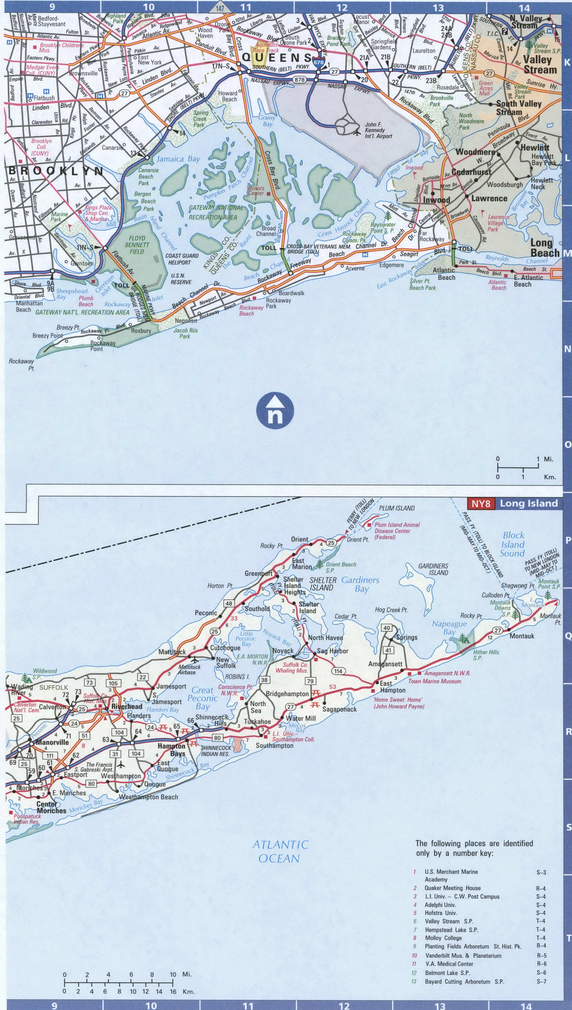
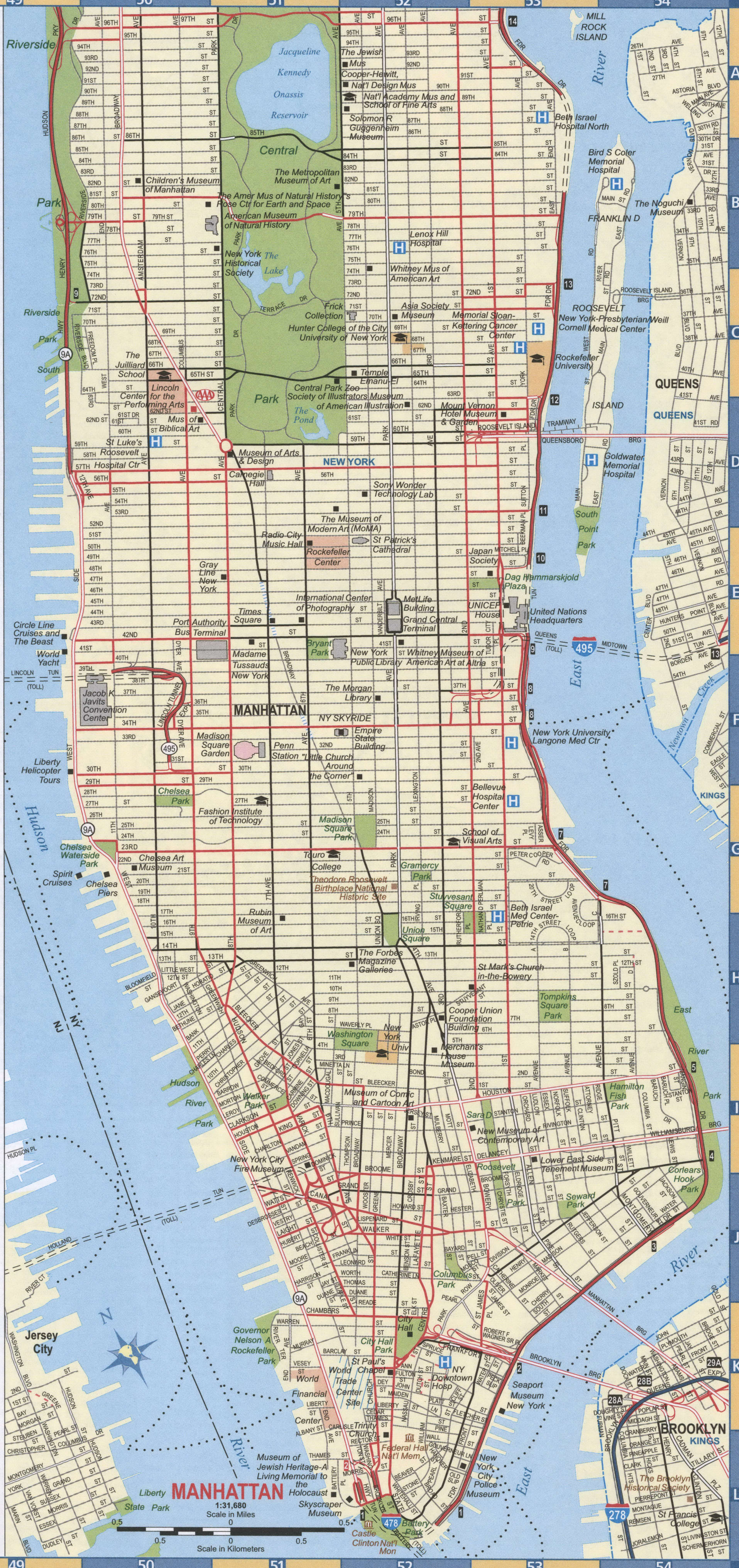
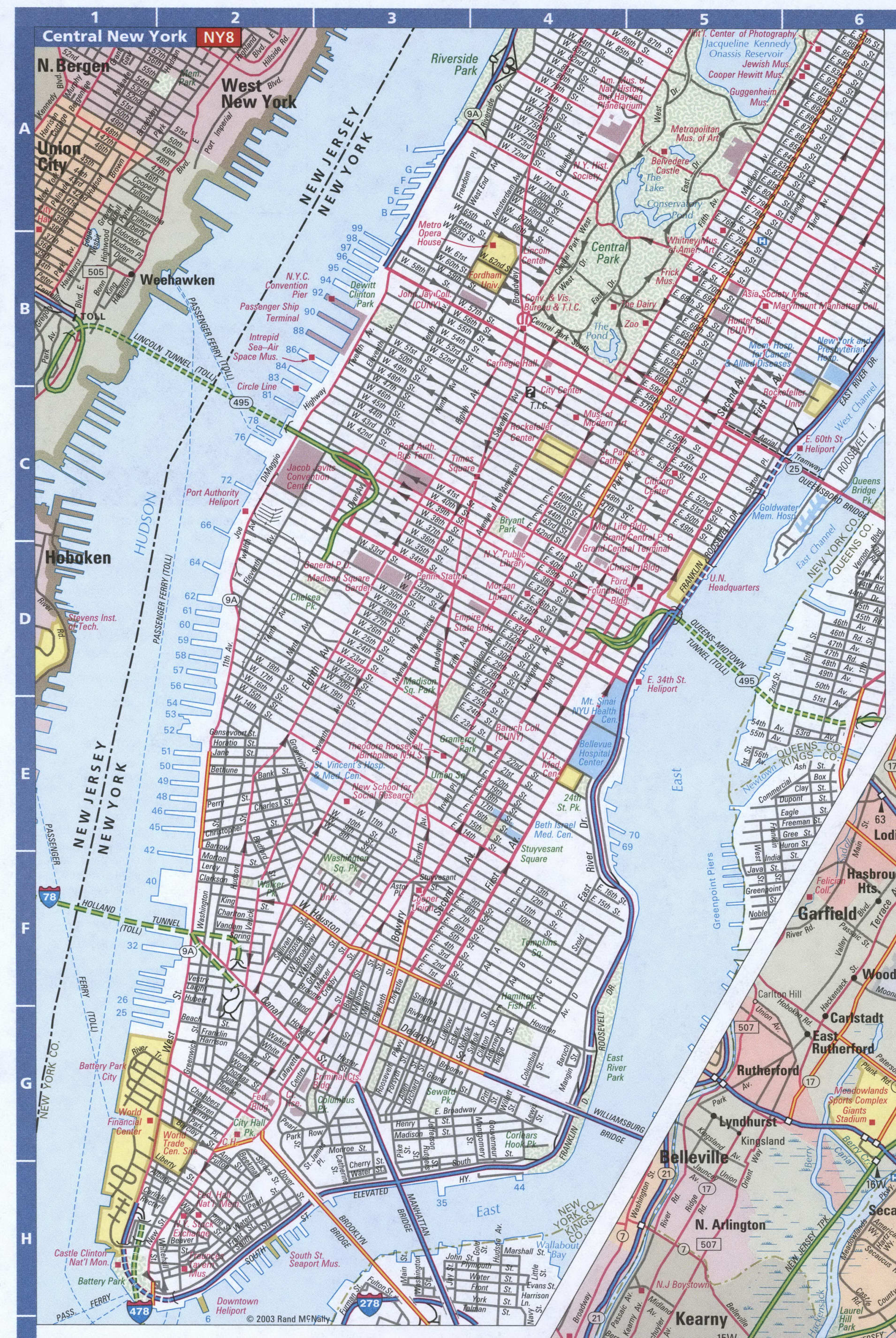
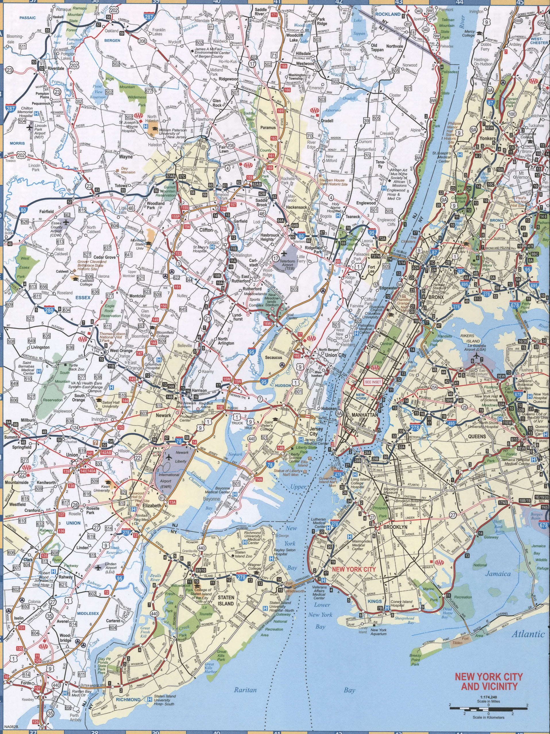
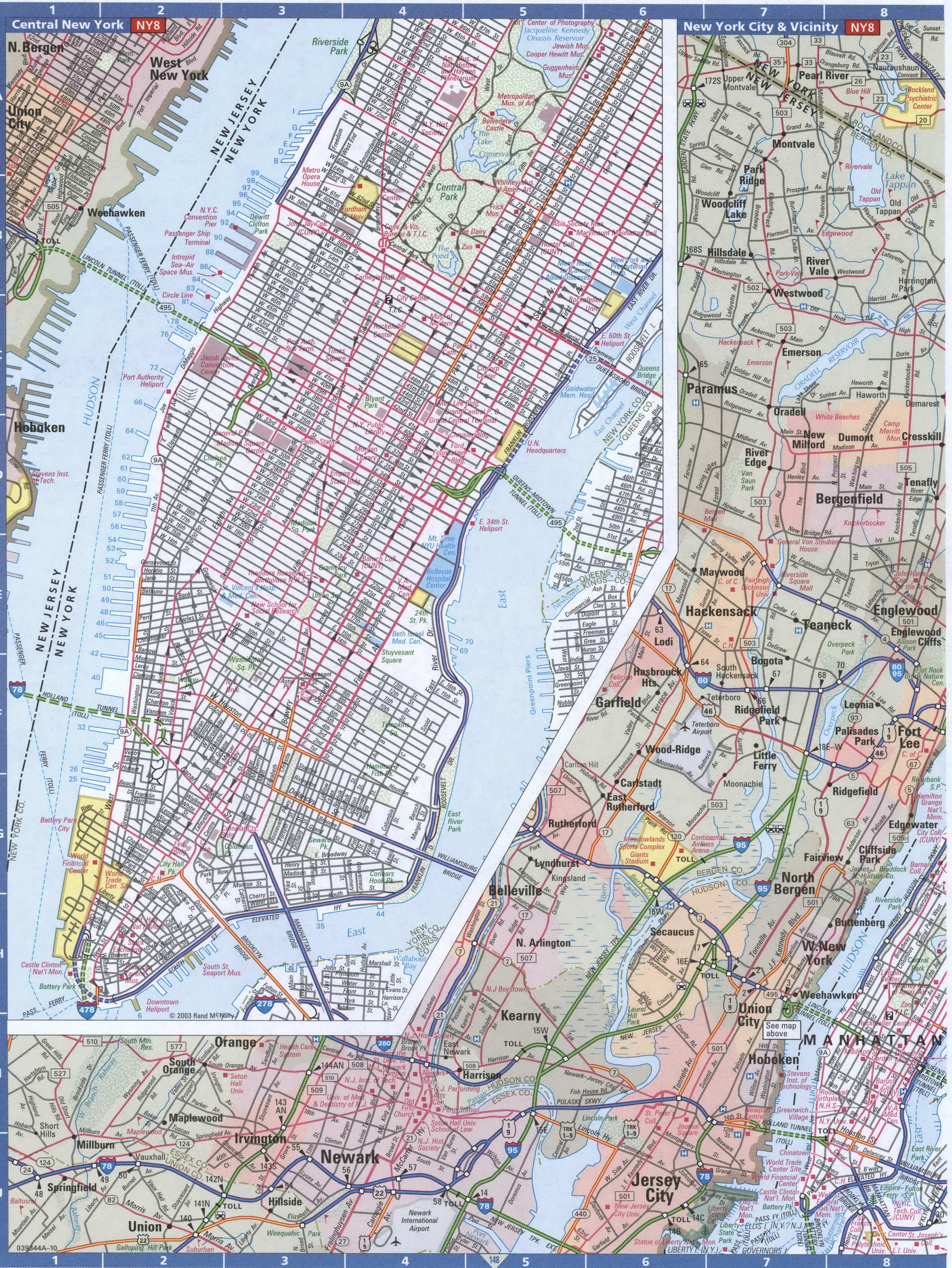
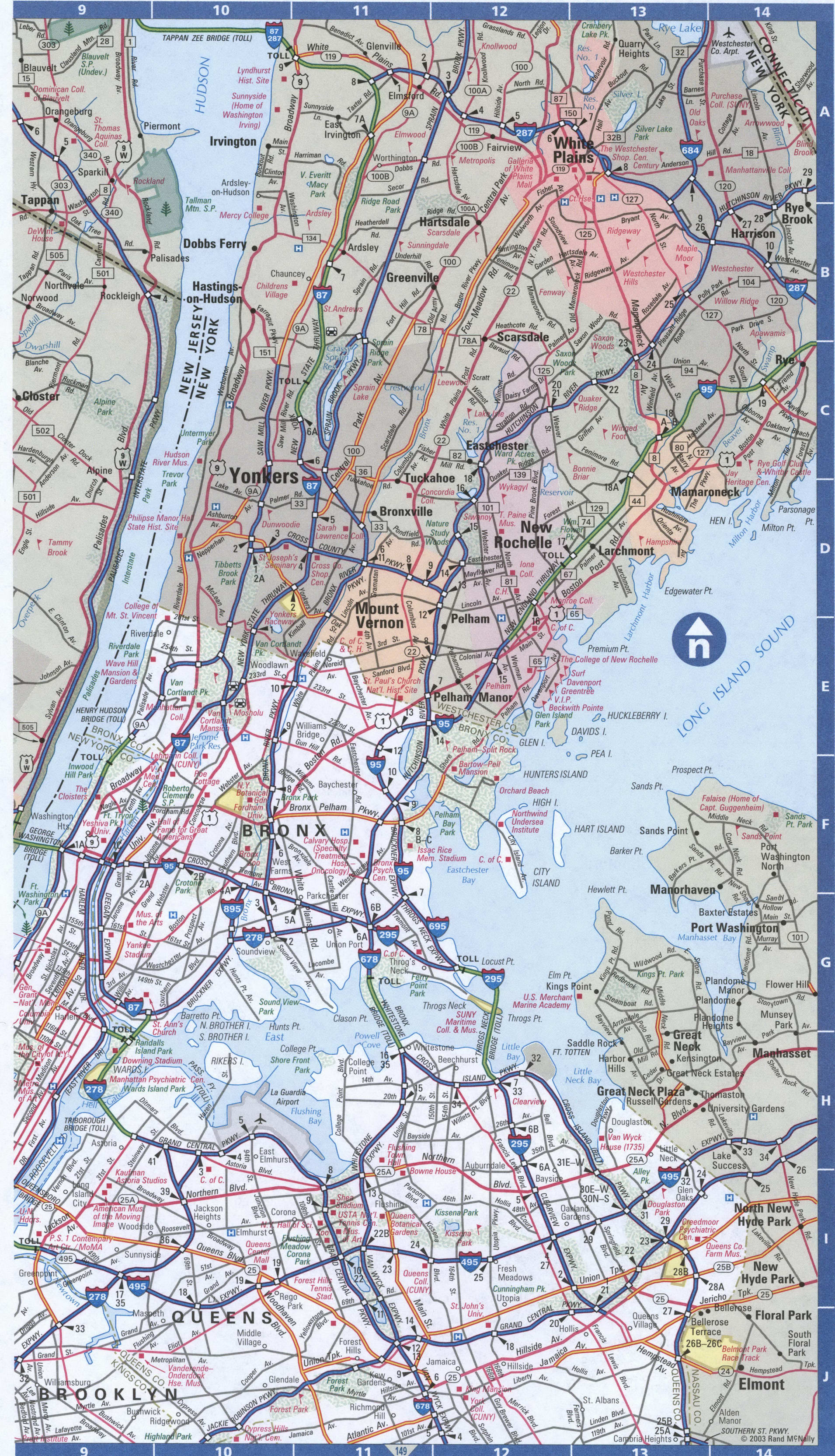
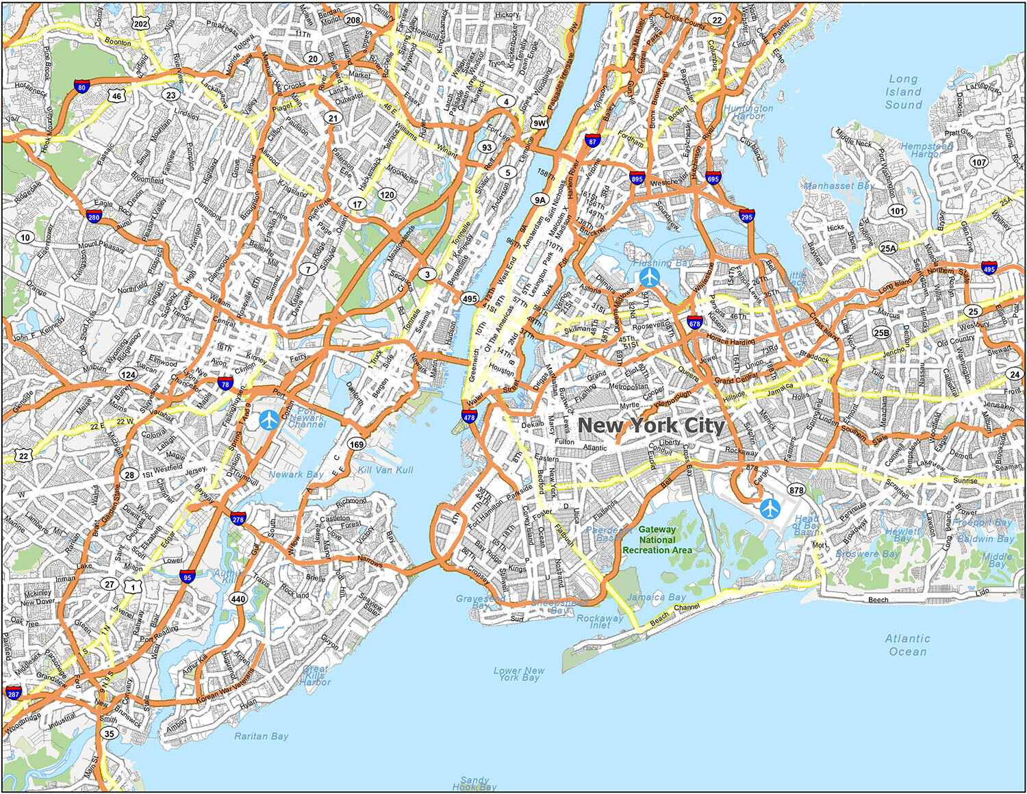
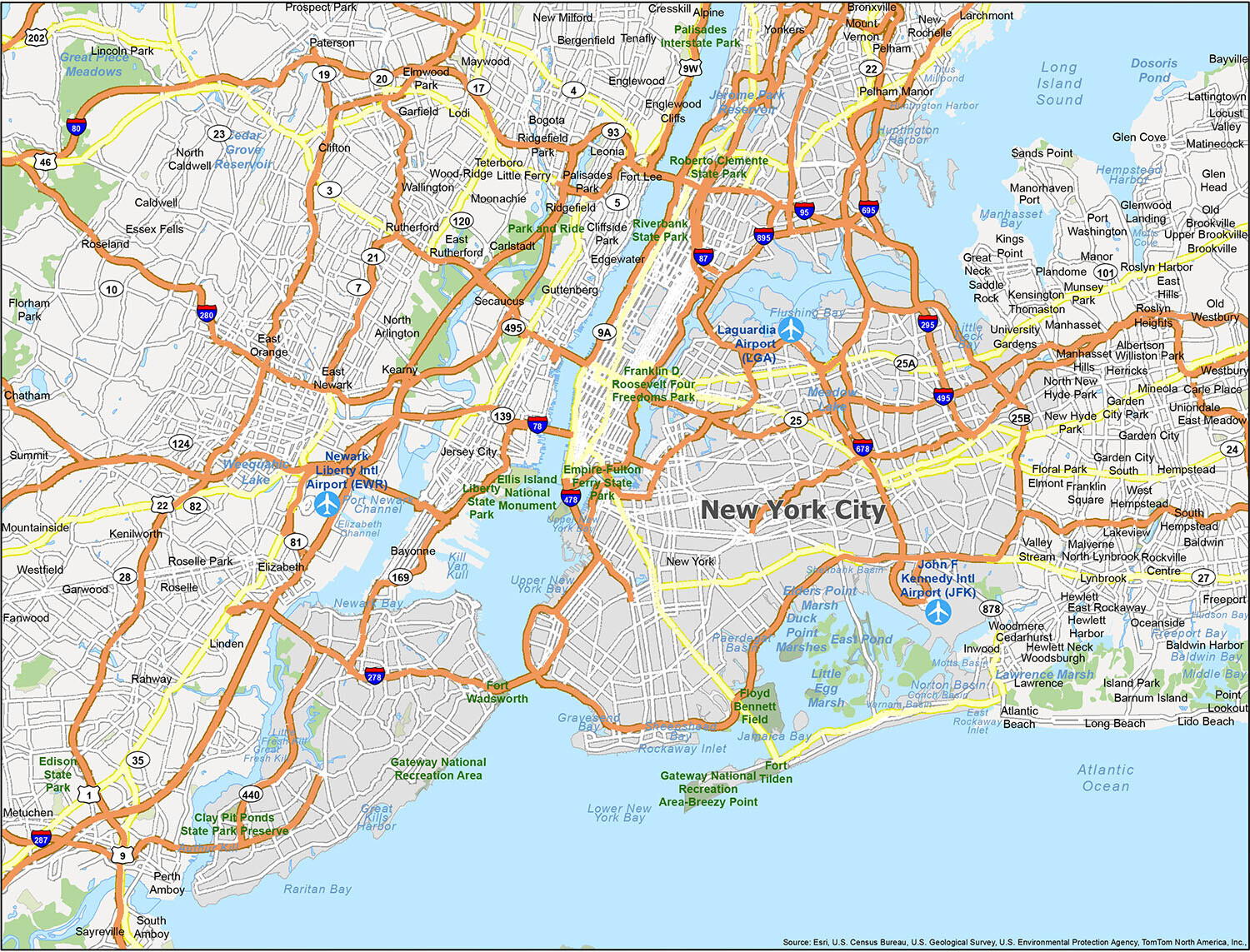
New York City is constantly bustling with life, from the hustle and bustle of Midtown Manhattan to the quaint neighborhoods in the outer boroughs. Since the city is so massive, it can be hard to know where to begin exploring it. Luckily, this informative map will help you on your journey to New York City. Whether you’re traveling or just looking to get acquainted with the city, this map will help you navigate your way around. Overall, this map provides you with everything you need to know about the state parks, bays, inlets, airports, and populated areas of NYC.
10 things to do in New York city
From its bustling neighborhoods to its world-class museums, exciting nightlife, and incomparable skyline, there is something for everyone to experience when you travel to New York City. This interactive map helps you explore the city and more. It includes the best restaurants and bars in New York City and is the perfect way to plan your itinerary for the day. This map is ideal for travelers who want to find the best places to visit, where to get the most out of their time, and where to stay. Find your favorite NYC places like the Empire State Building, Central Park, and Broadway shows on this map.
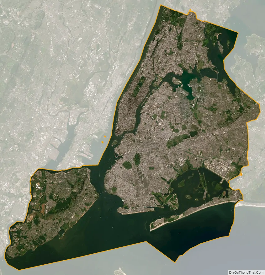
New York city Satellite Map
See also
Map of New York State and its subdivision:- Albany
- Allegany
- Bronx
- Broome
- Cattaraugus
- Cayuga
- Chautauqua
- Chemung
- Chenango
- Clinton
- Columbia
- Cortland
- Delaware
- Dutchess
- Erie
- Essex
- Franklin
- Fulton
- Genesee
- Greene
- Hamilton
- Herkimer
- Jefferson
- Kings
- Lake Ontario
- Lewis
- Livingston
- Madison
- Monroe
- Montgomery
- Nassau
- New York
- Niagara
- Oneida
- Onondaga
- Ontario
- Orange
- Orleans
- Oswego
- Otsego
- Putnam
- Queens
- Rensselaer
- Richmond
- Rockland
- Saint Lawrence
- Saratoga
- Schenectady
- Schoharie
- Schuyler
- Seneca
- Steuben
- Suffolk
- Sullivan
- Tioga
- Tompkins
- Ulster
- Warren
- Washington
- Wayne
- Westchester
- Wyoming
- Yates
- Alabama
- Alaska
- Arizona
- Arkansas
- California
- Colorado
- Connecticut
- Delaware
- District of Columbia
- Florida
- Georgia
- Hawaii
- Idaho
- Illinois
- Indiana
- Iowa
- Kansas
- Kentucky
- Louisiana
- Maine
- Maryland
- Massachusetts
- Michigan
- Minnesota
- Mississippi
- Missouri
- Montana
- Nebraska
- Nevada
- New Hampshire
- New Jersey
- New Mexico
- New York
- North Carolina
- North Dakota
- Ohio
- Oklahoma
- Oregon
- Pennsylvania
- Rhode Island
- South Carolina
- South Dakota
- Tennessee
- Texas
- Utah
- Vermont
- Virginia
- Washington
- West Virginia
- Wisconsin
- Wyoming