Menard is a city in and the county seat of Menard County, Texas, United States. Its population was 1,471 at the 2010 census.
| Name: | Menard city |
|---|---|
| LSAD Code: | 25 |
| LSAD Description: | city (suffix) |
| State: | Texas |
| County: | Menard County |
| Elevation: | 1,883 ft (574 m) |
| Total Area: | 2.06 sq mi (5.34 km²) |
| Land Area: | 2.06 sq mi (5.34 km²) |
| Water Area: | 0.00 sq mi (0.00 km²) |
| Total Population: | 1,471 |
| Population Density: | 680.56/sq mi (262.75/km²) |
| ZIP code: | 76859 |
| Area code: | 325 |
| FIPS code: | 4847628 |
| GNISfeature ID: | 1362610 |
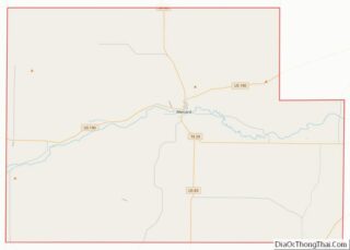
Online Interactive Map
Click on ![]() to view map in "full screen" mode.
to view map in "full screen" mode.
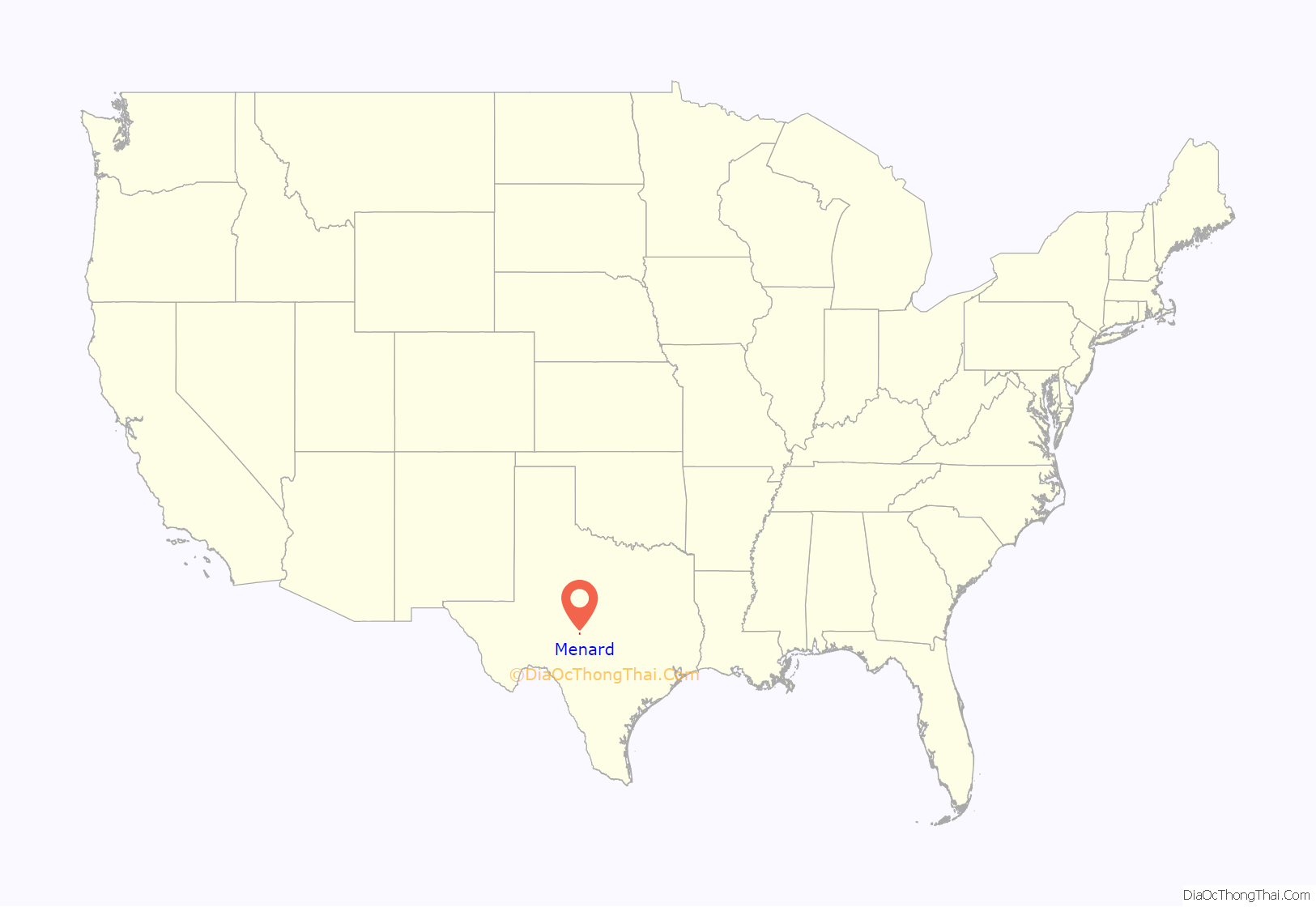
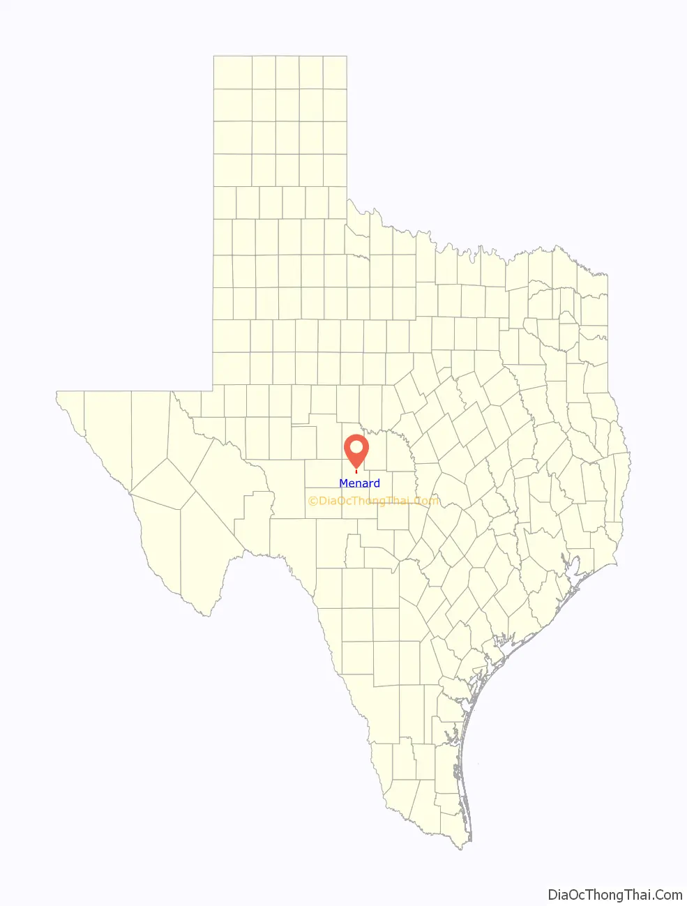
Menard location map. Where is Menard city?
History
The first settlement at the site of what is now Menard was the Spanish Mission San Sabá and the Presidio of San Luís de Amarillas, both established in April 1757. The presidio was later replaced by the Presidio of San Sabá in 1761. Both were intended to protect New Spain’s northern frontier from marauding Comanches. Due to the presidio’s isolation, it suffered repeated attacks, and was finally abandoned in 1770. Stones from the old presidio walls were used by later settlers to build homes and fences. The ruins of the old presidio were reconstructed in 1936.
The community was first known as Menardville when the site was laid out in 1858, after the formation of Menard County. Nearby Fort McKavett was deactivated in 1859, leaving the settlers with little protection from frequent Indian raids. The fort reopened after the Civil War. By 1867, Menardville had a store, a blacksmith shop, and a saloon. The community served as a trading post and overnight stop on north and west cattle trails. A county government was organized in 1871 and a two-story courthouse was built one year later. Menardville had around 150 residents by the mid-1880s. The San Saba River flooded in 1899, causing considerable damage to the community.
In 1910 or 1911, while the Fort Worth and Rio Grande Company was making plans to lay a track through the community, company officials asked residents to rename their town Menard to facilitate the painting of signs. An economic boom followed the arrival of the first train in 1911. The 1920 census recorded 1,164 people living in Menard. For many years, the town served as the principal shipping point for Menard County. Although the community was affected by the Great Depression, both of its banks—the Menard National Bank and Bevans State Bank—remained open. Menard’s population stood at 1,969 in 1930, 2,375 in 1940, and 2,685 in 1950. That figure began to decline during the 1950s and 1960s, as road improvements made travel and shipping less dependent on rail service. The Atchison, Topeka and Santa Fe Railroad discontinued its service to Menard in 1972, but donated the depot to the county for use as a history museum. The Menard County Historical Society began collecting artifacts in 1975 and dedicated the museum in 1978. By 1980, 1,697 people were living in Menard. In 1990, the population fell slightly to 1,606 before rebounding to 1,653 in 2000.
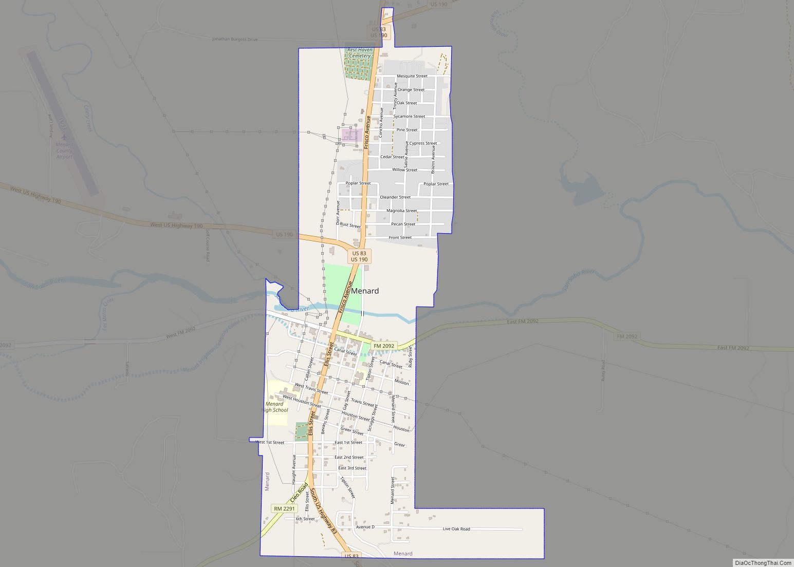
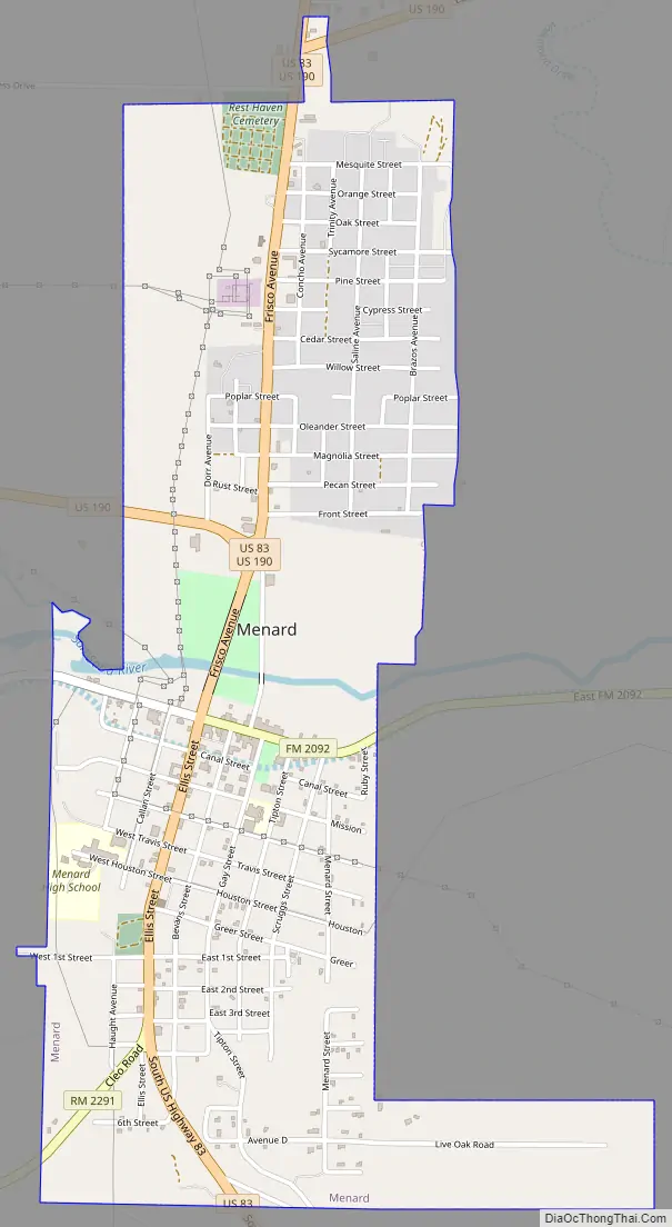
Menard Road Map
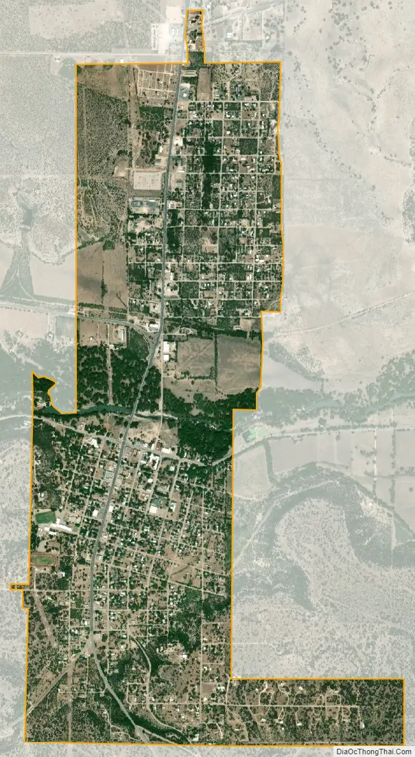
Menard city Satellite Map
Geography
Menard is located at 30°55′10″N 99°47′4″W / 30.91944°N 99.78444°W / 30.91944; -99.78444 (30.919519, –99.784446). It is situated along the banks of the San Saba River at the junction of U.S. Highways 83 and 190, about 140 miles northwest of Austin and San Antonio in central Menard County.
According to the United States Census Bureau, the city has a total area of 2.1 square miles (5.4 km), all of it land.
See also
Map of Texas State and its subdivision:- Anderson
- Andrews
- Angelina
- Aransas
- Archer
- Armstrong
- Atascosa
- Austin
- Bailey
- Bandera
- Bastrop
- Baylor
- Bee
- Bell
- Bexar
- Blanco
- Borden
- Bosque
- Bowie
- Brazoria
- Brazos
- Brewster
- Briscoe
- Brooks
- Brown
- Burleson
- Burnet
- Caldwell
- Calhoun
- Callahan
- Cameron
- Camp
- Carson
- Cass
- Castro
- Chambers
- Cherokee
- Childress
- Clay
- Cochran
- Coke
- Coleman
- Collin
- Collingsworth
- Colorado
- Comal
- Comanche
- Concho
- Cooke
- Coryell
- Cottle
- Crane
- Crockett
- Crosby
- Culberson
- Dallam
- Dallas
- Dawson
- Deaf Smith
- Delta
- Denton
- Dewitt
- Dickens
- Dimmit
- Donley
- Duval
- Eastland
- Ector
- Edwards
- El Paso
- Ellis
- Erath
- Falls
- Fannin
- Fayette
- Fisher
- Floyd
- Foard
- Fort Bend
- Franklin
- Freestone
- Frio
- Gaines
- Galveston
- Garza
- Gillespie
- Glasscock
- Goliad
- Gonzales
- Gray
- Grayson
- Gregg
- Grimes
- Guadalupe
- Hale
- Hall
- Hamilton
- Hansford
- Hardeman
- Hardin
- Harris
- Harrison
- Hartley
- Haskell
- Hays
- Hemphill
- Henderson
- Hidalgo
- Hill
- Hockley
- Hood
- Hopkins
- Houston
- Howard
- Hudspeth
- Hunt
- Hutchinson
- Irion
- Jack
- Jackson
- Jasper
- Jeff Davis
- Jefferson
- Jim Hogg
- Jim Wells
- Johnson
- Jones
- Karnes
- Kaufman
- Kendall
- Kenedy
- Kent
- Kerr
- Kimble
- King
- Kinney
- Kleberg
- Knox
- La Salle
- Lamar
- Lamb
- Lampasas
- Lavaca
- Lee
- Leon
- Liberty
- Limestone
- Lipscomb
- Live Oak
- Llano
- Loving
- Lubbock
- Lynn
- Madison
- Marion
- Martin
- Mason
- Matagorda
- Maverick
- McCulloch
- McLennan
- McMullen
- Medina
- Menard
- Midland
- Milam
- Mills
- Mitchell
- Montague
- Montgomery
- Moore
- Morris
- Motley
- Nacogdoches
- Navarro
- Newton
- Nolan
- Nueces
- Ochiltree
- Oldham
- Orange
- Palo Pinto
- Panola
- Parker
- Parmer
- Pecos
- Polk
- Potter
- Presidio
- Rains
- Randall
- Reagan
- Real
- Red River
- Reeves
- Refugio
- Roberts
- Robertson
- Rockwall
- Runnels
- Rusk
- Sabine
- San Augustine
- San Jacinto
- San Patricio
- San Saba
- Schleicher
- Scurry
- Shackelford
- Shelby
- Sherman
- Smith
- Somervell
- Starr
- Stephens
- Sterling
- Stonewall
- Sutton
- Swisher
- Tarrant
- Taylor
- Terrell
- Terry
- Throckmorton
- Titus
- Tom Green
- Travis
- Trinity
- Tyler
- Upshur
- Upton
- Uvalde
- Val Verde
- Van Zandt
- Victoria
- Walker
- Waller
- Ward
- Washington
- Webb
- Wharton
- Wheeler
- Wichita
- Wilbarger
- Willacy
- Williamson
- Wilson
- Winkler
- Wise
- Wood
- Yoakum
- Young
- Zapata
- Zavala
- Alabama
- Alaska
- Arizona
- Arkansas
- California
- Colorado
- Connecticut
- Delaware
- District of Columbia
- Florida
- Georgia
- Hawaii
- Idaho
- Illinois
- Indiana
- Iowa
- Kansas
- Kentucky
- Louisiana
- Maine
- Maryland
- Massachusetts
- Michigan
- Minnesota
- Mississippi
- Missouri
- Montana
- Nebraska
- Nevada
- New Hampshire
- New Jersey
- New Mexico
- New York
- North Carolina
- North Dakota
- Ohio
- Oklahoma
- Oregon
- Pennsylvania
- Rhode Island
- South Carolina
- South Dakota
- Tennessee
- Texas
- Utah
- Vermont
- Virginia
- Washington
- West Virginia
- Wisconsin
- Wyoming