Brownwood is a city in and the county seat of Brown County, Texas, United States. The population was 18,862 as of the 2020 census. Brownwood is located in the Northern Texas Hill Country and is home to Howard Payne University, which was founded in 1889.
| Name: | Brownwood city |
|---|---|
| LSAD Code: | 25 |
| LSAD Description: | city (suffix) |
| State: | Texas |
| County: | Brown County |
| Elevation: | 1,365 ft (416 m) |
| Total Area: | 14.99 sq mi (38.83 km²) |
| Land Area: | 14.97 sq mi (38.76 km²) |
| Water Area: | 0.03 sq mi (0.07 km²) |
| Total Population: | 19,644 |
| Population Density: | 1,233.13/sq mi (476.11/km²) |
| Area code: | 325 |
| FIPS code: | 4810780 |
| GNISfeature ID: | 1372753 |
| Website: | brownwoodtexas.gov |
Online Interactive Map
Click on ![]() to view map in "full screen" mode.
to view map in "full screen" mode.
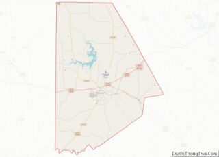
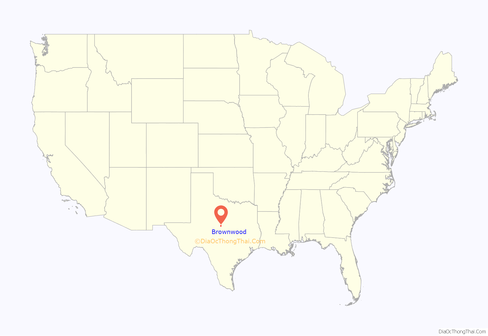
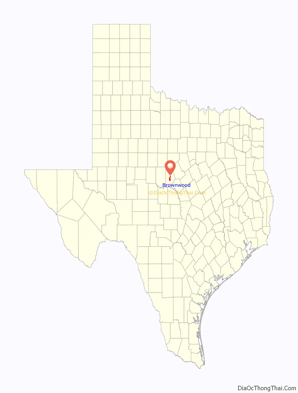
Brownwood location map. Where is Brownwood city?
History
The original site of the Brown County seat of Brownwood was east of Pecan Bayou. A dispute arose over land and water rights, and the settlers were forced to find a new location. Greenleaf Fisk donated 60 acres (24 ha) to relocate the county seat to the west side of the bayou, on what is now the current site of Brownwood, and 100 additional acres for county use. The town was incorporated in 1884.
During the Second World War, Brownwood was the location of U.S. Army Camp Bowie, which had a peak complement of over 80,000 soldiers. Camp Bowie serves as a training camp today at the intersection Farm-to-Market Roads 45 and 2126.
On April 19, 1976, an F5 tornado struck near Brownwood, causing extensive damage, with 11 reported injuries, but no fatalities.
Brownwood’s census figures were re-evaluated after the 2000 census from 18,813 to reflect more accurate figures of 20,407. The city was categorized in 2003 as a micropolitan statistical area. The federal Office of Management and Budget has issued a definition of micropolitan statistical areas as “an urban cluster of at least 10,000, but less than 50,000 population, plus adjacent territory that has a high degree of social and economic integration with the core, as measured by commuting ties.”
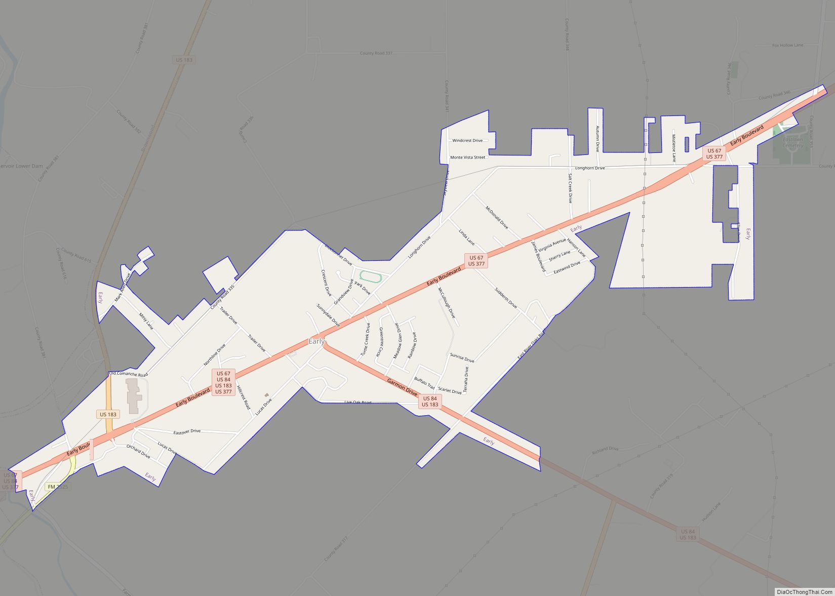
A dispute over water rights created the adjacent city of Early. The two cities are separated by the Pecan Bayou, one of five major tributaries of the Colorado River of Texas.
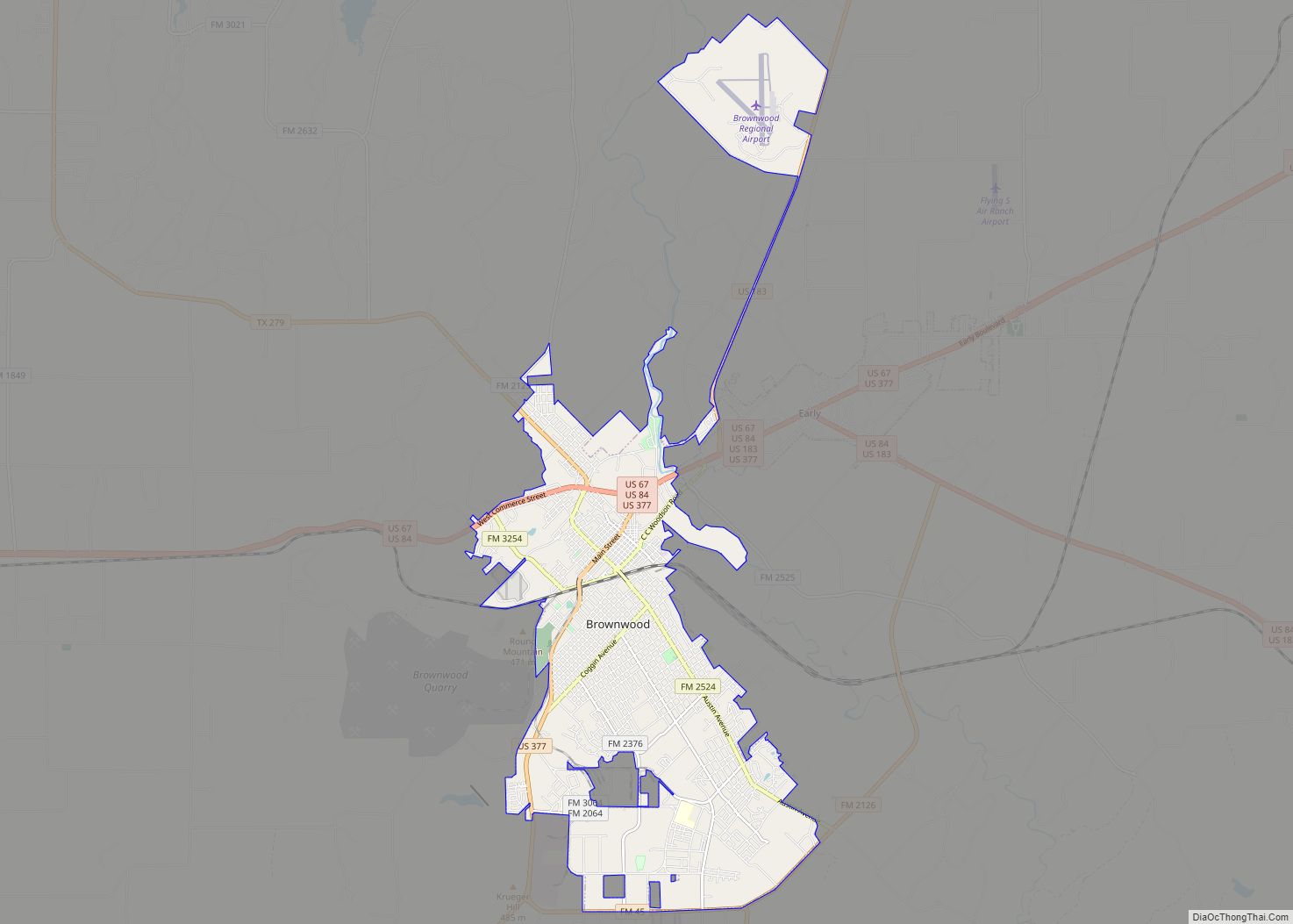
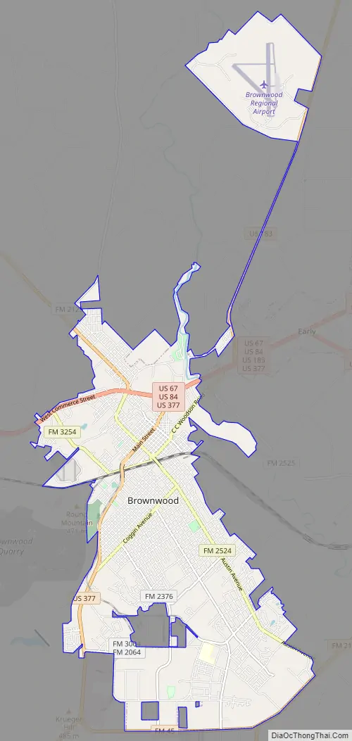
Brownwood Road Map
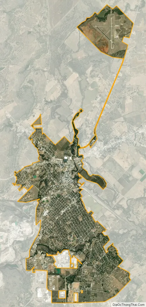
Brownwood city Satellite Map
Geography
Brownwood is located south of the center of Brown County, west of the Pecan Bayou. It is bordered to the east by the city of Early. Several U.S. Highways pass through the city. Routes 84 and 67 lead west towards Bangs and Santa Anna. U.S. Route 377 leads southwest towards Brady. All three highways head east into Early, where 67 and 377 continue northeast towards Comanche, while 84 leads southeast towards Goldthwaite. Just over the city line in Early, U.S. Route 183 leads north 46 miles (74 km) to Cisco and Interstate 20, the closest Interstate highway.
According to the United States Census Bureau, Brownwood has a total area of 14.9 square miles (38.5 km), of which 14.8 square miles (38.4 km) are land and 0.04 sq mi (0.1 km), or 0.17%, is water.
See also
Map of Texas State and its subdivision:- Anderson
- Andrews
- Angelina
- Aransas
- Archer
- Armstrong
- Atascosa
- Austin
- Bailey
- Bandera
- Bastrop
- Baylor
- Bee
- Bell
- Bexar
- Blanco
- Borden
- Bosque
- Bowie
- Brazoria
- Brazos
- Brewster
- Briscoe
- Brooks
- Brown
- Burleson
- Burnet
- Caldwell
- Calhoun
- Callahan
- Cameron
- Camp
- Carson
- Cass
- Castro
- Chambers
- Cherokee
- Childress
- Clay
- Cochran
- Coke
- Coleman
- Collin
- Collingsworth
- Colorado
- Comal
- Comanche
- Concho
- Cooke
- Coryell
- Cottle
- Crane
- Crockett
- Crosby
- Culberson
- Dallam
- Dallas
- Dawson
- Deaf Smith
- Delta
- Denton
- Dewitt
- Dickens
- Dimmit
- Donley
- Duval
- Eastland
- Ector
- Edwards
- El Paso
- Ellis
- Erath
- Falls
- Fannin
- Fayette
- Fisher
- Floyd
- Foard
- Fort Bend
- Franklin
- Freestone
- Frio
- Gaines
- Galveston
- Garza
- Gillespie
- Glasscock
- Goliad
- Gonzales
- Gray
- Grayson
- Gregg
- Grimes
- Guadalupe
- Hale
- Hall
- Hamilton
- Hansford
- Hardeman
- Hardin
- Harris
- Harrison
- Hartley
- Haskell
- Hays
- Hemphill
- Henderson
- Hidalgo
- Hill
- Hockley
- Hood
- Hopkins
- Houston
- Howard
- Hudspeth
- Hunt
- Hutchinson
- Irion
- Jack
- Jackson
- Jasper
- Jeff Davis
- Jefferson
- Jim Hogg
- Jim Wells
- Johnson
- Jones
- Karnes
- Kaufman
- Kendall
- Kenedy
- Kent
- Kerr
- Kimble
- King
- Kinney
- Kleberg
- Knox
- La Salle
- Lamar
- Lamb
- Lampasas
- Lavaca
- Lee
- Leon
- Liberty
- Limestone
- Lipscomb
- Live Oak
- Llano
- Loving
- Lubbock
- Lynn
- Madison
- Marion
- Martin
- Mason
- Matagorda
- Maverick
- McCulloch
- McLennan
- McMullen
- Medina
- Menard
- Midland
- Milam
- Mills
- Mitchell
- Montague
- Montgomery
- Moore
- Morris
- Motley
- Nacogdoches
- Navarro
- Newton
- Nolan
- Nueces
- Ochiltree
- Oldham
- Orange
- Palo Pinto
- Panola
- Parker
- Parmer
- Pecos
- Polk
- Potter
- Presidio
- Rains
- Randall
- Reagan
- Real
- Red River
- Reeves
- Refugio
- Roberts
- Robertson
- Rockwall
- Runnels
- Rusk
- Sabine
- San Augustine
- San Jacinto
- San Patricio
- San Saba
- Schleicher
- Scurry
- Shackelford
- Shelby
- Sherman
- Smith
- Somervell
- Starr
- Stephens
- Sterling
- Stonewall
- Sutton
- Swisher
- Tarrant
- Taylor
- Terrell
- Terry
- Throckmorton
- Titus
- Tom Green
- Travis
- Trinity
- Tyler
- Upshur
- Upton
- Uvalde
- Val Verde
- Van Zandt
- Victoria
- Walker
- Waller
- Ward
- Washington
- Webb
- Wharton
- Wheeler
- Wichita
- Wilbarger
- Willacy
- Williamson
- Wilson
- Winkler
- Wise
- Wood
- Yoakum
- Young
- Zapata
- Zavala
- Alabama
- Alaska
- Arizona
- Arkansas
- California
- Colorado
- Connecticut
- Delaware
- District of Columbia
- Florida
- Georgia
- Hawaii
- Idaho
- Illinois
- Indiana
- Iowa
- Kansas
- Kentucky
- Louisiana
- Maine
- Maryland
- Massachusetts
- Michigan
- Minnesota
- Mississippi
- Missouri
- Montana
- Nebraska
- Nevada
- New Hampshire
- New Jersey
- New Mexico
- New York
- North Carolina
- North Dakota
- Ohio
- Oklahoma
- Oregon
- Pennsylvania
- Rhode Island
- South Carolina
- South Dakota
- Tennessee
- Texas
- Utah
- Vermont
- Virginia
- Washington
- West Virginia
- Wisconsin
- Wyoming