Calhoun County is a county located in the south central part of the U.S. state of Arkansas. As of the 2020 census, the population was 4,739, making it the least populous county in Arkansas. The county seat is Hampton. Calhoun County is Arkansas’s 55th county, formed on December 6, 1850, and named for John C. Calhoun, a Vice President of the United States.
The county is part of the Camden, AR Micropolitan Statistical Area.
| Name: | Calhoun County |
|---|---|
| FIPS code: | 05-013 |
| State: | Arkansas |
| Founded: | December 6, 1850 |
| Named for: | John C. Calhoun |
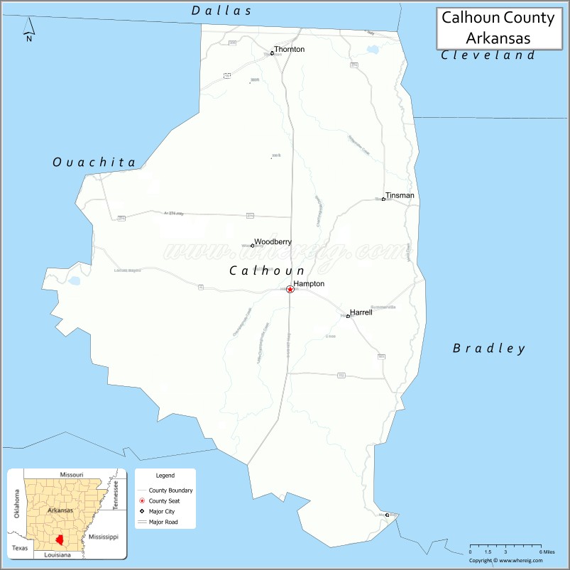
| Seat: | Hampton |
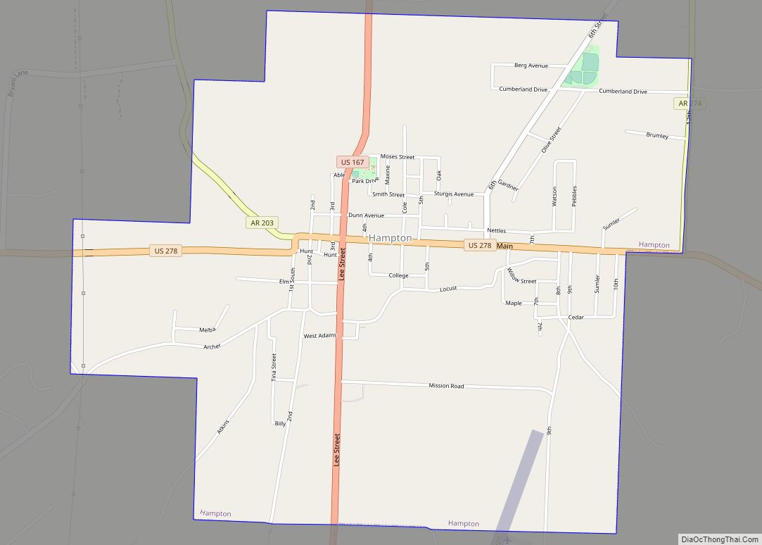
| Largest city: | Hampton |
| Total Area: | 632 sq mi (1,640 km²) |
| Land Area: | 629 sq mi (1,630 km²) |
| Total Population: | 4,739 |
| Population Density: | 7.5/sq mi (2.9/km²) |
| Time zone: | UTC−6 (Central) |
| Summer Time Zone (DST): | UTC−5 (CDT) |
| Website: | calhouncounty.arkansas.gov |
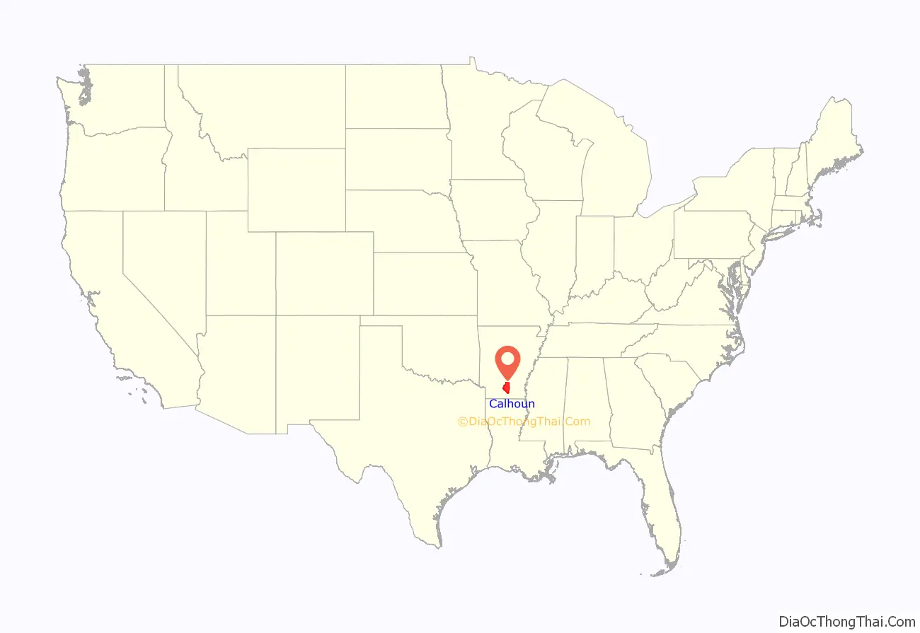
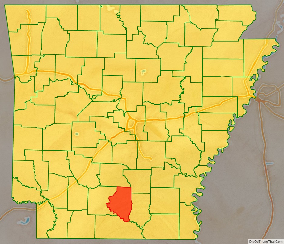
Calhoun County location map. Where is Calhoun County?
History
This area was initially developed for plantation agriculture, based on large gangs of slave workers. The population was majority enslaved African Americans before the American Civil War. After the Reconstruction era, there was increasing white violence against blacks as the minority attempted to assert dominance over the freedmen. From 1877 to 1950, whites lynched 10 African Americans in the county, mostly in the decades around the turn of the century. Several other counties in the state had higher rates of such murders.
In September 1892, what became known as the “Hampton Race War”, or the Calhoun County Race War, broke out across the southern part of the county. In 1891 the Democratic-dominated state legislature had passed laws to make voter registration more difficult for illiterate people both black and white, which effectively disenfranchised many of the poorer residents. But tensions were rising in this period, and the economy was poor. Whites resented that freedmen would work for lower wages, even if they knew the latter men seldom had a choice. Whitecappers, also called night riders, were poor white farmers and workers who acted as vigilantes, attacking various residents to enforce their moral views. They met in secret societies to patrol both black and white communities. Their reasons were also economic; they hoped to drive out the black workers.
The African Americans resented these attacks. Newspapers printed rumors of armed blacks planning attacks against whites, as was typical in tense times, inflaming existing tensions. There was also violence associated with the September election. Some newspapers reported that a white man named Unsill, an ex-convict Republican, led 42 armed blacks to the polls, “where they demanded to vote.” Accounts of this period are contradictory, but agree that major events seemed to take place within several days, beginning about September 17, while incidents were reported over the month of September. An estimated five to eight African Americans were killed during the violence, with one or more described as lynched. At least two whites were killed in these encounters; more men on both sides were wounded. Among the dead was a black man murdered by two whites; as he was a key witness in a trial in which they were defendants, this appeared to be a “murder of convenience” done while other violence was prevalent.
20th century to present
Due to such violence, social oppression, economic problems, and mechanization of agriculture, many African Americans and whites left the county in the first half of the 20th century. Population declined in every census after 1920 through 1970, as may be seen in the table in the Demographics section below. African Americans left in the Great Migration to northern and midwestern industrial cities for work before World War II; during and after that war, many others went to the West Coast, where defense industries had more jobs.
The Shumaker Naval Ammunition Depot in Calhoun and Ouachita counties operated from 1945 until 1957.
The Southern Arkansas University Tech is a two-year college specializing in technical training.
There are 40 acres of timber that have never been cut along the Wolf Branch (a tributary of Moro Creek) in southeast Calhoun County. Some of its large trees are over 200 years old.
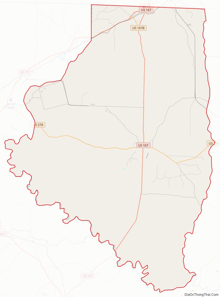
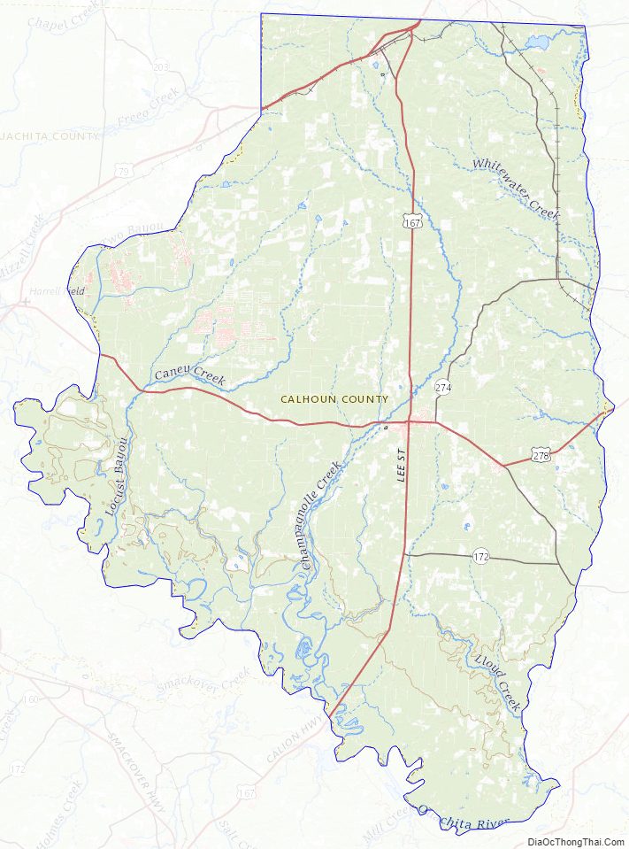
Calhoun County Road Map
Geography
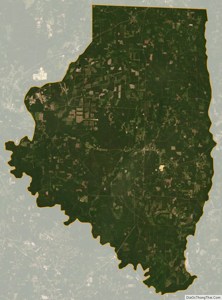
According to the U.S. Census Bureau, the county has a total area of 632 square miles (1,640 km), of which 629 square miles (1,630 km) is land and 3.8 square miles (9.8 km) (0.6%) is water.
Major highways
- Future Interstate 69
- U.S. Highway 79
- U.S. Highway 167
- U.S. Highway 278
- Highway 160
Adjacent counties
- Dallas County (north)
- Cleveland County (northeast)
- Bradley County (east)
- Union County (south)
- Ouachita County (west)
Calhoun County Topographic Map
Calhoun County Satellite Map
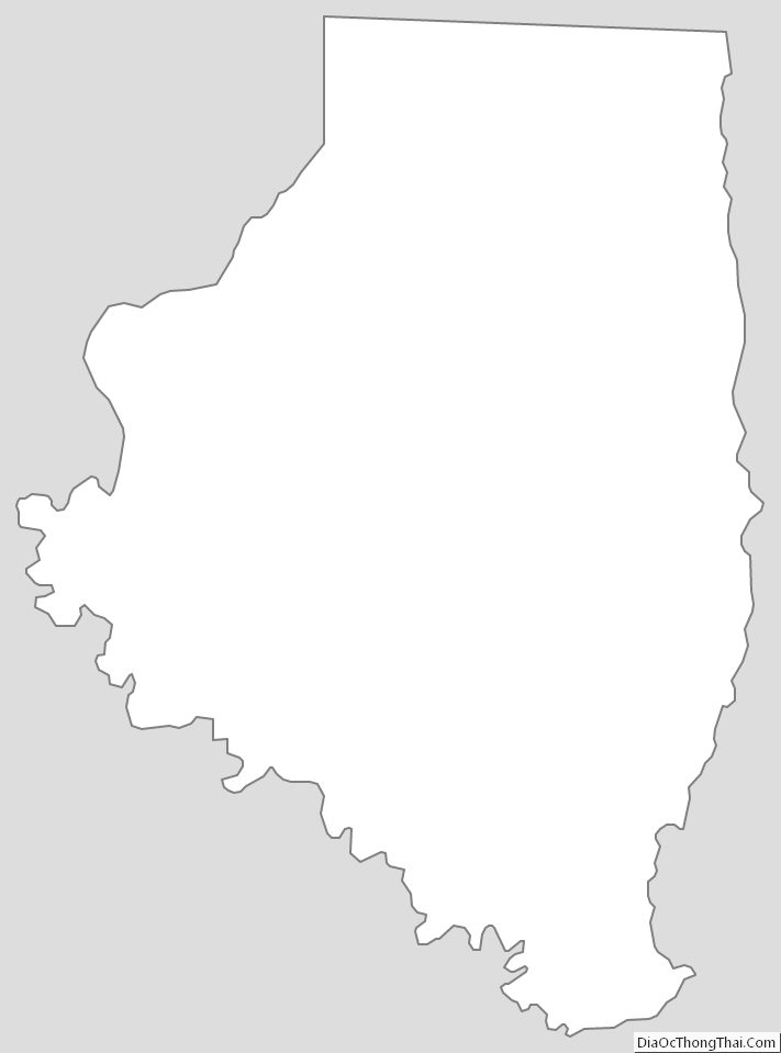
Calhoun County Outline Map