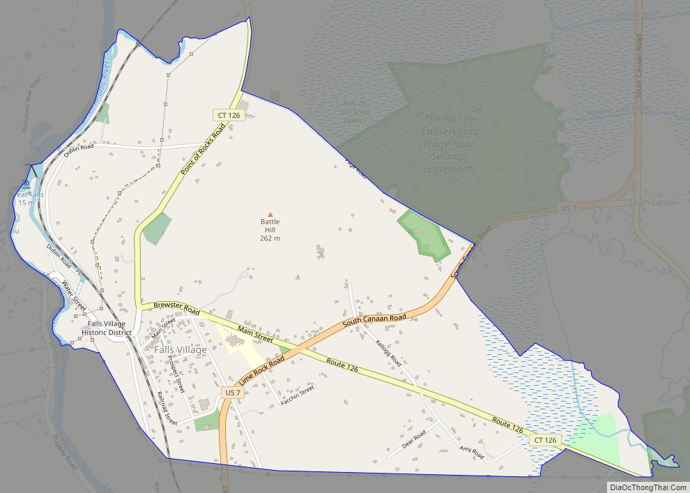
Falls Village is a village and census-designated place in the town of Canaan in Litchfield County, Connecticut, United States. As of the 2010 census it had a population of 538, out of 1,234 in the entire town of Canaan. Because Falls Village is the town center and principal constituent village in Canaan, the entire town is often referred to as “Falls Village”. That usage also avoids confusion of the town with Canaan Village in the town of North Canaan, Connecticut, just to the north. Falls Village derives its name from a waterfall, known as Great Falls, on the Housatonic River within the village.
The Falls Village post office is assigned ZIP code 06031, which encompasses the entire town of Canaan.
| Name: | Falls Village CDP |
|---|---|
| LSAD Code: | 57 |
| LSAD Description: | CDP (suffix) |
| State: | Connecticut |
| County: | Litchfield County |
| FIPS code: | 0927390 |
Online Interactive Map
Click on ![]() to view map in "full screen" mode.
to view map in "full screen" mode.
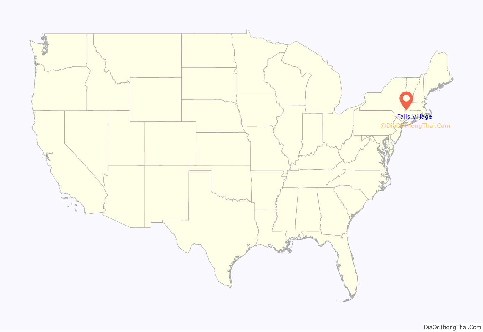
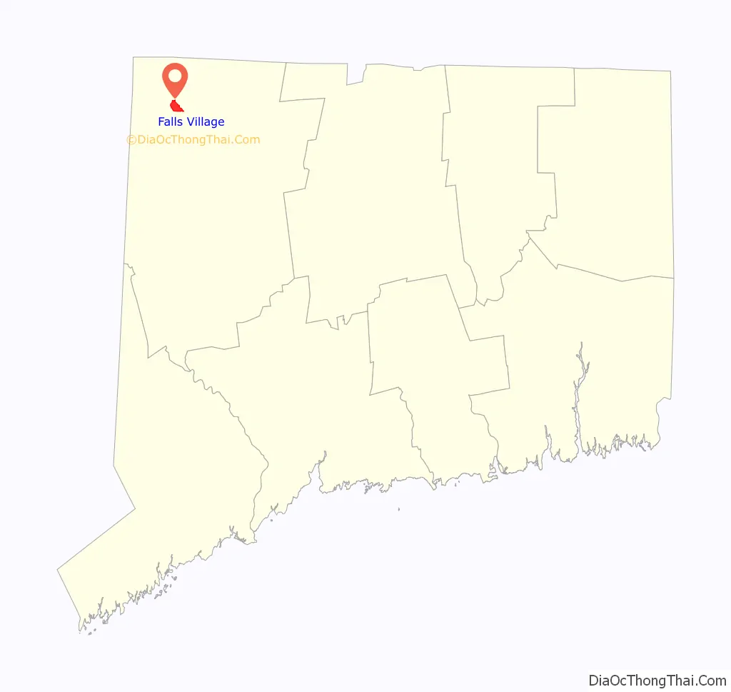
Falls Village location map. Where is Falls Village CDP?
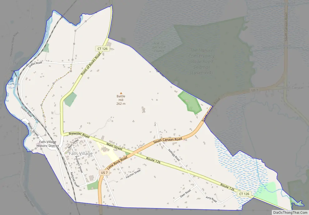
Falls Village Road Map
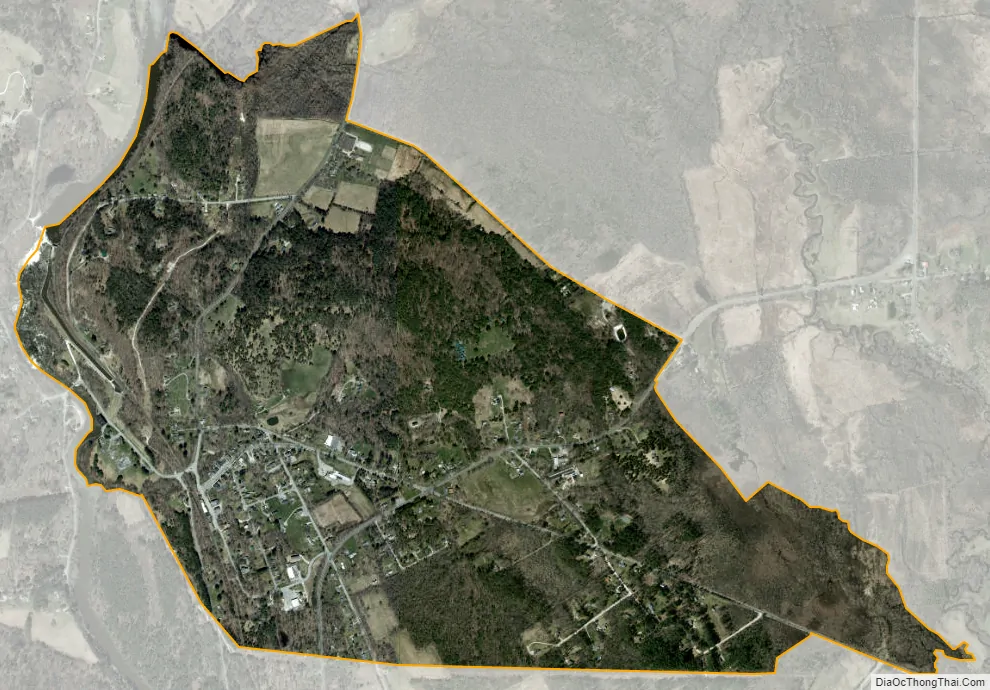
Falls Village city Satellite Map
Geography
Falls Village is on the western side of the town of Canaan in northwestern Connecticut. The western edge of the census-designated place is the Canaan–Salisbury town line following the Housatonic River, it extends north of the village as far as Page Road, and south to a power line corridor that crosses Beebe Hill. To the east the CDP extends out Connecticut Route 126 as far as Johnson Road.
U.S. Route 7 passes through the village, leading north 6 miles (10 km) to Canaan Village and south the same distance to West Cornwall. Route 126 leads east from Falls Village 2 miles (3 km) to Connecticut Route 63 and north 4 miles (6 km) to U.S. Route 44 in North Canaan.
According to the U.S. Census Bureau, the Falls Village CDP has an area of 1.6 square miles (4.1 km), all of it recorded as land.
See also
Map of Connecticut State and its subdivision: Map of other states:- Alabama
- Alaska
- Arizona
- Arkansas
- California
- Colorado
- Connecticut
- Delaware
- District of Columbia
- Florida
- Georgia
- Hawaii
- Idaho
- Illinois
- Indiana
- Iowa
- Kansas
- Kentucky
- Louisiana
- Maine
- Maryland
- Massachusetts
- Michigan
- Minnesota
- Mississippi
- Missouri
- Montana
- Nebraska
- Nevada
- New Hampshire
- New Jersey
- New Mexico
- New York
- North Carolina
- North Dakota
- Ohio
- Oklahoma
- Oregon
- Pennsylvania
- Rhode Island
- South Carolina
- South Dakota
- Tennessee
- Texas
- Utah
- Vermont
- Virginia
- Washington
- West Virginia
- Wisconsin
- Wyoming