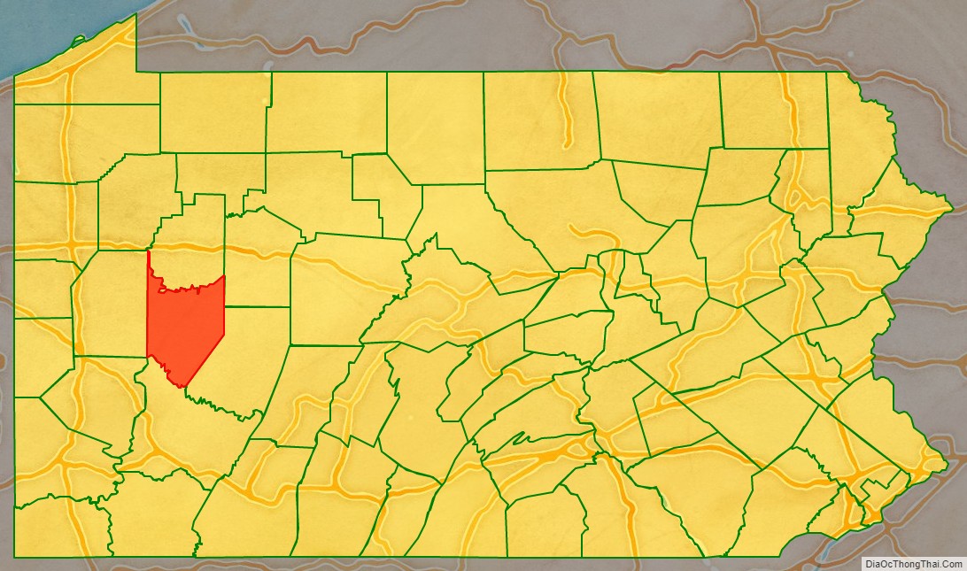
Armstrong County is a county in the Commonwealth of Pennsylvania. As of the 2020 census, the population was 65,558. The county seat is Kittanning. The county was organized on March 12, 1800, from parts of Allegheny, Westmoreland and Lycoming Counties. It was named in honor of John Armstrong, who represented Pennsylvania in the Continental Congress and served as a major general during the Revolutionary War.
Armstrong County is included in the Pittsburgh, PA Metropolitan Statistical Area.
| Name: | Armstrong County |
|---|---|
| FIPS code: | 42-005 |
| State: | Pennsylvania |
| Founded: | March 12, 1800 |
| Named for: | John Armstrong |
| Seat: | Kittanning |
| Total Area: | 664 sq mi (1,720 km²) |
| Land Area: | 653 sq mi (1,690 km²) |
| Total Population: | 65,558 |
| Population Density: | 100/sq mi (40/km²) |
| Time zone: | UTC−5 (Eastern) |
| Summer Time Zone (DST): | UTC−4 (EDT) |
| Website: | www.co.armstrong.pa.us |
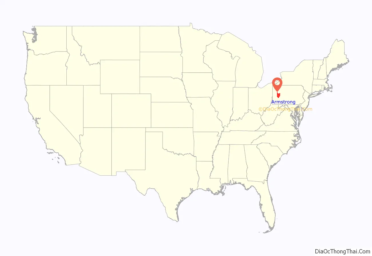
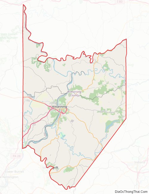
Armstrong County location map. Where is Armstrong County?
History
Little is known of the pre-Columbian history of the area that is today called Armstrong County, but the often cited starting point begins with the civilization known colloquially as the Mound Builders. Many 19th-20th century famers throughout the county have unearthed artifacts from this time period, such as arrowheads. Unfortunately, several of the prominent earthen works characteristic of this culture have been removed for agricultural and settlement purposes. One prominent mound was located between present-day Kittanning and Ford City and was believed to have been an earthen fortification used to defend against other tribal peoples. Other mounds were found in Boggs, South Buffalo, and Washington townships. The aboriginal inhabitants were given the name “Allegewi” by the tribes that drove them out sometime between the 15th and 17th centuries.
Historical accounts describe the tribes that conquered the Allegewi as primarily the Lenni-Lenape or “Delaware” tribes, as well as bands of Mohawk, Oneidas, Cayugas, Onondagas, and Seneca. The Lenni-Lenape and Delaware tribes made semi-permanent and permanent settlements in and around present-day Kittanning, and much of the area functioned as their hunting and agricultural lands. Blockhouses built by the Lenni-Lenape, not unlike the early European settler dwellings, were commonly seen around Ford City, Kittanning, South Buffalo, Brady’s Bend, and Red Bank. The Lenni-Lenape were the primary inhabitants of the area and were the primary points of contact for European settlers in this area at the turn of the 18th century.
With the arrival of European settlers also came the competing claims to the territory, primarily between the French and British empires, who were engaged in what became known as the Seven Years’ War. As the global conflict between the two empires expanded into the “New World,” both sides attempted to court the many Native American tribes. Several tribes in the Allegheny River Valley, including the Lenni-Lenape, sided with the French during this time period, as their friendship appeared to be more advantageous to their own territorial claims against the British-friendly Iroquois Nations. In exchange for furs, freedom of movement in Lenni-Lenape territory, and guerilla raids on British troops and settlers, the French supplied weapons and other European goods and offered military protection to the friendly tribes. This agreement and similar alliances with other tribes allowed the French to become more well dug-in along the Allegheny River, most prominently at Fort Duquesne in present-day Pittsburgh. Several military engagements in the Ohio country ( that would later become western Pennsylvania) were part of the greater conflict called the French and Indian War, so dubbed by the Anglo-American settlers in the region, a term still in use today.
One of the minor battles that erupted during the French and Indian War occurred at the present site of the Armstrong County seat, Kittanning, or Kit-hane-ink, as it was referred to by the Lenape, meaning “settlement by the main river.” Although the Battle of Kittanning was inconsequential to the greater conflict with the French and Indian tribes, it is an integral part of Armstrong County’s history. The expedition, led by Lieutenant Colonel John Armstrong, brought about the destruction of the Lenape village of Kittanning, which had served as a staging point for attacks by Lenape (Delaware) warriors against colonists in the British Province of Pennsylvania. Deep into hostile territory, the raid on Kittanning was the only major expedition carried out by Pennsylvania Provincial troops during the brutal backcountry war. It is often thought of by local historians as a type of pre-World War II Doolittle Raid.
With the surrender of George Washington at Fort Necessity in 1754 and Braddock’s defeat in 1755, the settlers on the Pennsylvania frontier were without professional military protection, and scrambled to organize a defense. The French-allied Indians who had defeated General Edward Braddock at the Monongahela were primarily from the Great Lakes region to the north. The local Indians, mostly Lenape and Shawnee who had migrated to the area after white colonists had settled their lands to the east, had waited to see who would win the contest—they could not risk siding with the loser. With Fort Duquesne now secured, the victorious French encouraged the Lenape and Shawnee to “take up the hatchet” against those who had taken their land.
Beginning about October 1755, Lenape and Shawnee war parties, often with French cooperation, began raiding settlements in Pennsylvania. Although European-Americans also waged war with cruelty, they found Indian warfare particularly brutal and frightening. Notable among the Indian raiders were the Lenape war leaders Shingas and Captain Jacobs, both of whom lived at Kittanning. The colonial governments of Pennsylvania and Virginia offered rewards for their scalps. Captain Jacobs was on an expedition led by Louis Coulon de Villiers that descended on Fort Granville (near present-day Lewistown) on the morning of August 2, 1756. The attackers were held off, but the garrison commander was killed, and his second in command surrendered the garrison, including the women and children, the next morning. The commander’s brother, Lieutenant Colonel John Armstrong, immediately organized an expedition of 300 men against Kittanning in response. Early on September 8, 1756, they launched a surprise attack on the Indian village. Many of the Kittanning residents fled, but Captain Jacobs put up a defense, holing up with his wife and family inside their home. When he refused to surrender, his house and others were set on fire, touching off gunpowder that had been stored inside. Captain Jacobs was killed and scalped after jumping from his home in an attempt to escape the flames. The battle ended when the entire village was engulfed in flames.
The destruction of Kittanning was hailed as a victory in Pennsylvania, and Armstrong was known afterwards as the “Hero of Kittanning”. He and his men collected the “scalp bounty” that had been placed on Captain Jacobs. However, the victory had limitations: the attackers suffered more casualties than they inflicted, and most of the villagers escaped, taking with them almost all of the prisoners that had been held in the village. The expedition also probably aggravated the frontier war; subsequent Indian raids that autumn were fiercer than ever. The Kittanning raid revealed to the village’s inhabitants their vulnerability, and many moved to more secure areas. A peace faction led by Shingas’s brother Tamaqua soon came to the forefront. Tamaqua eventually made peace with Pennsylvania in the Treaty of Easton, which enabled the British under General John Forbes to successfully mount an expedition in 1758 that drove the French from Fort Duquesne. Reenactments of the Battle of Kittanning have become a favorite pastime of the local inhabitants of present-day Armstrong County.
John Armstrong later served as a brigadier general in the Continental Army and as a major general in the Pennsylvania Militia during the Revolutionary War. He was also a delegate to the Continental Congress for Pennsylvania. Armstrong County, formed on March 12, 1800, from parts of Allegheny, Westmoreland and Lycoming Counties was named in the general’s honor.
In the early 1800s, most people in Armstrong County were “old stock Americans” of Scotch-Irish and English ancestry, whose ancestors had settled in the area prior to the American Revolution. In the decades following the American Civil War, and in particular between 1890 and 1910, immigrants arrived in large numbers from Germany, Italy, Ireland, and Poland.
As the county seat, Kittanning became the governmental, financial, and commercial hub for the county. In the 1890s, Water Street (sometimes called “Millionaire Row”) in Kittanning boasted more millionaire residents than anywhere else in Pennsylvania. Booming industries in the county such as coal, natural gas, plate glass, brick, ceramics, and iron created a strong local economy. Gradual population decline, via economic downturns, began in the 1970s and 1980s, and while there are still many coal mines and natural gas wells in operation throughout the county, the decline of the fossil fuel industry, due to government regulation and subsidizing of other sources of energy, has severely limited the economy of Kittanning . Recently, revitalization efforts have led to a beautification of Market Street in Kittanning in an effort to attract new businesses and people.
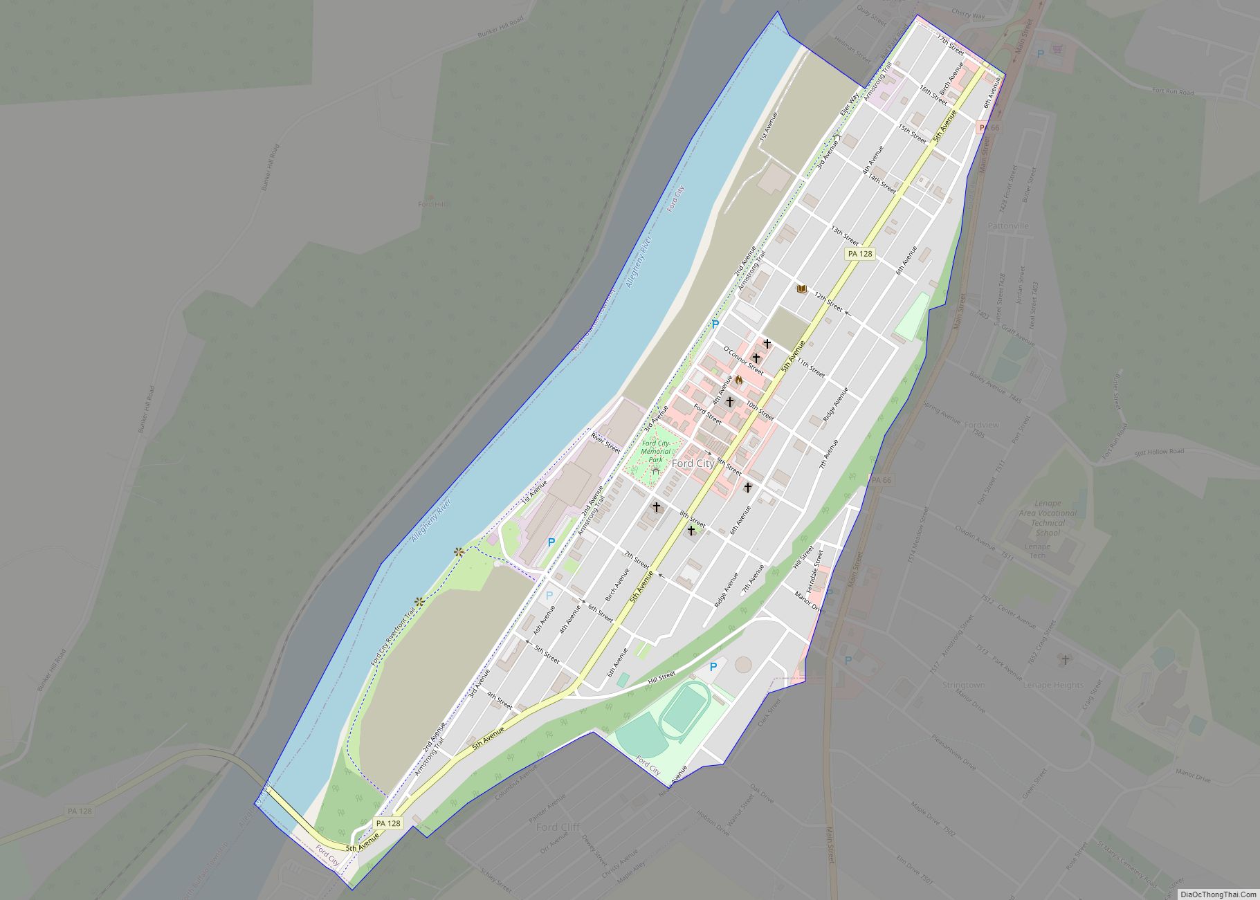
Three miles upriver from Kittanning is Ford City. Incorporated in 1887, Ford City was a company town for John Baptiste Ford’s renowned plate-glass industry, known today as Pittsburgh Plate Glass PPG Industries, a Fortune 500 Company. Eljer also operated a production facility along the river in Ford City that made ceramic toilets. The two companies employed nearly 10,000 people at the height of Armstrong County’s economy. Today, Ford City is a struggling, yet proud community that finds ways to keep its economy and heritage alive through creative businesses and lively festivals. In addition, Ford City is the future site of the Armstrong campus of Butler County Community College (BC3) – consistently ranked the Best Community College in Pennsylvania.
Armstrong County is home to the City of Parker, an incorporated third-class city, which was an oil boom town with a population rumored to be approximately 20,000 in 1873, but now is the “Smallest City in America” with a population of just under 800. Parker is located in the extreme northwest portion of the county.
Iron was made in the Brady’s Bend area of the county twenty years before there was a foundry in Pittsburgh doing so.
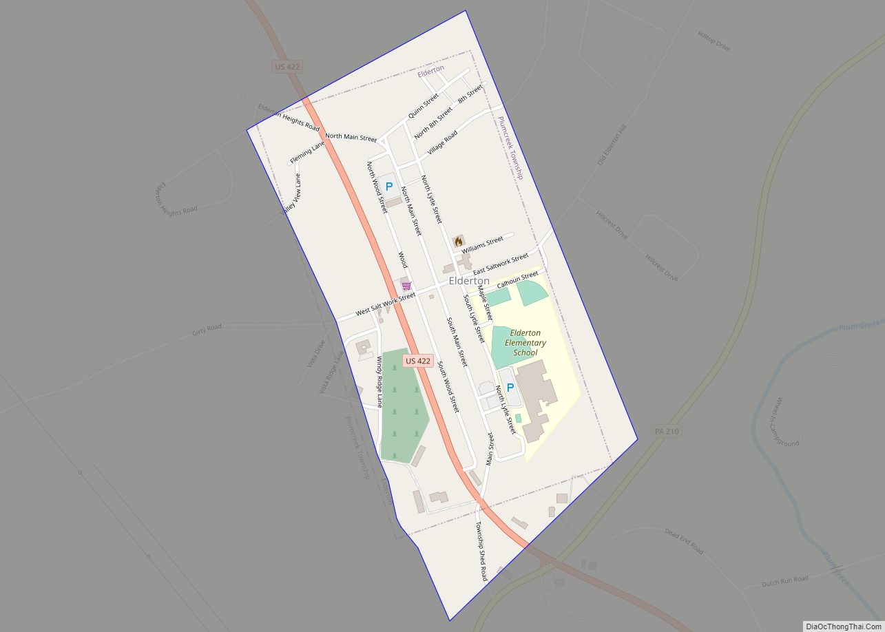
Elderton, whose name is derived from the famous resident of the area, Sara Elder, is a small community, home to the former Elderton Jr/Sr High School.
In 1869, Leechburg was the first place in the United States to use natural gas for metallurgical purposes. Natural gas was found while drilling for oil, and eventually introduced into the boilers and furnaces of Siberian Iron Works.
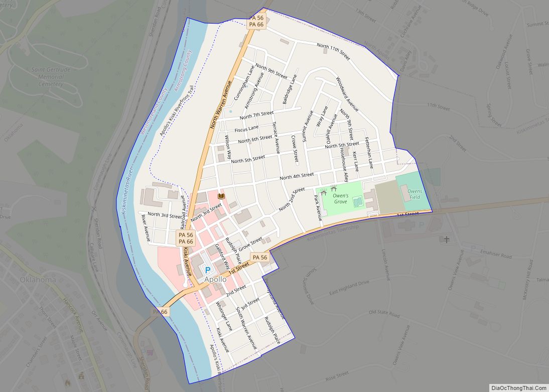
Freeport, Leechburg, and Apollo were communities built along the Pennsylvania Canal, which passed through on the Allegheny and Kiskiminetas rivers, at the southern border of the county.
Worthington is the county’s primary agricultural hub and lies just west of Kittanning along Route 422.
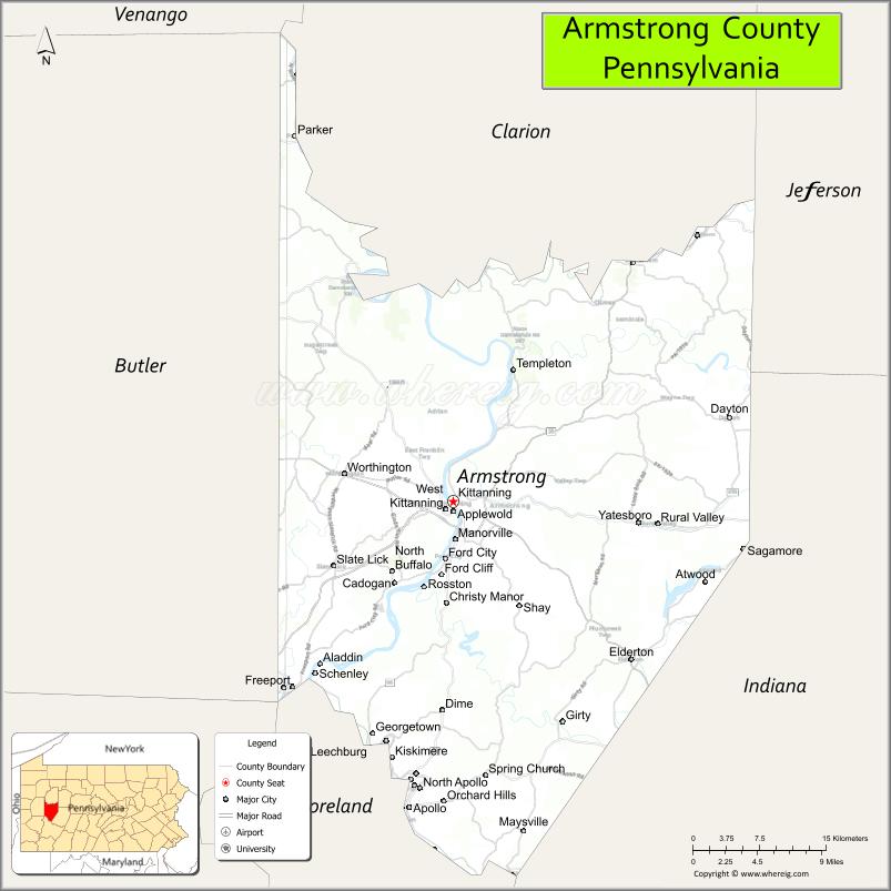
Armstrong County Road Map
Geography
According to the U.S. Census Bureau, the county has a total area of 664 square miles (1,720 km), of which 653 square miles (1,690 km) is land and 11 square miles (28 km) (1.6%) is water.
Streams
The Allegheny and Kiskiminetas rivers; Buffalo, Crooked, Cowanshannock, Redbank, and Mahoning creeks; and Carnahan Run, among others, have watersheds within the county. The Murphy, Nicholson, Ross, and Cogley islands are in the Allegheny in Armstrong County.
Scrubgrass Creek arises in Wayne Township and flows through Boggs Township, passing Goheenville, to Pine Township where it empties into the Mahoning Creek at Mahoning Station.
Sugar Creek flows through Bradys Bend Township where it empties into the Allegheny River. Its tributaries include Cove Run, Hart Run, Holder Run, Long Run, Pine Run, and Whiskey Run.
Adjacent counties
- Clarion County (north)
- Jefferson County (northeast)
- Indiana County (east)
- Westmoreland County (south)
- Allegheny County (southwest)
- Butler County (west)
- Venango County (northwest)
Major highways
- US 422
- PA 28
- PA 56
- PA 58
- PA 66
- PA 68
- PA 85
- PA 128
- PA 156
- PA 210
- PA 268
- PA 356
- PA 368
- PA 536
- PA 839
Climate
Armstrong has a humid continental climate (Dfa/Dfb). Average monthly temperatures in Kittanning range from 27.3 °F in January to 72.6 °F in July. [1]
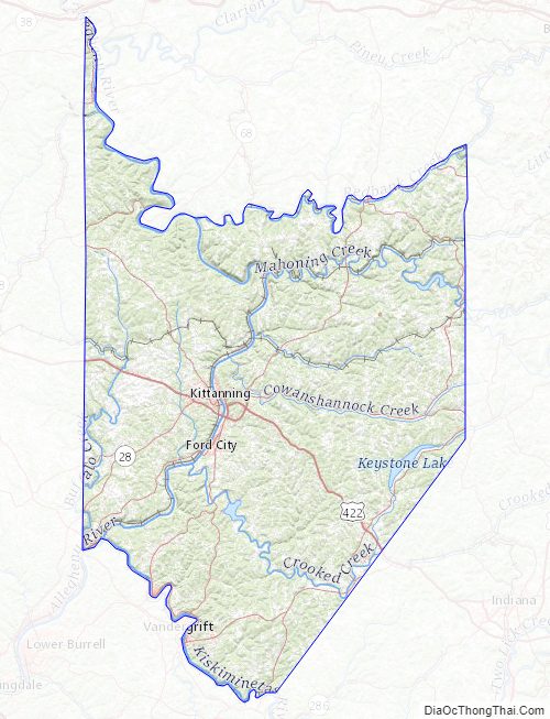
Armstrong County Topographic Map
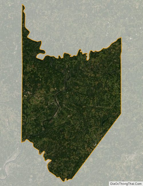
Armstrong County Satellite Map
Armstrong County Outline Map