Harrisburg is the capital city of the Commonwealth of Pennsylvania, United States, and the seat of Dauphin County. With a population of 50,135 as of 2021, Harrisburg is the ninth-largest city and 15th-largest municipality in Pennsylvania. Harrisburg is situated on the east bank of the Susquehanna River. It is the larger principal city of the Harrisburg–Carlisle metropolitan statistical area, also known as the Susquehanna Valley, which had a population of 591,712 as of 2020, making it the fourth-most populous metropolitan area in Pennsylvania after the Philadelphia, Pittsburgh, and Lehigh Valley metropolitan areas.
Harrisburg played a role in American history during the Westward Migration, the American Civil War, and the Industrial Revolution. During part of the 19th century, the building of the Pennsylvania Canal and later the Pennsylvania Railroad allowed Harrisburg to develop into one of the most industrialized cities in the Northeastern United States. In the mid-to-late 20th century, the city’s economic fortunes fluctuated with its major industries consisting of government, heavy manufacturing, agriculture, and food services. These economic fluctuations contributed to Harrisburg experiencing a decline of nearly half its population between 1950 and 2000.
The Pennsylvania Farm Show, the largest indoor agriculture exposition in the U.S., was first held in Harrisburg in 1917 and has been held there every early-to-mid January since. The city also hosts the annual Great American Outdoor Show, the largest of its kind in the world, among many other events. Harrisburg experienced the Three Mile Island accident on March 28, 1979, in nearby Middletown.
In 2010, Forbes rated Harrisburg as the second-best place in the U.S. to raise a family. Despite the city’s past financial troubles, in 2010 The Daily Beast website ranked 20 metropolitan areas across the country as being recession-proof, and the Harrisburg region was ranked seventh. The financial stability of the region is in part due to the high concentration of state and federal government agencies.
Harrisburg is located 83 miles (134 km) miles southwest of Allentown, Pennsylvania’s third-largest city, and 107 miles (172 km) northwest of Philadelphia, Pennsylvania’s largest city.
| Name: | Harrisburg city |
|---|---|
| LSAD Code: | 25 |
| LSAD Description: | city (suffix) |
| State: | Pennsylvania |
| County: | Dauphin County |
| Incorporated: | 1791; 232 years ago (1791) |
| Elevation: | 335 ft (102 m) |
| Land Area: | 8.12 sq mi (21.03 km²) |
| Water Area: | 3.75 sq mi (9.70 km²) |
| Population Density: | 6,174.26/sq mi (2,383.98/km²) |
| Area code: | 717 and 223 |
| FIPS code: | 4232800 |
| GNISfeature ID: | 1213649 |
| Website: | harrisburgpa.gov |
Online Interactive Map
Click on ![]() to view map in "full screen" mode.
to view map in "full screen" mode.
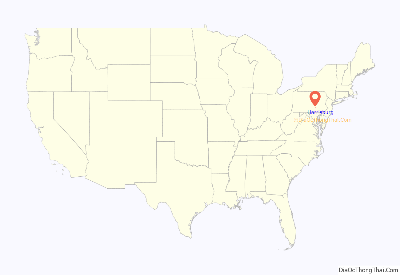
Harrisburg location map. Where is Harrisburg city?
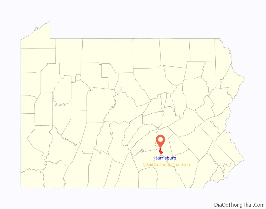
Harrisburg Road Map
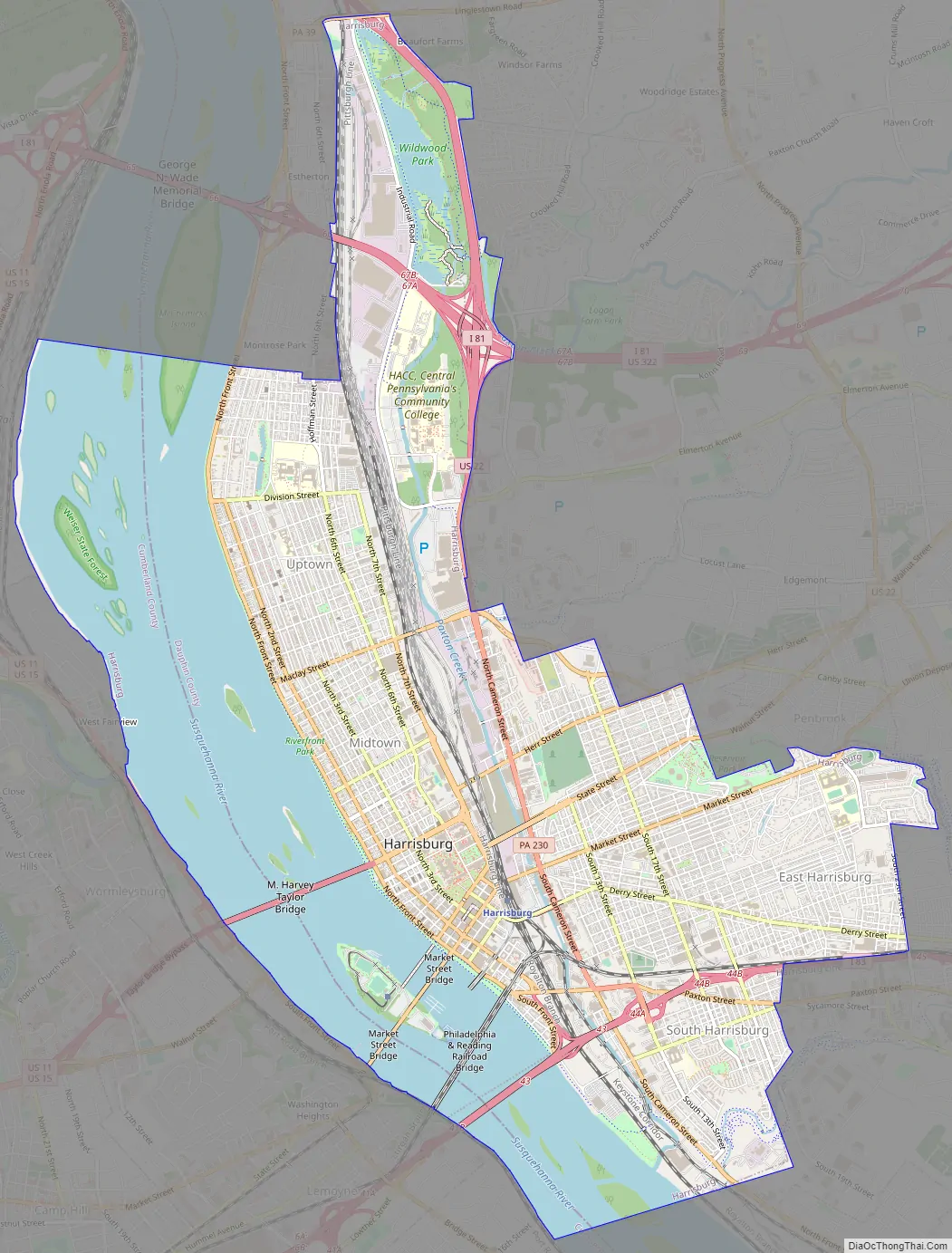
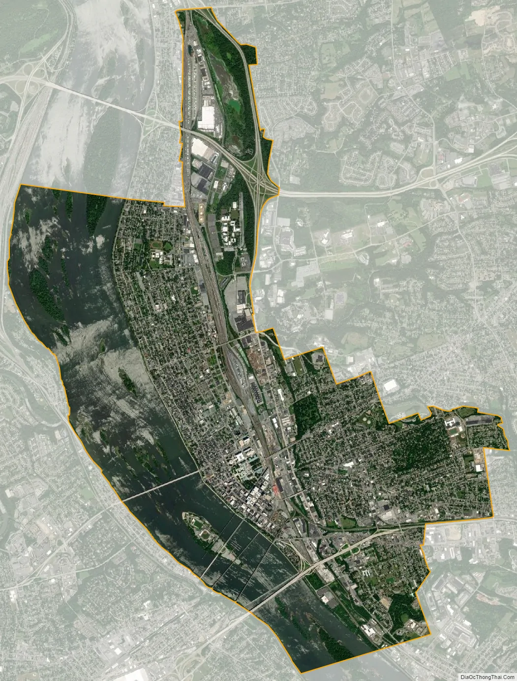
Harrisburg city Satellite Map
Geography
Topography
Harrisburg is located at 40°16′11″N 76°52′32″W / 40.26972°N 76.87556°W / 40.26972; -76.87556 (40.269789, -76.875613) in South Central Pennsylvania, within a two-hour drive of the metro areas of Baltimore, Washington, Philadelphia and three-hour drive of New York and Pittsburgh. According to the United States Census Bureau, the city has a total area of 11.4 square miles (30 km), of which 8.1 square miles (21 km) is land and 3.3 square miles (8.5 km) (29.11%) is water. Bodies of water include Paxton Creek, which empties into the Susquehanna River at Harrisburg, as well as Wildwood Lake and Italian Lake parks.
Directly to the north of Harrisburg is the Blue Mountain ridge of the Appalachian Mountains. The Cumberland Valley lies directly to the west of Harrisburg and the Susquehanna River, stretching into northern Maryland. The fertile Lebanon Valley lies to the east. Harrisburg is the northern fringe of the historic Pennsylvania Dutch Country.
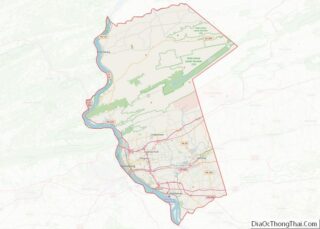
The city is the county seat of Dauphin County. The adjacent counties are Northumberland County to the north; Schuylkill County to the northeast; Lebanon County to the east; Lancaster County to the south; and York County to the southwest; Cumberland County to the west; and Perry County to the northwest.
Adjacent municipalities
Harrisburg’s western boundary is formed by the west shore of the Susquehanna River, which runs within the city boundaries and serves as the boundary between Dauphin and Cumberland counties. Harrisburg is divided into numerous neighborhoods and districts. Like many of Pennsylvania’s cities and boroughs that are at build-out stage, there are several townships outside of Harrisburg city limits that, although autonomous, use the name Harrisburg for postal and name-place designation. They include the townships of: Lower Paxton, Middle Paxton, Susquehanna, Swatara and West Hanover in Dauphin County. The borough of Penbrook, located just east of Reservoir Park, was previously known as East Harrisburg. Penbrook, along with the borough of Paxtang, also located just outside the city limits, maintain Harrisburg ZIP codes as well. The United States Postal Service designates 26 ZIP Codes for Harrisburg, including 13 for official use by federal and state government agencies.
Climate
Harrisburg has a variable, four-season climate lying at the beginning of the transition between the humid subtropical and humid continental zones (Köppen Cfa and Dfa, respectively). The city limits fall within the Cfa Humid subtropical climate classification, while the suburban areas and rural surroundings fall just into the Dfa Humid continental climate classification. The hottest month of the year is July, with a daily mean temperature of 77.5 °F (25.3 °C). Summer is usually hot and humid and occasional heat waves can occur. The city averages around 32 days per year with 90 °F (32 °C)+ highs, although temperatures reaching 100 °F (38 °C) are rare. Seven months average above 50 °F (10 °C) and three months average above 22 °C (71.6 °F.) The hottest temperature ever recorded in Harrisburg is 107 °F (42 °C) on July 3, 1966. Summer thunderstorms also occur relatively frequently. Autumn is a pleasant season, when the humidity and temperatures fall to more comfortable values. The hardiness zone is 7a/7b.
Winter in Harrisburg is mild to cool: January, the coolest month, remains above freezing, as it experiences a daily mean temperature of 32.6 °F (0.3 °C). A major snowstorm can also occasionally occur, and some winters snowfall totals can exceed 40 inches (102 cm), while in other winters, the region may receive very little snowfall. Snow that does fall often melts away quickly. The largest snowfall on a single calendar day was 26.4 in (67 cm) on January 23, 2016, recorded at Harrisburg International Airport in Middletown, while the snowiest month on record was February 2010, with 42.1 in (107 cm), recorded at the same location. Overall Harrisburg receives an average of 29.9 in (75.9 cm) of snow per winter. The coldest temperature ever recorded in Harrisburg was −22 °F (−30 °C) on January 21, 1994. Spring is also a pleasant time of year for outdoor activities. Precipitation is well-distributed and generous in most months, though July is clearly the wettest and February the driest.
See also
Map of Pennsylvania State and its subdivision:- Adams
- Allegheny
- Armstrong
- Beaver
- Bedford
- Berks
- Blair
- Bradford
- Bucks
- Butler
- Cambria
- Cameron
- Carbon
- Centre
- Chester
- Clarion
- Clearfield
- Clinton
- Columbia
- Crawford
- Cumberland
- Dauphin
- Delaware
- Elk
- Erie
- Fayette
- Forest
- Franklin
- Fulton
- Greene
- Huntingdon
- Indiana
- Jefferson
- Juniata
- Lackawanna
- Lancaster
- Lawrence
- Lebanon
- Lehigh
- Luzerne
- Lycoming
- Mc Kean
- Mercer
- Mifflin
- Monroe
- Montgomery
- Montour
- Northampton
- Northumberland
- Perry
- Philadelphia
- Pike
- Potter
- Schuylkill
- Snyder
- Somerset
- Sullivan
- Susquehanna
- Tioga
- Union
- Venango
- Warren
- Washington
- Wayne
- Westmoreland
- Wyoming
- York
- Alabama
- Alaska
- Arizona
- Arkansas
- California
- Colorado
- Connecticut
- Delaware
- District of Columbia
- Florida
- Georgia
- Hawaii
- Idaho
- Illinois
- Indiana
- Iowa
- Kansas
- Kentucky
- Louisiana
- Maine
- Maryland
- Massachusetts
- Michigan
- Minnesota
- Mississippi
- Missouri
- Montana
- Nebraska
- Nevada
- New Hampshire
- New Jersey
- New Mexico
- New York
- North Carolina
- North Dakota
- Ohio
- Oklahoma
- Oregon
- Pennsylvania
- Rhode Island
- South Carolina
- South Dakota
- Tennessee
- Texas
- Utah
- Vermont
- Virginia
- Washington
- West Virginia
- Wisconsin
- Wyoming