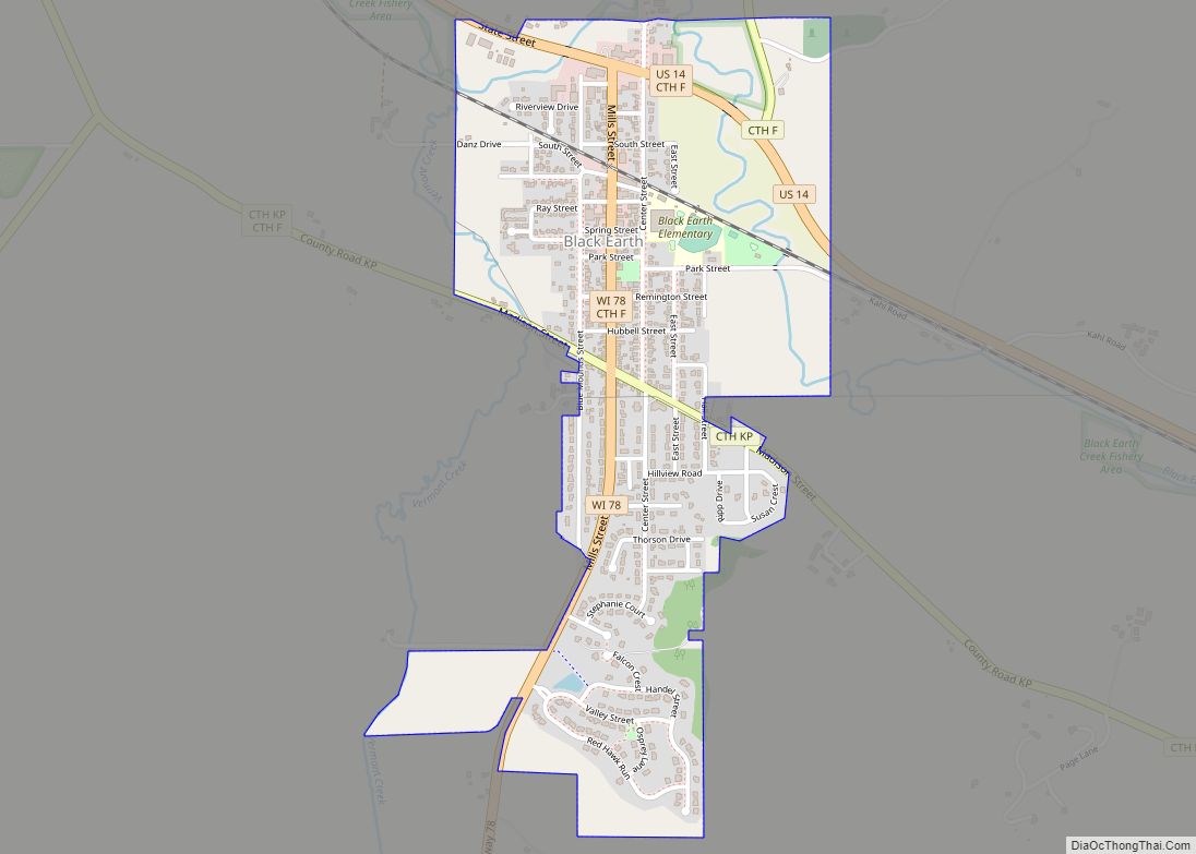
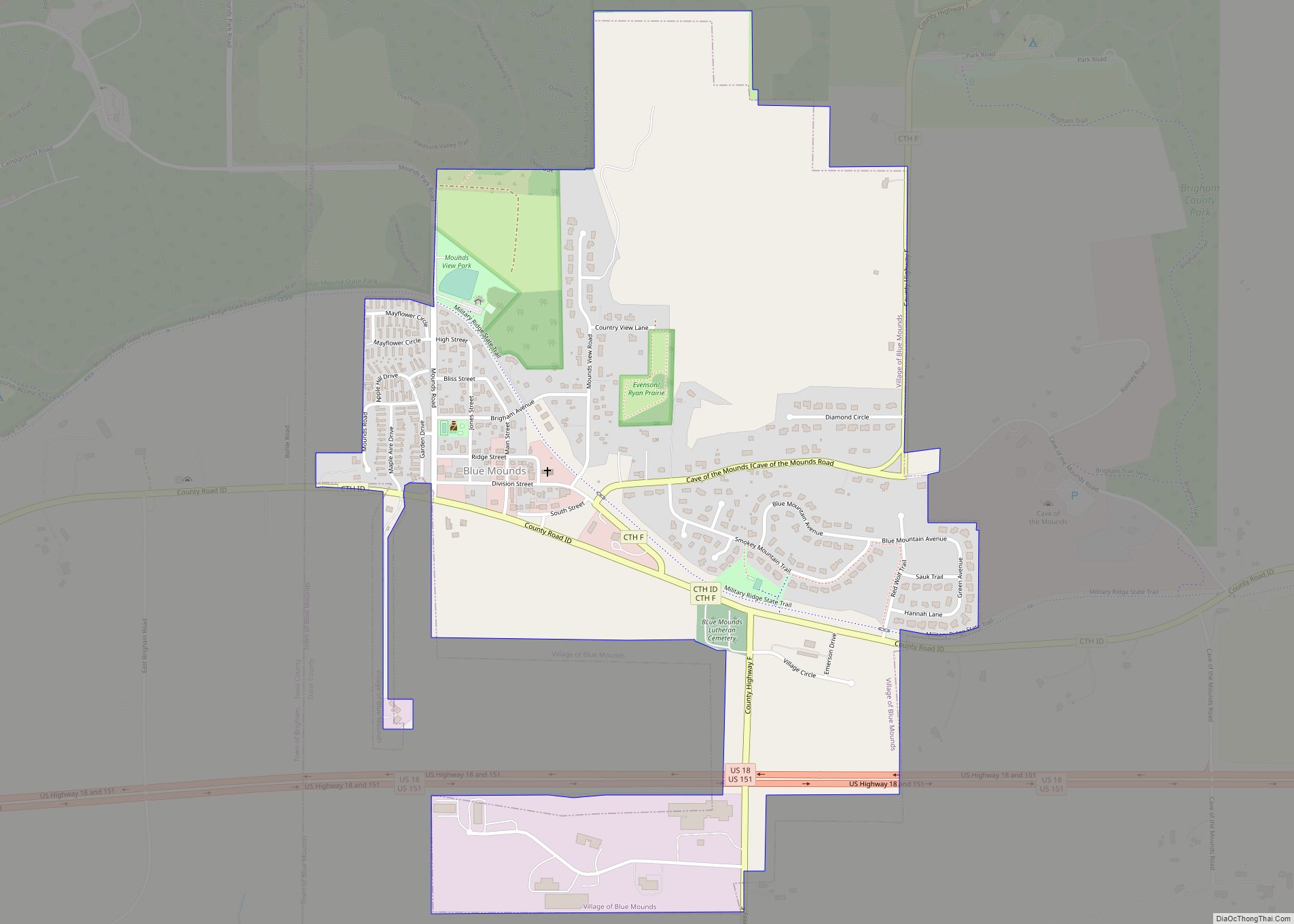
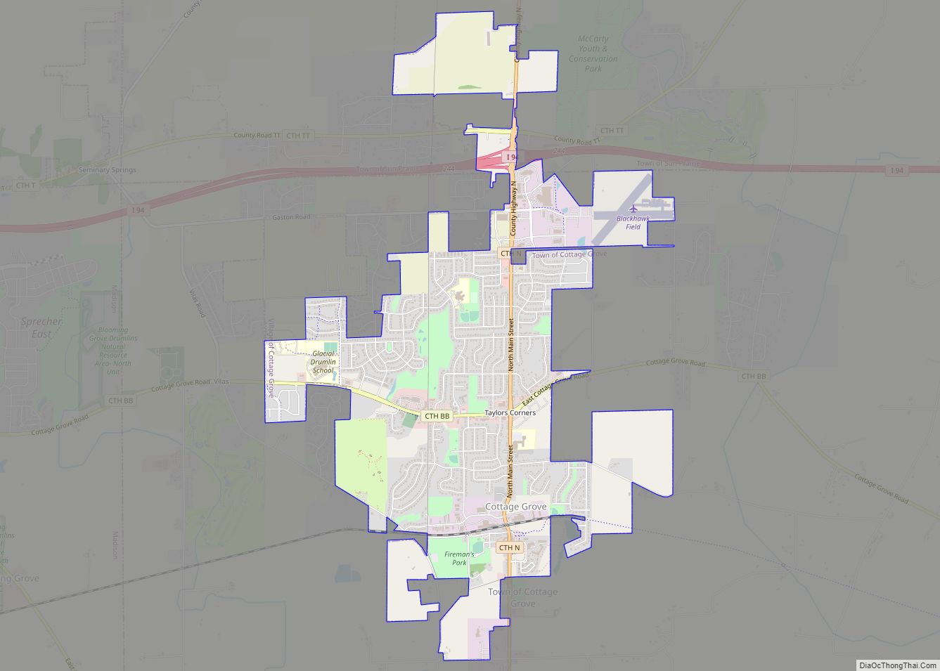
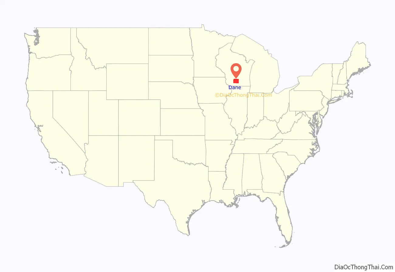
Dane County is a county in the U.S. state of Wisconsin. As of the 2020 census, the population was 561,504, making it the second-most populous county in Wisconsin. The county seat is Madison, which is also the state capital.
Dane County is the central county of the Madison, Wisconsin, Metropolitan Statistical Area, as well as the Madison-Janesville–Beloit Combined Statistical Area.
| Name: | Dane County |
|---|---|
| FIPS code: | 55-025 |
| State: | Wisconsin |
| Founded: | 1836 |
| Named for: | Nathan Dane |
| Seat: | Madison |
| Largest city: | Madison |
| Total Area: | 1,238 sq mi (3,210 km²) |
| Land Area: | 1,197 sq mi (3,100 km²) |
| Total Population: | 561,504 |
| Population Density: | 450/sq mi (180/km²) |
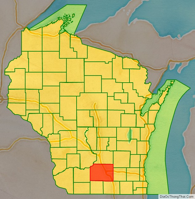
Dane County location map. Where is Dane County?
History
Dane County was formed in 1836 as a territorial county and organized in 1839. It was named after Nathan Dane, a Massachusetts delegate to the Congress of the Confederation who helped carve Wisconsin out of the Northwest Territory. Dane County was settled in the 1840s by settlers from New England.
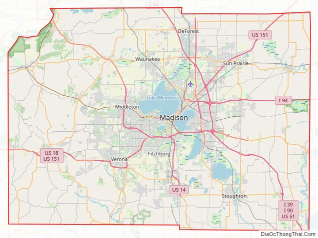
Dane County Road Map
Geography
According to the U.S. Census Bureau, the county has an area of 1,238 square miles (3,210 km), of which 1,197 square miles (3,100 km) is land and 41 square miles (110 km) (3.3%) is water.
Major highways
- Interstate 39
- Interstate 90
- Interstate 94
- U.S. Highway 12
- U.S. Highway 14
- U.S. Highway 18
- U.S. Highway 51
- U.S. Highway 151
- Highway 19 (Wisconsin)
- Highway 30 (Wisconsin)
- Highway 69 (Wisconsin)
- Highway 73 (Wisconsin)
- Highway 78 (Wisconsin)
- Highway 89 (Wisconsin)
- Highway 92 (Wisconsin)
- Highway 104 (Wisconsin)
- Highway 106 (Wisconsin)
- Highway 113 (Wisconsin)
- Highway 134 (Wisconsin)
- Highway 138 (Wisconsin)
- Highway 188 (Wisconsin)
Railroads
- Canadian Pacific
- Wisconsin and Southern Railroad
Buses
- Madison Metro
- List of intercity bus stops in Wisconsin
Airports
- Blackhawk Airfield (87Y)
- Dane County Regional Airport (MSN) provides commercial airline service.
- Middleton Municipal Airport (C29)
- Verona Airport (W19)
- Waunakee Airport (6P3)
Adjacent counties
- Columbia County (north)
- Dodge County (northeast)
- Green County (south)
- Iowa County (west)
- Jefferson County (east)
- Rock County (southeast)
- Sauk County (northwest)
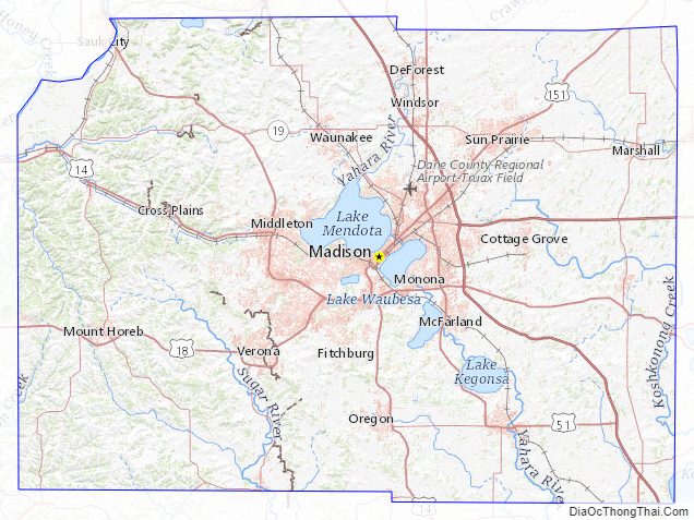
Dane County Topographic Map
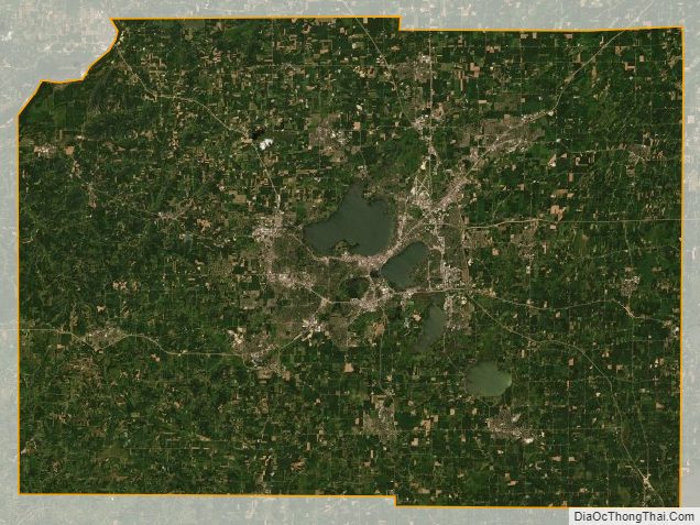
Dane County Satellite Map
Dane County Outline Map