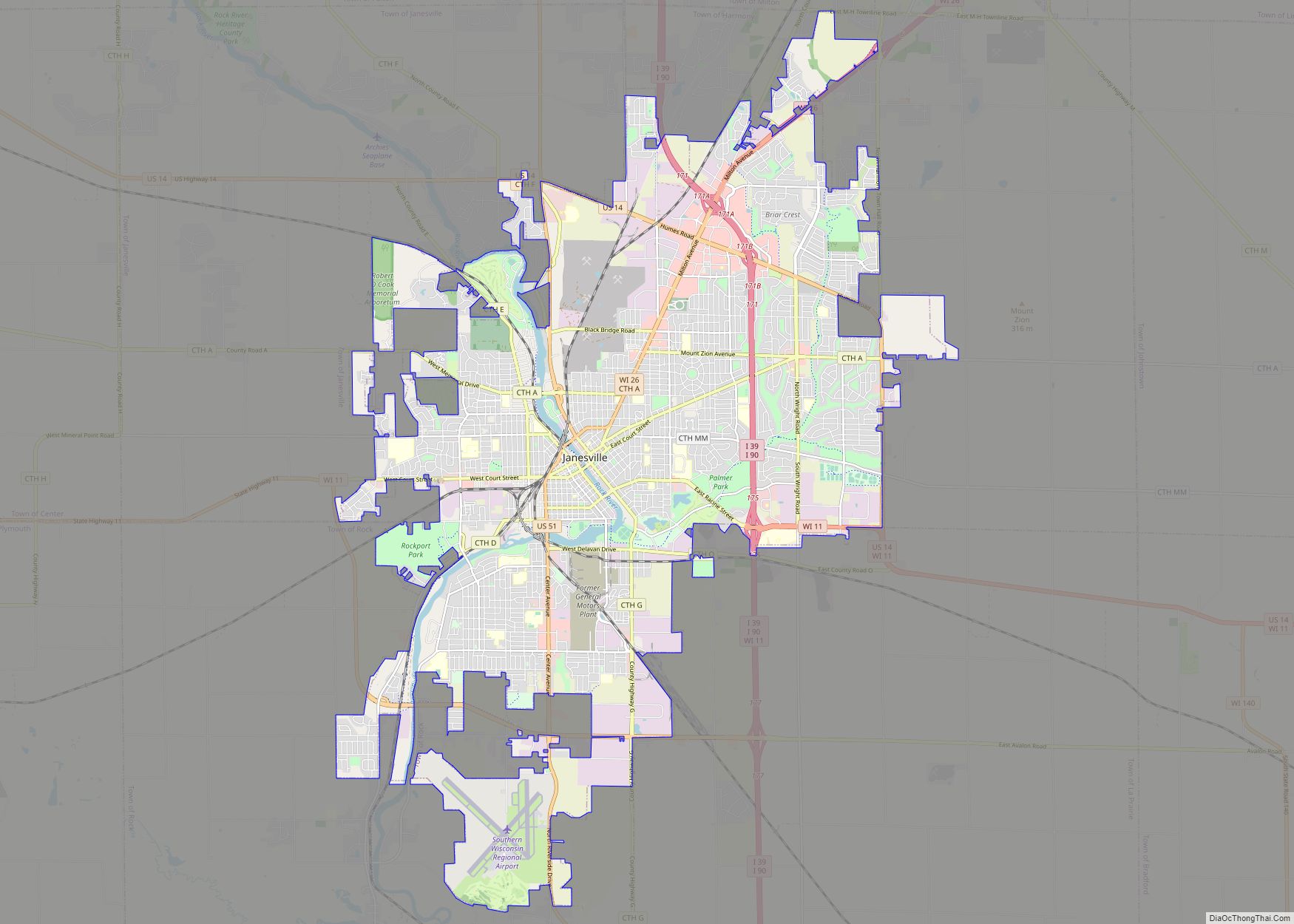
Janesville is a city in Rock County, Wisconsin, United States. It is the county seat and largest city in the county. It is a principal municipality of the Janesville, Wisconsin, Metropolitan Statistical Area and is included in the Madison–Janesville–Beloit, WI Combined Statistical Area. As of the 2020 census, the city had a population of 65,615.
| Name: | Janesville city |
|---|---|
| LSAD Code: | 25 |
| LSAD Description: | city (suffix) |
| State: | Wisconsin |
| County: | Rock County |
| Incorporated: | 1853 |
| Land Area: | 34.16 sq mi (88.47 km²) |
| Water Area: | 0.60 sq mi (1.56 km²) |
| Population Density: | 1,890.37/sq mi (729.87/km²) |
| Area code: | 608 |
| FIPS code: | 5537825 |
| Website: | www.janesvillewi.gov |
Online Interactive Map
Click on ![]() to view map in "full screen" mode.
to view map in "full screen" mode.
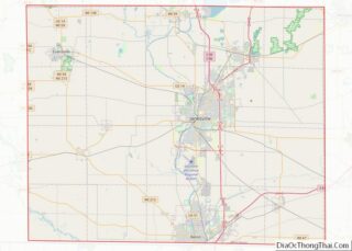
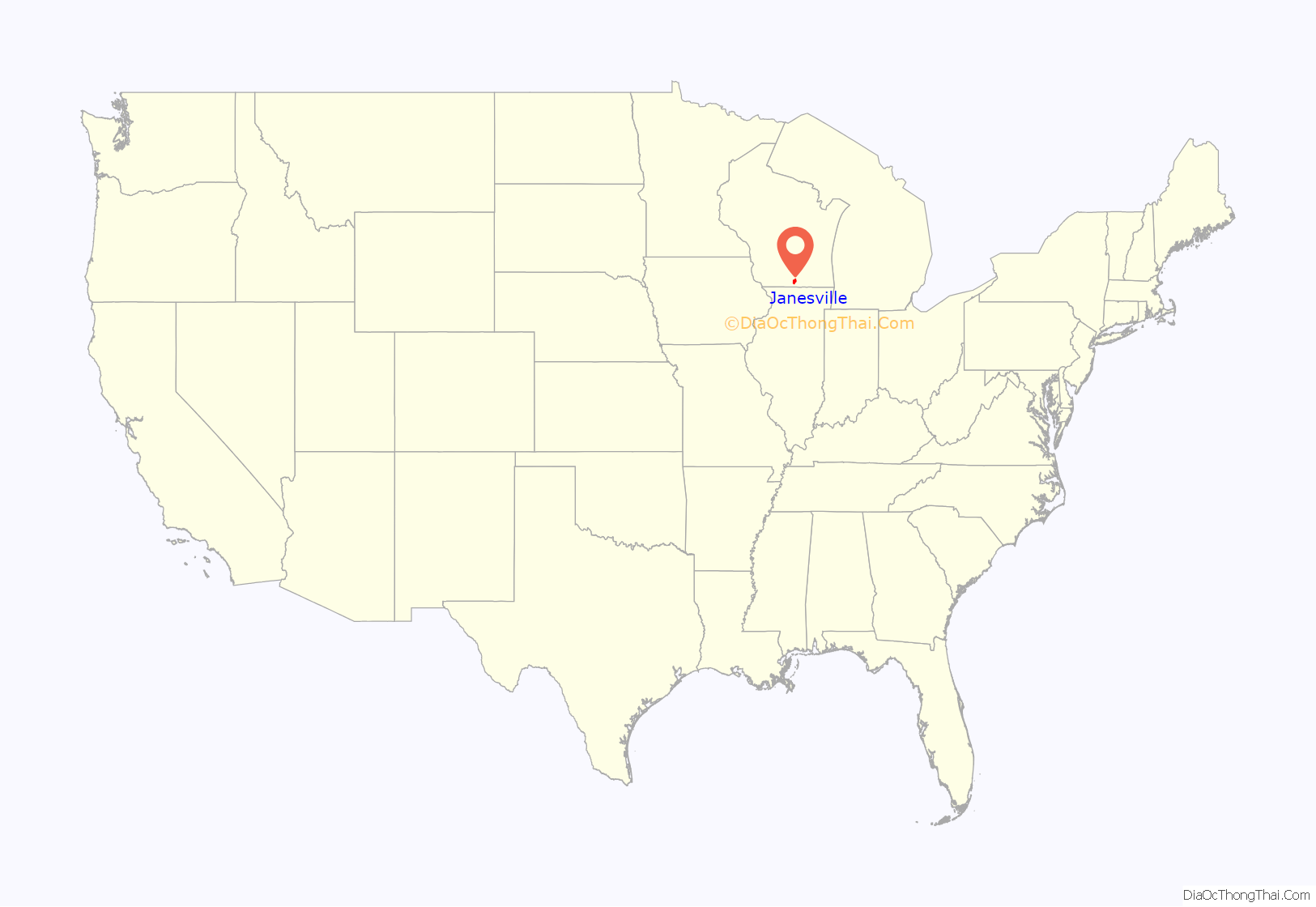
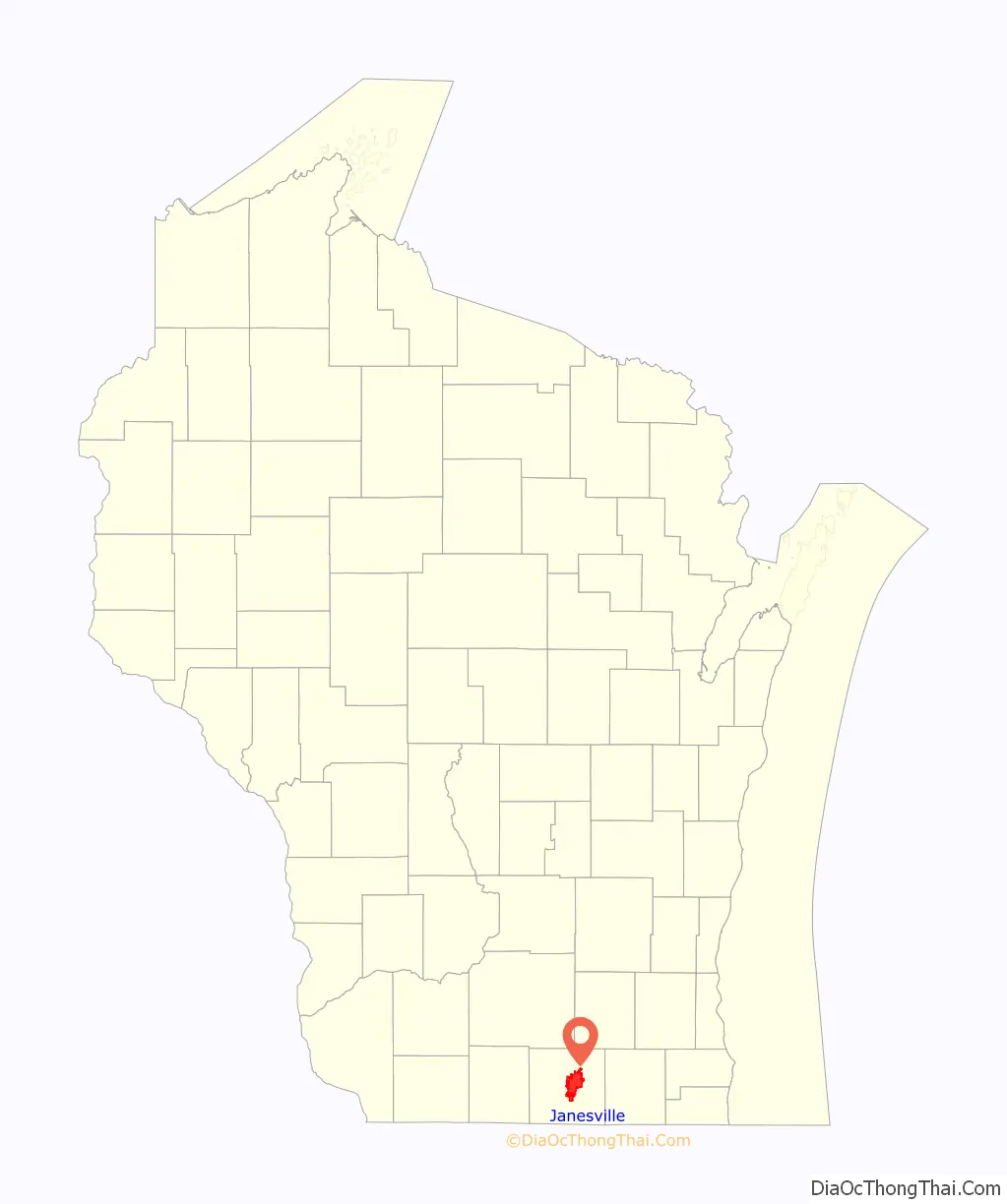
Janesville location map. Where is Janesville city?
History
The area that became Janesville was the site of a Ho-Chunk village named Įnį poroporo (Round Rock) up to the time of Euro-American settlement. In the 1825 Treaty of Prairie du Chien, the United States recognized the portion of the present city that lies west of the Rock River as Ho-Chunk territory, while the area east of the river was recognized as Potawatomi land. Following the Indian Removal Act of 1830 and the Black Hawk War of 1832, both nations were forced to surrender this land to the United States.
American settlers John Inman, George Follmer, Joshua Holmes, and William Holmes, Jr. built a crude log cabin in the region in 1835. Later that year, one key settler, Henry F. Janes, a native of Virginia who was a self-proclaimed woodsman and early city planner, arrived in what is now Rock County. Janes initially wanted to name the budding village “Blackhawk,” after the famous Sauk leader, Chief Black Hawk, but was turned down by Post Office officials. After some discussion, it was settled that the town would be named after Janes himself and thus, in 1835, Janesville was founded. Despite being named after a Virginian, Janesville was founded by old stock Yankee immigrants, descended from the English Puritans who settled New England in the 1600s. The completion of the Erie Canal caused a surge in New Englander immigration to what was then the Northwest Territory. Some of them were from upstate New York, and had parents who had moved to that region from New England shortly after the Revolutionary War. New Englanders, and New England transplants from upstate New York, were the vast majority of Janesville’s inhabitants during the first several decades of its history. Land surveys encouraged pioneers to settle in the area among the abundance of fertile farmland and woodlands. Many of these early settlers established farms and began cultivating wheat and other grains.
Some of the key settlers hailed from the burned-over district of western New York State, (an area notable for being a part of the Christian revival movement known as the Second Great Awakening). Some of those in that revival movement were also active in the abolitionist and women’s rights movements. One of the settlers in Janesville was William Tallman, who hailed from Rome, New York. Tallman came to the area in 1850 and bought up large tracts of land in hopes of inspiring his fellow New Yorkers to settle in the fertile Rock County. He established himself as one of the most influential and affluent members of the budding Janesville populace. He was passionate about the call for abolition and became a supporter of the Republican Party. One of the crowning moments in Tallman’s life was when he convinced the up-and-coming Illinois Republican, Abraham Lincoln, to speak in Janesville in 1859. The Tallman house is now a historical landmark, and best known as “The place where Abraham Lincoln slept.” As the population grew in the Janesville area, several new industries began cropping up along the Rock River, including flour and lumber mills. The first dam was built in 1844.
Janesville was very active during the Civil War. Local farms sold grains to the Union army, and Rock County was one of the counties in Wisconsin with the highest number of men enlisted. Thomas H. Ruger, of Janesville, served in the war, along with his brothers, Edward, William, and Henry, and he rose to the rank of brigadier general. Ruger later served as military governor of Georgia, and commandant of West Point. He is memorialized at Fort Ruger in Diamond Head, Hawaii.
After the Civil War, Janesville’s agriculture continued to surge and a greater demand for new farming technology led to the development of several foundries and farm machine manufacturers in the area, including the Janesville Machine Company, and the Rock River Iron Works. With the boom in the farm service sector and establishment of a rail system, Janesville soon began to ship goods to and from prominent eastern cities, including New York, Boston, and Philadelphia. After decades of rigorous grain farming, the soil quality around Janesville began to degrade. Farmers responded to this by planting tobacco, which became one of the most profitable and prolific crops grown in Wisconsin during the late 19th century.
Another development during the mid-19th century was the establishment of a women’s rights movement in Janesville. The movement was founded in the 1850s and continued after the Civil War. One of the key focuses of the group during the 1870s was the Temperance movement.
In the late 1880s, German immigrants began to arrive in Janesville in large numbers (making up less than 5% of the town before this time). They were the largest non-English-speaking group to settle there. Unlike in some other areas, in Janesville, they experienced virtually no hostility or xenophobia. Janesville’s founding English-Puritan-descended Yankee population welcomed them with open arms, with many writing back to relatives in Germany enthusiastically. This led to chain migration which increased the German population of the town. Only one German-language newspaper was founded in the town; it was known as The Janesville Journal, and began in 1889, printing for only a few years.
In the late 19th and early 20th centuries, the Milwaukee Road and Chicago and North Western railroads had freight and passenger rail connections to the city. Passenger rail service continued until 1971.
One of the key developments in Janesville’s history was the establishment of a General Motors plant in 1919. The plant was initially established to produce Samson tractors, a company acquired by GM co-founder William C. Durant. Durant was encouraged by Joseph Craig, the president of Janesville Machine, to build a plant to produce the Samson tractors in Janesville, to which Durant agreed. In the years following World War I, the demand for tractors plummeted and the plant shifted its focus to the production of automobiles.
One of the most prominent turns of the century figures in Janesville was George Parker, who developed new pen technologies and styles and eventually established the Parker Pen Company. His developments included the “lucky curve” ink feed system and the “trench pen”—a pen commissioned by the U.S. Army for use in World War I. Parker designed and established a headquarters and factory in downtown Janesville. The Parker Pen Company was handed down to George’s son, Ken, who developed the revolutionary “Parker 51” in the 1940s. A Parker pen was used by Dwight D. Eisenhower to sign Germany’s Armistice agreement to end World War II in Europe, and subsequently General Douglas MacArthur used his 20-year-old Parker Duofold in the signing of Japan’s surrender at the end of the War in the Pacific. The Parker Pen Company was one of the top employers in the area for over 70 years. The company was eventually sold off in a leveraged buyout in the 1980s.
Another important figure in Janesville’s history was John Nolen, who was hired by the city in 1919. Nolen was a city planner who saw the Rock River as a focal point for community and park development. His park planning established Janesville as the “City of Parks.”
Janesville was the site of the first Wisconsin State Fair in 1851, attended by approximately 10,000 people.
A tree that once stood in downtown Courthouse Park was the site of a lynch mob that, on their second attempt, having been rebuffed by an opposing crowd the day before, hanged a convicted murderer in 1859. Janesville had a “Peace Park” with a playground and a peace pole, which when constructed was the tallest in the world and is now the second tallest.
Janesville developed its first flag in 2015 in a design contest held in Janesville’s schools. The flag represents the community’s past, present, and future, with 1853 representing the year Janesville was incorporated, four stars symbolizing the city’s four original wards, a green background standing for the community’s agricultural industry, and black representing both the rich soil for which Janesville is known, and the smoke that billowed from smokestacks as the community developed a manufacturing economy. The tree in the center is the city’s logo, representing Janesville’s slogan, “Wisconsin’s Park Place.”
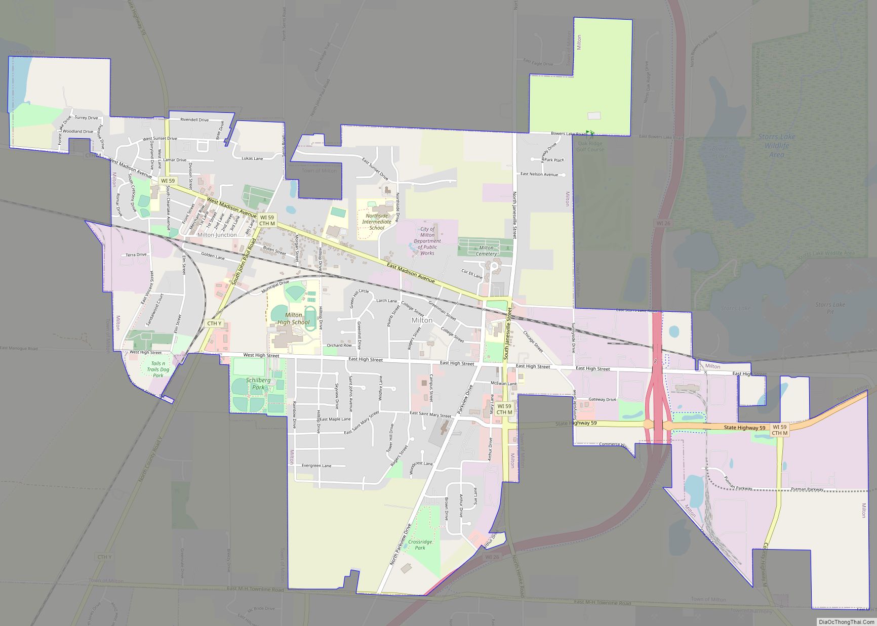
Janesville Road Map
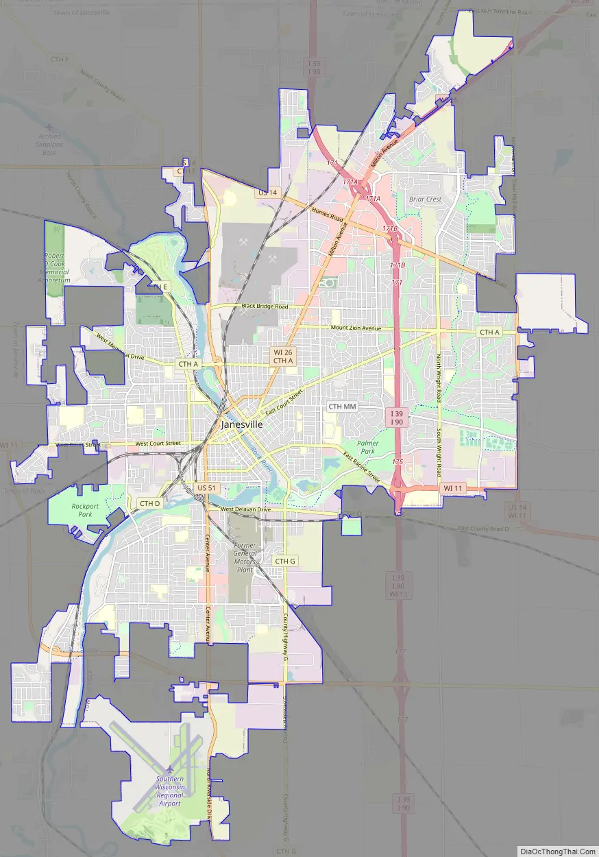
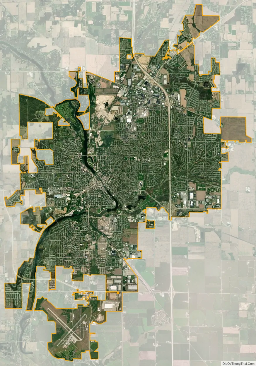
Janesville city Satellite Map
Geography
According to the United States Census Bureau, the city has a total area of 34.76 square miles (90.03 km), of which 34.16 square miles (88.47 km) is land and 0.6 square miles (1.55 km) is water. The city is divided by the Rock River.
Climate
Like the rest of Wisconsin the climate is humid continental, but its location is in the transition from warm to warm summers in the eastern and northern part of the state. Nowadays the city is the first choice, ie Dfa for Köppen classification where the hot season may not be so comfortable at times, although surges in the outskirts without UHI are in the Dfb zone. The city is at 5a / 5b in the USDA Plant Hardiness Zone.
See also
Map of Wisconsin State and its subdivision:- Adams
- Ashland
- Barron
- Bayfield
- Brown
- Buffalo
- Burnett
- Calumet
- Chippewa
- Clark
- Columbia
- Crawford
- Dane
- Dodge
- Door
- Douglas
- Dunn
- Eau Claire
- Florence
- Fond du Lac
- Forest
- Grant
- Green
- Green Lake
- Iowa
- Iron
- Jackson
- Jefferson
- Juneau
- Kenosha
- Kewaunee
- La Crosse
- Lafayette
- Lake Michigan
- Lake Superior
- Langlade
- Lincoln
- Manitowoc
- Marathon
- Marinette
- Marquette
- Menominee
- Milwaukee
- Monroe
- Oconto
- Oneida
- Outagamie
- Ozaukee
- Pepin
- Pierce
- Polk
- Portage
- Price
- Racine
- Richland
- Rock
- Rusk
- Saint Croix
- Sauk
- Sawyer
- Shawano
- Sheboygan
- Taylor
- Trempealeau
- Vernon
- Vilas
- Walworth
- Washburn
- Washington
- Waukesha
- Waupaca
- Waushara
- Winnebago
- Wood
- Alabama
- Alaska
- Arizona
- Arkansas
- California
- Colorado
- Connecticut
- Delaware
- District of Columbia
- Florida
- Georgia
- Hawaii
- Idaho
- Illinois
- Indiana
- Iowa
- Kansas
- Kentucky
- Louisiana
- Maine
- Maryland
- Massachusetts
- Michigan
- Minnesota
- Mississippi
- Missouri
- Montana
- Nebraska
- Nevada
- New Hampshire
- New Jersey
- New Mexico
- New York
- North Carolina
- North Dakota
- Ohio
- Oklahoma
- Oregon
- Pennsylvania
- Rhode Island
- South Carolina
- South Dakota
- Tennessee
- Texas
- Utah
- Vermont
- Virginia
- Washington
- West Virginia
- Wisconsin
- Wyoming