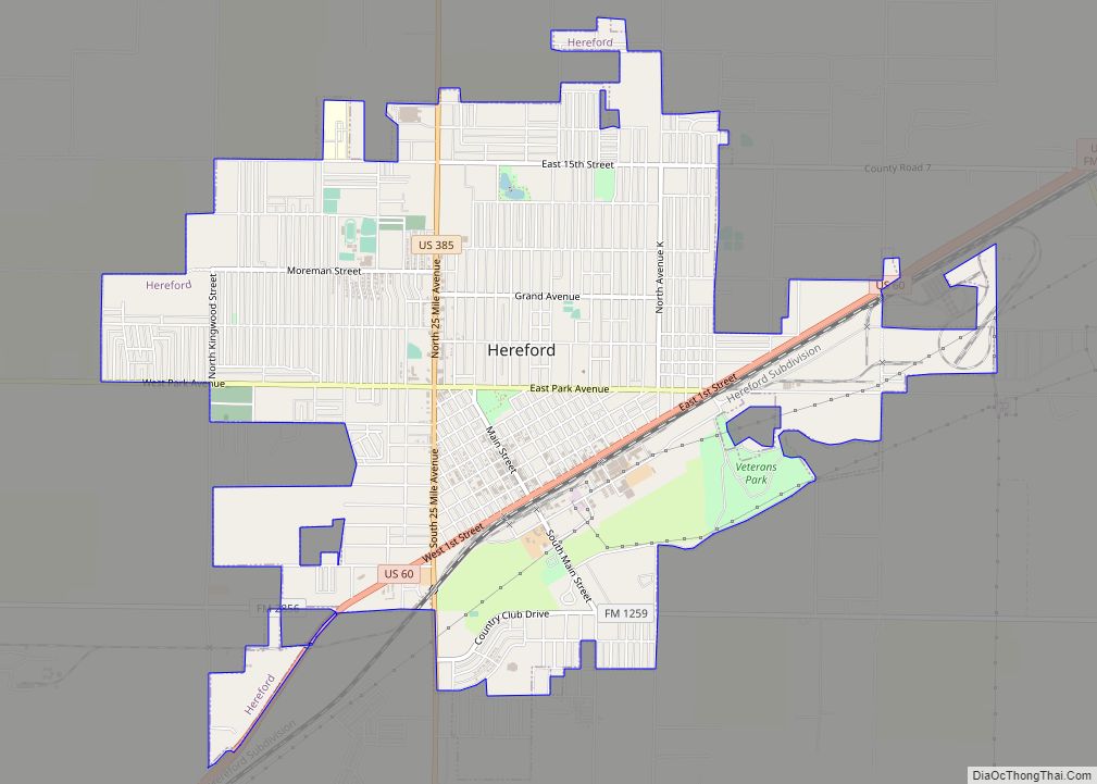
Deaf Smith County is a county located in the U.S. state of Texas. As of the 2020 census, the population was 18,583. The county seat is Hereford, which is known as the “Beef Capital of the World”. The county was created in 1876 and later organized in 1890.
The Hereford, TX Micropolitan Statistical Area includes all of Deaf Smith County.
| Name: | Deaf Smith County |
|---|---|
| FIPS code: | 48-117 |
| State: | Texas |
| Founded: | 1890 |
| Named for: | Deaf Smith |
| Seat: | Hereford |
| Largest city: | Hereford |
| Total Area: | 1,498 sq mi (3,880 km²) |
| Land Area: | 1,497 sq mi (3,880 km²) |
| Total Population: | 18,583 |
| Population Density: | 12/sq mi (4.8/km²) |
| Time zone: | UTC−6 (Central) |
| Summer Time Zone (DST): | UTC−5 (CDT) |
| Website: | www.co.deaf-smith.tx.us |
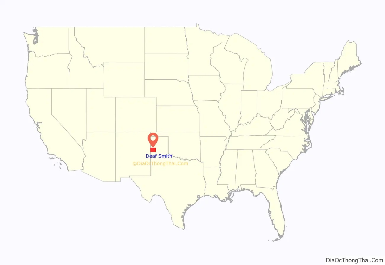
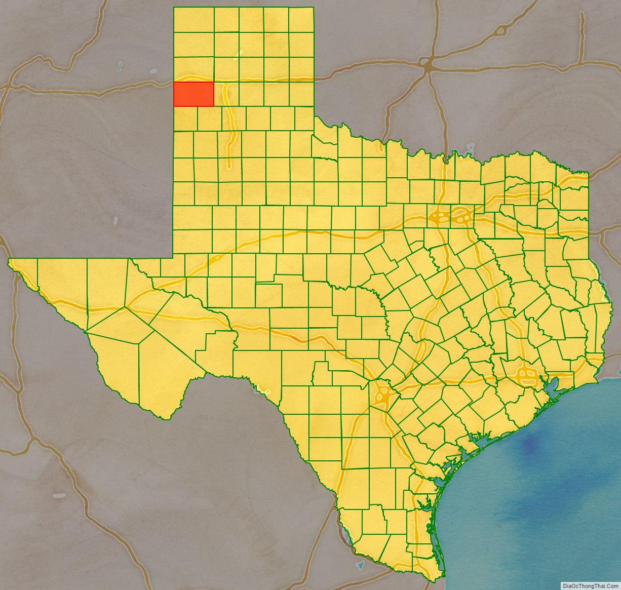
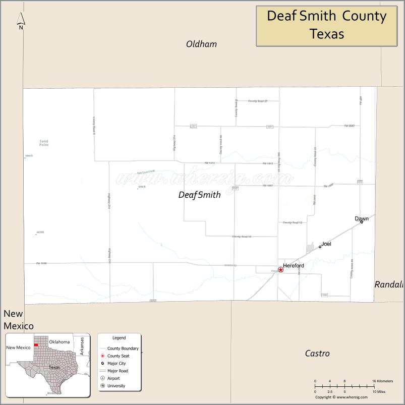
Deaf Smith County location map. Where is Deaf Smith County?
History
In 1876, the state legislature defined and named the county, but it was not organized until 1890, with the town of La Plata as the original county seat. The county was named for Erastus “Deaf” Smith (1787–1837), a partially deaf scout and soldier who served in the Texas Revolution, and was the first to reach the Alamo after its fall in 1836. The pronunciation of “Deaf”, as used by Smith himself, is /diːf/ DEEF; however, most residents pronounce it /dɛf/ DEF.
Deaf Smith as he appears at the Deaf Smith County Museum
The Deaf Smith County Historical Museum in Hereford
The Deaf Smith County Library formerly housed the National Cowgirl Hall of Fame on the ground floor. The museum is now located in a new building in the Historic District of Fort Worth.
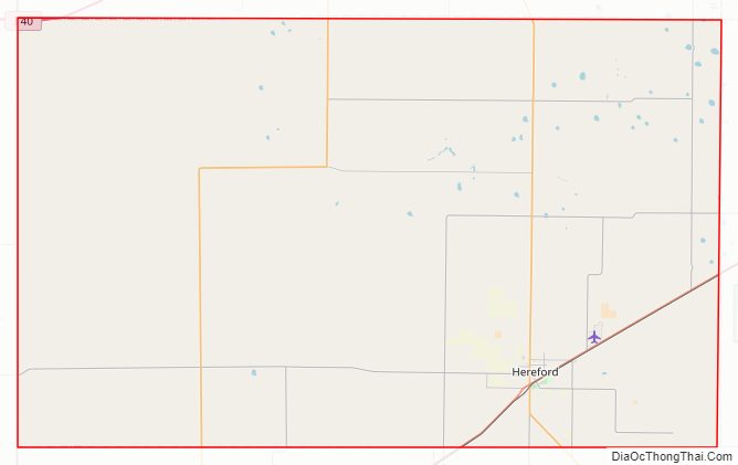
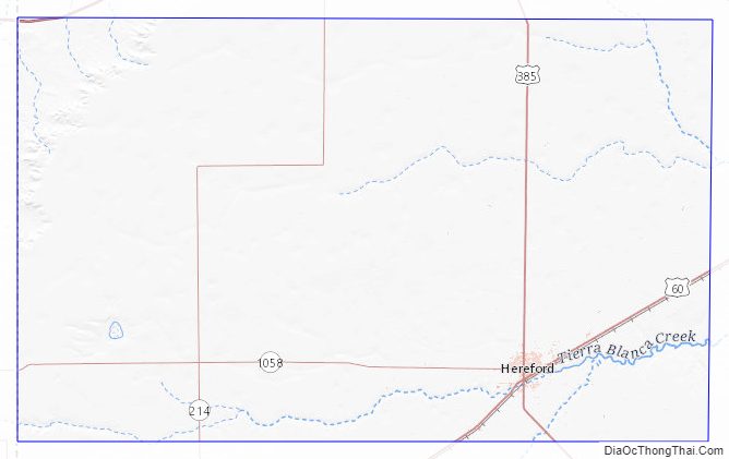
Deaf Smith County Road Map
Geography
According to the U.S. Census Bureau, the county has a total area of 1,498 sq mi (3,880 km), of which 1,497 sq mi (3,880 km) are land and 1.5 sq mi (3.9 km) (0.1%) are covered by water.
Major highways
- Interstate 40
- U.S. Highway 60
- U.S. Highway 385
- State Highway 214
Adjacent counties
- Oldham County (north)
- Potter County (northeast)
- Randall County (east)
- Castro County (southeast)
- Parmer County (south)
- Curry County, New Mexico (southwest/Mountain Time Zone)
- Quay County, New Mexico (west/Mountain Time Zone)
Deaf Smith County Topographic Map
Deaf Smith County Satellite Map
Deaf Smith County Outline Map