Hereford (/ˈhɜːrfərd/ HUR-furd) is a city in and county seat of Deaf Smith County, Texas, United States. It is 48 miles southwest of Amarillo. Its population was 15,370 at the 2010 census. It is the only incorporated locality named “Hereford” in the country.
Hereford’s local water supply contains an unusually high level of naturally occurring fluoride. Because fluoride is used to protect against tooth decay, Hereford earned the title “The Town Without a Toothache”.
It is also known as the “Beef Capital of the World” because of the large number of cattle feedlots in the area. The city is named for the Hereford breed. The local economy is affected significantly by growth in the dairy and ethanol industries.
The area is known for its semiarid climate, with heavy farming and ranching throughout the area sustained by irrigation from the Ogallala Aquifer and the saltier Santa Rosa Aquifer beneath it.
Hereford is home to the headquarters of the Deaf Smith Electric Cooperative, which serves Deaf Smith, Castro, Parmer, and Oldham Counties.
A rich Western heritage includes the Las Escarbadas ranch house of the XIT Ranch, once located southwest of Hereford. The restored historic structure can now be seen at the National Ranching Heritage Center at Texas Tech University in Lubbock. The Deaf Smith County Historical Museum at 400 Sampson Street in Hereford offers indoor and outdoor exhibits on the settlement of West Texas.
Hereford was once known as the “Windmill City” due to its many windmills supplying fresh water from the Ogallala Aquifer.
In December 2015, the Seattle Post-Intelligencer voted Hereford not only the “most conservative” city in Texas, but also in the United States, in terms of political contributions. Other West Texas communities in the most conservative lineup are Childress (number 9), Dalhart (number 8), and Monahans (number five). Princeton in Collin County north of Dallas was ranked number two. In contrast, Vashon Island, Washington, was named the “most liberal” city in the nation regarding political donations.
| Name: | Hereford city |
|---|---|
| LSAD Code: | 25 |
| LSAD Description: | city (suffix) |
| State: | Texas |
| County: | Deaf Smith County |
| Elevation: | 3,816 ft (1,163 m) |
| Total Area: | 6.30 sq mi (16.32 km²) |
| Land Area: | 6.30 sq mi (16.32 km²) |
| Water Area: | 0.00 sq mi (0.00 km²) |
| Total Population: | 15,370 |
| Population Density: | 2,320.22/sq mi (895.80/km²) |
| ZIP code: | 79045 |
| Area code: | 806 |
| FIPS code: | 4833320 |
| GNISfeature ID: | 1359066 |
| Website: | www.hereford-tx.gov |
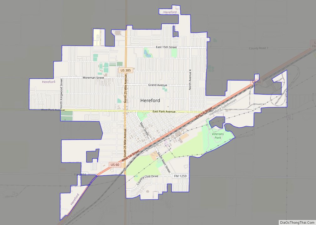
Online Interactive Map
Click on ![]() to view map in "full screen" mode.
to view map in "full screen" mode.
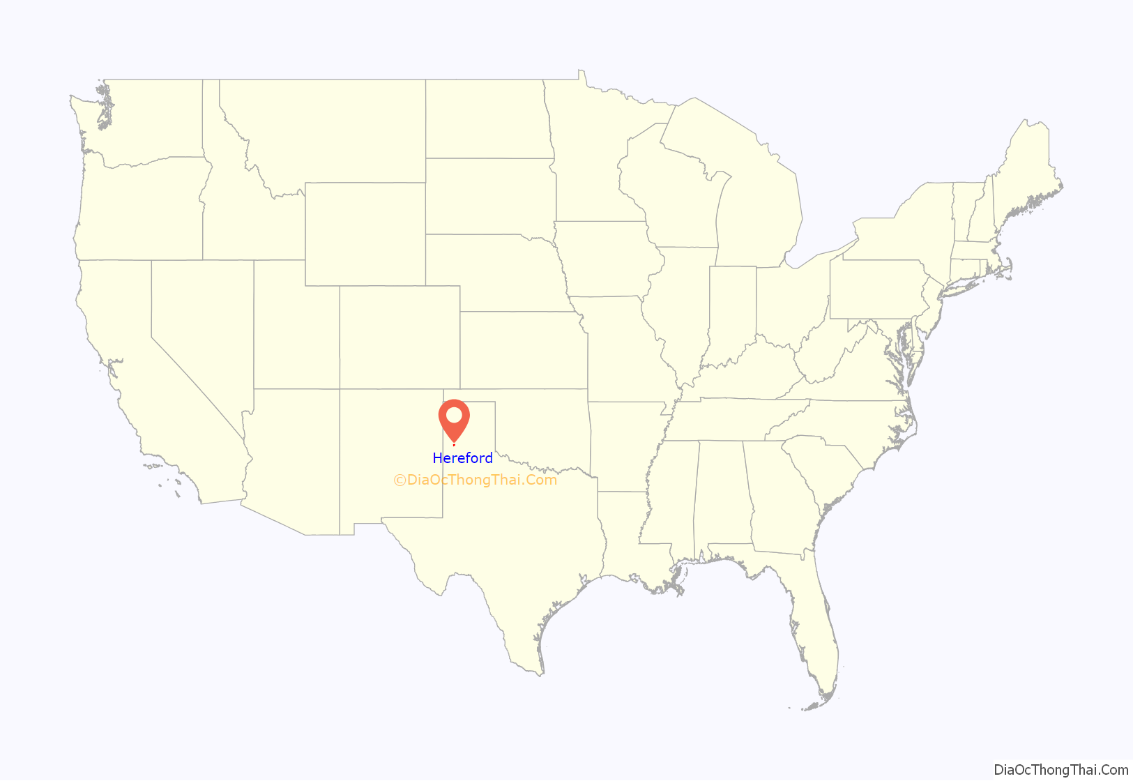
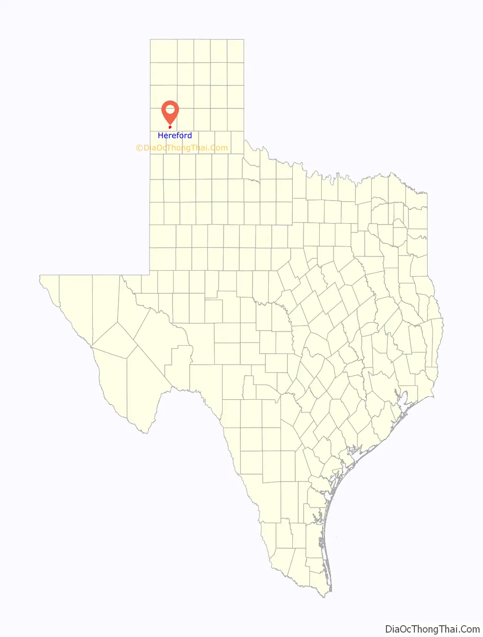
Hereford location map. Where is Hereford city?
History
Hereford was founded as “Blue Water” in 1899 after the Pecos and Northern Texas Railway connected Amarillo to Farwell. After a town already named Blue Water was discovered, residents renamed the town “Hereford” in honor of the cattle of the local ranchers and the city, Hereford, in the United Kingdom.
During World War II, a prisoner-of-war camp existed there for Italian prisoners of war. It was dismantled in 1947.
In 1975, popular high school teacher Wayne Woodward was fired for his efforts to establish a local branch of the American Civil Liberties Union. Mr. Woodward won a subsequent legal suit, that gained national attention, against the Hereford Independent School District. The events were documented in the 2022 book You Will Never Be One of Us by Timothy P. Bowman.
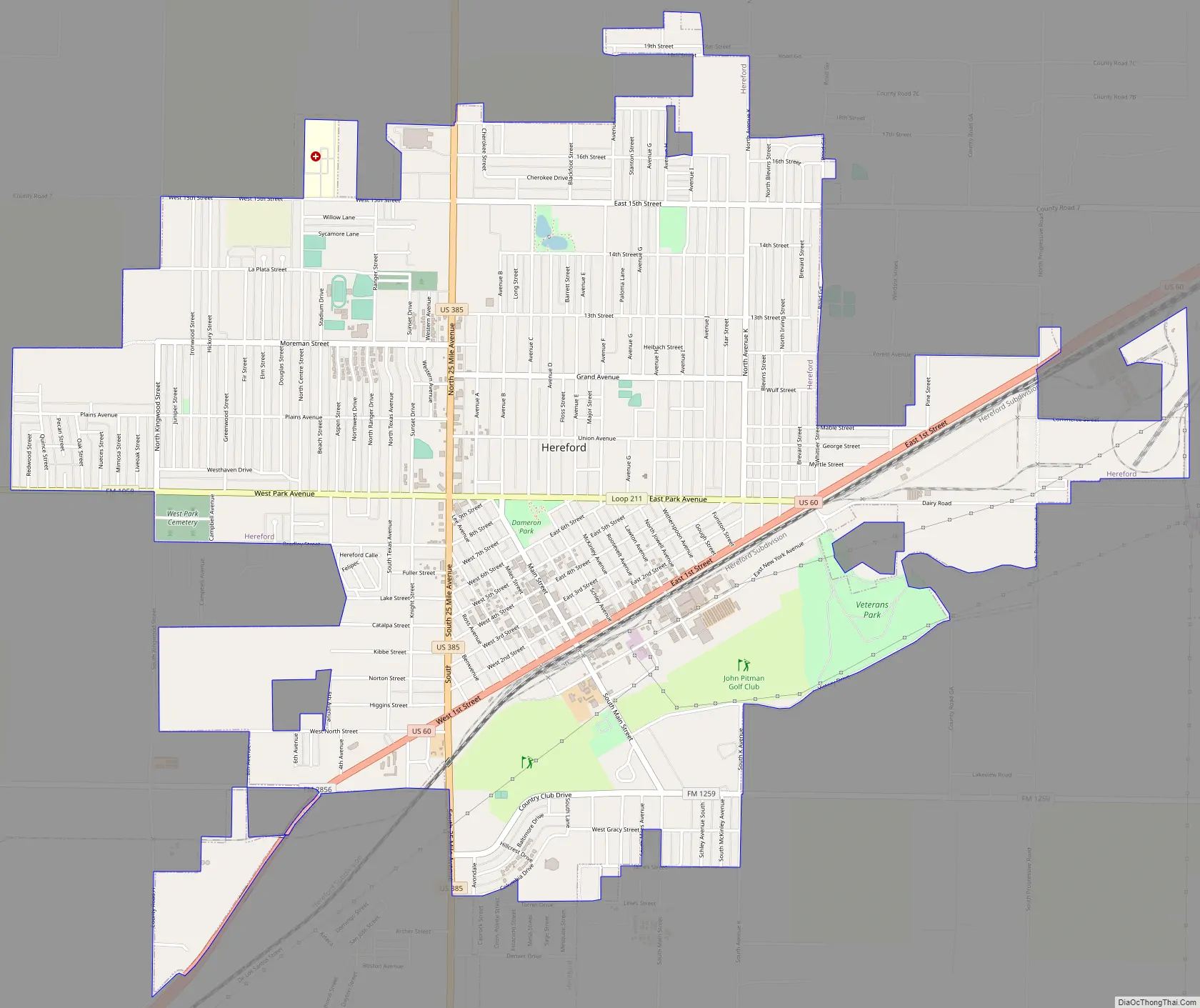
Hereford Road Map
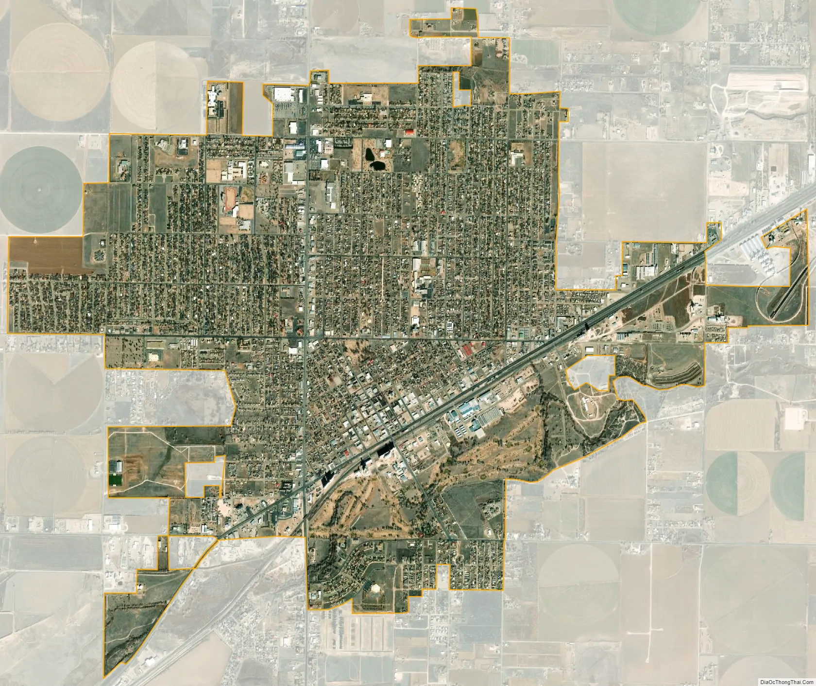
Hereford city Satellite Map
Geography
Hereford is located in southeastern Deaf Smith County at 34°49′19″N 102°23′55″W / 34.82194°N 102.39861°W / 34.82194; -102.39861 (34.821961, –102.398617) and is located on the Llano Estacado. According to the United States Census Bureau, the city has a total area of 5.9 square miles (15.4 km), all land.
U.S. Highway 60 passes through the city as 1st Street, leading northeast 48 miles (77 km) to Amarillo and southwest 57 miles (92 km) to Clovis, New Mexico. U.S. Highway 385 (25 Mile Avenue) runs north–south through the city, leading north 30 miles (48 km) to Interstate 40 at Vega and south 20 miles (32 km) to Dimmitt.
See also
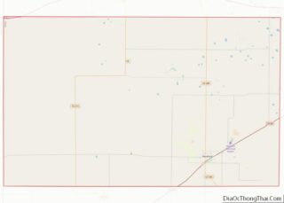
Map of Texas State and its subdivision:- Anderson
- Andrews
- Angelina
- Aransas
- Archer
- Armstrong
- Atascosa
- Austin
- Bailey
- Bandera
- Bastrop
- Baylor
- Bee
- Bell
- Bexar
- Blanco
- Borden
- Bosque
- Bowie
- Brazoria
- Brazos
- Brewster
- Briscoe
- Brooks
- Brown
- Burleson
- Burnet
- Caldwell
- Calhoun
- Callahan
- Cameron
- Camp
- Carson
- Cass
- Castro
- Chambers
- Cherokee
- Childress
- Clay
- Cochran
- Coke
- Coleman
- Collin
- Collingsworth
- Colorado
- Comal
- Comanche
- Concho
- Cooke
- Coryell
- Cottle
- Crane
- Crockett
- Crosby
- Culberson
- Dallam
- Dallas
- Dawson
- Deaf Smith
- Delta
- Denton
- Dewitt
- Dickens
- Dimmit
- Donley
- Duval
- Eastland
- Ector
- Edwards
- El Paso
- Ellis
- Erath
- Falls
- Fannin
- Fayette
- Fisher
- Floyd
- Foard
- Fort Bend
- Franklin
- Freestone
- Frio
- Gaines
- Galveston
- Garza
- Gillespie
- Glasscock
- Goliad
- Gonzales
- Gray
- Grayson
- Gregg
- Grimes
- Guadalupe
- Hale
- Hall
- Hamilton
- Hansford
- Hardeman
- Hardin
- Harris
- Harrison
- Hartley
- Haskell
- Hays
- Hemphill
- Henderson
- Hidalgo
- Hill
- Hockley
- Hood
- Hopkins
- Houston
- Howard
- Hudspeth
- Hunt
- Hutchinson
- Irion
- Jack
- Jackson
- Jasper
- Jeff Davis
- Jefferson
- Jim Hogg
- Jim Wells
- Johnson
- Jones
- Karnes
- Kaufman
- Kendall
- Kenedy
- Kent
- Kerr
- Kimble
- King
- Kinney
- Kleberg
- Knox
- La Salle
- Lamar
- Lamb
- Lampasas
- Lavaca
- Lee
- Leon
- Liberty
- Limestone
- Lipscomb
- Live Oak
- Llano
- Loving
- Lubbock
- Lynn
- Madison
- Marion
- Martin
- Mason
- Matagorda
- Maverick
- McCulloch
- McLennan
- McMullen
- Medina
- Menard
- Midland
- Milam
- Mills
- Mitchell
- Montague
- Montgomery
- Moore
- Morris
- Motley
- Nacogdoches
- Navarro
- Newton
- Nolan
- Nueces
- Ochiltree
- Oldham
- Orange
- Palo Pinto
- Panola
- Parker
- Parmer
- Pecos
- Polk
- Potter
- Presidio
- Rains
- Randall
- Reagan
- Real
- Red River
- Reeves
- Refugio
- Roberts
- Robertson
- Rockwall
- Runnels
- Rusk
- Sabine
- San Augustine
- San Jacinto
- San Patricio
- San Saba
- Schleicher
- Scurry
- Shackelford
- Shelby
- Sherman
- Smith
- Somervell
- Starr
- Stephens
- Sterling
- Stonewall
- Sutton
- Swisher
- Tarrant
- Taylor
- Terrell
- Terry
- Throckmorton
- Titus
- Tom Green
- Travis
- Trinity
- Tyler
- Upshur
- Upton
- Uvalde
- Val Verde
- Van Zandt
- Victoria
- Walker
- Waller
- Ward
- Washington
- Webb
- Wharton
- Wheeler
- Wichita
- Wilbarger
- Willacy
- Williamson
- Wilson
- Winkler
- Wise
- Wood
- Yoakum
- Young
- Zapata
- Zavala
- Alabama
- Alaska
- Arizona
- Arkansas
- California
- Colorado
- Connecticut
- Delaware
- District of Columbia
- Florida
- Georgia
- Hawaii
- Idaho
- Illinois
- Indiana
- Iowa
- Kansas
- Kentucky
- Louisiana
- Maine
- Maryland
- Massachusetts
- Michigan
- Minnesota
- Mississippi
- Missouri
- Montana
- Nebraska
- Nevada
- New Hampshire
- New Jersey
- New Mexico
- New York
- North Carolina
- North Dakota
- Ohio
- Oklahoma
- Oregon
- Pennsylvania
- Rhode Island
- South Carolina
- South Dakota
- Tennessee
- Texas
- Utah
- Vermont
- Virginia
- Washington
- West Virginia
- Wisconsin
- Wyoming