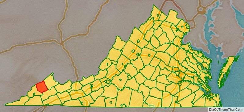
Dickenson County is a county located in the Commonwealth of Virginia. As of the 2020 census, the population was 14,124. Its county seat is Clintwood.
| Name: | Dickenson County |
|---|---|
| FIPS code: | 51-051 |
| State: | Virginia |
| Founded: | 1880 |
| Named for: | William J. Dickenson |
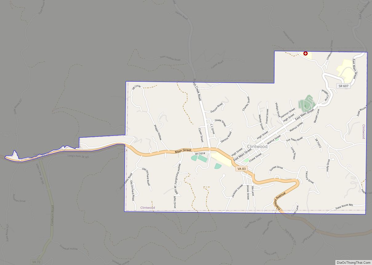
| Seat: | Clintwood |
| Largest town: | Clintwood |
| Total Area: | 334 sq mi (870 km²) |
| Land Area: | 331 sq mi (860 km²) |
| Total Population: | 14,124 |
| Population Density: | 42/sq mi (16/km²) |
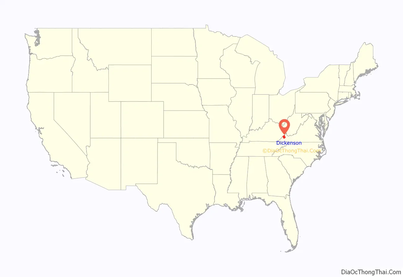
Dickenson County location map. Where is Dickenson County?
History
Dickenson County, formed in 1880 from parts of Buchanan County, Russell County, and Wise County, is Virginia’s youngest county. It was named for William J. Dickenson, delegate to the Virginia General Assembly from Russell County, 1859–1861, 1865–1867, and 1877–1882. This formation came as a result of demands from the inhabitants that they be represented by a county government closer to the people. In 1880, Delegate Dickenson sponsored the bill in the House of Delegates to establish Dickenson County as the one-hundredth county in Virginia. Dickenson County has since become known as “Virginia’s Baby.”
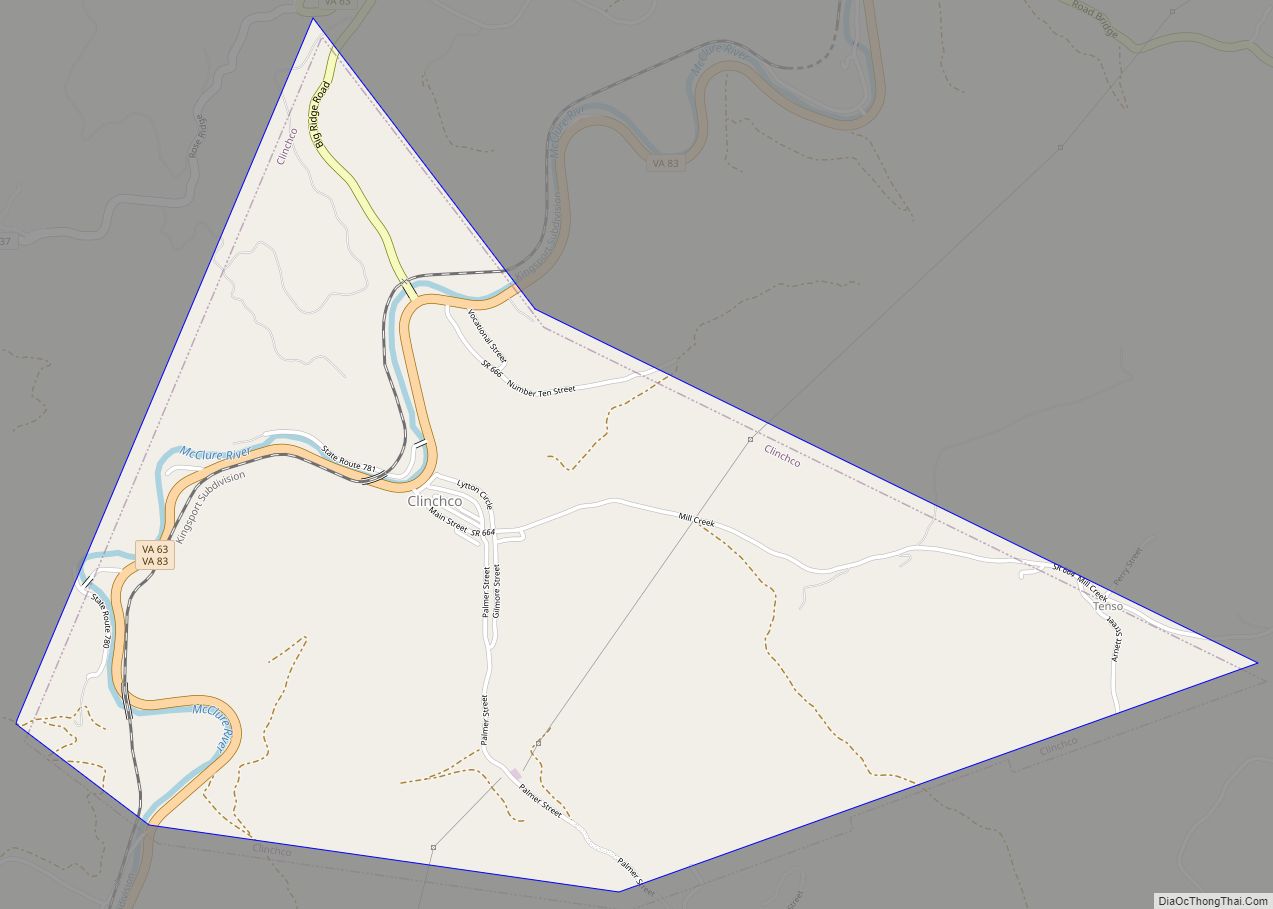
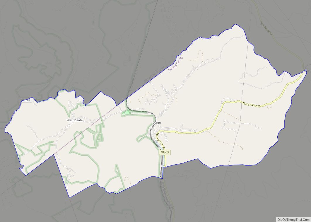
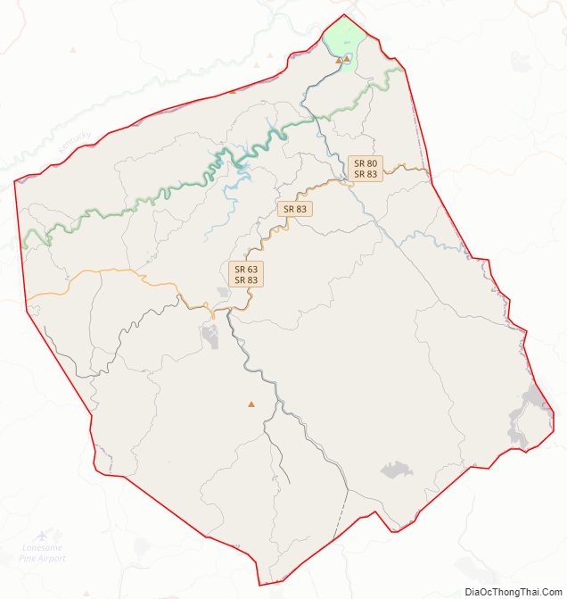
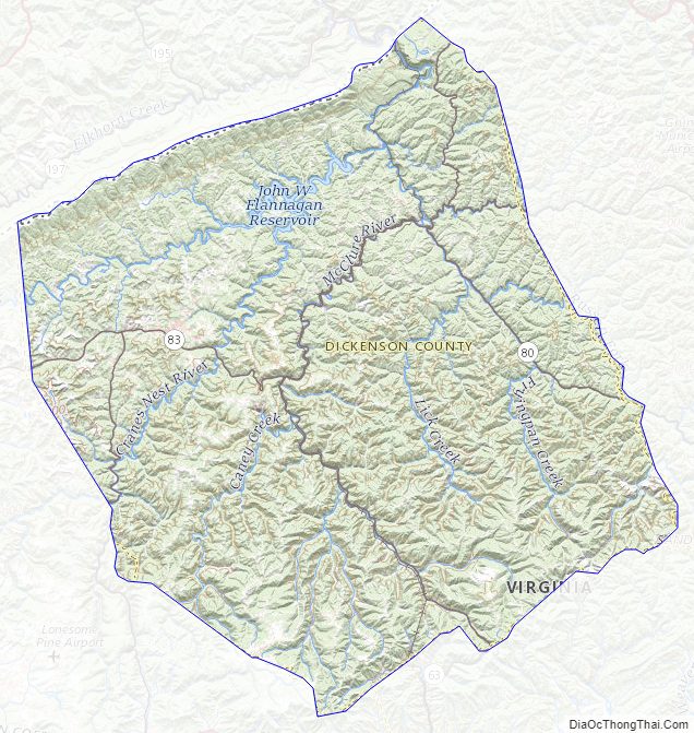
Dickenson County Road Map
Geography
According to the U.S. Census Bureau, the county has a total area of 334 square miles (870 km), of which 331 square miles (860 km) is land and 3.1 square miles (8.0 km) (0.9%) is water.
Districts
The county is divided into five magisterial districts with a supervisor elected from each district every four years. The districts are: Clintwood, Ervinton, Sandlick, Kenady, and Willis.
Adjacent counties
- Buchanan County, Virginia – northeast
- Russell County, Virginia – southeast
- Wise County, Virginia – southwest
- Pike County, Kentucky – northwest
National protected area
- Jefferson National Forest (part)
Major highways
- SR 63
- SR 72
- SR 80 (U.S. Bicycle Route 76)
- SR 83
Dickenson County Topographic Map
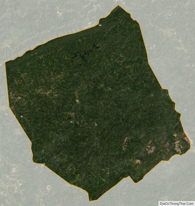
Dickenson County Satellite Map
Dickenson County Outline Map