Clinchco is a town in Dickenson County, Virginia, United States. The town, formerly known as Moss, was named for both the Clinchfield Railroad and the Clinchfield Coal Corporation. The population was 337 at the 2010 census, down from 424 at the 2000 census. The Clinchco post office was established in 1917.
| Name: | Clinchco town |
|---|---|
| LSAD Code: | 43 |
| LSAD Description: | town (suffix) |
| State: | Virginia |
| County: | Dickenson County |
| Elevation: | 1,398 ft (426 m) |
| Total Area: | 2.83 sq mi (7.32 km²) |
| Land Area: | 2.79 sq mi (7.23 km²) |
| Water Area: | 0.03 sq mi (0.08 km²) |
| Total Population: | 337 |
| Population Density: | 105.26/sq mi (40.64/km²) |
| ZIP code: | 24226 |
| Area code: | 276 |
| FIPS code: | 5117504 |
| GNISfeature ID: | 1502782 |
| Website: | https://clinchcova.net/ |
Online Interactive Map
Click on ![]() to view map in "full screen" mode.
to view map in "full screen" mode.
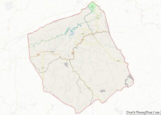
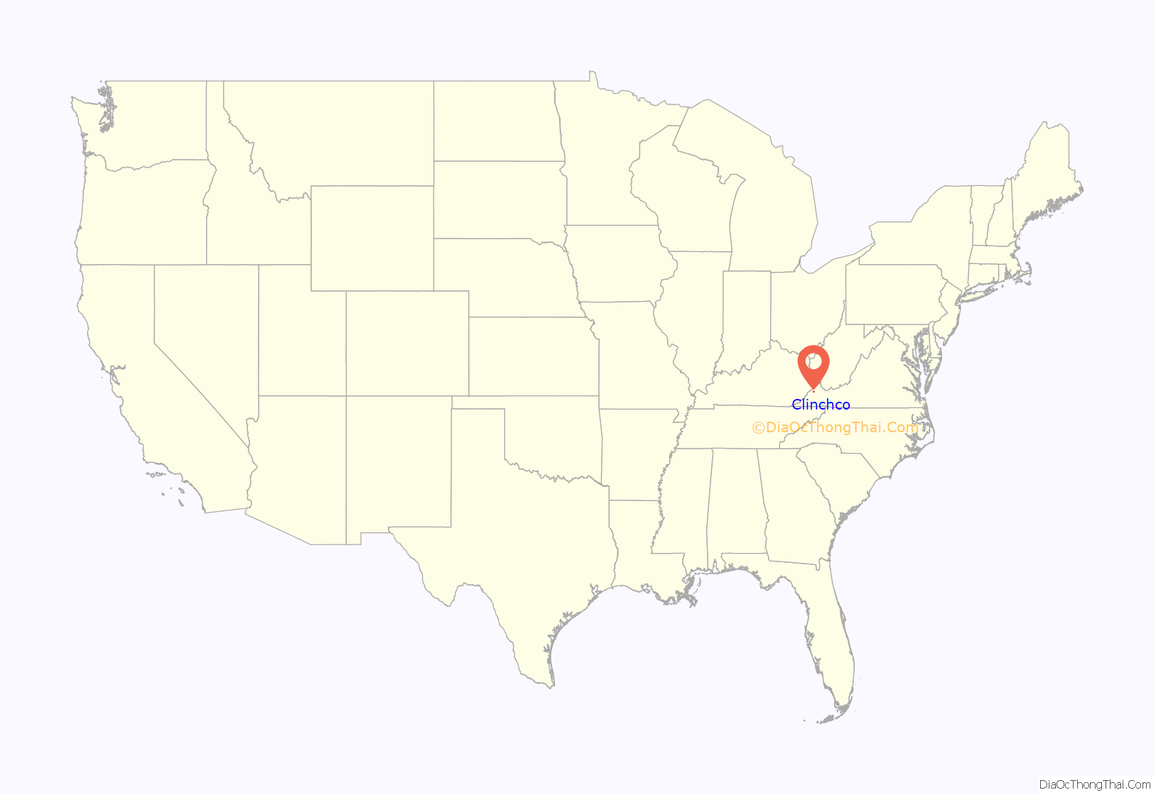
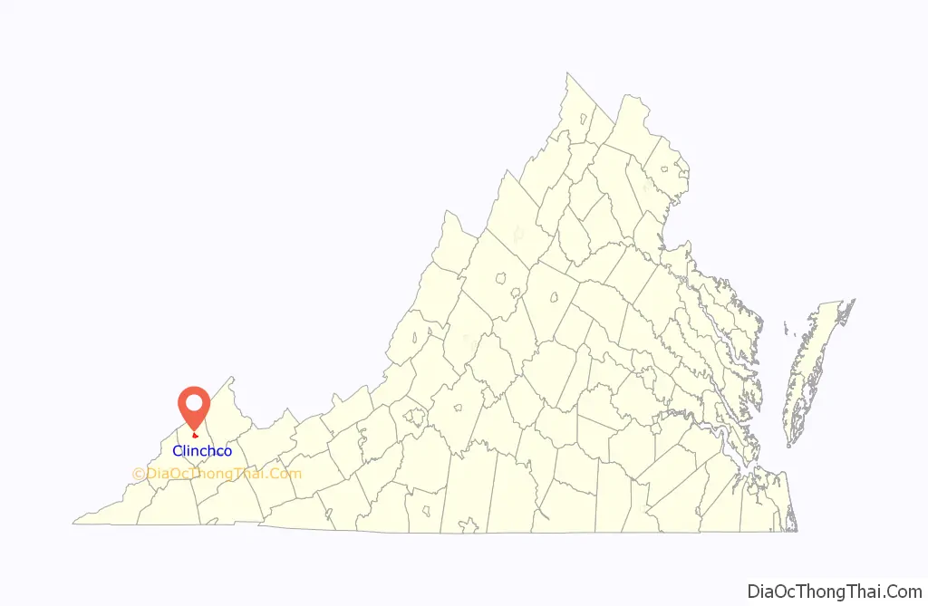
Clinchco location map. Where is Clinchco town?
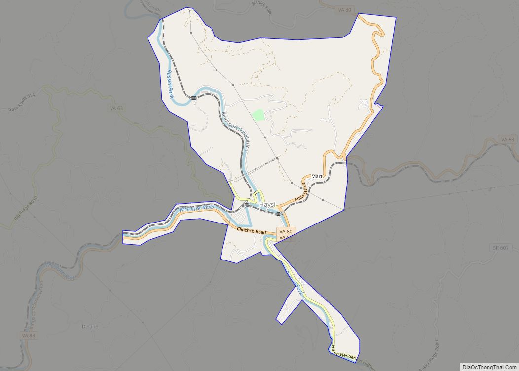
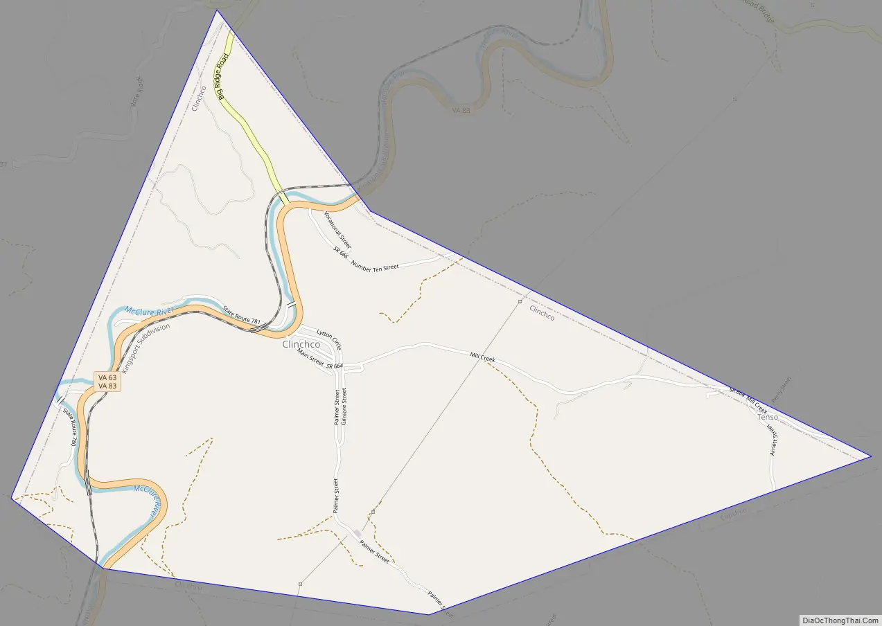
Clinchco Road Map
Clinchco city Satellite Map

Geography
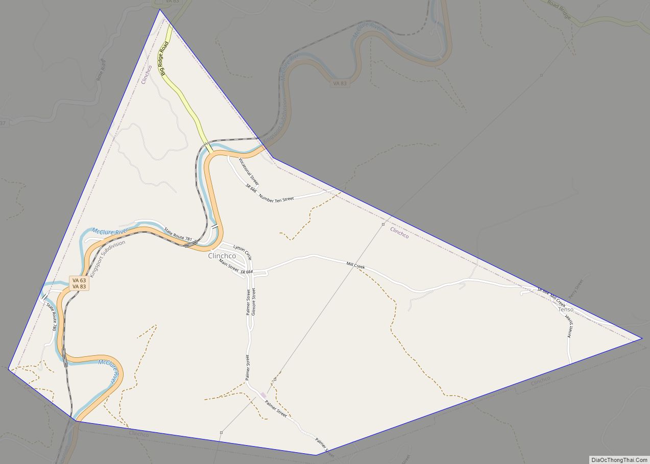
Clinchco is located in north-central Dickenson County at 37°9′45″N 82°21′36″W / 37.16250°N 82.36000°W / 37.16250; -82.36000 (37.162466, −82.359951). The town is situated in the valley of the McClure River, a northeast-flowing tributary of the Russell Fork, part of the Levisa Fork/Big Sandy River system leading north to the Ohio River. Virginia State Routes 63 and 83 run through the center of town. VA 83 leads northeast (downriver) 7 miles (11 km) to Haysi, while VA 63 follows a ridge route that takes 10 miles (16 km) to reach Haysi. The two highways run south (upriver) together 5 miles (8 km) to Fremont. St. Paul is 29 miles (47 km) south of Clinchco via VA 63, and Pound is 20 miles (32 km) west via VA 83.
According to the United States Census Bureau, Clinchco has a total area of 2.84 square miles (7.35 km), of which 2.80 square miles (7.26 km) is land and 0.03 square miles (0.08 km), or 1.15%, is water.
See also
Map of Virginia State and its subdivision:- Accomack
- Albemarle
- Alexandria
- Alleghany
- Amelia
- Amherst
- Appomattox
- Arlington
- Augusta
- Bath
- Bedford
- Bedford City
- Bland
- Botetourt
- Bristol
- Brunswick
- Buchanan
- Buckingham
- Buena Vista
- Campbell
- Caroline
- Carroll
- Charles City
- Charlotte
- Charlottesville
- Chesapeake
- Chesterfield
- Clarke
- Clifton Forge City
- Colonial Heights
- Covington
- Craig
- Culpeper
- Cumberland
- Danville
- Dickenson
- Dinwiddie
- Emporia
- Essex
- Fairfax
- Fairfax City
- Falls Church
- Fauquier
- Floyd
- Fluvanna
- Franklin
- Frederick
- Fredericksburg
- Galax
- Giles
- Gloucester
- Goochland
- Grayson
- Greene
- Greensville
- Halifax
- Hampton
- Hanover
- Harrisonburg
- Henrico
- Henry
- Highland
- Hopewell
- Isle of Wight
- James City
- King and Queen
- King George
- King William
- Lancaster
- Lee
- Lexington
- Loudoun
- Louisa
- Lunenburg
- Lynchburg
- Madison
- Manassas
- Manassas Park
- Martinsville
- Mathews
- Mecklenburg
- Middlesex
- Montgomery
- Nelson
- New Kent
- Newport News
- Norfolk
- Northampton
- Northumberland
- Norton
- Nottoway
- Orange
- Page
- Patrick
- Petersburg
- Pittsylvania
- Poquoson
- Portsmouth
- Powhatan
- Prince Edward
- Prince George
- Prince William
- Pulaski
- Radford
- Rappahannock
- Richmond
- Roanoke
- Roanoke City
- Rockbridge
- Rockingham
- Russell
- Salem
- Scott
- Shenandoah
- Smyth
- Southampton
- Spotsylvania
- Stafford
- Staunton
- Suffolk
- Surry
- Sussex
- Tazewell
- Virginia Beach
- Warren
- Washington
- Waynesboro
- Westmoreland
- Williamsburg
- Winchester
- Wise
- Wythe
- York
- Alabama
- Alaska
- Arizona
- Arkansas
- California
- Colorado
- Connecticut
- Delaware
- District of Columbia
- Florida
- Georgia
- Hawaii
- Idaho
- Illinois
- Indiana
- Iowa
- Kansas
- Kentucky
- Louisiana
- Maine
- Maryland
- Massachusetts
- Michigan
- Minnesota
- Mississippi
- Missouri
- Montana
- Nebraska
- Nevada
- New Hampshire
- New Jersey
- New Mexico
- New York
- North Carolina
- North Dakota
- Ohio
- Oklahoma
- Oregon
- Pennsylvania
- Rhode Island
- South Carolina
- South Dakota
- Tennessee
- Texas
- Utah
- Vermont
- Virginia
- Washington
- West Virginia
- Wisconsin
- Wyoming