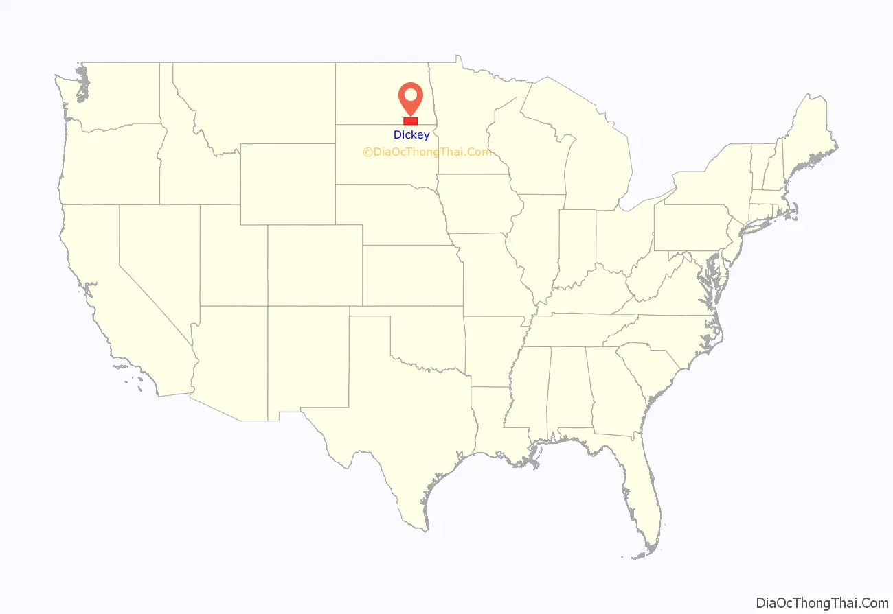
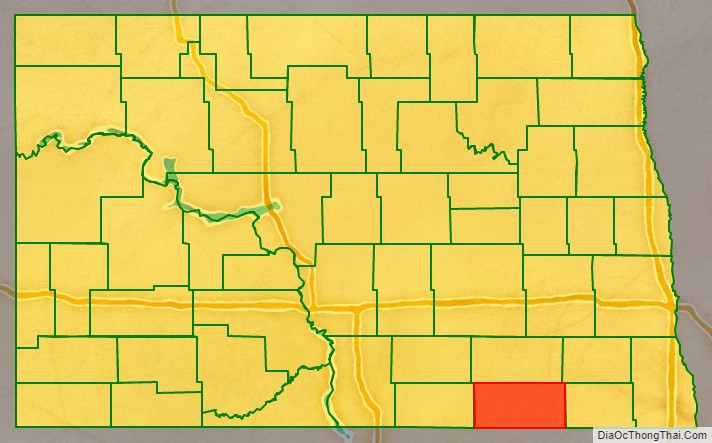
Dickey County is a county in the U.S. state of North Dakota. As of the 2020 census, the population was 4,999. Its county seat is Ellendale.
| Name: | Dickey County |
|---|---|
| FIPS code: | 38-021 |
| State: | North Dakota |
| Founded: | 1881 |
| Named for: | George H. Dickey |
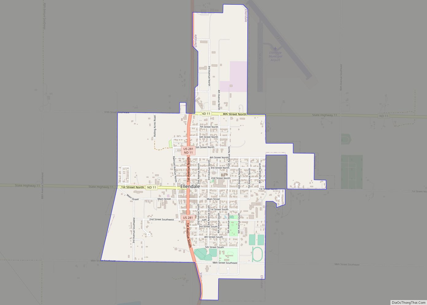
| Seat: | Ellendale |
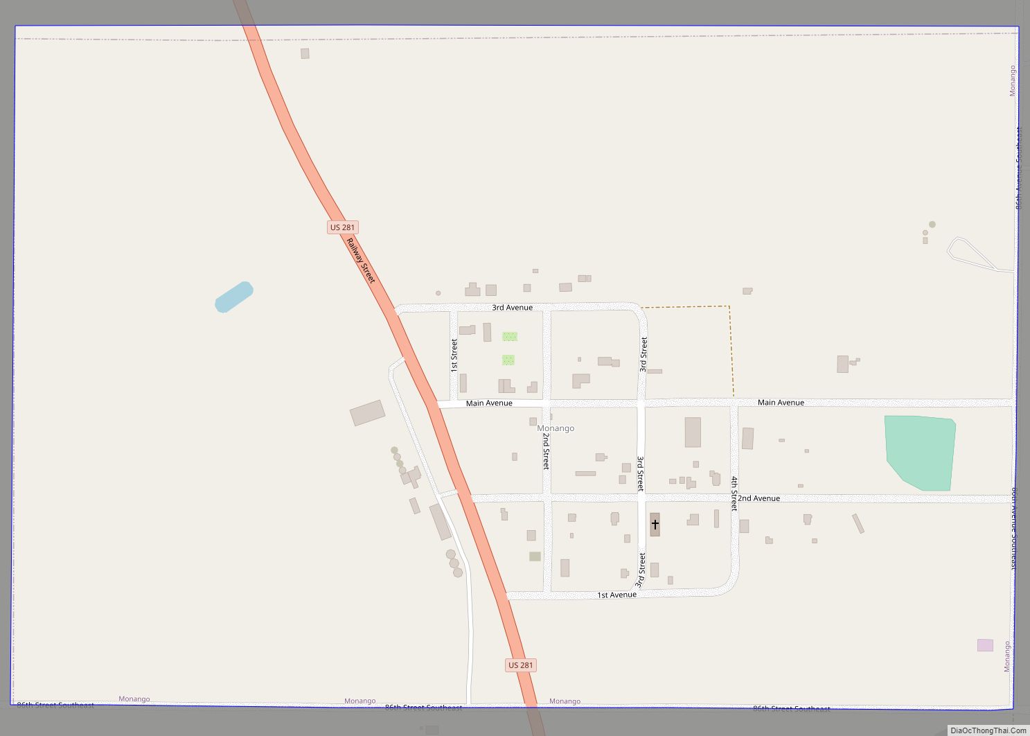
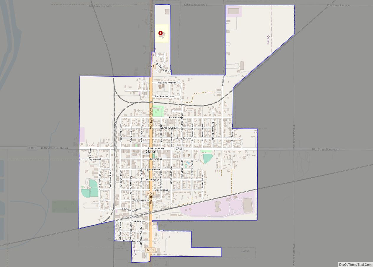
| Largest city: | Oakes |
| Total Area: | 1,142 sq mi (2,960 km²) |
| Land Area: | 1,131 sq mi (2,930 km²) |
| Total Population: | 4,999 |
| Population Density: | 4.4/sq mi (1.7/km²) |
| Time zone: | UTC−6 (Central) |
| Summer Time Zone (DST): | UTC−5 (CDT) |
| Website: | www.dickeynd.com |
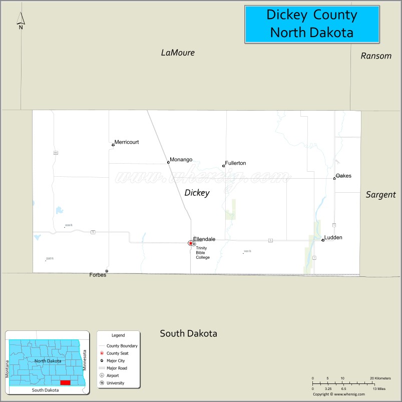
Dickey County location map. Where is Dickey County?
History
The Dakota Territory legislature created Dickey County on March 5, 1881, with territories annexed from McPherson County, South Dakota and Ransom County, North Dakota, with some previously unorganized territories added. Its governing structure was effected on August 18, 1882. It was named for a member of the Territorial Legislature, George H. Dickey.
Dickey County Road Map
Geography
Dickey County lies on the south side of North Dakota. Its south boundary line abuts the north boundary line of the state of South Dakota. The James River flows south-southeasterly through the east part of the county, and the Maple River flows south-southeasterly through the center part of the county. The county terrain consists of rolling hills, dotted with lakes and ponds in its western portion, with the area devoted to agriculture. The terrain slopes to the south and east, with its highest point being a hill near the southwestern corner at 2,139′ (652m) ASL. The county has a total area of 1,142 square miles (2,960 km), of which 1,131 square miles (2,930 km) is land and 11 square miles (28 km) (0.9%) is water.
Major highways
- U.S. Highway 281
- North Dakota Highway 1
- North Dakota Highway 11
- North Dakota Highway 56
Adjacent counties
- LaMoure County – north
- Ransom County – northeast
- Sargent County – east
- Brown County, South Dakota – south
- McPherson County, South Dakota – southwest
- McIntosh County – west
National protected areas
- Dakota Lake National Wildlife Refuge
- Maple River National Wildlife Refuge
Lakes
- Hilles Lake
- Pheasant Lake
Dickey County Topographic Map
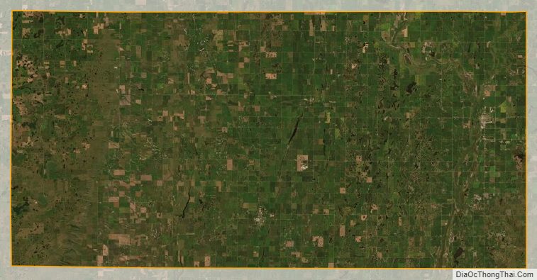
Dickey County Satellite Map
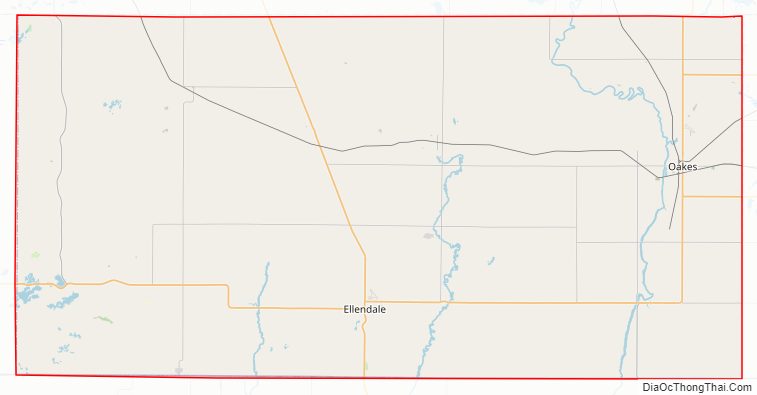
Dickey County Outline Map