Duchesne County (/duːˈʃeɪn/ doo-SHAYN) is a county in the northeast part of the U.S. state of Utah. As of the 2010 United States Census, the population was 18,607. Its county seat is Duchesne, and the largest city is Roosevelt.
| Name: | Duchesne County |
|---|---|
| FIPS code: | 49-013 |
| State: | Utah |
| Founded: | 1915 |
| Named for: | Duchesne River |
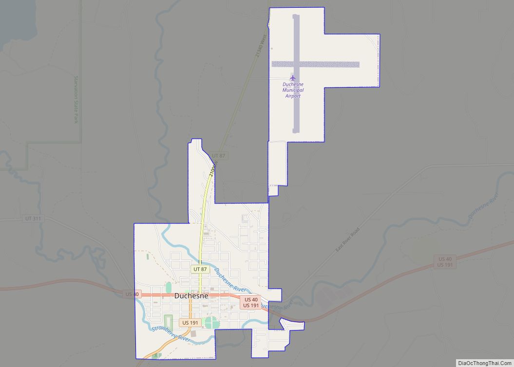
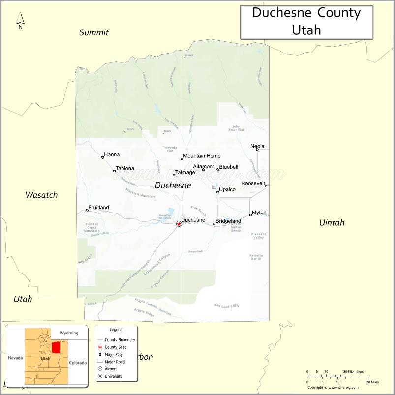
| Seat: | Duchesne |
| Largest city: | Roosevelt |
| Total Area: | 3,256 sq mi (8,430 km²) |
| Land Area: | 3,241 sq mi (8,390 km²) |
| Total Population: | 19,596 |
| Population Density: | 6.0/sq mi (2.3/km²) |
| Time zone: | UTC−7 (Mountain) |
| Summer Time Zone (DST): | UTC−6 (MDT) |
| Website: | duchesne.utah.gov |
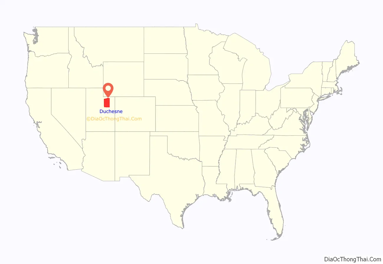
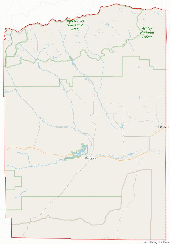
Duchesne County location map. Where is Duchesne County?
History
Much of Duchesne County was part of the Uintah Reservation, created 1861 by US President Abraham Lincoln as a permanent home of the Uintah and White River Utes. Later the Uncompahgre Utes were moved to the Uintah and newly created Uncompahgre Indian reservations from western Colorado. At the turn of the century, under the Dawes Act, both Indian reservations were thrown open to homesteaders. This was done after allotments of land were made to Indians of the three tribes. The homesteading process was opened on the Uintah on August 27, 1905.
Unlike much of the rest of Utah Territory, settlement of the future Duchesne County area did not occur due to LDS Church pressures. It was settled by individuals who obtained 160 acres under the federal Homestead Act. Homesteaders were required to prove that they intended to farm the land. After five years of living on the land, making improvements, and paying $1.25 per acre, homesteaders were given title to their homesteads.
On July 13, 1914, a referendum was presented to voters of Wasatch County to partition the eastern part into a separate county. The referendum passed, so Utah Governor William Spry proclaimed on January 4, 1915. The county seat was decided by county vote on November 5, 1914, election. The new county was named for its county seat, which in turn was called for the Duchesne River, which flows southward and then eastward through the central part of the county near the city. Its name is of uncertain origin, but the holding theory is that fur trappers named it in the 1820s in honor of Mother Rose Philippine Duchesne, founder of the School of the Sacred Heart near St. Louis, Missouri, although other theories as to the name exist. The county boundary with Uintah County was adjusted by legislative act on March 5, 1917; Duchesne County boundaries have remained in their current configuration since that date.
Duchesne County Road Map
Geography
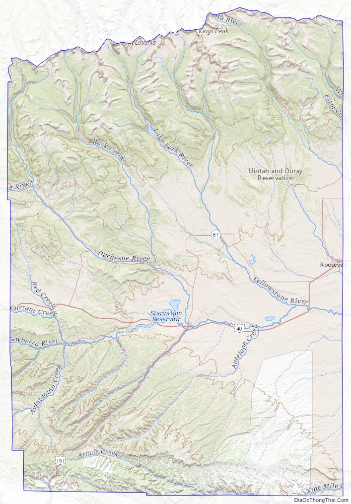
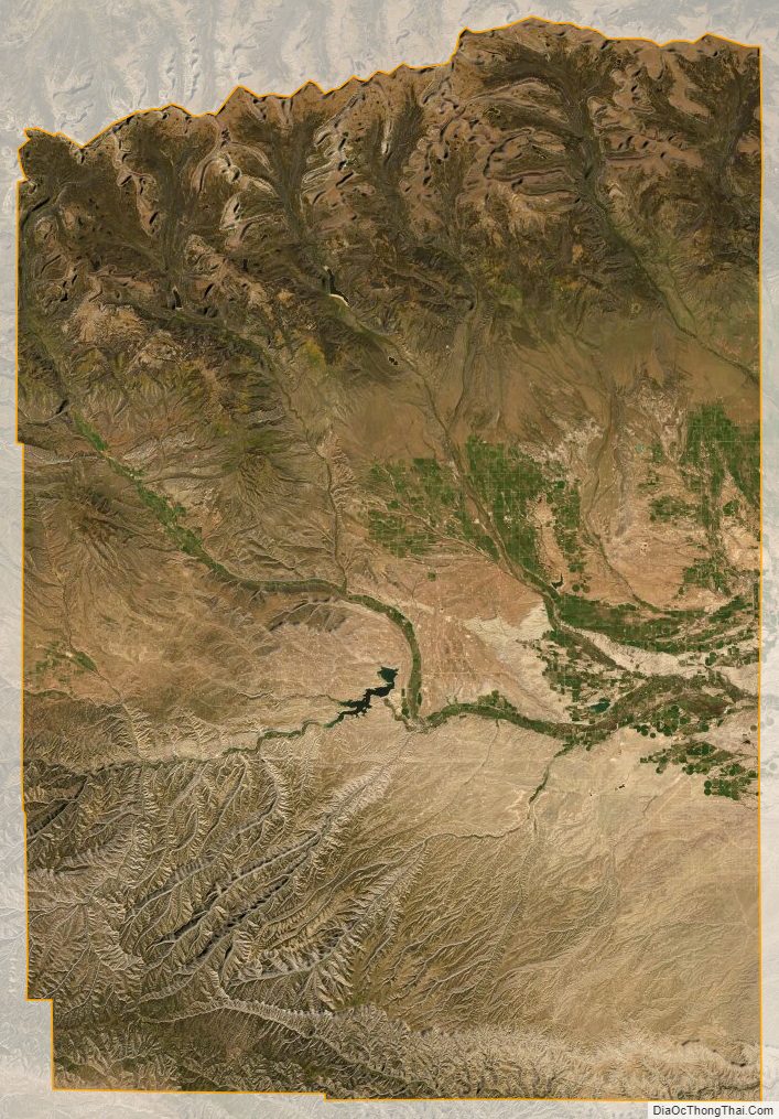
Duchesne County’s terrain is semi-arid, rough, and scarred with drainages. The Duchesne River drains the central part of the county. The county generally slopes to the south and east. The county has a total area of 3,256 square miles (8,430 km), of which 3,241 square miles (8,390 km) is land and 15 square miles (39 km) (0.5%) is water. The northern part of the county contains much of the east-west oriented Uinta Mountains. The highest natural point in Utah, Kings Peak at 13,528 feet (4,123 m), is located in Duchesne County.
Major highways
- US 40
- US 191
- SR-35
- SR-87
- SR-121
- SR-150
- SR-208
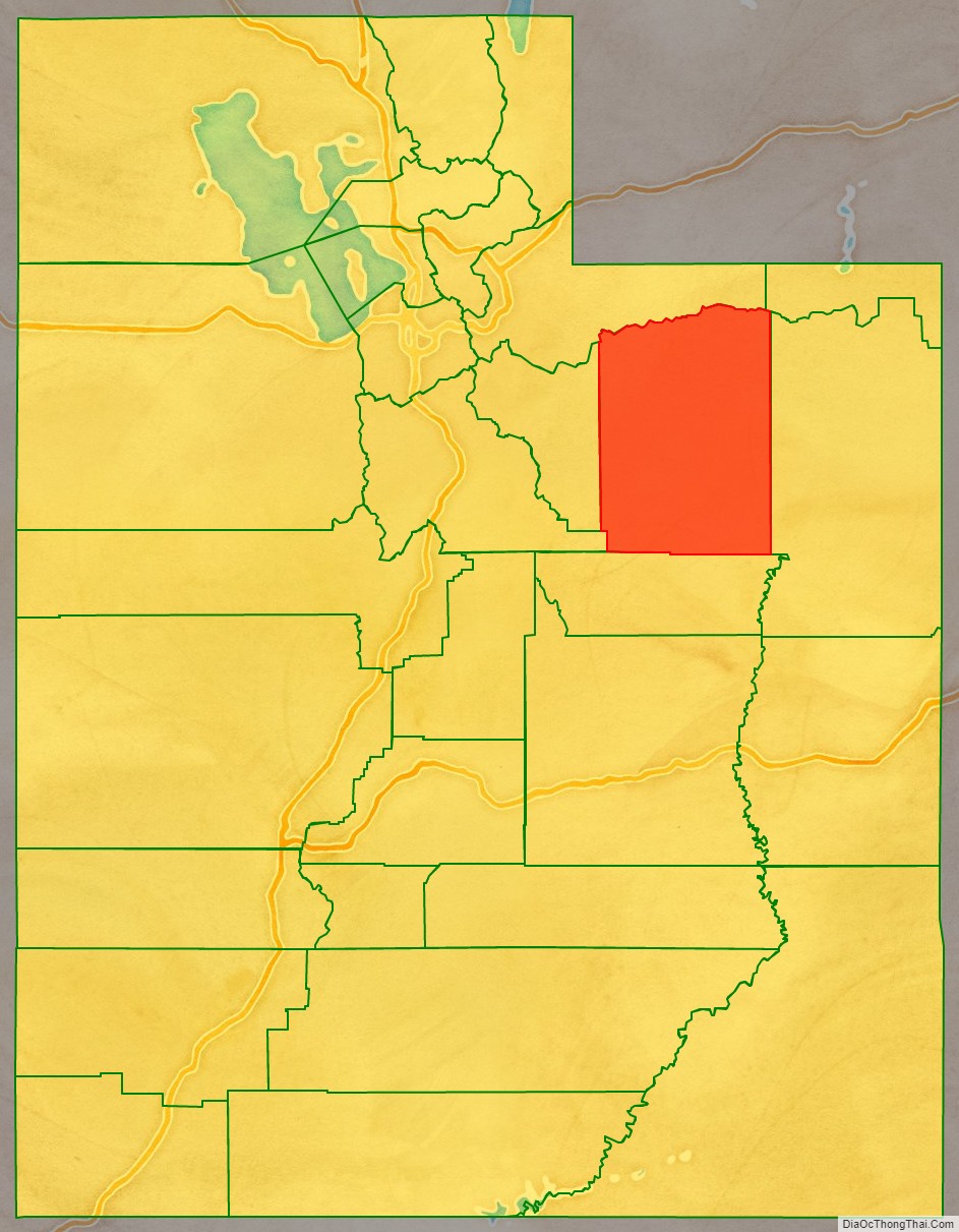
Adjacent counties
- Summit County – north
- Daggett County – northeast
- Uintah County – east
- Carbon County – south
- Utah County – southwest
- Wasatch County – west
Protected areas
- Ashley National Forest (part)
- Big Sand State Park
- Currant Creek Wildlife Management Area
- High Uintas Wilderness (part)
- Red Creek Wildlife Management Area
- Skitzy Wildlife Management Area
- Starvation State Park
- Wasatch-Cache National Forest (part)
Lakes
- Big Sand Wash Reservoir
- Cedar View Reservoir
- Chepeta Lake
- Crater Lake
- Daynes Lake
- Grandaddy Lake
- Kidney Lake
- Lake Atwood
- Mirror Lake
- Moon Lake
- Starvation Reservoir
- Upper Stillwater Reservoir
Duchesne County Topographic Map
Duchesne County Satellite Map
Duchesne County Outline Map