Duchesne (/duːˈʃeɪn/ doo-SHAYN) is a city in and the county seat of Duchesne County, Utah, United States. The population was 1,588 at the 2020 census.
| Name: | Duchesne city |
|---|---|
| LSAD Code: | 25 |
| LSAD Description: | city (suffix) |
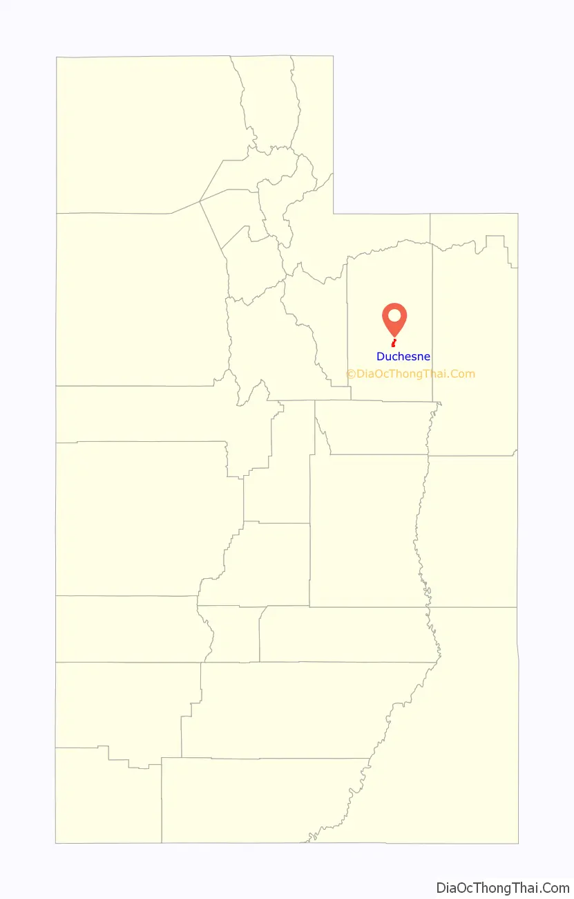
| State: | Utah |
| County: | Duchesne County |
| Elevation: | 5,518 ft (1,682 m) |
| Total Area: | 2.80 sq mi (7.26 km²) |
| Land Area: | 2.80 sq mi (7.26 km²) |
| Water Area: | 0.00 sq mi (0.00 km²) |
| Total Population: | 1,588 |
| Population Density: | 600/sq mi (230/km²) |
| ZIP code: | 84021 |
| Area code: | 435 |
| FIPS code: | 4920340 |
| GNISfeature ID: | 1427601 |
| Website: | www.duchesnecity.com |
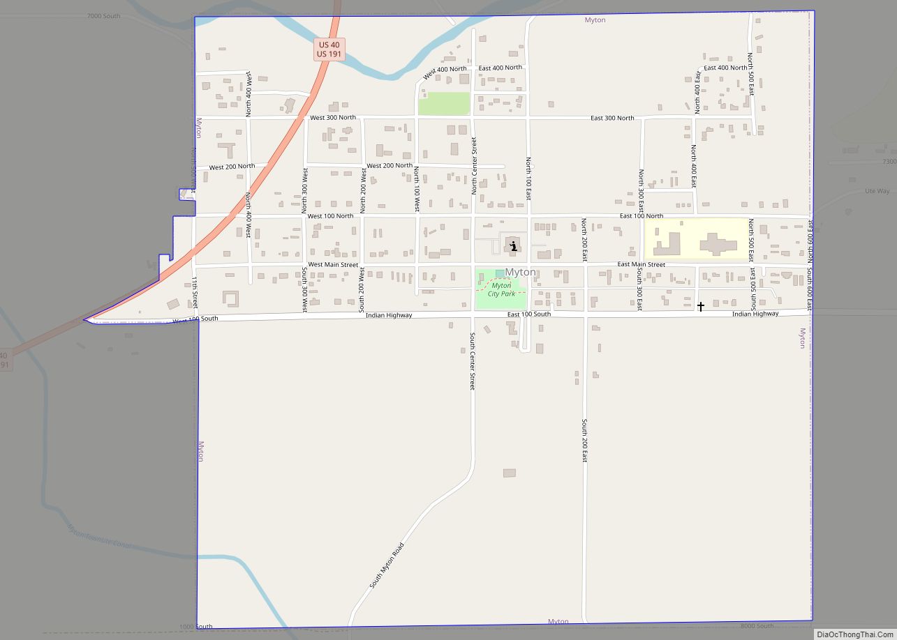
Online Interactive Map
Click on ![]() to view map in "full screen" mode.
to view map in "full screen" mode.
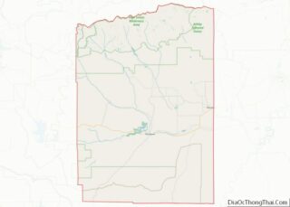
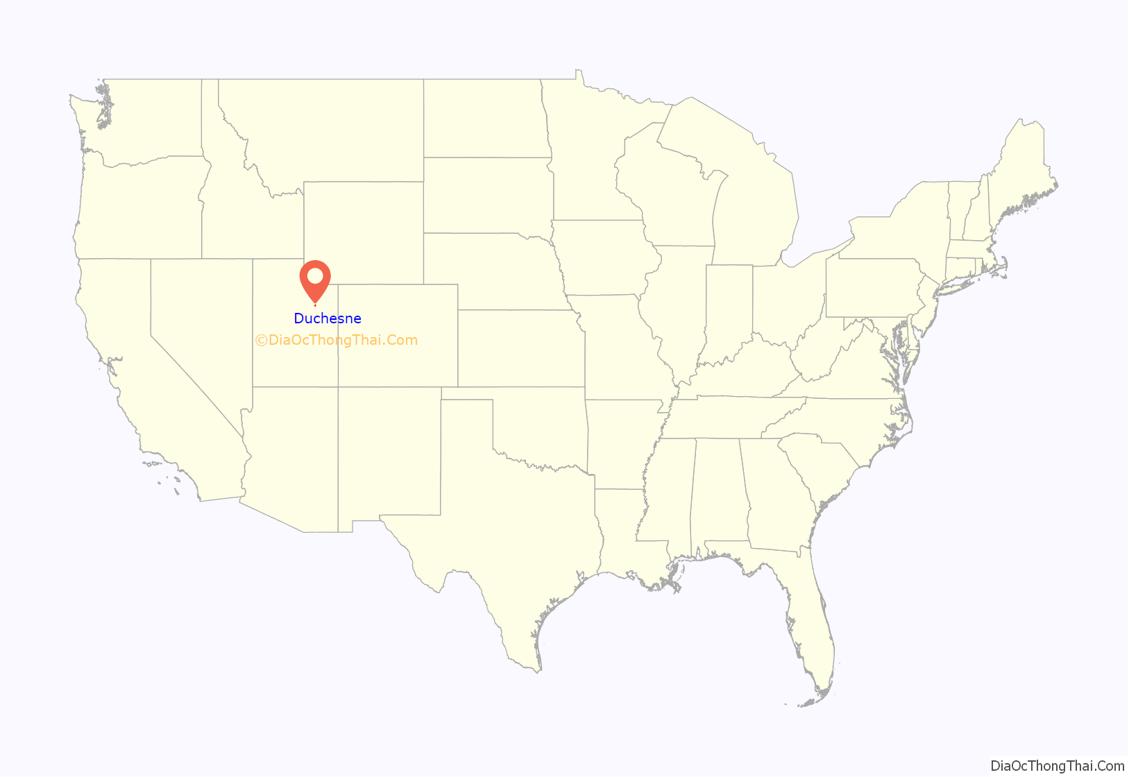
Duchesne location map. Where is Duchesne city?
History
18 September 1776 The Dominguez–Escalante Expedition came from the east where they crossed Blue Bench and descended into the valley north of the present-day town of Duchesne. “We ascended a not very high mesa [Blue Bench] which was level and very stony, traveled about three-quarters of a league including ascent and descent, crossed another small river [Duchesne River] which near here enters the San Cosme (Strawberry River), named it Santa Caterina de Sena, and camped on its banks.” “Along these three rivers we have crossed today, there is plenty of good land for crops to support three good settlements, with opportunities for irrigation, beautiful cottonwood groves, good pastures, timber, and firewood nearby.”
1822–1840 French Canadian trappers Étienne Provost, François le Clerc, and Antoine Robidoux entered the Uintah Basin by way of the Old Spanish Trail and made their fortunes by trapping the many beaver and trading with the Uintah tribe. From these French Canadian trappers, the Duchesne River and ultimately Duchesne City received its name.
1900–1905 Leases were arranged with the Ute tribe through the Indian agent “Major” H.P. Myton to provide pasture for sheep in and around where Duchesne city is located now. A story passed down from Mrs. William J. Bond about her Father Joseph W. Thomas discusses the area. “During the winter of 1901 – 02, he (Thomas) hauled supplies from Heber to the now Duchesne area, to the sheep herd camp of John E. Austin, a brother-in-law. Together with three herders, Mr. Thomas tended sheep on the West bench (D-hill) near the (Theodore) cemetery site. They moved the herds to the East desert for the winter months. The Indians had quite a village where Duchesne is now. It was a winter camp, and in spring, they scattered.
A fence was stretched across the Indian Canyon as pasture for the horses grazed there on 8″ and 10″ salt grass. Seguesee Jack (Ute tribe leader) refused settlers (sheep herders) permission to trespass the village site. The Indians feared the sheep would eat the good grasses.”
1905–1906 On 7 June 1905, the Secretary of the Interior directed the Commissioner of Indian Affairs to select one or more tracts of land in the Uintah Reservation suitable for townsites, so they might be reserved as such under the statutes of the United States. Three sites were designated, which are the current sites of Duchesne, Myton, and Randlett. A month later, President Theodore Roosevelt approved the selections and declared these lands reserved as townsites. On 28 August, the US government opened up the Uintah Basin to settle land they had acquired from the Ute Indians under the allotment act of 1891. “Land lotteries” were held in Vernal, Provo, Price, Grand Junction, Colorado, and Vernal, where each person was given a ticket with a number. On 28 August, 1 through 111 was allowed to make their claim. On 29 August, the next 111 people could make their claims. Sixty people, 46 adults and 14 children, settled on the townsite that is now Duchesne and called it by its first name, “Elsie” (Glen). Government surveyors laid out the streets, and the government accepted the survey on 18 October 1905. The first cabin was built by Charles Dickerson and Charles Ragland in October 1905. A.M. Murdock, with the help of a few men, put up a large circus tent to act as a trading post and post office. The town’s name was changed to “Dora” for a short time after Murdock’s 23-year-old daughter, then changed once again to “Theodore”, in honor of President Theodore Roosevelt. On 15 September 1905, Robert Duchesne Marsh was the first “white” child born in the townsite. The first winter was harsh, and the residents lived in tents or other temporary shelters. When spring came, the high water of the Duchesne River overflowed its banks, flooding the town. Many homesteaders’ dreams died after the first winter, and they sold their claims off for next to nothing. Judge M. M. Smith recalls, “One man asked me to write out a relinquishment for him, remarking, ‘I must either give up my claim or my wife. She won’t live here.'” Dikes were quickly built up but washed away, and some of the town was under 2 feet (0.61 m) of water until June. Tents and houses were moved around to avoid the flooding problem before the next spring.
The flooding continued annually until 1910 when $5,000 was finally given to make the four river cut-offs needed to fix the problem. In 1906 the first bridge was built by Wasatch County across the Duchesne River in east Theodore.
1907–1914 The men of Theodore organized the Boosters Club, and the women organized the Standard Bearers in 1907. Both groups became a forceful factor in the early development of the town. With the flooding of the rivers every spring, the Boosters club was finding it hard to attract people and business to the “muddy” little town. The Boosters Club raised $500 to build a bridge across the Strawberry River at the mouth of Indian Canyon. The bridge was completed in 1908 and later replaced by the state in 1914. In 1908 A. M. Murdock took down the tent and built the first store, barber shop, and post office, the “Pioneer Supply”. The citizens built a town hall in 1907. After the flooding issue was resolved, the town grew quickly. In 1910 the population of “Theodore” was 929. The town’s first newspaper, The Duchesne Record, started publication 8 April 1909. By 1910 the citizens had decided to change the name to “Duchesne”. The post office kept the name “Theodore” until the town’s petition to change the name was acknowledged on 5 May 1911. The town was incorporated in 1913, and A. M. Murdock was the first mayor.
On 13 July 1914, “Wasatch County was divided, and Duchesne County was created.” Duchesne was made the county seat on 5 Nov 1914 by the popular vote of the county’s citizens.
The name “Duchesne” is taken from the name of the river that runs through town and may have been named by fur trappers in the 1820s in honor of Mother Rose Philippine Duchesne, founder of the School of the Sacred Heart near St. Louis, Missouri, although other theories as to the name exist.
A photograph dated 1909, showing the A. M. Murdock Pioneer Supply Store and post office at Theodore, Utah (which was located approximately where Kohl’s Market stood in Duchesne in 1991) appeared in a postal history magazine in 1992. The Theodore post office operated from 1905 through 1913, when it was renamed Duchesne.
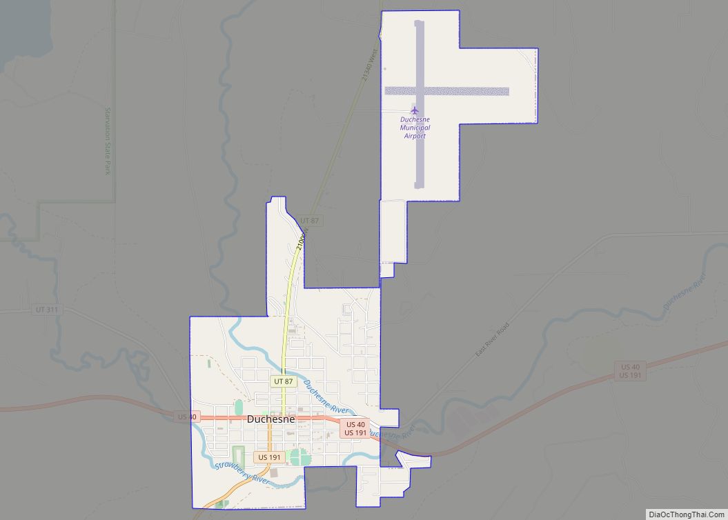
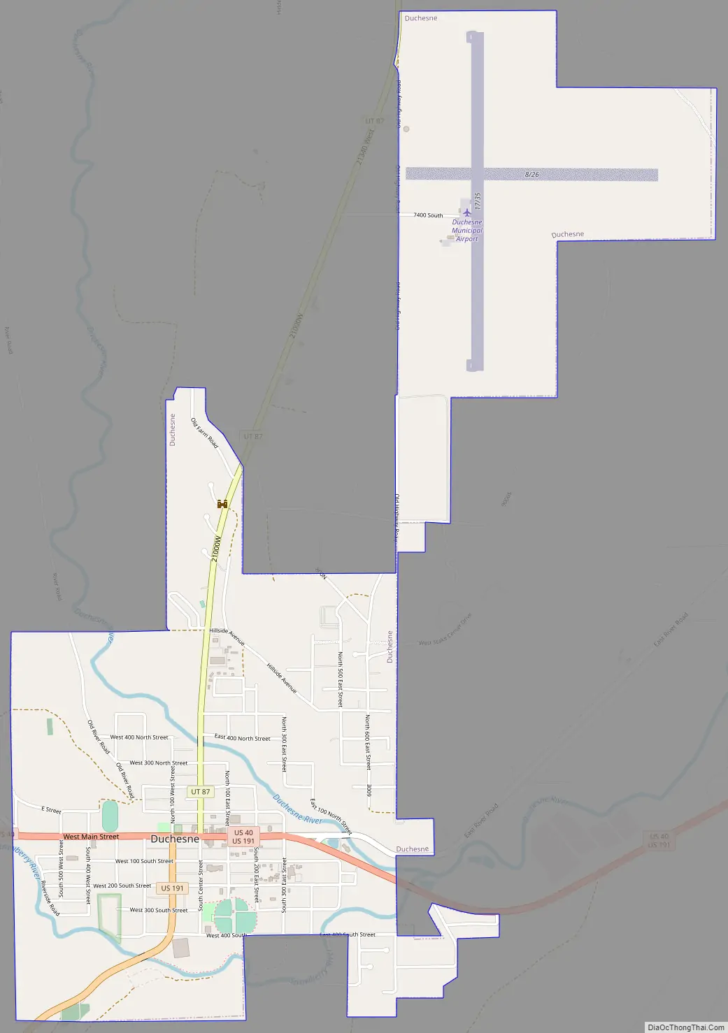
Duchesne Road Map
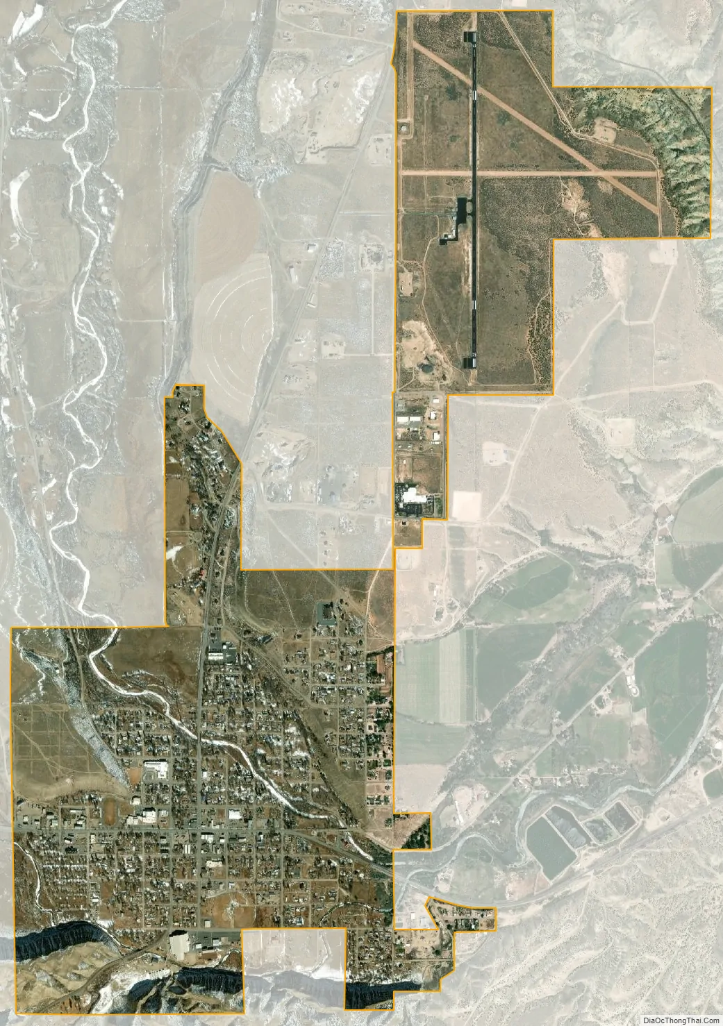
Duchesne city Satellite Map
Geography
Duchesne is located just west of the junction of the Strawberry and Duchesne rivers in the Uintah Basin of northeastern Utah. The Duchesne River drains the southwest slope of the Uinta Mountains, and the Strawberry river drains the eastern slopes of the Wasatch Range and is connected to Strawberry Reservoir. The two rivers combine at Duchesne, and the Duchesne River continues east to join the Green River at Ouray, Utah.
Native stands of cottonwood trees and willows grow along the river banks, while sagebrush and rabbitbrush fill the unirrigated bench tops. Alfalfa is the main cultivated crop of farmers in the area.
Via highway, Salt Lake City is 114 miles (183 km) to the west, Vernal is 58 miles (93 km) to the east, and Price is 54 miles (87 km) to the south.
According to the United States Census Bureau, the city has a total area of 2.5 square miles (6.5 km), all land.
See also
Map of Utah State and its subdivision: Map of other states:- Alabama
- Alaska
- Arizona
- Arkansas
- California
- Colorado
- Connecticut
- Delaware
- District of Columbia
- Florida
- Georgia
- Hawaii
- Idaho
- Illinois
- Indiana
- Iowa
- Kansas
- Kentucky
- Louisiana
- Maine
- Maryland
- Massachusetts
- Michigan
- Minnesota
- Mississippi
- Missouri
- Montana
- Nebraska
- Nevada
- New Hampshire
- New Jersey
- New Mexico
- New York
- North Carolina
- North Dakota
- Ohio
- Oklahoma
- Oregon
- Pennsylvania
- Rhode Island
- South Carolina
- South Dakota
- Tennessee
- Texas
- Utah
- Vermont
- Virginia
- Washington
- West Virginia
- Wisconsin
- Wyoming