Eddy County is a county in the U.S. state of North Dakota. As of the 2020 census, the population was 2,347. Its county seat is New Rockford.
| Name: | Eddy County |
|---|---|
| FIPS code: | 38-027 |
| State: | North Dakota |
| Founded: | 1885 |
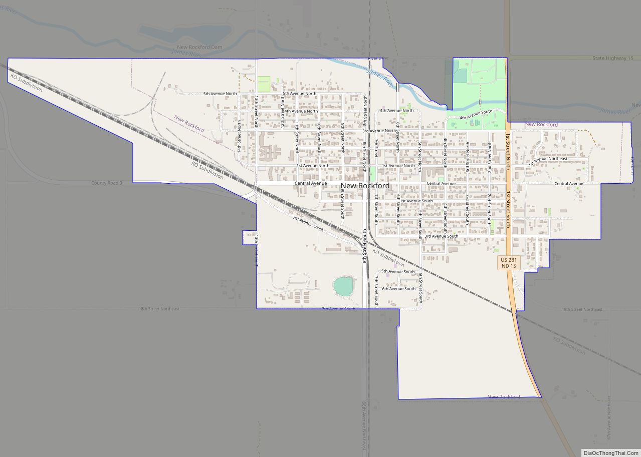
| Seat: | New Rockford |
| Largest city: | New Rockford |
| Total Area: | 644 sq mi (1,670 km²) |
| Land Area: | 630 sq mi (1,600 km²) |
| Total Population: | 2,347 |
| Population Density: | 3.6/sq mi (1.4/km²) |
| Time zone: | UTC−6 (Central) |
| Summer Time Zone (DST): | UTC−5 (CDT) |
| Website: | Eddy County, North Dakota |
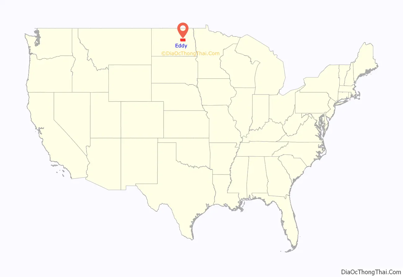
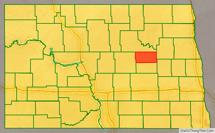
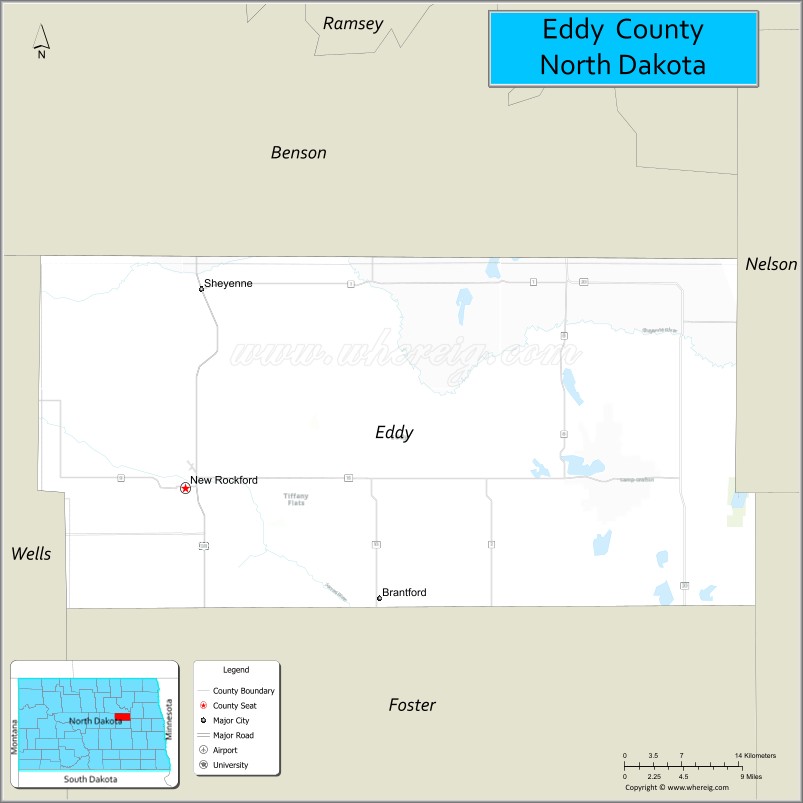
Eddy County location map. Where is Eddy County?
History
The Dakota Territory legislature created the county on March 31, 1885, with territory partitioned from Foster County. It was named for Ezra B. Eddy, a Fargo, North Dakota banker who had died a few weeks earlier. The county government was established on April 27, 1885.
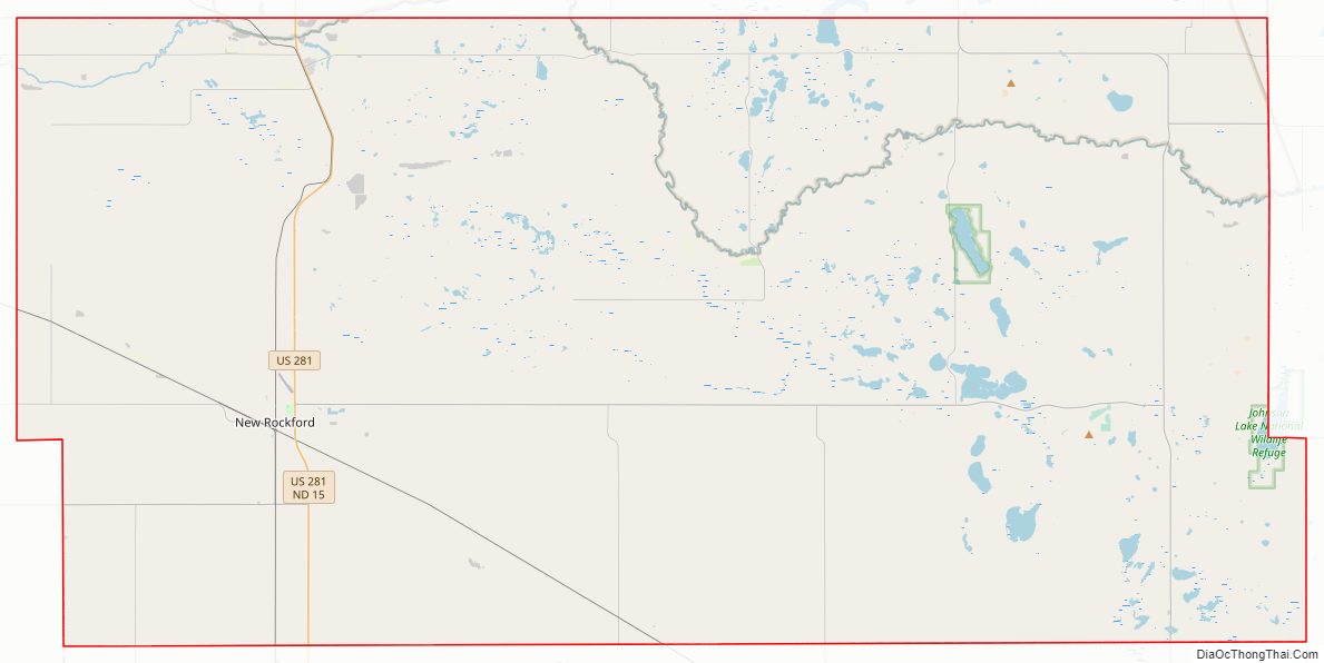
Eddy County Road Map
Geography
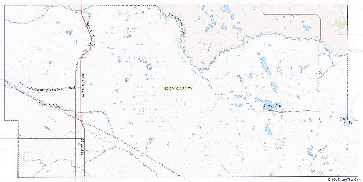
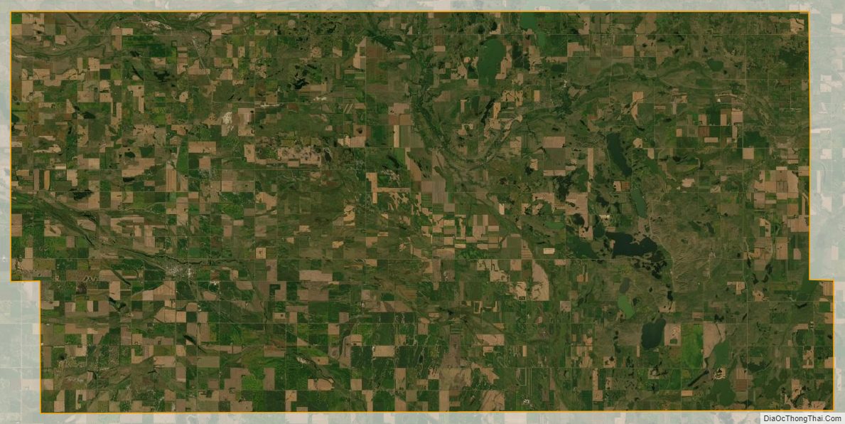
The Sheyenne River flows easterly through the upper part of the county. The county terrain consists of semi-arid hills, featuring some agriculture. The terrain slopes to the east and slightly to the north, with its highest point on a hill at the county’s southwestern corner, at 1,562′ (476m) ASL. The county has a total area of 644 square miles (1,670 km), of which 630 square miles (1,600 km) is land and 14 square miles (36 km) (2.2%) is water. It is the smallest county in North Dakota by area.
Adjacent counties
- Benson County – north
- Nelson County – northeast
- Griggs County – southeast
- Foster County – south
- Wells County – west
Major highways
- U.S. Highway 281
- North Dakota Highway 15
- North Dakota Highway 20
County roads
- Eddy County Road 1
- Eddy County Road 2
- Eddy County Road 3
- Eddy County Road 4
- Eddy County Road 5
- Eddy County Road 6
- Eddy County Road 7
- Eddy County Road 8
- Eddy County Road 9
- Eddy County Road 10
- Eddy County Road 12
- Eddy County Road 14
- Eddy County Road 16
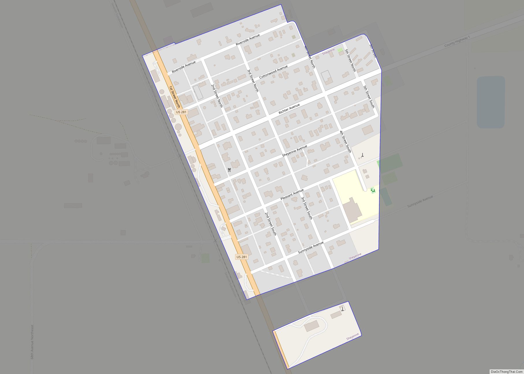
Eddy County Road 14 is a north-south County Road in North Dakota. It runs from North Dakota Highway 15 near New Rockford to Eddy County Road 9 (1st Ave North) in downtown New Rockford. Eddy County Road 9 is an east-west County Road in North Dakota. It runs from US 281/Highway 15 (1st Street) in New Rockford to Wells County CR 2, near New Rockford.
National protected area
- Johnson Lake National Wildlife Refuge (part)
Eddy County Topographic Map
Eddy County Satellite Map
Eddy County Outline Map