New Rockford is a city in Eddy County, North Dakota, United States. It is the county seat of Eddy County. The population was 1,361 at the 2020 census. New Rockford was founded in 1883.
| Name: | New Rockford city |
|---|---|
| LSAD Code: | 25 |
| LSAD Description: | city (suffix) |
| State: | North Dakota |
| County: | Eddy County |
| Founded: | 1883 |
| Elevation: | 1,532 ft (467 m) |
| Total Area: | 1.75 sq mi (4.53 km²) |
| Land Area: | 1.72 sq mi (4.45 km²) |
| Water Area: | 0.03 sq mi (0.08 km²) |
| Total Population: | 1,361 |
| Population Density: | 792.20/sq mi (305.82/km²) |
| ZIP code: | 58356 |
| Area code: | 701 |
| FIPS code: | 3856620 |
| GNISfeature ID: | 1030398 |
| Website: | cityofnewrockford.com |
Online Interactive Map
Click on ![]() to view map in "full screen" mode.
to view map in "full screen" mode.
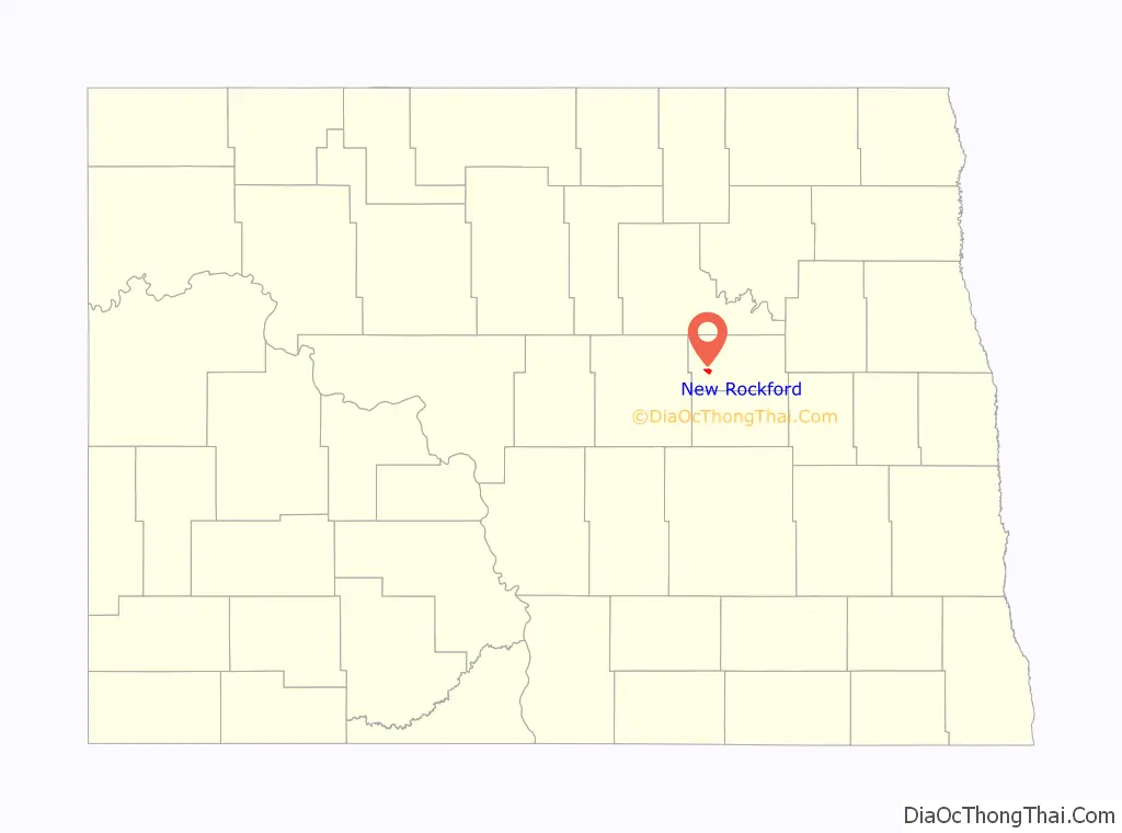
New Rockford location map. Where is New Rockford city?

History
New Rockford was founded in 1883, when the Great Northern Railway arrived in the area.
In 1915, residents mounted a challenge to have the state capital relocated from Bismarck to New Rockford. This did not succeed, leaving Bismarck the capital.
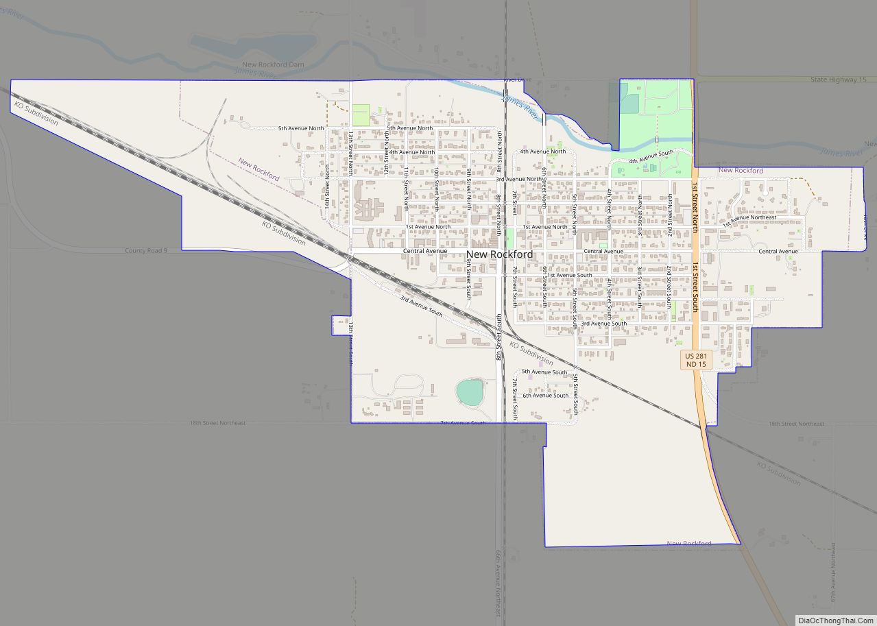
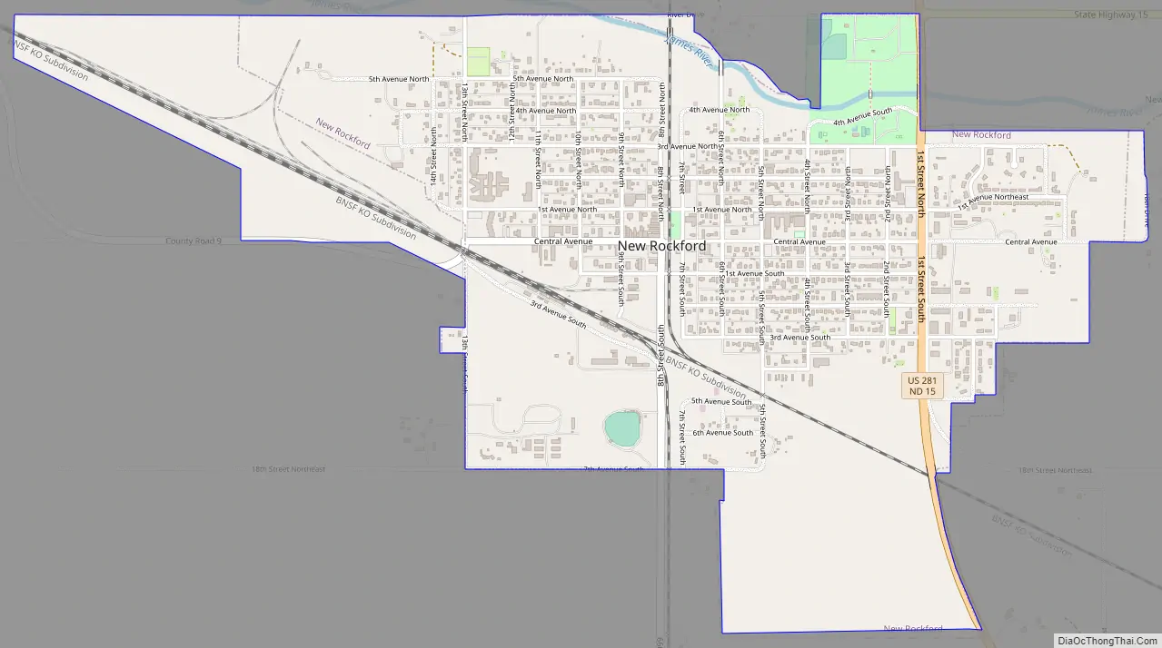
New Rockford Road Map
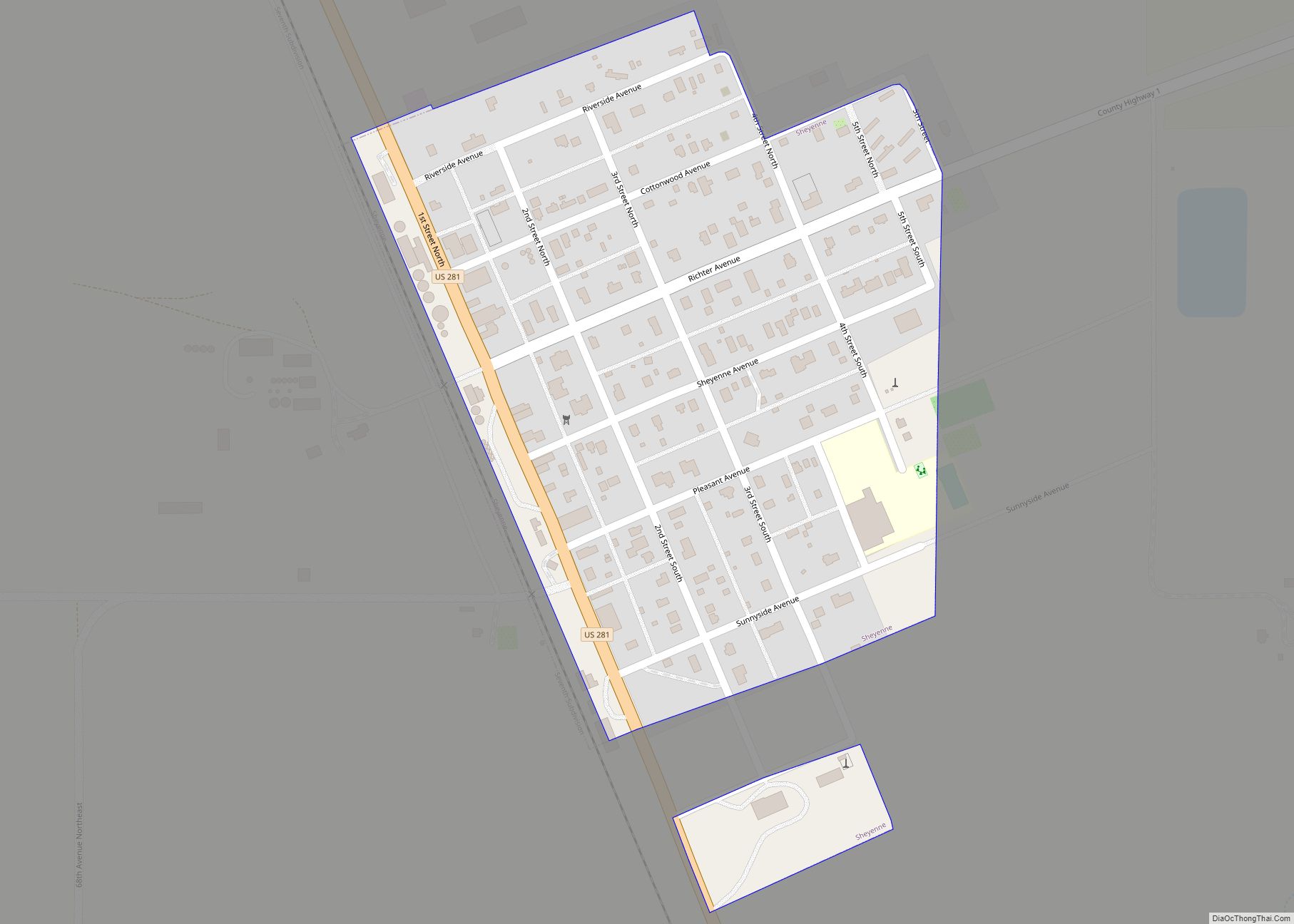
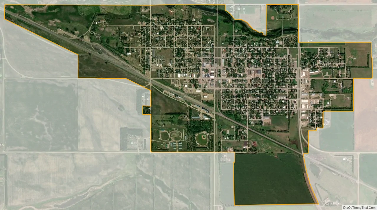
New Rockford city Satellite Map
Geography
New Rockford is located at 47°40′50″N 99°8′10″W / 47.68056°N 99.13611°W / 47.68056; -99.13611 (47.680579, −99.136177).
According to the United States Census Bureau, the city has an area of 1.54 square miles (3.99 km), of which 1.51 square miles (3.91 km) is land and 0.03 square miles (0.08 km) is water. New Rockford’s zip code is 58356.
See also
Map of North Dakota State and its subdivision:- Adams
- Barnes
- Benson
- Billings
- Bottineau
- Bowman
- Burke
- Burleigh
- Cass
- Cavalier
- Dickey
- Divide
- Dunn
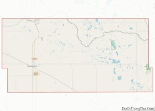
- Eddy
- Emmons
- Foster
- Golden Valley
- Grand Forks
- Grant
- Griggs
- Hettinger
- Kidder
- Lamoure
- Logan
- McHenry
- McIntosh
- McKenzie
- McLean
- Mercer
- Morton
- Mountrail
- Nelson
- Oliver
- Pembina
- Pierce
- Ramsey
- Ransom
- Renville
- Richland
- Rolette
- Sargent
- Sheridan
- Sioux
- Slope
- Stark
- Steele
- Stutsman
- Towner
- Traill
- Walsh
- Ward
- Wells
- Williams
- Alabama
- Alaska
- Arizona
- Arkansas
- California
- Colorado
- Connecticut
- Delaware
- District of Columbia
- Florida
- Georgia
- Hawaii
- Idaho
- Illinois
- Indiana
- Iowa
- Kansas
- Kentucky
- Louisiana
- Maine
- Maryland
- Massachusetts
- Michigan
- Minnesota
- Mississippi
- Missouri
- Montana
- Nebraska
- Nevada
- New Hampshire
- New Jersey
- New Mexico
- New York
- North Carolina
- North Dakota
- Ohio
- Oklahoma
- Oregon
- Pennsylvania
- Rhode Island
- South Carolina
- South Dakota
- Tennessee
- Texas
- Utah
- Vermont
- Virginia
- Washington
- West Virginia
- Wisconsin
- Wyoming