Vincennes is a city in and the county seat of Knox County, Indiana, United States. It is located on the lower Wabash River in the southwestern part of the state, nearly halfway between Evansville and Terre Haute. Founded in 1732 by French fur traders, notably François-Marie Bissot, Sieur de Vincennes, for whom the Fort was named, Vincennes is the oldest continually inhabited European settlement in Indiana and one of the oldest settlements west of the Appalachians.
According to the 2010 census, its population was 18,423, a decrease of 1.5% from 18,701 in 2000. Vincennes is the principal city of the Vincennes, IN Micropolitan Statistical Area, which comprises all of Knox County and had an estimated 2017 population of 38,440.
| Name: | Vincennes city |
|---|---|
| LSAD Code: | 25 |
| LSAD Description: | city (suffix) |
| State: | Indiana |
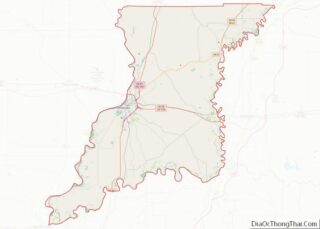
| County: | Knox County |
| Elevation: | 420 ft (128 m) |
| Total Area: | 7.48 sq mi (19.37 km²) |
| Land Area: | 7.41 sq mi (19.19 km²) |
| Water Area: | 0.07 sq mi (0.18 km²) 0.94% |
| Total Population: | 16,759 |
| Population Density: | 2,261.67/sq mi (873.19/km²) |
| ZIP code: | 47591 |
| Area code: | 812 and 930 |
| FIPS code: | 1879208 |
| GNISfeature ID: | 0445300 |
| Website: | www.vincennes.org |
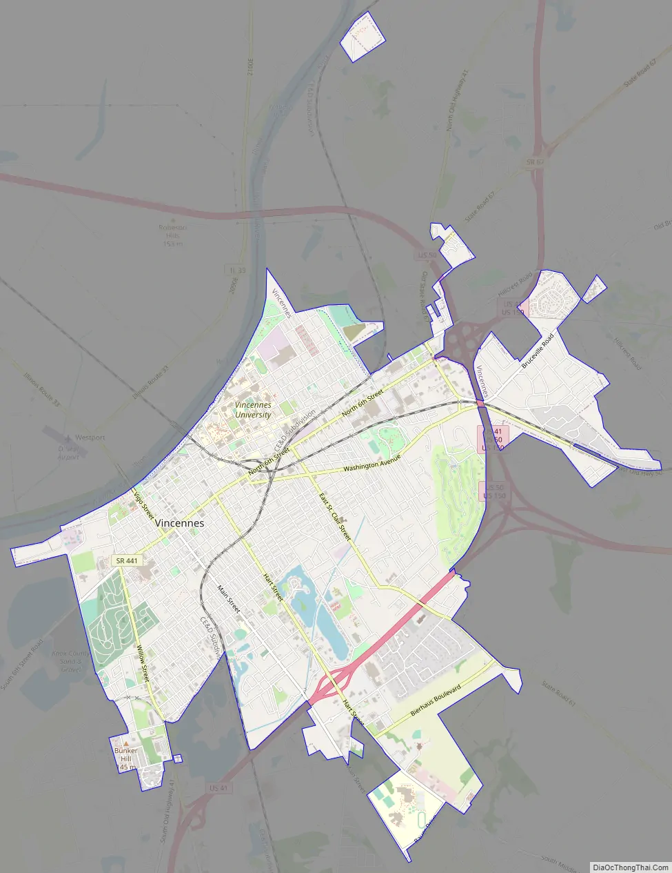
Online Interactive Map
Click on ![]() to view map in "full screen" mode.
to view map in "full screen" mode.
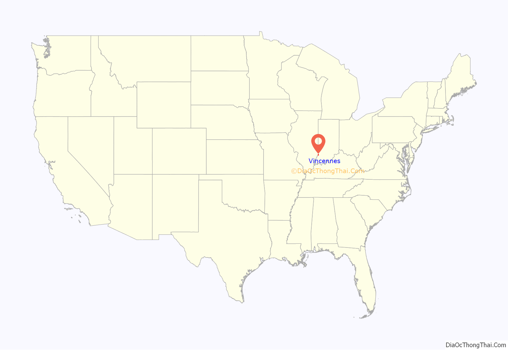
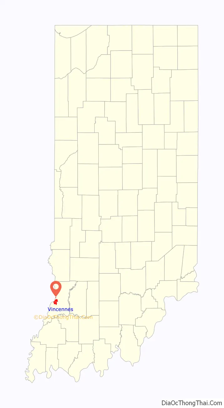
Vincennes location map. Where is Vincennes city?
History
The vicinity of Vincennes was inhabited for thousands of years by different cultures of indigenous peoples. During the Late Woodland period, some of these peoples used local loess hills as burial sites; some of the more prominent examples are the Sugar Loaf Mound and the Pyramid Mound. In historic times, prominent local Indian groups who drove these people out were the Shawnee, Wabash, and the Miami tribe.
The first European settlers were French, when Vincennes was founded as part of the French colony of New France. Later on, it would be transferred to the colony of Louisiana. Several years later, France lost the French and Indian War (part of the Seven Years’ War), and as result ceded territory east of the Mississippi River, including Vincennes, to the victorious British.
Once the area was under British control, it was associated with the Province of Quebec until after the Revolutionary War. It then became part of the Illinois Country of the Colony and Dominion of Virginia. Next it became part of Knox County in the Northwest Territory, and it was later included in the Indiana Territory. Vincennes served as capital of the Indiana Territory from 1800 until 1813, when the government was moved to Corydon.
New France
The first trading post on the Wabash River was established by Sieur Juchereau, Lieutenant General of Montréal. With thirty-four Canadiens, he founded the company post on October 28, 1702, to trade for Buffalo hides with American Indians. The exact location of Juchereau’s trading post is not known, but because the Buffalo Trace crosses the Wabash at Vincennes, many believe it was here. The post was a success; in the first two years, the traders collected over 13,000 buffalo hides. When Juchereau died, the post was abandoned. The French-Canadian settlers left what they considered hostile territory for Mobile (in present-day Alabama), then the capital of Louisiana.
The oldest European town in Indiana, Vincennes was officially established in 1732 as a second French fur trading post in this area. The Compagnie des Indes commissioned a French officer, François-Marie Bissot, Sieur de Vincennes, to build a post along the Wabash River to discourage local nations from trading with the English. Vincennes founded the new trading post near the meeting points of the Wabash and White rivers, and the overland Buffalo Trace. Vincennes, who had lived with his father among the Miami tribe, persuaded the Piankeshaw to establish a village at his trading post. He also encouraged Canadien settlers to move there, and started his own family to increase the village population. Because the Wabash post was so remote, however, Vincennes had a hard time getting trade supplies from Louisiana for the native nations, who were also being courted by English traders. The boundary between the French colonies of Louisiana and Canada, although inexact in the first years of the settlement, was decreed in 1745 to run between Fort Ouiatenon (below the site of modern-day Lafayette, Indiana) and Vincennes.
In 1736, during the French war with the Chickasaw nation, Vincennes was captured and burned at the stake near the present-day town of Fulton, Mississippi. His settlement on the Wabash was renamed Poste Vincennes in his honor.
Louisiana Governor Jean-Baptiste Le Moyne, Sieur de Bienville, next appointed Louis Groston de Saint-Ange de Bellerive to command Poste Vincennes.
As the French colonists pushed north from Louisiana and south from Canada, however, the American colonists to the east continued to push west. In addition, British traders lured away many of Indians who had traded with the Canadiens. This competition escalated in the Ohio Country until 1754 and the eruption of the French and Indian War (the North American theater of the Seven Years’ War between Britain and France.)
British America
On February 10, 1763, when New France was ceded to the British at the conclusion of the French and Indian War, Vincennes fell under the authority of Great Britain. British officer John Ramsey came to Vincennes in 1766. He took a census of the settlement, built up the fort, and renamed it Fort Sackville. The population grew quickly in the years that followed, resulting in a unique culture of interdependent Native Americans, Canadien settlers and British traders.
Vincennes was far from centers of British power. In 1770 and 1772, Thomas Gage, the commander in chief of Britain’s North American forces, received warnings that the residents of Vincennes were agitating against the Crown, and were inciting native tribes along the river trade routes to attack British traders. The Colonial Secretary, the Earl of Hillsborough, ordered the residents to be removed from Vincennes in response. Gage demurred while the residents responded to the charges against them, claiming to be “peaceful settlers, cultivating the land which His Most Christian Majesty [meaning the King of France] granted us.” The issue was resolved by Hillsborough’s successor, Lord Dartmouth, who insisted to Gage that the residents were not lawless vagabonds, but British subjects whose rights were protected by the Crown. Gage took no action against the residents of Vincennes. In 1778, residents at Poste Vincennes received word of the French alliance with the American Second Continental Congress from Father Pierre Gibault and Dr. Jean Laffont. They mobilized in support of the American revolutionaries, as did the local Piankeshaw, led by Chief Young Tobacco.
Revolutionary War
Lieutenant Colonel George R. Clark, Captain Leonard Helm, and others created a plan to capture the French forts that the British occupied after Louisiana was ceded. After Kaskaskia was captured by Clark, Lieutenant Governor Henry Hamilton sent British soldiers and reinforcements from Detroit to Fort Vincennes and helped to rebuild the fort.
The Italian merchant and Patriot Francis Vigo found Clark and informed the British presence at the fort. Vigo served with the Patriots, ordered war supplies from the Spanish to help, and acted as a secret agent for the Patriots. Clark rounded up enough men to outnumber the British and planned a surprise attack on Fort Vincennes in the heart of winter, a horrible time when no armies were expected to be able to attack due to illness, lack of food, and the flood waters that were high during this time. The Patriots won the Battle of Vincennes on February 23–24, 1779. Hamilton thought of Vincennes as “a refuge for debtors and Vagabonds from Canada.” George Rogers Clark recaptured Fort Sackville in the Battle of Vincennes without losing a single soldier.
Post-Revolution turmoil
Although the Americans would remain in control of Vincennes, it took years to establish peace. In 1786, Captain John Hardin led a mounted Kentucky militia across the Ohio River and destroyed a friendly Piankeshaw town near Vincennes. This led to a series of attacks and counter-attacks between Wabash Indians and American settlers. Finally, on 15 July 1786, the Wabash landed in forty-seven war canoes at Vincennes to drive the Americans back to Kentucky. The Indians warned the Canadians in advance of their attack and assured them that they would not be harmed, but the Canadians warned the Americans. They quickly supplied Fort Patrick Henry and waited out the siege. One American was killed and four wounded, and the war party left after destroying the Americans’ farms.
In response, Virginia Governor Patrick Henry authorized George Rogers Clark to raise the Kentucky militia and mount an expedition against the warring tribes. General Clark gathered a force of 1,000 militia and departed Clarksville 9 September 1786, along the Buffalo Trace. The militia spent ten days in Vincennes before marching north along the Wabash, but men deserted by the hundreds. Clark was soon forced to return to Vincennes without any action taken. Clark left 150 men to help defend Vincennes, but this force soon turned into a lawless mob, and the citizens of Vincennes petitioned Congress for help. Secretary of War Henry Knox sent Colonel Josiah Harmar and the First American Regiment to restore order. The Kentucky militia fled Vincennes at the approach of U.S. Regulars.
Colonel Harmar left 100 regulars under Major Jean François Hamtramck and directed them to build a fort, Fort Knox. Vincennes remained an isolated town, difficult to supply due to its position deep within Indian territory. Secure transport to and from Vincennes meant travelling with a large, armed party, whether over land or via the Wabash River. On 30 September 1790, Major Hamtramck led 350 men from Vincennes as far north as the Vermillion River, to engage some of the Indian villages which had been at war with Vincennes. The Kickapoo tracked the party, however, and evacuated every village along the way before the Americans arrived. Hamtramck destroyed some abandoned villages, but he did not engage any war parties. Faced with desertions from Kentucky militia, Hamtramck returned to Vincennes. The expedition had done no serious harm to the enemies of Vincennes, but it distracted some of the Wabash villages while Josiah Harmar, now a General, led a much larger expedition up through Ohio country towards Kekionga.
The Vincennes Tract
The earliest land claims by inhabitants of Vincennes were based on a sale by the Indians to the French in 1742 of a tract of land containing 1.6 million acres, known as the Vincennes Tract. It was a rectangular block lying at right angles to the course of the Wabash River at Vincennes. The tract was ceded by France to Britain by treaty in 1763 after the French and Indian War. On October 18, 1775, an agent for the Wabash Company purchased two tracts of land along the Wabash River from the Piankeshaw tribe called the ‘Plankashaw Deed’. In these deeds, the Vincennes Tract was excepted, and it was the first recognition of the tract in period documents. Eventually, the United States Supreme Court invalidated the deeds.
The claims based on French sovereignty or individual deeds issued under it were eventually rejected by congress, because if there were such grants, they passed to the United States by the Treaty of Paris 1783.
By right of conquest, George Rogers Clark secured this land for the United States in 1779 and the Land Act of 1796 honored its boundaries.
The Vincennes Donation Lands were embodied in An Act for granting lands to the Inhabitants and settlers at Vincennes and the Illinois country, in the territory northwest of the Ohio, and for confirming them in their possessions (1791).
Growth of the town
By 1798, the population had reached 2,500. Vincennes was no longer considered a trading outpost, but a thriving city.
Elihu Stout published the first newspaper in the Indiana Territory in 1804 at Vincennes. The Indiana Gazette debuted on July 31, 1804. Fire destroyed the printing presses in 1806, but Stout revived the newspaper as the Western Sun in 1807.
Vincennes served as the first capital of Indiana Territory until it was moved to Corydon on May 1, 1813.
In 1826, “A party of Shawnee Indians … in men, women, and children, to 500, passed through this place [Vincennes] … from their reservation at Wapaghkonetta, moving to the Mississippi. The celebrated Indian prophet, and a son of the great Tecumseh, were in the company.”
Slavery
Vincennes Road Map
Vincennes is located on the banks of the Wabash River at the western edge of Knox County; this is also the western edge of the state of Indiana, and Illinois is across the river to the west. The city lies about 100 miles (160 km) southwest of Indianapolis. U.S. Route 41 passes through the city from north to south, and U.S. Route 50 passes just to the north of the city from east to west.
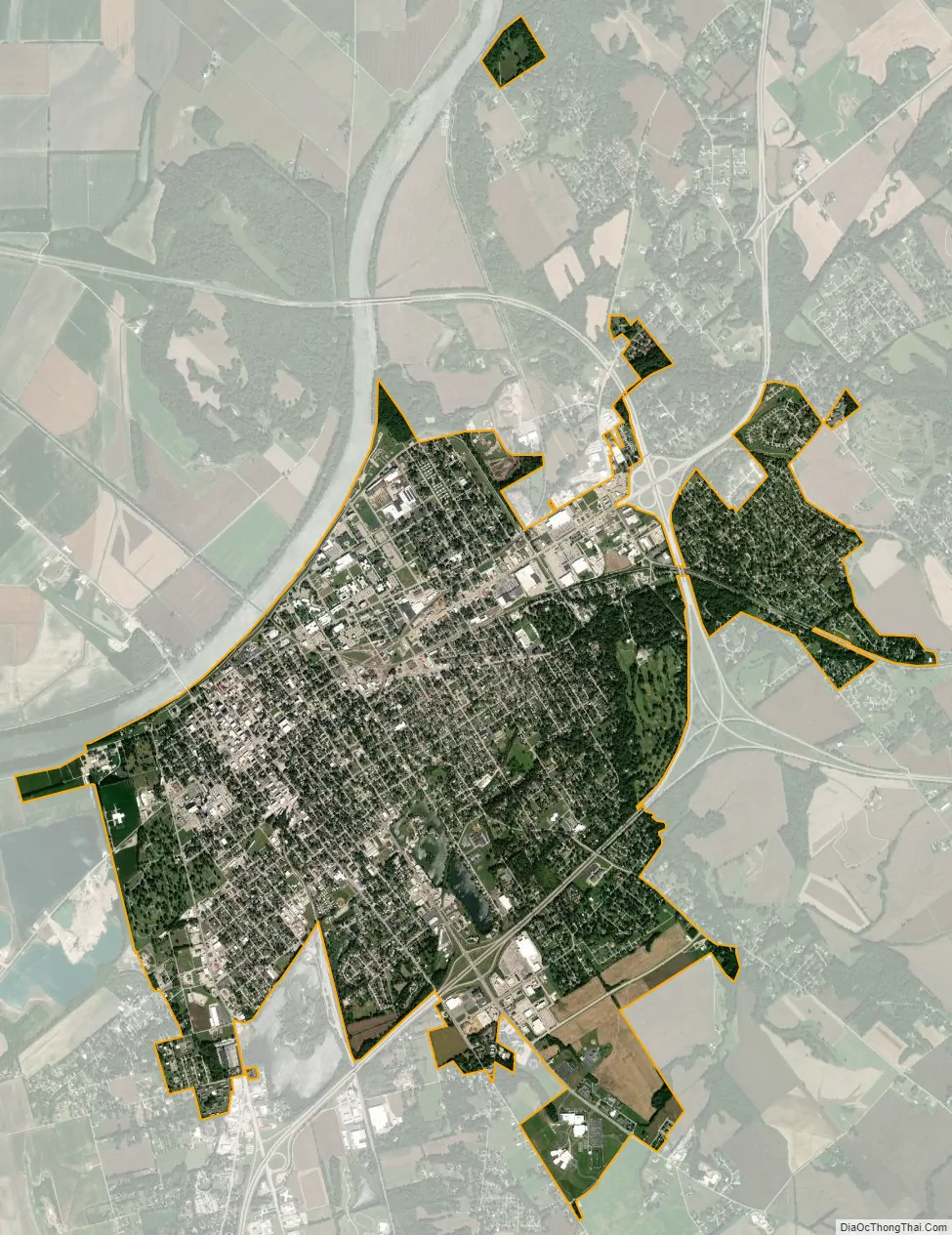
According to the 2010 census, Vincennes has a total area of 7.478 square miles (19.37 km), of which 7.41 square miles (19.19 km) (or 99.09%) is land and 0.068 square miles (0.18 km) (or 0.91%) is water.
Vincennes has a humid subtropical climate with hot summers and cool winters with heavy rainfall at times throughout much of the year. There are an average of 53.1 days with highs of 90 °F (32 °C) or higher and an average of 101.5 days with lows of 32 °F (0 °C) or lower. Average January temperatures are a high of 36.3 °F (2.4 °C) and a low of 18.3 °F (−7.6 °C). Average July temperatures are a high of 87.7 °F (30.9 °C) and a low of 64.8 °F (18.2 °C). The record high temperature was 104 °F (40 °C) on June 26, 1988. The record low temperature was −26 °F (−32 °C) on January 19, 1994.
Average annual precipitation is 44.43 inches (112.9 cm). Measurable precipitation occurs on an average of 105.6 days each year. The wettest year was 1990 with 60.08 inches (152.6 cm) and the dryest year was 1988 with 36.02 inches (91.5 cm). The most precipitation in one month was 11.18 inches (28.4 cm) in November 1985. The most precipitation in 24 hours was 5.07 inches (12.9 cm).
Average annual snowfall is 5.8 inches (15 cm). Measurable snowfall occurs on only 2.6 days. The snowiest season was 1989–90 when 16.4 inches (42 cm) fell. The most snow in one month was 8.5 inches (22 cm) in December 1990. The most snow in 24 hours was 8.0 inches (20 cm) on March 24, 1990.
Vincennes city Satellite Map
Geography
Climate
See also
Map of Indiana State and its subdivision:
Map of other states: