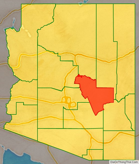
Gila County (/ˈhiːlə/ HEE-lə) is in the central part of the U.S. state of Arizona. As of the 2020 census, the population was 53,272. The county seat is Globe.
Gila County comprises the Payson, Arizona Micropolitan Statistical Area.
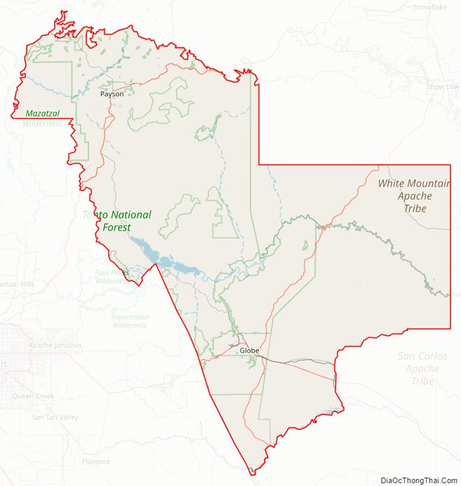
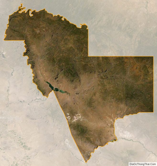
Gila County contains parts of Fort Apache Indian Reservation and San Carlos Indian Reservation.
| Name: | Gila County |
|---|---|
| FIPS code: | 04-007 |
| State: | Arizona |
| Founded: | February 8, 1881 |
| Named for: | Gila River |
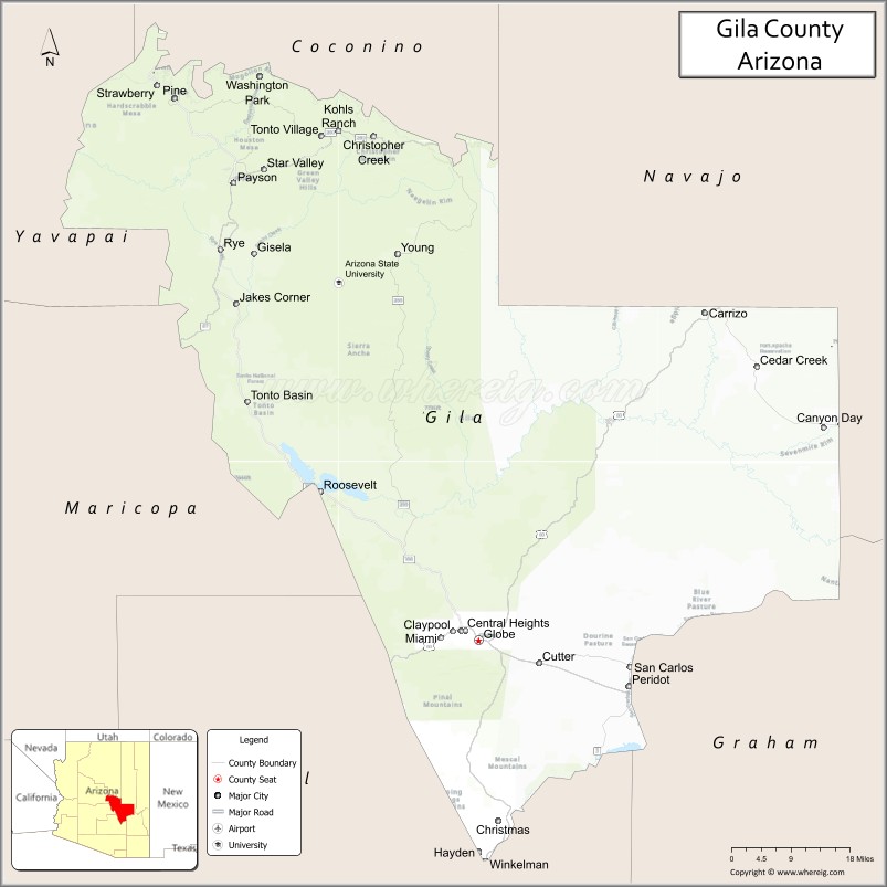
| Seat: | Globe |
| Largest town: | Payson |
| Total Area: | 4,795 sq mi (12,420 km²) |
| Land Area: | 4,758 sq mi (12,320 km²) |
| Total Population: | 53,272 |
| Population Density: | 11/sq mi (4.3/km²) |
| Time zone: | UTC−7 (Mountain) |
| Website: | www.gilacountyaz.gov |
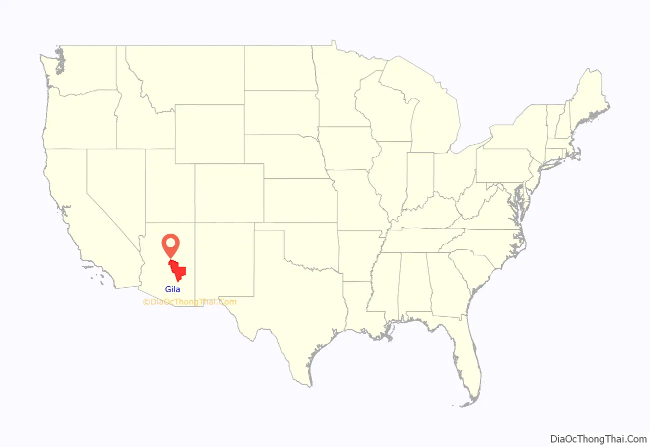
Gila County location map. Where is Gila County?
History
The county was formed from parts of Maricopa and Pinal counties on February 8, 1881. The boundary was then extended eastward to the San Carlos River by public petition in 1889. The original county seat was in the mining community of Globe City, now Globe.
Popular theory holds that the word “Gila” was derived from a Spanish contraction of Hah-quah-sa-eel, a Yuma word meaning “running water which is salty”.
In the 1880s, a long range war broke out in Gila County that became the most costly feud in American history, resulting in an almost complete annihilation of the families involved. The Pleasant Valley War (also sometimes called the Tonto Basin Feud or Tonto Basin War) matched the cattle-herding Grahams against the sheep-herding Tewksburys. Once partisan feelings became tense and hostilities began, Frederick Russell Burnham, who later became a celebrated scout and the inspiration for the boy scouts, was drawn into the conflict on the losing side.
Burnham shot many men in the feud, and was himself nearly killed by a bounty hunter. Tom Horn, an infamous assassin, was known to have taken part as a killer for hire, but it is unknown which side employed him. Both sides suffered fatalities. No one was ever charged or prosecuted.
In the 1960s, it was home of Gerald Gault, who was the subject of the 1967 U.S. Supreme Court ruling, in re Gault, that stated juveniles have the same rights as adults when arrested to be notified of the charges against them, the rights to attorneys, for family members to be notified of their arrests and to confront their accusers and to not be punished more harshly than adults who are convicted of the same crime, especially if an adult’s penalty for the crime would be less than that accorded a juvenile convict.
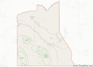
Gila County Road Map
Geography
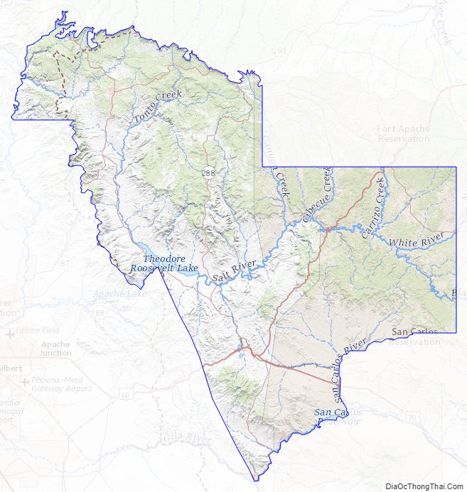
According to the United States Census Bureau, the county has a total area of 4,795 square miles (12,420 km), of which 4,758 square miles (12,320 km) is land and 38 square miles (98 km) (0.8%) is water.
Adjacent counties
- Yavapai County – northwest-north
- Maricopa County – west
- Pinal County – south
- Graham County – south
- Navajo County – east, northeast
- Coconino County – north
National protected areas
- Coconino National Forest (part)
- Tonto National Forest (part)
- Tonto National Monument
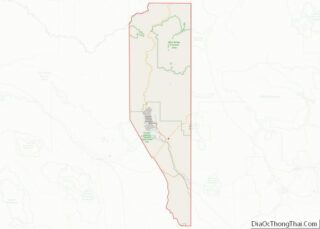
Gila County Topographic Map
Gila County Satellite Map
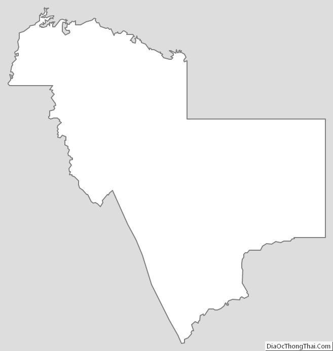
Gila County Outline Map