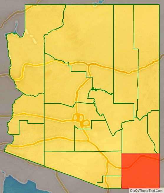
Cochise County (/koʊˈtʃiːs/) is a county in the southeastern corner of the U.S. state of Arizona. It is named after the Native American chief Cochise.
The population was 125,447 at the 2020 census. The county seat is Bisbee and the most populous city is Sierra Vista.
Cochise County includes the Sierra Vista–Douglas, Arizona Metropolitan Statistical Area. The county borders southwestern New Mexico and the northwestern Mexican state of Sonora.
| Name: | Cochise County |
|---|---|
| FIPS code: | 04-003 |
| State: | Arizona |
| Founded: | February 1, 1881 |
| Named for: | Cochise |
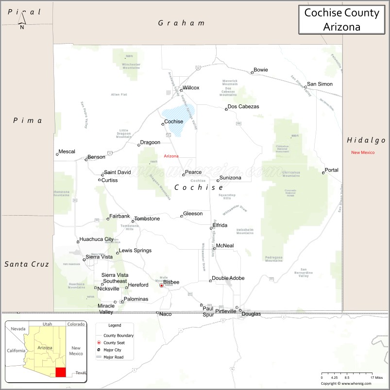
| Seat: | Bisbee |
| Largest city: | Sierra Vista |
| Total Area: | 6,219 sq mi (16,110 km²) |
| Land Area: | 6,166 sq mi (15,970 km²) |
| Total Population: | 125,447 |
| Population Density: | 20/sq mi (7.8/km²) |
| Time zone: | UTC−7 (Mountain) |
| Website: | www.cochise.az.gov |
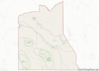
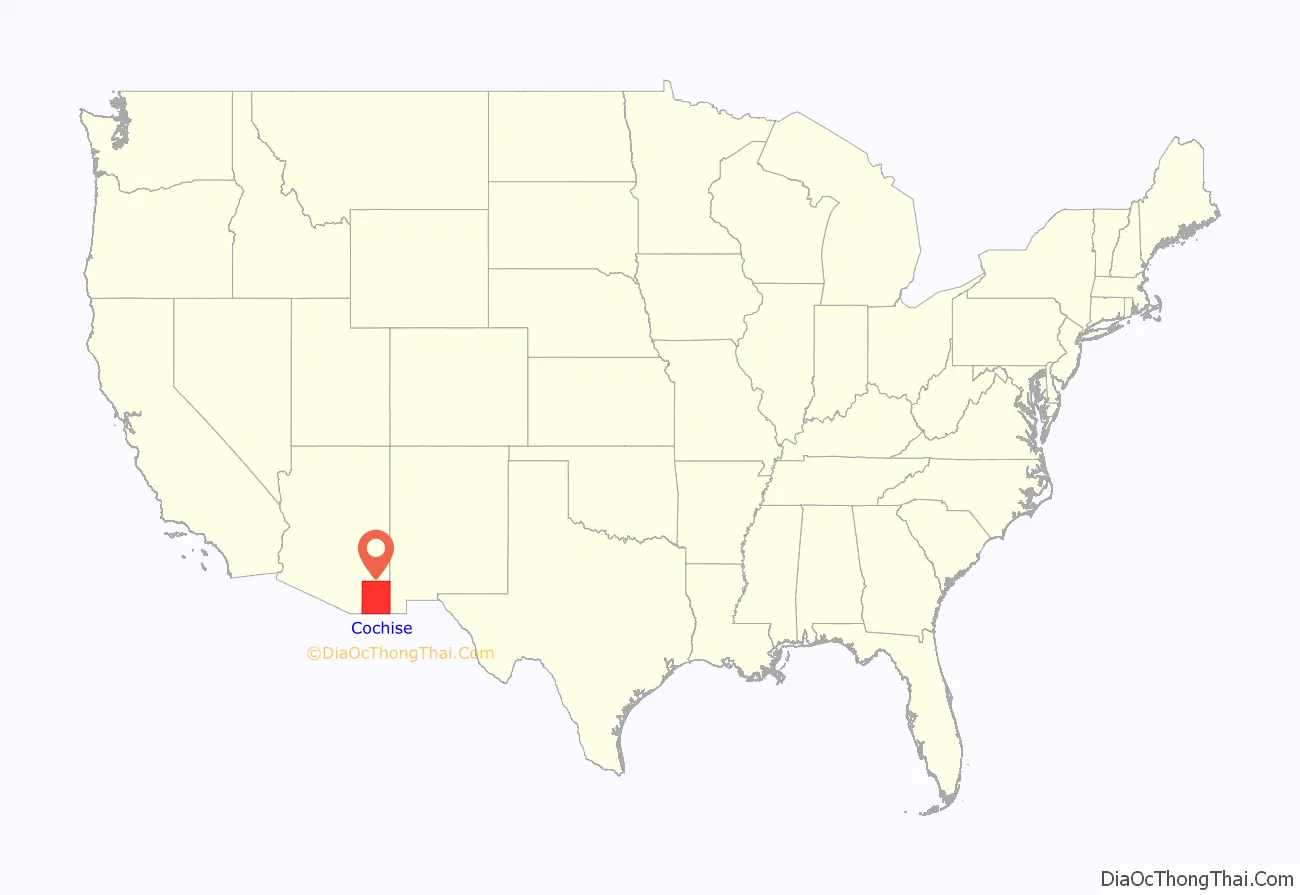
Cochise County location map. Where is Cochise County?
History
In 1528, Spanish explorers Álvar Núñez Cabeza de Vaca, Estevanico, and Fray Marcos de Niza survived a shipwreck off the Texas coast. Captured by Native Americans, they spent eight years finding their way back to Mexico City, via the San Pedro Valley. Their journals, maps, and stories led to the Cibola, seven cities of gold myth. The Expedition of Francisco Vásquez de Coronado in 1539 using it as his route north through what they called the Guachuca Mountains of Pima (Tohono O’odham) lands and later part of the mission routes north, but was actually occupied by the Sobaipuri descendants of the Hohokam. They found a large Pueblo (described as a small city) between present-day Benson and Whetstone, and several smaller satellite villages and smaller pueblos including ones on Fort Huachuca, Huachuca City and North Eastern Fry. About 1657 Father Kino visited the Sobaipuris just before the Apache forced most from the valley, as they were struggling to survive due to increasing Chiricahua Apache attacks as they moved into the area of Texas Canyon of the Dragoon Mountains. In 1775, Presidio Santa Cruz de Terrenate was founded on the west bank of the San Pedro River to protect the natives as well as the Spanish settlers who supplied the mission stations. The presidio was chronically short on provisions due to raids, however, and lacked personnel to adequately patrol the eastern route due to wars with France and England, so the main route north shifted west to the Santa Cruz valley, farther from the range of the Chiricahua Apache who almost exclusively controlled the area by 1821.
Cochise County was created on February 1, 1881, out of the eastern portion of Pima County. It took its name from the legendary Chiricahua Apache war chief Cochise. The county seat was Tombstone until 1929 when it moved to Bisbee. Notable men who once held the position of County Sheriff were Johnny Behan, who served as the first sheriff of the new county, and who was one of the main characters during the events leading to and following the gunfight at the O.K. Corral. Later, in 1886, Texas John Slaughter became sheriff. Lawman Jeff Milton and lawman/outlaw Burt Alvord both served as deputies under Slaughter.
A syndicated television series which aired from 1956 to 1958, The Sheriff of Cochise starring John Bromfield, was filmed on location in Cochise County. The Jimmy Stewart movie Broken Arrow and subsequent television show of the same name starring John Lupton, which also aired from 1956 to 1958, were set in Cochise County but filmed at other locations.
J.A. Jance’s Joanna Brady mystery series takes place in Cochise County, where Brady is sheriff.
Beginning in the late 1950s, the small community of Miracle Valley was the site of a series of bible colleges and similar religious organizations, founded by television evangelist A. A. Allen. In 1982, Miracle Valley and neighboring Palominas were the site of a series of escalating conflicts between a newly arrived black religious community and the county sheriff and deputies that culminated in the Miracle Valley shootout.
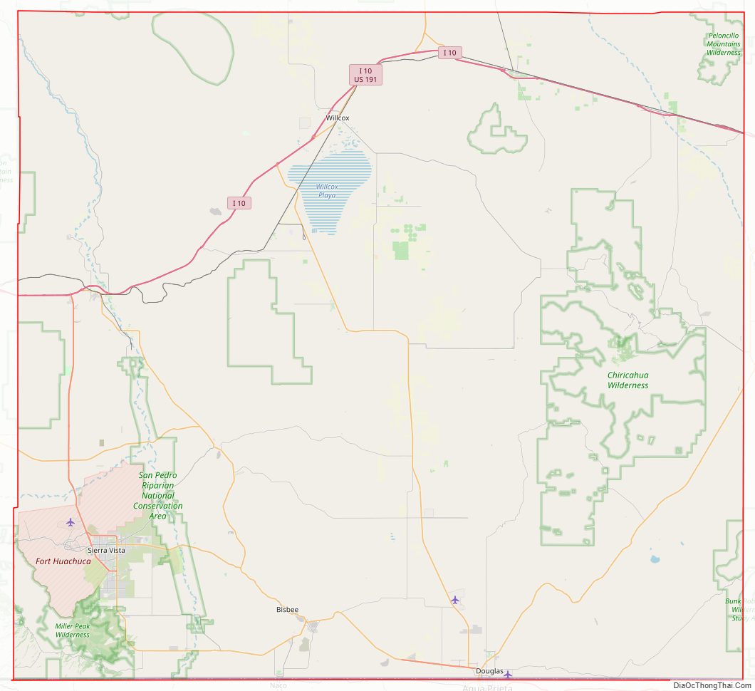
Cochise County Road Map
Geography
According to the United States Census Bureau, the county has a total area of 6,219 square miles (16,110 km), of which 6,166 square miles (15,970 km) is land and 53 square miles (140 km) (0.9%) is water. Cochise County is close to the size of the states of Rhode Island and Connecticut combined.
Adjacent counties and municipios
- Santa Cruz County – south and west
- Pima County – west
- Graham County – north
- Greenlee County – north
- Hidalgo County, New Mexico – east
- Agua Prieta, Sonora, Mexico – south
- Cananea, Sonora, Mexico – south
- Naco, Sonora, Mexico – south
- Santa Cruz, Sonora, Mexico – south
Protected areas
- Chiricahua National Monument
- Coronado National Forest (part)
- Coronado National Memorial
- Fort Bowie National Historic Site
- Kartchner Caverns State Park
- Leslie Canyon National Wildlife Refuge
- San Pedro Riparian National Conservation Area
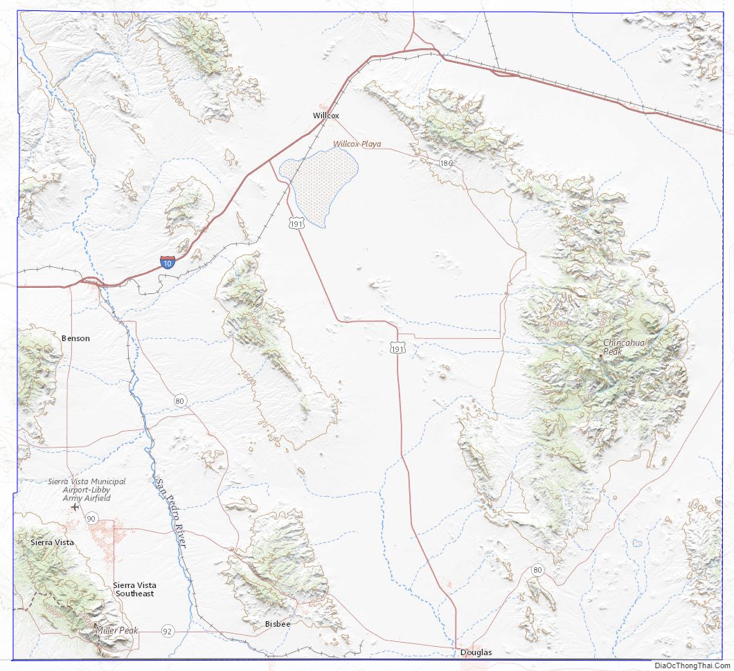
Cochise County Topographic Map
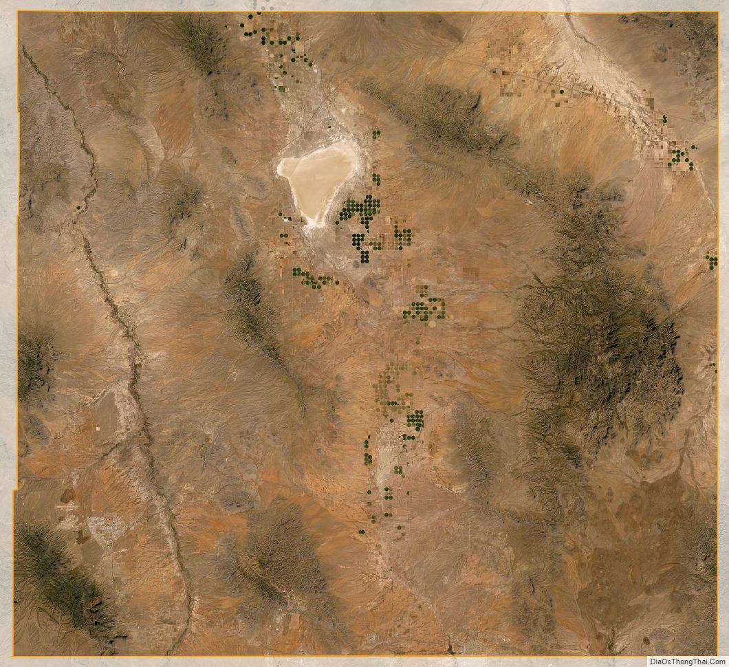
Cochise County Satellite Map
Cochise County Outline Map