Payson is a town in northern Gila County, Arizona, United States. Due to Payson’s location being very near to the geographic center of Arizona, it has been called “The Heart of Arizona”. The town is surrounded by the Tonto National Forest, the largest of the six national forests in Arizona and is the ninth largest national forest in the United States.[1][2]
Payson boasts a lively festival calendar, including the World’s Oldest Continuous Rodeo, established in 1884 and the Old Time Fiddlers Contest which celebrates the area’s musical heritage.
As of the 2020 census, the population of Payson was 16,361.
| Name: | Payson town |
|---|---|
| LSAD Code: | 43 |
| LSAD Description: | town (suffix) |
| State: | Arizona |
| County: | Gila County |
| Incorporated: | 1973 |
| Elevation: | 5,100 ft (1,554.48 m) |
| Total Area: | 19.36 sq mi (50.13 km²) |
| Land Area: | 19.35 sq mi (50.11 km²) |
| Water Area: | 0.01 sq mi (0.02 km²) |
| Total Population: | 16,361 |
| Population Density: | 845.10/sq mi (326.30/km²) |
| ZIP code: | 85541, 85547 |
| Area code: | 928 |
| FIPS code: | 0453700 |
| Website: | www.paysonaz.gov |
Online Interactive Map
Click on ![]() to view map in "full screen" mode.
to view map in "full screen" mode.
Payson location map. Where is Payson town?


History
The founding year of Payson is considered to be 1882, at which time the town was known as “Green Valley”. On March 3, 1884, a post office was established with the help of Illinois Representative Levi Joseph Payson. In honor of the representative’s help, the town’s name was changed to “Payson”.
Payson had its first rodeo in 1884. The town declares the competition to be the world’s oldest and continuous rodeo as it has been held every year since.
In 1918 author Zane Grey made his first trip to the area surrounding Payson. He would visit with regularity through 1929, and would purchase two plots of land near Tonto Creek, including 120 acres (49 ha) from Sampson Elam Boles under Myrtle Point. Grey wrote numerous books about the area and also filmed some movies, such as To the Last Man, in the Payson area in the 1920s.
During Prohibition the manufacture, sale, and distribution of liquor was plentiful. The transactions took place on historic Bootleg Alley.
During the 1930s an effort was begun to establish a better road from Payson to connect it to the outside world. At that time the town was very isolated, with a trip from Phoenix to Payson taking eight to twelve hours. Throughout the 1950s work on a paved road from Phoenix to Payson progressed, and the road was completed in 1958. The highway, State Route 87 (also known as the “Beeline Highway”), was later expanded to four lanes.
Ellison Creek & East Verde River flooding
On July 15, 2017, heavy rains from upstream of the creek and river caused the waterways to swell, subsequently leading to downstream flooding which crucially affected the popular Water Wheel swimming hole where 10 people were killed and 4 others were injured during the flood event.
Payson Road Map

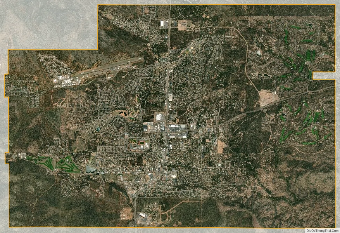
Payson city Satellite Map
Geography
Located in northern Gila County at an elevation of 5,000 feet (1,500 m), the town has a total area of 19.5 square miles (51 km). The Mogollon Rim, the southern boundary of the Colorado Plateau, lies to the north of Payson, with elevations exceeding 7,500 feet (2,300 m); there are many cold water lakes on top of the rim. They are stocked with fish by the Arizona Game and Fish Department.
Payson is bordered to the east by the town of Star Valley. Other nearby communities are Pine, Strawberry, Gisela and Rye, all within Gila County. Globe, the Gila County seat, is 80 miles (130 km) to the south via State Routes 87 and 188. State Route 87, the Beeline Highway, leads southwest 90 miles (140 km) to Phoenix and northeast 90 miles (140 km) to Winslow. State Route 260 leads east from Payson 90 miles (140 km) to Show Low.
Zane Grey Country
“Zane Grey Country” is a term for the area around Payson. This term was most often used in the 1970s and 1980s, and appeared in the header of the local newspaper, the Payson Roundup. In recent times it has fallen somewhat out of favor, as the term “Rim Country” has become more popular among locals.
See also
Map of Arizona State and its subdivision: Map of other states:- Alabama
- Alaska
- Arizona
- Arkansas
- California
- Colorado
- Connecticut
- Delaware
- District of Columbia
- Florida
- Georgia
- Hawaii
- Idaho
- Illinois
- Indiana
- Iowa
- Kansas
- Kentucky
- Louisiana
- Maine
- Maryland
- Massachusetts
- Michigan
- Minnesota
- Mississippi
- Missouri
- Montana
- Nebraska
- Nevada
- New Hampshire
- New Jersey
- New Mexico
- New York
- North Carolina
- North Dakota
- Ohio
- Oklahoma
- Oregon
- Pennsylvania
- Rhode Island
- South Carolina
- South Dakota
- Tennessee
- Texas
- Utah
- Vermont
- Virginia
- Washington
- West Virginia
- Wisconsin
- Wyoming


