Globe (Western Apache: Bésh Baa Gowąh “Place of Metal”) is a city in Gila County, Arizona, United States. As of the 2020 census, the population of the city was 7,249. The city is the county seat of Gila County. Globe was founded c. 1875 as a mining camp. Mining, tourism, government and retirees are most important in the present-day Globe economy.
The Globe Downtown Historic District was added to the National Register of Historic Places in 1987.
| Name: | Globe city |
|---|---|
| LSAD Code: | 25 |
| LSAD Description: | city (suffix) |
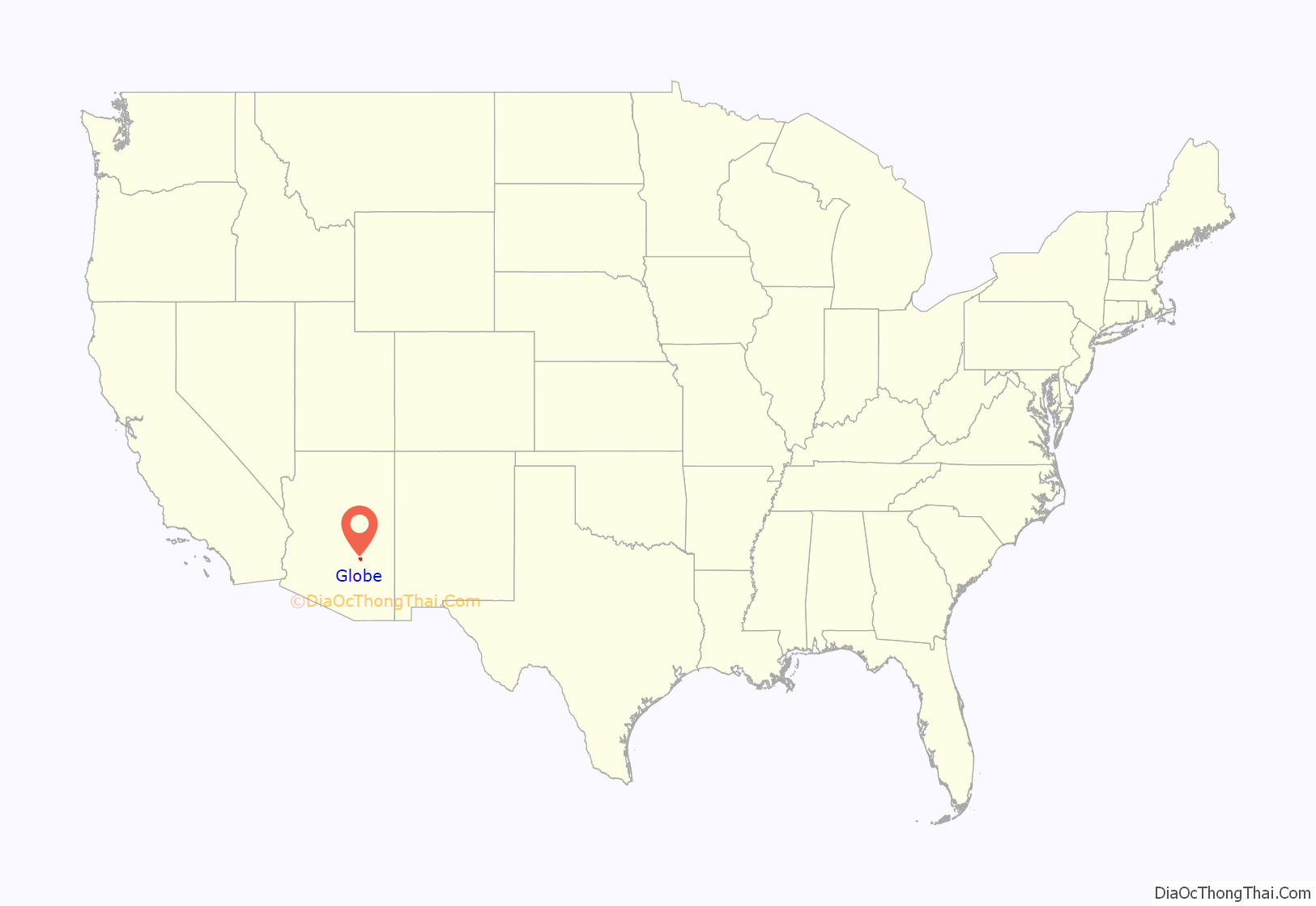
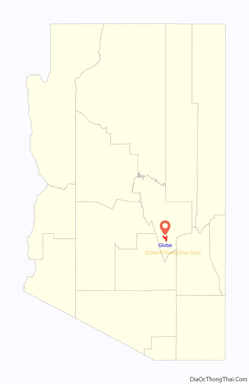
| State: | Arizona |
| County: | Gila County |
| Founded: | c. 1875 |
| Incorporated: | 1907 |
| Elevation: | 3,510 ft (1,070 m) |
| Total Area: | 18.21 sq mi (47.17 km²) |
| Land Area: | 18.20 sq mi (47.14 km²) |
| Water Area: | 0.01 sq mi (0.03 km²) |
| Total Population: | 7,249 |
| Population Density: | 398.27/sq mi (153.77/km²) |
| ZIP code: | 85501-85502 |
| Area code: | 928 |
| FIPS code: | 0428030 |
| GNISfeature ID: | 29342 |
| Website: | www.globeaz.gov |
Online Interactive Map
Click on ![]() to view map in "full screen" mode.
to view map in "full screen" mode.
Globe location map. Where is Globe city?
History
Besh-Ba-Gowah, about one mile south of Globe, was occupied by Salado populations between AD 1225 and AD 1400.
In 1875 silver was discovered in the San Carlos Apache Indian Reservation. Accordingly, that same year, the mining camp at Ramboz Peak nearest to the reservation relocated to what became Globe. The plans for an incorporated Globe were established in July 1876, with retail stores, banks, and Globe’s first newspaper printing its first issue on May 2, 1878. By February 1881, Globe was the Gila County seat. Coming with Globe’s new importance as the county seat came a stagecoach line linking it to Silver City, New Mexico.
Due to Globe’s relative isolation from the rest of Arizona and its proximity to the San Carlos Apache reservation, Globe remained a frontier town. Globe’s history is laced with many historic events such as murders, stagecoach robberies, outlaws, lynchings, and Apache raids. Natiotish, a San Carlos Apache, left the reservation with a group of about 50 men and continued to attack ranchers and miners.
In 1884 the surviving Clanton brothers Ike and Phineas arrived in Apache County after the infamous gunfight at the OK Corral in Tombstone. Ike was eventually killed by a local deputy sheriff, and Phineas, after serving prison time for a stage robbery, moved to Globe, where he died of pneumonia and was buried in 1906.
Globe is also known for having links to Geronimo and the Apache Kid. On October 23, 1889, the Apache Kid’s trial was held in the Globe Courthouse. After he was convicted, it was the responsibility of Sheriff Glenn Reynolds to transport him to the Arizona Territorial Prison in Yuma. Sheriff Reynolds, his deputy, and their prisoners set out in an armored stagecoach holding the Apache Kid inside. At an incline in the road, known as the Kelvin Grade Massacre, near present-day Kearny, Sheriff Reynolds let some of the prisoners out of the stagecoach seeing as they were on an uphill climb and he wanted to ease the burden on the horses. The prisoners were able to overcome and murder Sheriff Reynolds as well as one other man. A third was left for dead. In response, the United States Army launched a campaign to track down the renegades.
Old Dominion copper mine
The Old Dominion Mining Company was incorporated in 1880, and ran “on a financial roller-coaster” for the next twenty years. In 1894, the mine was sold to the Lewisohn Brothers of New York. The arrival of the railroad in 1898 dramatically lowered shipping costs. In 1904, the mine was acquired by Phelps-Dodge, who appointed Louis D. Ricketts as general manager. From 1904 to 1908, Phelps-Dodge spent $2.5 million on expanding and modernizing the mine and plant. As the mine grew, so did Globe. World War 1 brought increased copper demand; the mine and town both prospered. 1917 was a year of labor unrest in the copper mines nationwide. A strike on the Globe mines was called on July 1, 1917. Federal troops were called in to restore order, miners began returning to work, and the mine was back to normal production by October.
In the postwar years, the Old Dominion never returned to its former glory. Neglected maintenance, declining ore grades, and flooding underground all took their toll. The mine closed during the recession of 1921–22, and the mine closed permanently in 1931. In its half-century of operation, the mine produce some 800 million pounds of copper, and returned gross earnings of $134 million to shareholders. It was the economic mainstay for the Globe community for most of this half-century.
The property was sold to the Miami Copper Company as a water supply in 1941, and continues to supply both industrial and domestic water to the area.
Historic buildings
(Buildings that burned or no longer stand are listed in italics)
- Gila County Courthouse and Jail – four-story courthouse and adjacent three-story jail behind which many were hanged, built 1905, 1909 – today it is the Cobre Valley Center for the Arts.
- Drift Inn Saloon – A bar in Downtown Historic Globe which has been operating since 1902.
- Trust building (European Hotel, Terminal Hotel, Pioneer Hotel) – a four-story brick structure that contained apartments, offices, and hotel rooms for rent, built 1906 burned 2005.
- Old Dominion Hotel – a prominent hotel of downtown Globe; known for Cactus Room Cocktails and the balconies that hung over the street. Built 1905; burned 1981.
- Elks Lodge building – the tallest three-story building in the world. Built 1910; is now an Antique store.
- Murphy Hotel (Tonto Hotel) – a 1916 hotel that closed in the 1970s and is in need of restoration.
- Old Dominion Library – built in 1915 as a memorial to miner’s deaths in a mining accident; burned 1981.
- Woolworth Building – opened 1916 as FW Woolworth and Company. This was the last Woolworth store to close west of the Mississippi River. Now contains United Jewelry Company.
- Gila Valley Bank and Trust Building – a 1909 building designed by Sullivan architects of Chicago. The entire ceiling has the original skylights, is now a day spa.
- Globe High School – built 1910; the oldest high school in the State of Arizona that is still in use by its original tenant.
- Globe Theater – built 1917; art deco theater with copper columns, a balcony, and retro concession stand; burned 2005, but has since been reconstructed on the original site using original marquee and other architectural features.
- Alden Theater – an art deco/Spanish colonial theater built around 1910; torn down after a fire in 1974.
- Holy Angels Catholic Church – 1918 church with seven story bell tower; still in operation.
- Hill Street Mall – a.k.a. “Johnnie’s Country Corner”. The Dance Hall Platform for Globe prior to statehood. Has also been the Pay’n Takit grocery, Coca-Cola Bottling Plant, Gila County Museum and Safeway grocery. Shaped in the state of Arizona. Currently operating as an antique and fabric mall.
- Globe-Miami Mine Rescue Station – operated into the 1960s, serving as an emergency rescue center. Now used as a museum.
- Gila Valley, Globe, and Northern Railway Station (Southern Pacific station, Arizona Eastern station) – built 1910/1916; prominent train depot from construction to close in the 1950s, now a museum.
- Central School, built in 1891 (addition in 1912). For many years, it was one of the oldest school buildings still in use in Arizona. It was demolished circa 1996.
- Noftsger Hill School is a classical-revival structure, built in 1917. It is presently used as a bed and breakfast inn.
- Besh-Ba-Gowah Pueblo is a reconstructed 14th century Salado Indian ruin, with an archaeological museum adjacent.
- Gila Pueblo was built as an archaeology center c. 1930 by Harold S. Gladwin. Now used as the Gila Pueblo campus of Eastern Arizona College, the building is on the National Register of Historic Places.
- Cubitto Jewelry building is the building which housed Cubitto Jewelry from 1905 to 1996; the building has large original glass windows, original maple floor, and skylights.
Globe Road Map
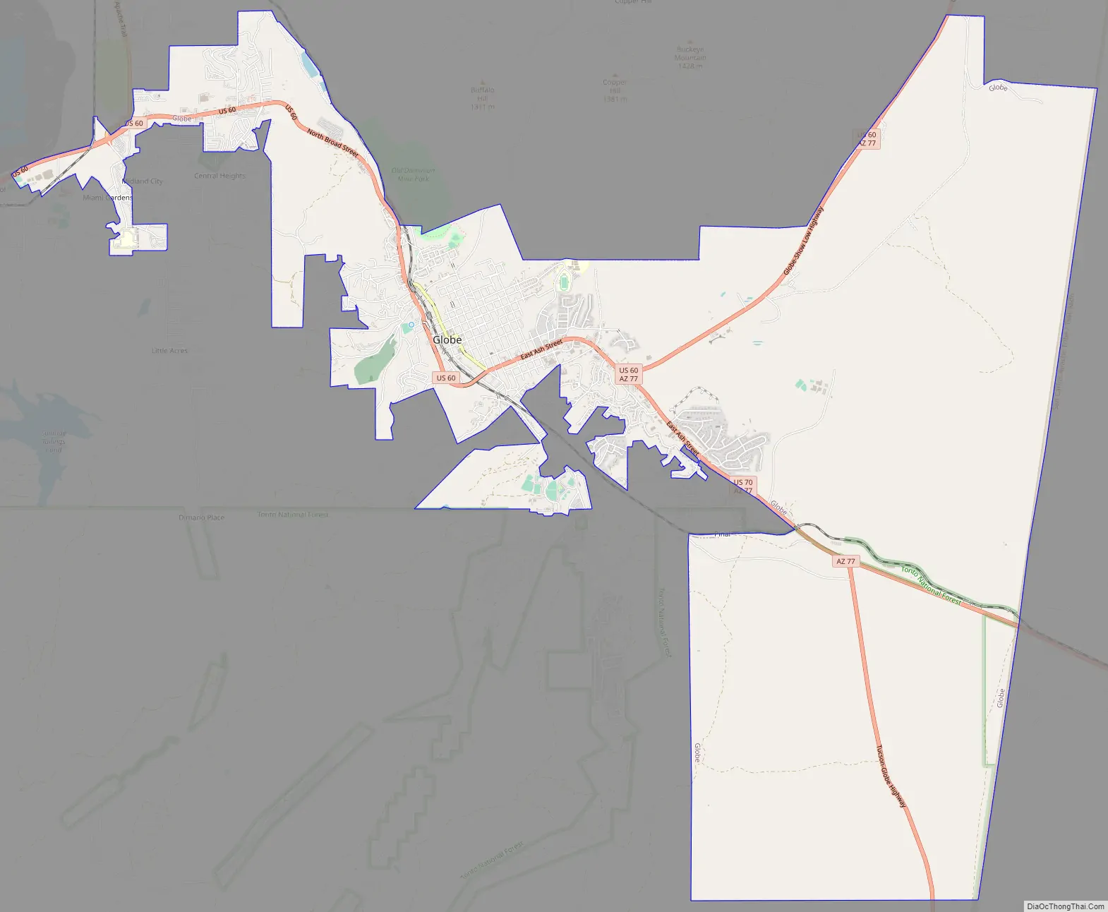
Globe city Satellite Map

Geography
Globe is in southern Gila County at 33°23′59″N 110°46′54″W / 33.39972°N 110.78167°W / 33.39972; -110.78167 (33.399858, −110.781570), in the valley of Pinal Creek, a north-flowing tributary of the Salt River. U.S. Route 60 passes through the city, leading northeast through the Fort Apache Indian Reservation 87 miles (140 km) to Show Low, and west 87 miles (140 km) to Phoenix. The western terminus of U.S. Route 70 is in Globe at US 60 on the east side of town; US 70 leads southeast through the San Carlos Apache Indian Reservation 77 miles (124 km) to Safford and 2,385 miles (3,838 km) to its eastern terminus at Atlantic, North Carolina. Arizona State Route 77 leads south from Globe 36 miles (58 km) to Winkelman, and Roosevelt is 31 miles (50 km) to the northwest via State Route 188, which also provides a route to Payson, located along State Route 87.
According to the United States Census Bureau, the city of Globe has a total area of 18.2 square miles (47.1 km), of which 0.01 square miles (0.03 km), or 0.07%, is water. The town of Miami is 6 miles (10 km) west of Globe’s downtown. Globe, Miami, and the unincorporated areas nearby (including Inspiration, Claypool and Central Heights-Midland City) are commonly called “Globe-Miami”.
See also
Map of Arizona State and its subdivision: Map of other states:- Alabama
- Alaska
- Arizona
- Arkansas
- California
- Colorado
- Connecticut
- Delaware
- District of Columbia
- Florida
- Georgia
- Hawaii
- Idaho
- Illinois
- Indiana
- Iowa
- Kansas
- Kentucky
- Louisiana
- Maine
- Maryland
- Massachusetts
- Michigan
- Minnesota
- Mississippi
- Missouri
- Montana
- Nebraska
- Nevada
- New Hampshire
- New Jersey
- New Mexico
- New York
- North Carolina
- North Dakota
- Ohio
- Oklahoma
- Oregon
- Pennsylvania
- Rhode Island
- South Carolina
- South Dakota
- Tennessee
- Texas
- Utah
- Vermont
- Virginia
- Washington
- West Virginia
- Wisconsin
- Wyoming


