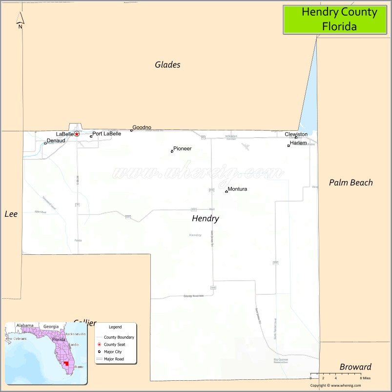
Hendry County is a county in the Florida Heartland region of the U.S. state of Florida. As of the 2020 census, the population was 39,619, down from 42,022 at the 2010 census. Its county seat is LaBelle.
Hendry County comprises the Clewiston, Micropolitan Statistical Area.
| Name: | Hendry County |
|---|---|
| FIPS code: | 12-051 |
| State: | Florida |
| Founded: | May 11, 1923 |
| Named for: | Francis A. Hendry |
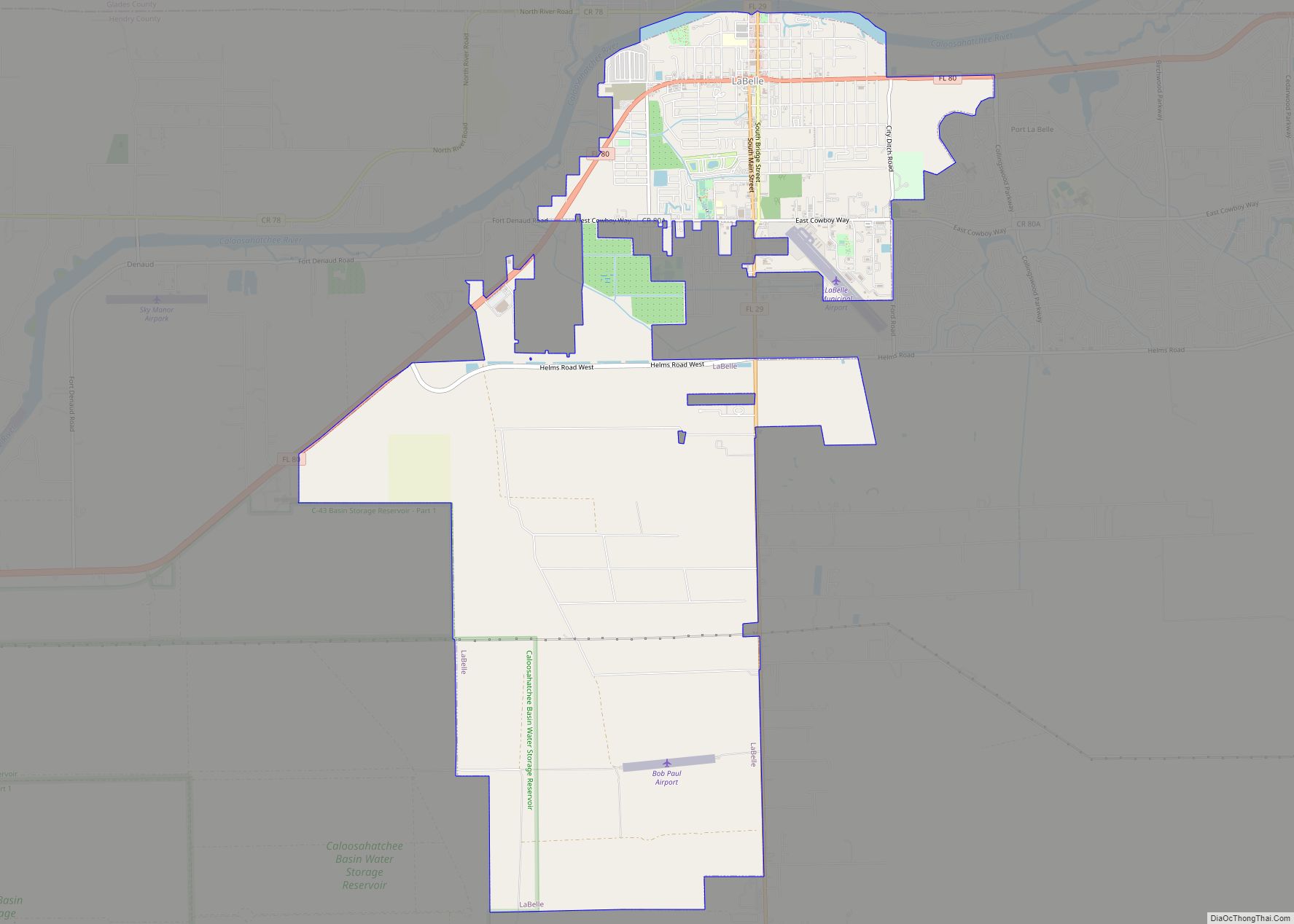
| Seat: | LaBelle |
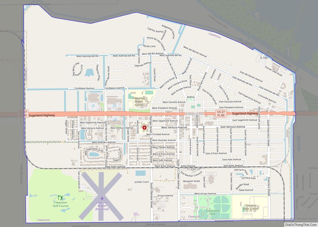
| Largest city: | Clewiston |
| Total Area: | 1,190 sq mi (3,100 km²) |
| Land Area: | 1,153 sq mi (2,990 km²) |
| Total Population: | 39,619 |
| Population Density: | 33/sq mi (13/km²) |
| Time zone: | UTC−5 (Eastern) |
| Summer Time Zone (DST): | UTC−4 (EDT) |
| Website: | www.hendryfla.net |
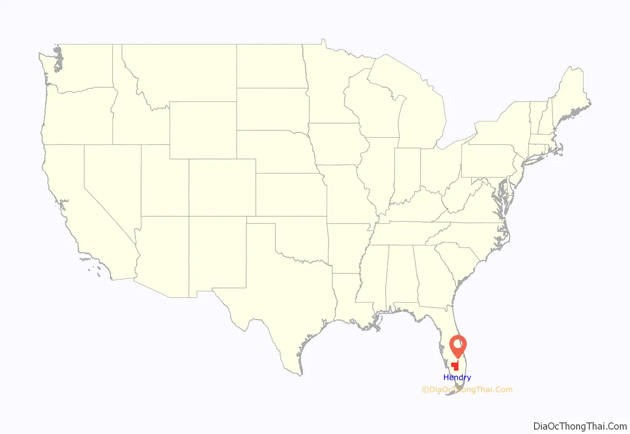
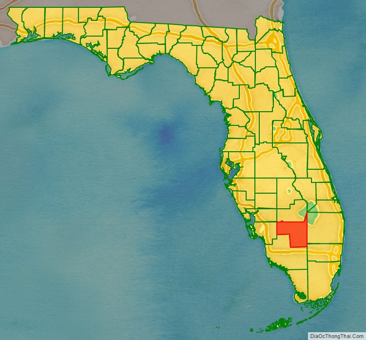
Hendry County location map. Where is Hendry County?
History
Indigenous peoples migrated into Florida around 10000 B.C.E., while the Glades culture existed in southern Florida from approximately 500 B.C.E. to 1500 C.E. Archaeological sites attesting to the presence of the Glades culture in modern-day Hendry County include Clewiston Mounds, Maple Mound, South Lake Mounds, and Tony’s Mound. When Europeans arrived in Florida in the 16th century, the Calusa and Mayaimi tribes resided in Southwest Florida and around Lake Okeechobee.
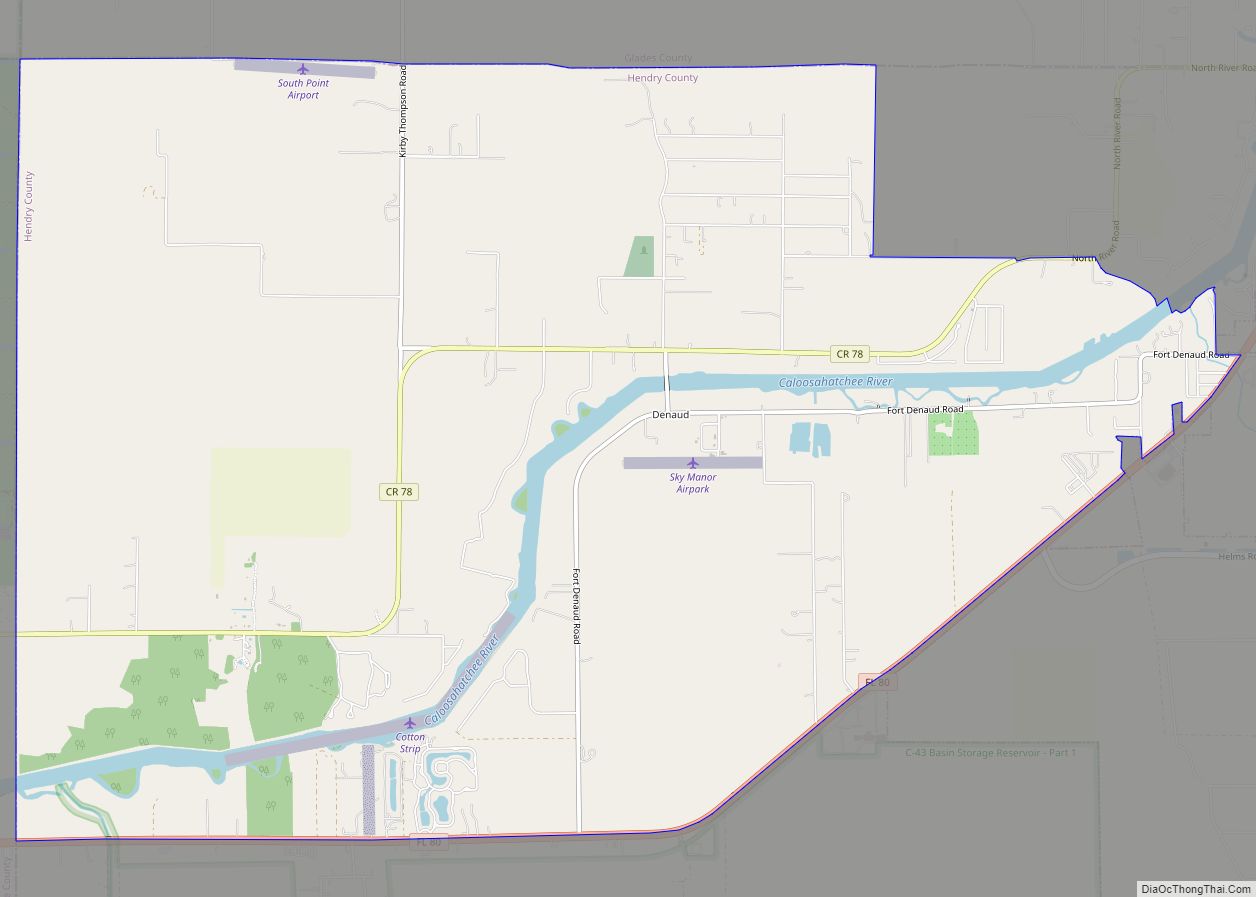
In the early 1800s, French trader Pierre Denaud established a trading post in the modern-day LaBelle area. During the Seminole Wars, United States troops built a fort along the Caloosahatchee River in 1838, named Fort Denaud in his honor. About three years later, Fort Thompson was established. These military posts became the first permanent settlements in modern-day Hendry County. Originally, the area now comprising Hendry County remained relatively inaccessible, as the Florida Everglades covered more than half of the county’s present-day boundaries. Further, nearly the entire area became submerged with water seasonally; thus, only cattle-grazing was a suitable industry. However, by 1881, the Atlantic and Gulf Coast and Okeechobee Land Company began draining the land after entering into a contract with the trustees of the internal improvement fund. The county’s first post office was established at Fort Thomson in 1884. The state of Florida established Lee County in 1887, which included land now part of Hendry County. Settlement in LaBelle began around 1889 or 1890, after the town was platted by Francis A. Hendry, a cattle rancher, politician, and officer in the Confederate States Army during the American Civil War.
Around the beginning of the 20th century, commercial fishermen began building fishing camps along Lake Okeechobee at Sand Point, later renamed Clewiston, though the city was not permanently settled until about 1920. In 1911, LaBelle became the oldest municipality in modern-day Hendry County after officially incorporating. That same year, the United States government established the Big Cypress Indian Reservation in present-day Hendry County via executive order by President William Howard Taft. By the early 1920s, residents in the eastern Lee County communities of Clewiston, Felda, Fort Denaud, and LaBelle began campaigning for the creation of a new county. Among their reasons for supporting the establishment of a new county was dissatisfaction with the distance between eastern Lee County settlements and the county seat, Fort Myers. Around that time, the Caloosahatchee Current was established to prove that the area could sustain a newspaper publication.
On May 11, 1923, just three days after neighboring Collier County was also created and partitioned from Lee County, the Florida Legislature voted to establish Hendry County, named after Francis A. Hendry. The first county commissioners were M.F. Boisclaire, M.E. Forrey, Thomas O’Brien, R.H. Magill, and L.N. Thomas. The town of LaBelle (chartered as a city in 1925) was designated as the county seat. A temporary jail was erected at a city park in LaBelle, while E.E. Goodno, who owned the Everett Hotel, allowed rooms and office space in the building to be used as a temporary courthouse.
Residents voted by a wide margin in favor of a $530,000 bond issue in November 1924, with $430,000 to be allotted towards improvement of roads and $100,000 for construction of a courthouse. The courthouse was finished in 1927, and has been listed in the National Register of Historic Places since 1990. In 1925, the only other incorporated municipality in Hendry County, Clewiston, became a city. In mid-1926, a cross-state highway (initially designated as State Road 25, but later renumbered 80) linking Fort Myers to Palm Beach was completed and passed through Hendry County. Around this time, the Gulf Atlantic Transportation, based in LaBelle, began providing transportation from Fort Myers to West Palm Beach. Another improvement to transportation occurred when the Seaboard–All Florida Railway started its rail service from LaBelle to Fort Myers in mid-1927. The 1926 Miami hurricane and 1928 Okeechobee hurricane both impacted Hendry County, though damage and loss of life was significantly less than in other areas around Lake Okeechobee.
The Number 5 British Flying Training School was operated at Riddle Field in Clewiston during World War II, with more than 1,800 Royal Air Force pilots trained there. Upon completion of the Herbert Hoover Dike in 1961, a dedication ceremony was held in Clewiston, which included a speech by former president Herbert Hoover.
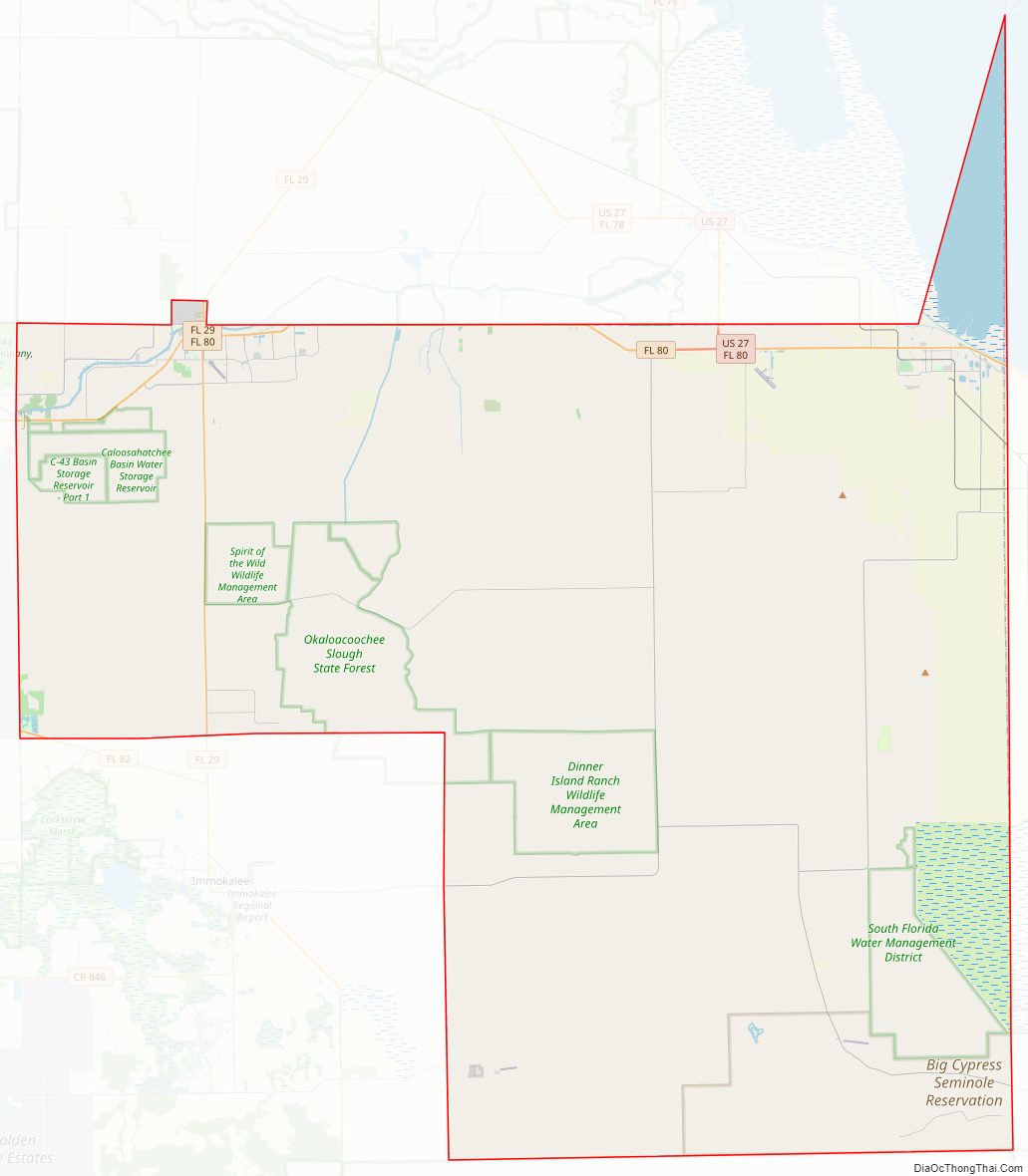
Hendry County Road Map
Geography
According to the U.S. Census Bureau, the county has a total area of 1,190 square miles (3,100 km), of which 1,153 square miles (2,990 km) is land and 37 square miles (96 km) (3.1%) is water. The county borders Lake Okeechobee; the Lake Okeechobee Scenic Trail runs through Hendry County.
Adjacent counties
- Glades County – north
- Martin County – northeast
- Okeechobee County –
northeast point in the middle of Lake Okeechobee - Palm Beach County – east
- Broward County – southeast
- Collier County – south
- Lee County – west
- Charlotte County – west
Hendry County Topographic Map
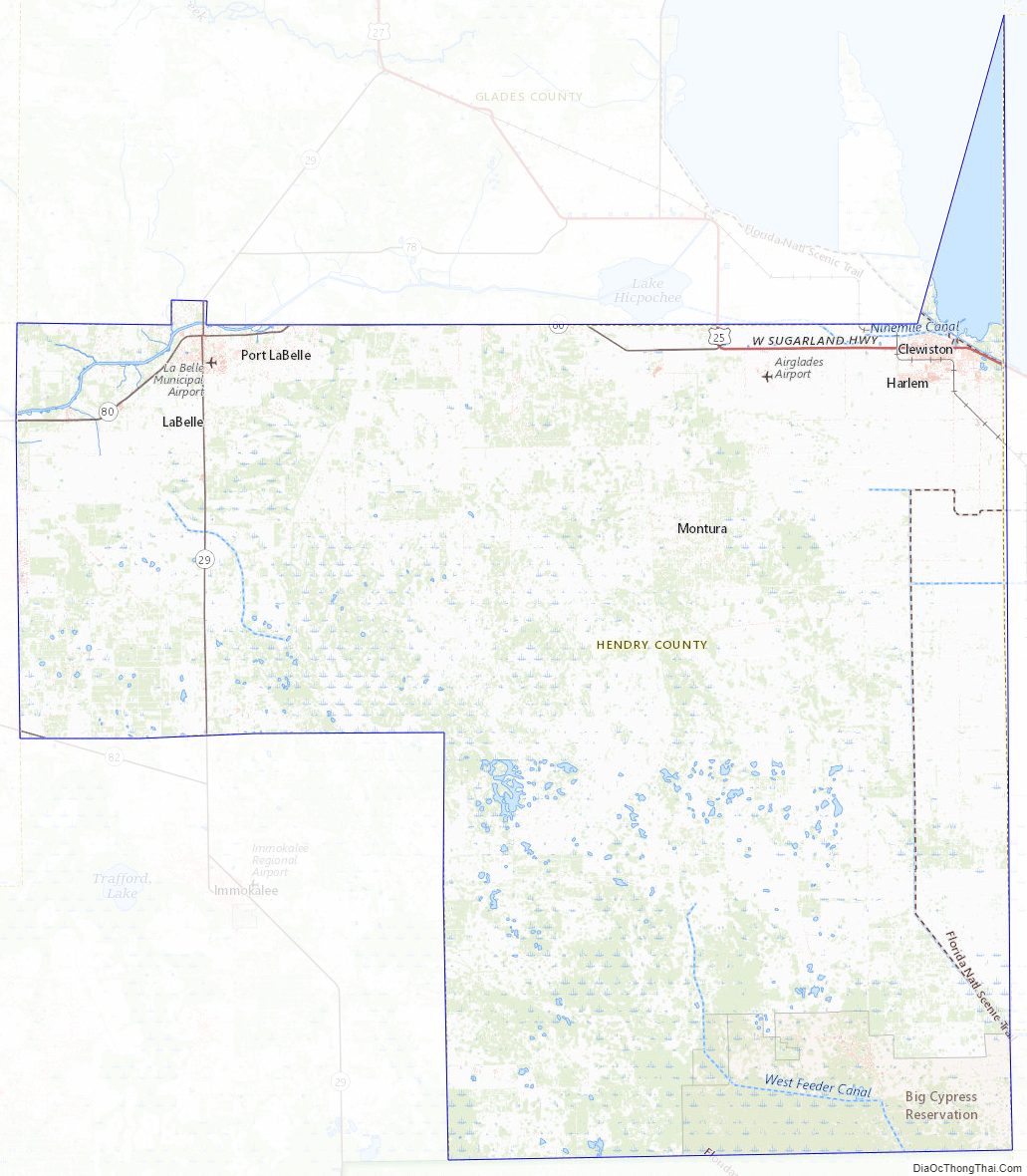
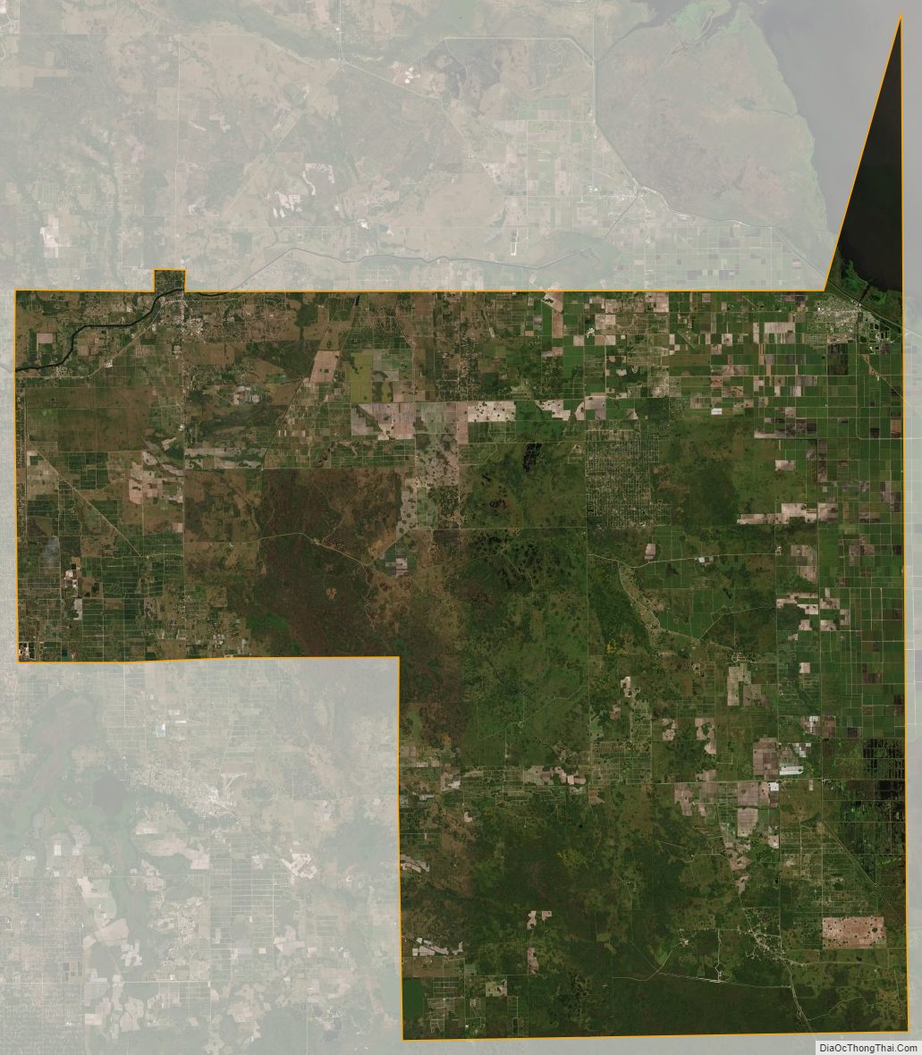
Hendry County Satellite Map
Hendry County Outline Map