El Centro (Spanish for “The Center”) is a city and county seat of Imperial County, California, United States. El Centro is the largest city in the Imperial Valley, the east anchor of the Southern California Border Region, and the core urban area and principal city of the El Centro metropolitan area which encompasses all of Imperial County. El Centro is also the largest U.S. city to lie entirely below sea level (−42 feet or −13 meters). The city, located in southeastern California, is 113 miles (182 km) from San Diego and less than 20 miles (32 km) from the Mexican city of Mexicali.
The city was founded in 1906 by W. F. Holt and C.A. Barker, who purchased the land on which El Centro was eventually built for about $40 per acre ($100 per hectare) and invested $100,000 ($3,000,000 in 2021 dollars) in improvements. The modern city is home to retail, transportation, wholesale, and agricultural industries. There are also two international border crossings nearby for commercial and noncommercial vehicles. El Centro’s census population as of 2020 was 44,322, up from 42,598 at the 2010 Census.
| Name: | El Centro city |
|---|---|
| LSAD Code: | 25 |
| LSAD Description: | city (suffix) |
| State: | California |
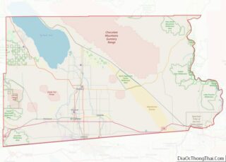
| County: | Imperial County |
| Incorporated: | April 16, 1908 |
| Elevation: | −42 ft (−12 m) |
| Total Area: | 11.86 sq mi (30.72 km²) |
| Land Area: | 11.84 sq mi (30.67 km²) |
| Water Area: | 0.02 sq mi (0.05 km²) 0.16% |
| Total Population: | 44,322 |
| Population Density: | 3,722.26/sq mi (1,437.12/km²) |
| ZIP code: | 92243-92244 |
| FIPS code: | 0621782 |
| Website: | www.cityofelcentro.org |
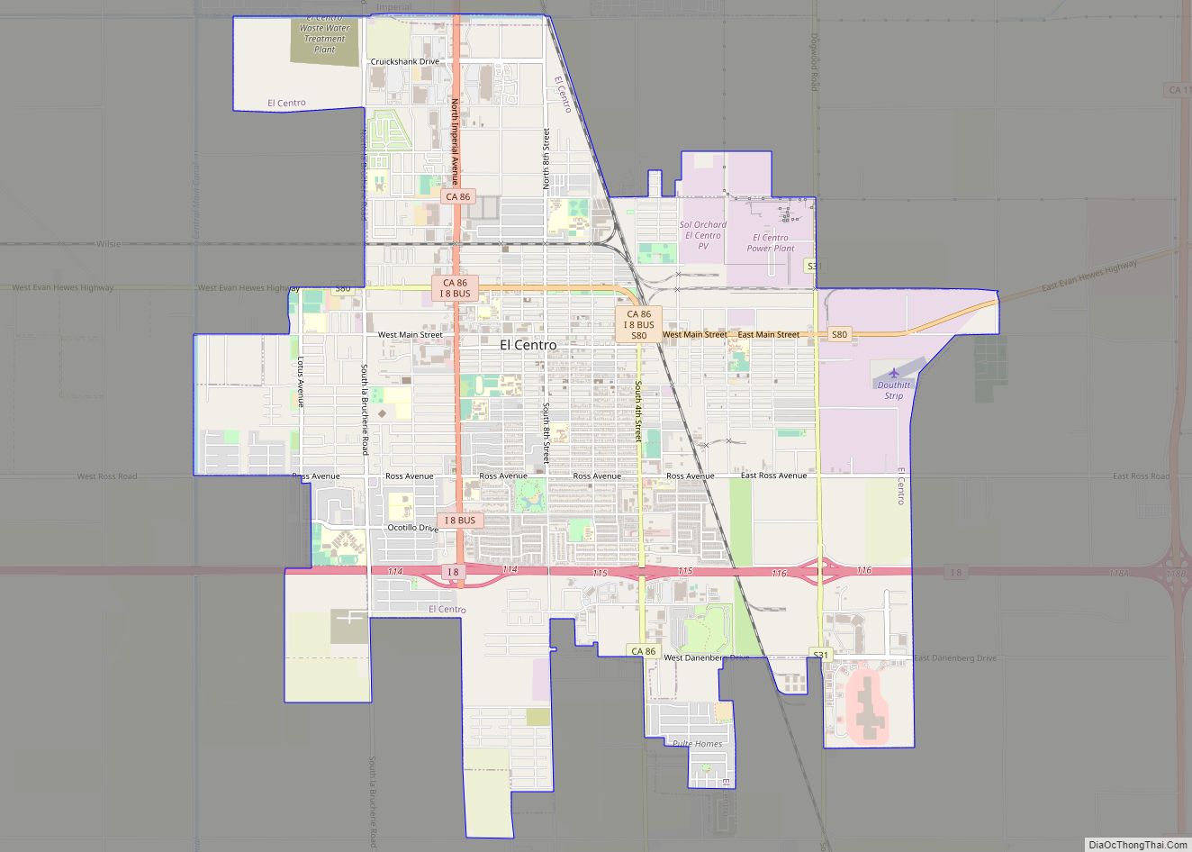
Online Interactive Map
Click on ![]() to view map in "full screen" mode.
to view map in "full screen" mode.
El Centro location map. Where is El Centro city?


History
Spanish explorer Melchor Díaz was one of the first Europeans to visit the area around El Centro and Imperial Valley in 1540. The explorer Juan Bautista de Anza also explored the area in 1776 (an elementary school in El Centro now bears his name). Years later, after the Mexican–American War, the northern half of the valley was annexed by the U.S., while the southern half remained under Mexican rule. Small scale settlement in natural aquifer areas occurred in the early 19th century (the present-day site of Mexicali), but most permanent settlement (Anglo Americans on the U.S. side, Mexicans on the other side) was after 1900.
Originally part of San Diego County, the Imperial Valley was settled by farmers once water from the Colorado River was diverted via canals to irrigate the desert valley floor.
In 1906, the land on which El Centro was later built was purchased by W. F. Holt and C.A. Barker.
In 1907 Imperial County was split off from San Diego County; by then much of the valley was successfully irrigated.
Before the town began, the railroad had established a station and named the place Cabarker. The name honored C.A. Barker, a friend of the landowner. The first post office in El Centro opened in 1905.
Early growth was rapid with the city’s population reaching 1,610 by 1910 and more than tripling by 1920 to 5,646 people. One reason for this rapid early growth was El Centro’s successful battle with the City of Imperial to become the county seat. In these early days, relationships among the cities of the Imperial Valley were often intensely competitive, reflecting the particular frontier character of the area and the fact that six cities within a twenty-mile radius were all established within one generation. These cities were in a horse race to win the prize of being the Valley’s leading city and the intense competition is measured by the fact that it took twenty years to get a county fair started because of strong local loyalties on the County Board of Supervisors.
The City of El Centro was incorporated on April 16, 1908. One reason for this rapid growth was El Centro’s becoming the county seat of Imperial County.
Population growth was slow, but accelerated in the 1930s, and again in the 1940s, despite the city being hard hit by a 7.1 earthquake in May 1940.
By the mid-1940s, El Centro had become the second largest city in the Imperial Valley, with a population of about 11,000 people. El Centro had also become the location of the Imperial Irrigation District (IID) administrative offices.
Agriculture has been an important industry within El Centro since the 1940s, because of its strategic location near rail lines and U.S. Highways 80 and 99 – more than 35 growers and shippers still operate in El Centro. However, by the early 1980s the two largest employment sectors in El Centro were government and wholesale/retail trade, reflecting El Centro’s emerging role as a regional administrative and commercial center.
Imperial Valley Mall opened on the southeast side of the city in 2005.
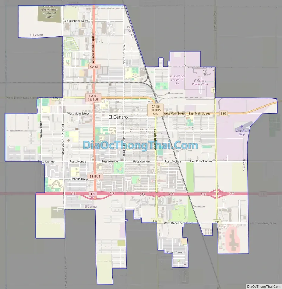
El Centro Road Map
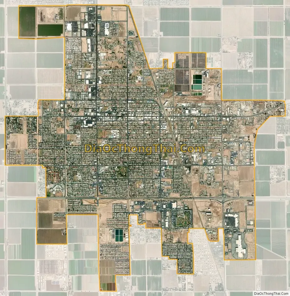
El Centro city Satellite Map
Geography
According to the United States Census Bureau, the city has a total area of 11.1 square miles (29 km), of which over 99% is land.
El Centro is located in the Imperial Valley (considered locally as synonymous with Imperial County). The city is 50 feet (15 m) below sea level and the largest city in the United States below sea level. The Imperial Valley is in the Colorado Desert, an extension of the larger Sonoran Desert.
The agriculture industry’s demand for water is supplied by canals diverting water from the nearby Colorado River. The Salton Sea was created after a 1905 flood from the Colorado River.
The El Centro earthquake of 1940 had a moment magnitude of 6.9 and a maximum perceived intensity of X (Extreme) on the Mercalli intensity scale. It was the first major earthquake to be recorded by a strong-motion seismograph located next to a fault rupture. It was intensely studied by structural engineers and assumed to be typical until the Northridge earthquake of 1994. In this region, the geology is dominated by the transition of the tectonic plate boundary from rift to transverse fault. The southernmost strands of the San Andreas Fault connect the northernmost extensions of the East Pacific Rise. Consequently, the region is subject to earthquakes, and the crust is being stretched, resulting in a sinking of the terrain over time.
Climate
El Centro has a desert climate and is the southernmost desert city below sea level in the continental United States. It features long, extremely hot summers, and mild winters. El Centro has over 350 days of sunshine and under 3 inches (76 mm) of rain annually. Winter temperatures are in the mid to high 60s with over-night lows in the low 40s. During summer days of June; typically the driest month of the year with no precipitation, the dry, desert heat can push temperatures well into the 100s, while the nights stay in the high 70s. The North American Monsoon typically increases moisture. At times, the climate can resemble that of tropical areas in the Caribbean. This leads to daily thunderstorms that can bring hail, downpours, lightning, and dust storms, more commonly known as Haboob. During the Eastern Pacific hurricane season, remnants of hurricanes or tropical storms may track through the desert and can result in heavy thunderstorms. This can lead to significantly higher than normal precipitation, at times bringing heavy rain.
The precipitation in the winter months is predominantly rain showers from the occasional winter storms. At times these storms bring cold temperatures to El Centro and surrounding cities, and mountain snowfall to the nearby Mountains. El Niño and La Niña play a large role in how much rain falls in the winter, La Nina typically brings drier and cooler conditions to El Centro and surrounding areas. El Niño tends to being wetter and average temperatures.
Snow is almost totally unknown in the area. However, on December 12, 1934, a very powerful winter storm brought record cold and snowfall to El Centro and surrounding areas of the Imperial Valley. Snow began falling at 8:45 p.m. December 11 and by 5 a.m. the next day (December 12)1-4 inches of snow had blanketed the desert floor.
Another instance of freezing precipitation was observed in December 1967 as a mix of sleet hail. On average there are about 15 days that dip into the mid to lower 30s.
Being below sea level, El Centro has warm days and cool nights in winter. The coldest daily maximum on record is 44 °F (7 °C) on December 14, 1967, and the mean for the coldest day is at 56.1 °F (13.4 °C) for the reference period between 1991 and 2020. The warmest low temperature on record is 98 °F (37 °C), recorded on August 30, 1976. The mean for the hottest night annually is at 87.2 °F (30.7 °C).
See also
Map of California State and its subdivision:- Alameda
- Alpine
- Amador
- Butte
- Calaveras
- Colusa
- Contra Costa
- Del Norte
- El Dorado
- Fresno
- Glenn
- Humboldt
- Imperial
- Inyo
- Kern
- Kings
- Lake
- Lassen
- Los Angeles
- Madera
- Marin
- Mariposa
- Mendocino
- Merced
- Modoc
- Mono
- Monterey
- Napa
- Nevada
- Orange
- Placer
- Plumas
- Riverside
- Sacramento
- San Benito
- San Bernardino
- San Diego
- San Francisco
- San Joaquin
- San Luis Obispo
- San Mateo
- Santa Barbara
- Santa Clara
- Santa Cruz
- Shasta
- Sierra
- Siskiyou
- Solano
- Sonoma
- Stanislaus
- Sutter
- Tehama
- Trinity
- Tulare
- Tuolumne
- Ventura
- Yolo
- Yuba
- Alabama
- Alaska
- Arizona
- Arkansas
- California
- Colorado
- Connecticut
- Delaware
- District of Columbia
- Florida
- Georgia
- Hawaii
- Idaho
- Illinois
- Indiana
- Iowa
- Kansas
- Kentucky
- Louisiana
- Maine
- Maryland
- Massachusetts
- Michigan
- Minnesota
- Mississippi
- Missouri
- Montana
- Nebraska
- Nevada
- New Hampshire
- New Jersey
- New Mexico
- New York
- North Carolina
- North Dakota
- Ohio
- Oklahoma
- Oregon
- Pennsylvania
- Rhode Island
- South Carolina
- South Dakota
- Tennessee
- Texas
- Utah
- Vermont
- Virginia
- Washington
- West Virginia
- Wisconsin
- Wyoming